Wednesday, June 29, 2016

doesn't get much better than this

It had been three weeks since H had been on his MTB, but he seemed to remember how to do it okay.  Apparently it's just like riding a bike.  We had been gifted with glorious weather all weekend - completely clear, sunny and much cooler, with temperatures topping out only in the low- to mid-80s - and got up early on Sunday to take advantage of it.  It was only in the 50s when we started (cold in the shade!) and it stayed very comfortable for our whole ride.  Another bonus to an early-ish (8:45 a.m.) start: there were scarcely any people on the Round Valley trails while we were on them.

It has been very dry here lately which means that the dirt on the trails is rock-hard, plus dusty.  I was riding fairly well, with just a little fatigue in the legs from the hike the day before, and kept right on H's rear wheel for the climb up the former My Nemesis.  There were some new signs posted on the downhill side and throughout the middle of the Round Valley area, notifying trail users that coyotes have set up camp.  The coyotes are welcome to be there; the signs are just telling people to be aware, especially if they have off-leash dogs.

Two wheels and a bunch of sagebrush

H rode right up Hammerhead Hill with no problem and we continued around to Rambler, just meeting a handful of other riders.  Going up the Sweet Sixteen went well, except for the one downhill rider who didn't see me coming up; I saw him and so I pulled over to let him by, killing my momentum and forcing me to walk one of the corners I am usually able to ride.  Riding down the other side was fantastic, however, since we had the whole Sagebrush Switchbacks section to ourselves - that never happens.

My luck held and there wasn't even much of a headwind for the return trip up the paved bike path back to the truck.  We opted for beers and sandwiches right there in the parking lot - we figured that Guardsman Pass would be a zoo - but even that was just fine on such a nice day.  We sure are lucky to have such great trails and great summer weather to ride them on.

Sunday, June 26, 2016

rock-hopping

I was glad that H was back in the swing of things for Saturday because he picked a great hike for Saturday: back to Maybird Lakes.  We had last done this hike in October 2014 and it was time for a revisit.  The trail head is the extremely popular White Pine/Red Pine one in Little Cottonwood Canyon: you hike up the Red Pine Lakes trail but then turn off, to the west, for Maybird Gulch.  Because there aren't any signs for Maybird - either at the start of the hike or at the turn-off from the Red Pine trail - it sees much less foot traffic than either of Red Pine or White Pine.

First snow underfoot

We started at 7:45 a.m., at which point the parking lot was already full; we were the first to park out on the canyon road and four other cars pulled in behind us by the time we hit the trail.  The first section is the old road, wide and even but rocky, climbing steadily up to the junction where the White Pine and Red Pine trails split.  There were a few other hikers starting when we did, much younger than we are and with backpacks and good footwear, so we opted to let them get by us.  We turned off onto the trail to Red Pine Lake which is narrower than the White Pine trail.  The Red Pine trail climbs steadily, steeply in some spots, almost entirely shaded.  The trail is a little rocky and in spots we had to walk in some water due to some seasonal runoff.

Nice view of the Pfeifferhorn

When we turned off onto the Maybird Gulch trail, the trail continued up steadily but not too steeply and definitely not as steeply as the final push to Red Pine Lake is.  There was one other hiker on the trail up ahead of us and when we got to the two tiny lakes, ringed by rocky grey cliffs, he soon left.  We paused for snacks at the upper lake and then decided to try something we hadn't done before: scrambling up the boulder field below the Pfeifferhorn.

View of the far side of LCC (plus lake)

The Pfeifferhorn looms pretty large above Maybird Gulch, surrounded by boulder fields.  We walked to the inlet of the upper lake and started rock-hopping immediately.  The lakes are fed by snowmelt and probably some groundwater too but there isn't an above-ground creek: the water rushes downhill under the boulders.  The sound was wonderful - and loud enough that we had to raise our voices to talk to each other - but we only caught fleeting glimpses of the water as it flowed past.

H rock-hopping in the bowl below the Pfeifferhorn

We scrambled up the side of a short bowl, stepping rock to rock cautiously as many of the smaller ones would shift under our feet.  We got to the lip of the bowl, finding a great view of the little lakes below us, then picked our way through some pines and across some lingering snow to the far side of the bowl.  Our descent down the bowl was a little quicker since we were able to glissade down some snow before hopping back onto the boulders.

View of both Maybird lakes from the boulder field

Our descent down out of the mountains was quick too despite having to dodge other hikers.  White Pine/Red Pine are such popular trails that we knew we'd encounter a lot of other people, especially as the day got later.  We passed just two other hikers on the Maybird Gulch trail, then sixty-six (!!!) on the Red Pine section and another thirty-four on the final leg back to the truck.  The parking lot was overflowing and the canyon road near the trail head was lined with cars as well.  Given how well-used the Red and White Pine trails are, it is amazing that we had most of Maybird to ourselves.  I sure hope they don't ever put a sign up for it.


Hike stats: 8.4 miles round trip; 3:56 hours hiking time (plus another 1:14 standing around); 2.1 m.p.h. moving average speed; 2,498 foot elevation gain.

Edited to add the hike map:


Wednesday, June 22, 2016

spinning solo

Poor H was still all tied up Sunday so I was solo for the second day in a row.  I wasn't going to let that stop me from MTBing, though!  My little Subaru is just big enough for me to stuff my MTB in the back - I don't have a trailer hitch for our rack nor do we have one of those over-the-hatchback racks - and that's what I did.  My little Subaru is also too much of a beater these days for me to want to attempt I-80 through Parley's Canyon (which I find terrifying even in a car that can go fast without shaking to pieces) so it would be over Guardsman Pass both ways.  Some people find that road scary but I don't, especially since the speed limit is 15 m.p.h. on it.

Since I was riding solo I felt no compunction about cutting off the part of the ride that I like the least: riding on the paved bike path from our in-town parking spot out to Quinn's Trailhead.  Don't mistake me - it's a fantastic bike path.  But it's a long slog of an uphill at the end of the ride and I just wasn't feeling it.  I parked at Quinn's, one of only a few cars there, and got my wheels on dirt a little after 9 a.m.  The temperature was quite nice and the sun was bright in a clear sky.

With no one to take photos, here's one from a year ago.
I was even wearing that same shirt this Sunday, so it counts.

There were very few people out there on the trails with me, perhaps because it was Father's Day?  I only came across folks once I was on the second half of the ride, on Rambler.  I didn't meet anyone on the Sweet Sixteen switchbacks and I climbed them pretty well, feeling like I was getting a little faster than I've been.  I rode the downhill side a little less well for some reason, but then redeemed myself on a good climb up the Staircase.  From there it was an easy net-downhill back to the car where my beer and snacks were waiting for me.  You always have to have beer and snacks post-ride, even if you only are toasting with yourself.

Sunday, June 19, 2016

a pretty good crowd for a saturday

H had to be elsewhere on Saturday so I did a solo hike in Millcreek Canyon.  The snow is almost entirely gone from that canyon - except for patches spotted up at the highest elevations - so that means that Big and Little Cottonwood Canyons should be losing their snow as well.  With the hot temperatures we're due to get this coming week (high 90s), I would say that all the trails will be dry very soon.

Remembering my vow to get an earlier start, I had laid out my gear and, thusly organized, was out the door before 7 a.m.  There were lots of road cyclists out at that time, folks taking advantage of the cooler temperatures and lighter traffic.  As I drove up Millcreek Canyon, there were lots of cars parked at the Pipeline Trail trail head and also along the road for the Church Fork trail head, but the other parking areas weren't yet full.  I took a spot in the small lot across the canyon road from the Terraces trail head/group site, grabbed my pack and hiking poles and headed out.

My plan was to go up the road to the Terraces trail head, then turn left onto the Terraces/Elbow Fork ridge trail, then take the Pipeline trail back down the canyon to make a loop.  The Terraces/Elbow Fork trail is really lovely footing-wise, smooth packed dirt, but it doesn't spend a whole lot of time on the level.  It seems like it's either steadily climbing or steadily descending, and where it does flatten out, there's a bit of a side hill tilt to it.  None of it is too steep, however, and most of it is shaded, being on the north-facing slope, with thick green groundcover carpeting the hillside under the tall pines.  The wildflowers are starting to really get going too: whereas last weekend we mostly saw blue ones (bluebells, penstemon and low larkspur, , now the yellows and pinks are coming out in force, including wild roses, geranium and sunflowers.

After coming down through Elbow Fork, I crossed the canyon road and headed down canyon on the Pipeline trail.  It was brighter, being on the south-facing slope, but it was still early enough that it wasn't hot.  The Pipeline trail, which runs all the way from the bottom of Millcreek Canyon, is a very easy trail to walk on: flat, even footing, rocky only in spots and really only hilly coming out of the Burch Hollow entry.  I exited the trail at Burch Hollow and turned left to walk just a short ways up the canyon road to get back to my car.

The most amazing thing about this hike (which is probably under seven miles and which took me 2 hours and 20 minutes - because you can walk quickly when it's so flat), is how few people I saw: 20 walkers (all but one on the Pipeline trail), nine MTBers (all on Pipeline), six trail runners (three on Terraces/Elbow Fork) and three dogs (all on Pipeline).  Given how close to downtown SLC/popular Millcreek Canyon is, to have more than half of my hike all to myself was a real treat.  You do get rewarded for getting up early.


I didn't get a photo myself but I did spot a western tanager, 
chirping to himself on the side of the trail.  Gorgeous bird! 
Photo from Montana Field Guides, by Nathan DeBoer

Wednesday, June 15, 2016

gobbler's knob via butler fork

Lo and behold Sunday morning was dry, with the sun shining through partly cloudy skies.  I slept through my first alarm, finally getting up at 7:20 a.m., and when H confirmed that the Round Valley trails would be too wet to ride, we quickly determined that it was dry enough for hiking.  After some scurrying around to find gear and clothing, we were out the door just before 8 a.m.  I suggested heading up Butler Fork, thinking that (a) the south-facing slopes would be clear of snow and (b) we could summit either Gobblers Knob or Mt. Raymond, depending on what we felt like.  When we pulled into the trail head lot in Big Cottonwood Canyon just before 8:30 a.m., we realized that we hadn't been alone in deciding upon this trail as the small lot was full.  Once again I determined to get an earlier start next weekend.

Pretty green looking up Big Cottonwood Canyon
I don't really know why Butler Fork is so popular: although much of the trail up to the Butler Pass saddle is lovely packed dirt, it is quite steep in sections, including a long steep bit right at the start, which I think winnows out a lot of would-be hikers who weren't expecting such a pitch.  The temperature was fantastic - very cool, especially in the shade - but it was pretty humid, with the foliage still wet from the recent rains.  After the initial steep section, the trail flattens a little bit but it does gain elevation steadily, following switchbacks up the drainage through gorgeous aspen groves.  Some wildflowers are just beginning to come out and those aspen groves were thick with bluebells.

Looking down the avalanche path

As we continued up Mill A Basin, we got above the snow line and also crossed the debris path of an avalanche from this past winter.  There was a wide swath of broken aspens sweeping down the hillside; it didn't seem to have started at a particularly steep spot and so served to reinforce just how dangerous the backcountry can be in the wintertime.  We passed a few hikers here and then came upon a larger group of trailrunners, pausing for snacks at Baker Pass.  The trailrunners all went down the mountain, back the way we'd come up; a solo hiker headed off for Mt. Raymond; and we, looking to have the trail to ourselves for as long as we could, opted for Gobblers Knob.

Where's my skis? Totally could have skied that

At this point, the trail gets steep again and rockier, so our speed dropped a bit.  The wind picked up too as we gained elevation.  The views were good, with unusual low clouds stuck in the valley and the low drainages.  Once we got to the first (false) summit, we continued along the ridge as far as we could, at times walking along the remnants of what must have been an impressive wintertime snow cornice.  The ridge turned just enough that the wind died out when we got to the (real) summit, so it was warm enough for us to pause for snacks.  A very bold chipmunk showed up, quite interested in our snacks as well: if I'd wanted to hold out a peanut for him, I'm sure he would have taken it from my hand.  But human food isn't good for critters so we declined to share with him, and he eventually took off in search of other food sources.

View towards Alexander Basin

We came across lots more folks as we descended back the way we came, H noting that the increased foot traffic probably meant that the trail head lot would be overflowing with cars.  He quickly outpaced me once we got below the pass as I just can't keep up with him on the downhills unless it is very steep and/or rocky.  We descended more quickly than we'd climbed, even with having to step off the trail to let the late-starters ascend.  Our knees, calves, ankles and feet were plenty sore by the time we got back to the car, however, because that Butler Fork trail really is deceptively steep, with a 3,000+ foot elevation gain from road to summit.  But a pitcher of Full Suspension and a chicken quesadilla at the bar at the Porcupine made the pain go away, or at least subside for a while.

Hike stats:  8.02 miles round-trip; 3,082 foot elevation gain; 3 hours 36 minutes hiking time, plus 52 minutes of standing around gawking at stuff; 2.2 m.p.h. moving speed (the steeper it is, the slower we go).


Sunday, June 12, 2016

slow start

It really seems like we're getting a slow start to the summer here, despite the 90+ F temperatures this past week.  Between the weather, work schedules and road races, we haven't been hiking for a month - since Moab! - and have only been on our MTBs a couple of times.  This past weekend didn't do us any favors either:  H had to travel for work and so he got back very late Friday night (or very early Saturday morning, depending on how you look at it) and was just exhausted Saturday morning, plus it started raining at 10 a.m. and continued all day, until just after 7 p.m.  Not particularly conducive to getting back on the trails.

It isn't always like this in June in northern Utah, though.  Here are links to some older posts about when we actually had gotten outside in June to put boots on dirt:  Mt. Aire last year, which is always steeper than I remember it being; a chilly Red Pine Lake hike in 2014; a solo Desolation Lake hike in 2013; in 2012, checking out the last bit of snow at Alta; hiking in Butler Fork and Deer Valley; and the ever-popular Grandeur Peak.

Wednesday, June 8, 2016

weekend warm-up

By late Saturday, temperatures in greater SLC had just skipped right over the 80s and went straight into the 90s.  Summer is apparently here to stay.  That meant we tried to get a bit earlier of a start for Round Valley MTBing on Sunday.  As it turned out, we managed about a half hour earlier - and will try to do better for next weekend, as it's likely to stay hot - and even with the earlier time, it was definitely warmer than it had been last weekend.  No need for long-fingered bike gloves!

I felt the fatigue in my quadriceps right away, leftover from the Crack of Dawn race: going downstairs at home was pretty rough but biking uses different muscles, so although my legs were tired the cycling wasn't painful. I was a little concerned that my legs would end up rebelling before the ride was over; I made it just fine, but I did note the exact moment when I burned through my Pop-Tart breakfast when my stomach started growling.

Just getting to the top of the Staircase

The slightly earlier start brought us quite a few critter sightings: sixteen pot-guts (Uinta ground squirrels), two chipmunks and H caught a glimpse of a rabbit flashing across the trail.  It also brought very little trail traffic ... until the magic hour of 10:30 a.m.  Then there were LOTS of folks out and about on the trails, mostly MTBers and several large groups.  I had thought that perhaps trail traffic would be down since this was the first Park Silly of the summer but I was wrong.  Yet another reason for us to try to get out there earlier.

The trails were still in good shape because of the recent dry weather: dusty but not yet sandy and no wet spots.  Those bugs were still present, especially along the former My Nemesis section, and we were hopeful that it was just a hatch that wouldn't last much longer.  We didn't break any speed records what with my sluggish legs and having to pull over so often for other MTBers, but it was still a good ride.  I thought I rode better than I had the weekend before, especially up Sweet Sixteen, so no complaints about that.  After the ride, there was nothing left to do but have beers and sandwiches at our picnic spot, drive over Guardsman Pass and head for home.  Another good day on those Round Valley trails.

Saturday, June 4, 2016

crack of dawn, part 5

I did it again: signed up for and ran the Crack of Dawn 8K at 6:30 a.m.  It's the same course as it has been, starting at the Millcreek Canyon gate closure and running down the canyon road, then turning left onto Wasatch Boulevard for a slightly uphill finish.  I had convinced my work neighbor N to run it again this year since she likes downhill races; again, she was using it as a training run with Ragnar coming up for her in two weeks and then the Big Cottonwood Canyon half marathon later this summer.

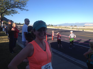
H, ever the good guy, got up early with me to be race support.  We picked N up at the Olympic Hills shopping center/finish line so she could leave her car there, and then H dropped us both at the start around 6 a.m.  It was cool, albeit definitely warmer than last year's race, and I was grateful that the sun was still behind the mountains.  N and I thought that it seemed like fewer runners this year as we maneuvered ourselves to the start, mostly women.  It's still a very lowkey event, although we did notice a few runners who were clearly in it to win it.  Including one woman who we had seen running UP the canyon road as we drove in.  You know, as a warm-up.  (She ended up winning for the women.)

Almost done

For some reason I got a much faster start than I usually do.  My legs felt good and I pulled away from N right away.  I stayed feeling good for probably two miles and then slowed up a bit as my back tightened up, thinking that perhaps I shouldn't have gone off so fast.  When the road flattened out, with about a mile to go, I remember thinking, "Why? Why do I do this race?"  But at that point the end was in sight (figuratively speaking) and there was a woman in front of me who I wanted to catch, so I just kept going.  One runner passed me just as we turned onto Wasatch Boulevard, much to my dismay, and because of the uphill, and having no kick left in my legs, I just couldn't pass this one woman who was mere steps ahead of me.  Still, I had my fastest time to date, so I can't complain too much.

Done!

They put the results up right away and after confirming that I was not on the podium, H and I bid N adieu and headed off for breakfast.  We were heading to the Lazy Day Cafe but before we got there, noticed that the Millcreek Cafe & Eggworks was open and not yet busy, and so we landed there instead.  H had a lovely Denver omelette with hash browns and sourdough toast; I over-ordered with the Millcreek Mound: two eggs, bacon, sausage and ham (I read it as "bacon, sausage OR ham" and ended up giving H my sausages), with hash browns and sourdough toast.  I couldn't quite finish my breakfast but felt like I did perhaps earn all the calories I stuffed down my gullet.

Race results
2016:  5/18 age group finish; 34/115 overall finish; time: 39:55.96
2015:  8/23 age group finish; 59/175 overall finish; time: 41:24.02
2014:  5/23 age group finish; 65/174 overall finish; time 40:53.07
2012:  5/12 age group finish; 61/126 overall finish; time 44:15.11
2011:  6/15 age group finish; 45/106 overall finish; time 41:09.75

June 4th was a very busy day for races, actually,  In addition to my race, there was the Porcupine Hill Climb and the Tri the Heights (both in Cottonwood Heights), the Corporate Cup 5K in SLC, the Dirty Dash (Midway), the Oquirrh Mountain half marathon/10K/5K (Tooele) and the Thelma and Louise half marathon (Moab), to name just a few.  So nice to see people getting outside and getting after it.

Thursday, June 2, 2016

first of the season

On Memorial Day itself we ended up being homebodies, reluctant to fight the oodles of people that were sure to be crawling all over the trails: this time of year, with still plenty of snow at elevation, the lower, drier trails along the Wasatch Front can get very busy, particularly on a holiday.  I went for a run and H got back on his road bike, still trying to make up his miles deficit from the wet and rainy spring.  I also did some laundry, planted some sedum under the tree in the front yard and put some succulents in some pots for our patio.


After that, there really was nothing left to do but sit in the shade on said patio and read, and indulge in the first gin and tonic of the season.  Welcome to summer, everyone!