Saturday, August 31, 2019

professor creek - maryjane canyon

We just can't stay away from Moab.  And why would we, when we're still finding new and different places to explore?  Case in point, we managed to get back down there mid-August, just for the weekend, arriving Friday night.  We were wound up from the drive (and Milton needed to sleep off the stress of the drive) so we swung by Woody's for a beer.  We talked to some other folks at the bar and voila!  They gave us intel on a brand new hike for Saturday morning: Mary Jane Canyon, a/k/a Professor Creek, out Castle Valley way.


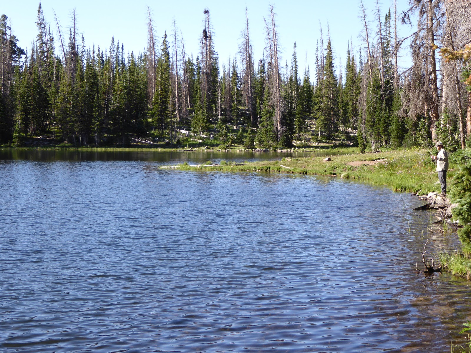
We drove 18.4 miles out Route 128 and then turned right onto a dirt road: Ranch Road.  You drive by an excellent private ranch and the road terminates at the Sylvester trailhead parking lot.  The trail for Mary Jane Canyon is not marked by a sigh but it starts across the parking lot from the Sylvester kiosk.  I had screenshotted the first part of this post describing the hike so we knew that the trail crossed the wash and went up the creek.


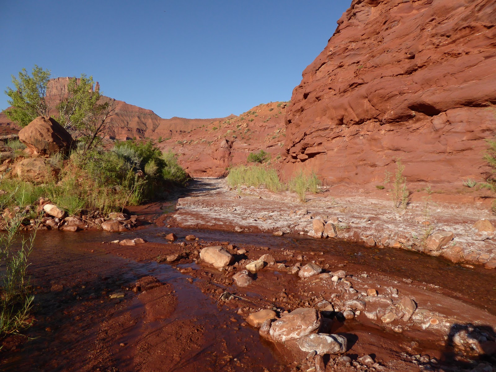
The trail goes creekside for a while and then drops down so we were walking in Professor Creek itself.  The water wasn't more than mid-calf deep and felt very refreshing.  We took Milton off his leash as soon as we got away from the parking lot and he was obviously enjoying running through the water.  I hadn't screenshotted the whole post, however (and there were no bars out there), so we missed the part about "don't take any of the dry forks." 


So when we got to a fork where the main wash - dry - went right and the creek itself, in a narrower wash, went left ... we went right.  This meant we didn't make it to the narrow slot with the waterfall but it also meant we saw nobody for the whole hike.  Nobody except a few birds, plenty of lizards for Milton to chase and one nearly 3' long snake (non-rattler) that I nearly stepped on.


It was a terrific hike.  The footing was pretty firm as we were mostly walking on packed sand and dirt and it was a very slight uphill since we were walking up the creek.  We did see footprints (people, dogs/coyotes, deer, possibly raccoon) so we weren't the only ones who'd ever gone up there.  In some spots the wash was wide, shallow and sandy; in other places the red rock canyon walls were tall enough to shade the width of the drainage.


We followed the wash all the way up to its end at a vertical wall.  For the last several hundred yards it was very narrow and we were scrambling over rubble.  It took us about two hours to get out there.


The way back was a bit quicker (about 1:45).  The sun was getting higher so we didn't want to dawdle too much.  Milton, who had run ahead a lot for the outbound leg, wised up on the return, stopping to wait for us whenever shade presented itself.  He still managed to chase any lizards he saw, despite the fatigue setting in.


When we got back to the actual creek, the wading felt fantastic, the still-cool water refreshing on hot feet.  During our post-hike parking lot beers, all the other hikers came over to talk with us and meet Milton (including a husky puppy and a frugle - French bulldog/beagle mix).  Milton enjoyed the attention but enjoyed resting in the shade more; he had to fight to keep his eyes open on the drive back to town.  We may not have done the hike we intended to do - but now we can go back again and do the right hike.  (And the Sylvester trail looks good too!)


Hike stats: 8.87 miles; 3:05 / 2.9 m.p.h. moving; 3:31 / 2.5 m.p.h. overall; just 710 feet of elevation

Thursday, August 29, 2019

interlude

Slight break in the Moab action:

On August 24, we went to Park City to MTB.  It had seemed like ages.  We went to Round Valley where we found ourselves once more in the midst of the National Ability Center's Summit Challenge road ride.  We confirmed that this is a great time to ride RV: the parking lots are slammed with the road ride participants so casual MTBers stay away, leaving the trails nearly empty.  Except for us!

The weather was great: temperatures in the low 60s and sunny with no wind.  The few people we did see out on the trails seemed like local riders, not tourists, although we did come across a group of women with nameplates workshopping a section of Rademan Ridge. 

This was our route:  the usual Quinn's TH start, Matt's Flat, up PorcUClimb, down Rusty Shovel to the paved bike path, around to and up Happy Gilmore, segueing to up Tin Man to Rademan Ridge (a solid eighteen minute climb), down Rambler and then back up Rambler (sagebrush switchbacks), back up PorcUClimb and down Down Dog (the "PDog loop"), back to Matt's Flat and out.  Our second PorcUClimb climb was better than the first; our legs had had a chance to warm up.


Ride stats:  16.35 miles; 1:46 hours; avg. speed 9.4 m.p.h. / top speed (H) 25.3 m.p.h.; 1,270 feet of climbinb

Tuesday, August 27, 2019

last day of summer vacation

All good things, etc., etc.  To wrap up our excellent summer vacation week, we returned once more to the MOAB Brand trails for a morning ride.  It was fairly cool, given the cloud cover, and a light breeze kept temperatures quite pleasant at around 86 F.  There were just a handful of vehicles in the parking lot when we got there but one of them was a big tour group: thirteen tourists and two guides.  We managed to get ahead of them at the start of Rusty Spur and then, on our second time around, lapped them as they were turning off at the cut-off back to the parking lot.

Gentle slickrock

Other than that big group, we saw just a couple people out on the trails, which was in keeping with all the rides and hikes we'd done that week: it's just not crowded in late July (because it's so dang hot).  After our 16.58 miles, we had parking lot beers to cheers the great week.

And then there was nothing left to do to go back, clean up, toss the dog and all the dirty clothes in the truck and head home.  On the drive north, we were already planning out what to do on the next trip.  There's still so much to do!

Sunday, August 25, 2019

exploring millcreek

On Saturday, we slept in a little and headed over to Millcreek with Milton, having promised him one more hike.  It was still early enough that there were just a couple of cars in the parking lot and then we really didn't see anyone until we heading back past the big waterfall.

Less water but still falling

We went up the north fork again (same branch of the canyon that we did last time), letting Milton off his leash once we got up to the creek.  He was really good at coming back when he was called, even when there were tempting lizards to chase.  It was sunny and calm and we could hear the trilling calls of canyon wrens echoing off the canyon walls.

Still pretty wild so close to town

When we got to the pool where we had turned around last time, we rolled up our shorts and boosted Milt up onto the pour-over ledge.  He doesn't hesitate to splash right into the water but he doesn't like it (yet) when it gets deep.  We kept going up the canyon where my jaw dropped with amazement as the canyon widened.  It was just beautiful up there, with the high cliff walls, grassy meadows and the creek plunging through the middle of it all.  We just kept going upstream until the trail faded out in a choke of vegetation.  If we'd had more fortitude - and a machete - we likely could have followed the canyon all the way up to the La Sals.

I was so surprised to see it open up like this

We tried to get Milton to swim on our way back out; he wasn't having any of it, although I suspect that if we were somewhere the two of us could swim, he could be convinced to give it a try.  He did enjoy making big leaps and jumps wherever he could, and seemed to amuse himself by ducking his head under the water as he walked.

Splish splash

There were a few locals at the waterfall and several cars in the parking lot when we got back, but it wasn't crowded like it had been last time.  Milton was so tired from all the leaping and bounding and lizard chasing that he crashed for the whole afternoon.  With temperatures over 100 F, so did we.

Hike stats:  5.68 miles; 2:33 hours total; 790 feet of elevation


Friday, August 23, 2019

7-up

After some research, we came up with a brand-new (to us) MTB trail for Friday: 7-Up.  In order to get some miles in, and because we didn't have an extra vehicle to shuttle, we did it 7-Up and then 7-Down, leaving us with a downhill finish.  Sort of.

At the start

The lower terminus (elevation 4,900') is just off of Route 313, on a wide slickrock area on the left of the road (as you drive up), just past the hairpin turns.  We have seen folks actually parked on that slickrock but we drove up the road a little further and parked in the scenic overlook's parking lot.  You're probably not supposed to do that but since it was 7:30 .m. on a July Friday, we figured we'd be back before anyone really needed our spot.

Lovely desert meadows

We suspected that most people shuttle to the top and ride down from the Gemini Bridges/Bull Run area, especially since all the signs were facing away from us as we rode up.  The trail is easy to follow, however: well-signed, with blue blazes on both the single-track and the double-track.  The single-track was really nice and hardpacked; the double-track, although old jeep roads, was looser but not too sandy. 

Non-technical doubletrack

This trail is really scenic.  The air was pretty clear as we crossed meadows and followed the rim of Seven Mile Canyon, which provided outstanding views.  The route then turned southwest-ish and started really climbing over rocky ridges as we went through the Horsethief area towards Gemini Bridges. 

Seven Mile Canyon

The heat was creeping up on us at this point.  I was going really slowly on the rockier singletrack so I sent H on ahead.  While he churned his way to the upper trailhead (Mag 7 area, elevation 5,800'), I paused for a snack with a view (photo below).  When H met me on his way back, I turned around and we started the long descent.


Nice place for a snack

Being mostly downhill, our return trip (this was an out-and-back for us) went noticeably faster: it took us 2 hours 15 minutes on the outbound leg but only 1 hour 45 minutes to go back.  We were able to roll down over a lot more of what we had had to walk too, especially on the stretches of well-used jeep roads in and around Gemini Bridges.  Jeeps and ATVs make trails loose and sandy and much less fun to MTB.

Upper trailhead

Because of where we had parked, we had a quarter mile climb along 313 once we finished the trail.  It was hot when we finished.  7-Up is a good ride with fantastic scenery and we had it all to ourselves, having seen just one other rider, an older guy, riding downhill.  I absolutely would ride it again - but in the fall when it's cooler.


Ride stats:  20.72 miles; 4:07 total time; 1,900 feet of climbing

Wednesday, August 21, 2019

seven mile canyon, north fork

And now we're back to recapping our summer vacation week in Moab.  On Thursday, we got up, organized and out at our usual time for hiking the north fork of Seven Mile Canyon with Milton.  We parked at the cattleguard on Route 313, just before the road starts climbing into the hairpin turns.  We climbed over the fence and down into the wash, startling two or three young hawks who were perched in the cottonwood trees there.

Natural layers, example 1

Temperatures started cool under the light cloud cover; as the morning wore on and the clouds thinned, the heat moved in.


Milton's claws wear down much quicker when he hikes slickrock

There was no trail per se but the plan was to explore each of the three branches of the canyon, working our way up until we couldn't go any further. 

Adventure dog, off-leash

The first branch we did (bearing to the far right) was narrowest and seemed to be pointed right at the Monitor and Merrimac buttes.  When it started getting boulder-y in the wash - perfectly explorable for people but more difficult with a medium-sized dog - we tried climbing up a few levels. Up there we found cryptobiotic soil, however, and we were concerned about off-leash Milton running through it so we turned around and backtracked out of this wash.

Natural layers, example 2

The second branch we went into was shorter than the first one and we made it all the way to the end.  We heard the trilling of canyon wrens but didn't see much bird activity.  We did spot tracks for lizards and cows and possibly some coyote poop, so there are definitely critters in the area.

Didn't find the rest of the skull, just this jaw

The main branch of the north fork of Seven Mile Canyon (bear left at the main fork when you are walking into the canyon) started out wide.  We had to turn around before we reached the end because it got so choked with vegetation.  We found some sun-bleached cow bones (jaw bone and some leg fragments); they had been out there in the elements long enough that Milton wasn't the slightest bit interested in them.

When the sun came out

On the way back out, we explored another side canyon.  This one had four-to-five foot high pour-overs which were easy to get over (and Milton liked launching himself off them for grand leaps into the sand) and very nice views.

Forcing the adventure dog to pose

As it got warmer, Milton was feeling the effects of possibly having overdone it early in the hike.  He stopped a couple of times to lie down in some shade to rest.  When we got to the mouth of the canyon, we spent some time searching for pictographs and petroglyphs that are supposed to be there.  We never found them.

Classic apres pose

For post-hike beers and snacks, we drove a bit further up Route 313 to the scenic overlook just past the hairpin turns.  This gave us views of Monitor and Merrimac as well as glimpses into the canyon we'd just hiked.  We still couldn't see any petroglyphs, even with a birds' eye view.

Hike stats: 5.97 miles; 2:33 total time; 790 feet of elevation

Monday, August 19, 2019

return to lofty lakes

This post should be subtitled: "How Milton won the Uintas."

Fisherman at Picturesque Lake 

After disappointing our dog terribly on Saturday when we didn't take him MTBing with us (he hopped in the truck and would not get out until we had driven around the block, thus taking him somewhere), we drove out with Milt to Mirror Lake Highway in the Uintas for a hike.  We didn't want to overdo it for him with a really long hike so we decided to go back and do the Lofty Lakes loop, which we did back in 2010.

I always forget how rocky the Uintas are

The parking lot was nearly full when we got to the Pass Lake trailhead a bit after 8 a.m.  It seemed like most of the vehicles were for people who had been backpacking and camping over the weekend, however, because we really didn't encounter too many dayhikers when we were out on the trail.  We had done the loop clockwise the first time; this time we did it counter-clockwise (mostly to go the opposite way of a group of loud-talkers) but we ended up liking the loop better this time around.

Ridge above Lofty Lake

Doing the loop this way means you get the bulk of the climbing over with early and the back half of the trail is well-shaded as the sun gets higher.  I always forget how rocky the Uintas are: the trails are rugged and loose when steep and the surrounding peaks are covered with impressive scree fields.  We came first to Picturesque Lake, then Steiner Lake (the scout camp did not appear to be in session), then climbed a steep rocky pitch towards Lofty Lake (elevation: 10,840 feet).

You can see how the water runs off by where the vegetation grows

At this point, we let Milton off the leash - it's safer for both the dog and the person on the other end of the leash if they're not connected in the steep spots.  He did wonderfully, running ahead but coming back to check in with us, chasing birds and squirrels but stopping and returning when we called him.  He splashed into all the creeks and shallow ponds and was friendly with all the other dogs we saw.  One hiker who stopped to pet him - Milton ran up to him and immediately sat down for pats - said that it looked like we'd won the dog lottery with our boy.

Not sure which lake this is but it's pretty

Kamas Lake (10,520 feet above sea level) came next, just as beautiful as it was when we first saw it nine years ago.  After that we started to descend a bit, coming to the turn-off for Cuberant Lake.  There were tons of wildflowers in the marshy spots: Lewis's monkeyflower, elephant head, paint brush, geranium.  We then retraced our steps back to the main trail and finished the loop.

Snack break at Kamas Lake

Milton was a tired boy: H and I had done over seven miles but we figured he'd done close to ten with all his running around.  He put up with wearing his doggles while we had beers and lunch (M had water and the rest of his breakfast) and greeted the other dogs in the area with interest but not a whole lot of energy.

Lots of birds and small critters to chase in these meadows

On the way back we stopped in at The Notch in the little village of Samak (before you get back to Kamas).  Their shady patio is dog-friendly, we learned, and we took advantage of that to stop in for a beer.  Milton made so many friends: people really respond to how sweet and calm he is and before long, the tables on either side of us were vying for his attention.  Five other dogs showed up while we were there and he again greeted them all politely, then turned back to the people for more pats.  Everyone raved about how sweet he was.  He really is.  We got lucky when we got him.

Chillin' in the parking lot post-hike

The drive back home was uneventful, Milton struggling to stay awake the whole way.  When we got home, he totally crashed while we unloaded and got cleaned up.  We woke him up long enough to sit outside with us for a bit, enjoying the balmy 86 degrees in the shade.  He was so tired that he didn't even lift his head when a neighbor dog walked by.  It was a really good day for everyone.

Map isn't quite right - our GPS must have freaked out a bit


Hike stats:  7.47 miles; 3;06 hours / 2.4 m.p.h. moving; 3:47 hours total; 1,690' elevation

Saturday, August 17, 2019

navajo rocks

When Wednesday of our Moab vacation week rolled around, we were up at 6 a.m. and out the door at 7, leaving behind a Milton who had been quite hopeful whilst watching H load the MTBs onto the truck.  We were off to ride the trails at Navajo Rocks, which we hadn't done since November 2016.  This newer trail system is very popular in the busy season: if you go, go early or really late.

Yay MTBing!

We had our wheels on the dirt around 8 a.m., heading out on the same loop that we'd done last time around, only doing it clockwise (recommended direction, per the signs) this time.  We did Middle Earth to Coney Island to the Big Lonely to Big Mesa and saw literally no one else while we were out there.

Big Lonely slickrock

We rode fairly well in the middle sections but the start of Coney Island and the end of Big Mesa are rather more technical, with loose rocks, ledges and tight, sandy corners, forcing us to hike-a-bike.  There is no shame in hike-a-bike.  Big Lonely was lots of fun: rolling hardpack through the sagebrush and big, wide, flat slickrock stretches.  There was one other truck in the parking lot when we finished our loop, requiring us to stare at the scenery during our post-ride beers since there were no people to people-watch.

Views during beers

It rained off and on in the afternoon, including a downpour while we were at Woody's for beers.  The clouds broke up a little: the daytime cloud cover had been keeping temperatures reasonable even with the slightly higher humidity.  We even managed glimpses of stars that night.

Ride stats: only 10.29 miles but it took a while because I had to walk so many sections

Thursday, August 15, 2019

super-busy

We are taking a break our regularly-scheduled Moab vacation coverage to bring you a brief update on recent MTBing at Round Valley in Park City.  We had to check the trail conditions because there had been some pretty substantial local storms recently - including one that caused major landslides across Little Cottonwood Canyon, closing the road for more than twenty-four hours.  The trails were dry but boy, were they ever busy!

When we pulled into the Quinn's Trailhead parking area, it was pretty full.  Not only was the third race of the Park City Trail Series going on but there were just a LOT of MTBers out there too, including several squads of high school age riders.  The high school teams weren't there racing, just training or scouting, and to be honest, some of them were a little annoying, not heeding to the uphill-has-the-right-of-way creed.  We suggested to the adult coaches trailing off the back of the pack that they might want to teach their team some trail etiquette.  We were even polite about it.

Riding the brakes on Down Dog
Rolling through Rambler

Because of the trail race going on, we had to pick and choose our route to stay out of the runners' way as best we could.  We managed to do a P-Dog loop (PorcUClimb and Down Dog), rode up Kari's and Highside to the midpoint of the "Sweet Sixteen" switchbacks, then finished the climb on Rambler.  We even worked in a new-to-us trail, Backslide.  We went counterclockwise and I didn't love it as it was pretty rocky, which meant some struggles on the climb; we think that if we went the other way, the climb might be easier.  But then all the rocks would be on the downhill bits.  Can't win.

It wasn't the best day of riding but the temperature was pleasant and the trails were in good shape.  They can't all be A+ days, I guess.  Plus we learned a lesson:  go early on August Saturdays ... or go on Sundays.

Ride stats: 15.16 miles

Tuesday, August 13, 2019

squaw springs hike

Clouds had moved in Monday night and because of the blanketing cloud cover, it really hadn't cooled down that much when we got up Tuesday: it was already close to 90F when H, Milt and I left town for the La Sal mountains.  We drove up the loop road about twelve miles to the Geyser Pass (dirt) road, and then continued on another three-ish miles to the Squaw Springs trailhead.  Up there it was about 75 F, mostly cloudy and with a light breeze.

Stunning Sego lily

The Squaw Springs trail goes up and down over ridges and washes through a variety of terrain: gorgeous aspen groves with some of the biggest aspens I've ever seen, scrub oak stands (complete with range cattle!), open meadows and dark spruce forests.  There were a couple of creek crossing but the water, while running well, wasn't too high.  There were tons of wildflowers - including our very first Sego lilies (Utah state flower) - and the aspen groves were so lush and green that it was difficult to believe we were in the desert.

Flower-filled meadows

After about 3.1 miles, we descended into a green meadow with the ruins of a log cabin and the abundant spring.  It was a beautiful spot with plenty of water - a good place to build a cabin.  We poked around for a while and then retraced our steps back to the truck.  Even though it was a little humid with all the greenery and creeks, the temperature hadn't climbed much due to the continuing cloud cover. 


Cabin and corner detail


Milton did well on this hike, although this time we kept him leashed.  With so many distractions (squirrels, birds, deer, cows), we were worried that he might get himself lost.  Even without running free, he tired himself out enough that when we got back to the truck, he laid down and napped, face in the dirt, without trying to get pets from the other hikers milling around at the trailhead.

So green

Hike stats:  6.3 miles; 3:08 total time; 1,280' elevation

So tired

Sunday, August 11, 2019

dead horse point state park

It cooled off overnight, making for pleasant sleeping with the windows open, and Monday came in with a spectacular sunrise.  We got the biking stuff into the truck and were once again on the road at 7 a.m. to drive up to Dead Horse Point State Park.  We were surprised that it was already fairly warm up there - around 75 F - but were consoled by the fact that we were literally the only ones in the parking lot.  Two bikers did come through while we were gearing up but out on the trails we never saw them - we didn't see anyone out on the trails at all.  A far cry from May/September!

So scenic

Although these are trails I know fairly well at this point, the heat was bothering me a bit and I was riding slowly (more slowly than usual).  I felt like I did a little better on the newer trails (Whiptail, etc.) than I had last time, however.  It was very quiet out there and not even much wind to keep us company.  H saw two desert cottontails out taking advantage of the peace and quiet.

When we were done, I skipped the post-ride beer because my stomach was feeling a little upset, probably from the heat.  Back in town, it got hotter and hotter, so we siesta'ed after we got cleaned up, then walked to Woody's for some beers before dinner.  It was 102 F and we were hoping that those temperatures wouldn't stick around for the whole week.

Ride stats:  16.91 miles