Tuesday, August 29, 2017

"i don't think they're part of the group"

We have discovered that a great day to MTB at Round Valley is the day of the National Ability Center's Summit Challenge fundraiser road ride.  Of course, we had no idea that the ride was going on when we headed for Park City Saturday morning.  Because of our big hike the day before, I had suggested that we ride from Quinn's Trailhead, foregoing the extra three miles (each way) on the paved bike path if we parked in town; when we pulled in to Quinn's, the parking lots were packed and hordes of road cyclists in brightly colored spandex were milling around or getting their rides (16, 50, 80 or 100 mile options) underway.  We squeezed into a parking space at a further lot and hit the dirt.

It was immediately apparent - to me, anyway; H is in terrific shape right now - that we'd put some miles on our legs the day before.  My breathing was better than it has been but my legs were tired.  I figured I could do the climbing once I warmed up but I knew I was going to be wobbly and slow.  I was right: my climb up the Sweet Sixteen was very slow, although I did manage to ride all but two of the corners, which I count as a success; and I stayed on the trail for the whole ride, climbing up the Staircase with wobbly aplomb.  And then I was grateful that it was all downhill back to the truck.

Nobody there but us

The best part of the day was that we encountered so few people on the trails.  I think people may have been dissuaded by all the Summit Challenge folks taking all the parking spots but boy, did we enjoy that.  For the beginning piece, from the start to the top of My Nemesis: two walkers and one trail runner.  From the top of My Nemesis to the Nouvelle Loop: one trail runner with two dogs.  From the Nouvelle Loop to the bottom of the Sweet Sixteen: no one.  From Sweet Sixteen to the rocky right-hand corner where I fell and scraped up my shoulder a few years ago: no one.  It was awesome.  After that, there were a few other riders climbing up as we descended the Sagebrush Switchbacks on the backside of Rambler.  We also had to dodge some Summit Challengers on the short stretch of the paved path before we got back on the dirt for the final bit.  It was there that we confused some Summit Challenge volunteers: they were helping direct riders at an intersection, depending on what length ride you were doing.  We blew right past them and one woman said to the other, "I don't think they're part of the group!" Nope, we're really not.

Sunday, August 27, 2017

redemption

About a year ago, we did a 14+ mile Alta Dry Fork/Mineral Basin loop and it kicked my butt.  I bonked HARD on the final climb - from the base of the Mineral Basin chairlift to the top of Hidden Peak at Snowbird.  We've done a decent number of longer hikes but what makes this one tough is the uphill finish.  I didn't manage my nutrition well at all last year and suffered for it.  Ever since, I have been determined to do it again and not bonk.  When our anniversary rolled around last Friday, we decided to take the day off and do that hike again.  You know, to celebrate.

Virga overhead

So that is how I happened to wake up an hour before I usually do on a weekday morning, all so we could be hiking at 6:20 a.m.  We parked at Snowbird's Entry 2 and walked up the Little Cottonwood Canyon Road to Alta, continuing along the dirt Summer Road for a little bit (and encountering Alta rush hour: two cars and a squirrel, all within the space of one minute) before turning off to the Albion Meadow trail.  We saw a mule deer and a coyote but no moose.  We didn't see any people either, other than the two bow hunters headed back to their car after a morning's scouting.

H at Sunset Pass

We paused for a snack at the top of Catherine's Pass.  After that, we were very good about our calorie intake, stopping approximately every hour for more food.  I had brought Payday bars, granola bars, dark chocolate, dried fruit, peanuts and raisins, plus Sour Patch Kids and some energy shots/bars.  We were desperate for something salty by the time it was all over but we were able to keep our energy level in a good place, despite shredding the inside of our mouths with those darn Sour Patches and dried pineapple.

Alta Dry Fork is scenic

After Catherine's Pass, it was a short climb to Sunset Pass (where we saw two other hikers, the only other people we would see for about ten miles) before the long descent.  Seriously - we lost a LOT of elevation, going down the Great Western Trail through Alta Dry Fork, then continuing to go down through aspen groves towards American Fork.  We descended for over an hour and a half before turning and starting the climb towards Mineral Basin.  The American Fork River that we had been able to rock-hop last summer was noticeably higher this year, and rather than risk wet feet for the second half of the hike, we took off our boots and socks and waded across barefoot.  That water, coming out of the mountain as it does, was very cold - like early spring Maine ocean cold, like ice cream headache for your feet cold.  But, after we'd dried off and put our boots back on, our feet felt great, rejuvenated for about a mile.  I highly recommend a cold soak midway through a long hike!

Cliffs and meadows (and me)

We followed the rough road (dry-ish river bed, really) up to the bottom of Mineral Basin, where Snowbird's Hidden Peak, our finish line, loomed above us.  We paused for one more snack - and this time I downed a vanilla energy shot which would give me a quick 400 calorie boost - and charged ahead.  The climb up Mineral Basin is completely exposed but it wasn't as hot as it could have been, with a decent breeze cooling things off.  H soon outpaced me but I didn't care: I was slow, stopping occasionally to admire a marmot or a pika or the still-impressive wildflowers, but I was steady and I was not bonking.  We started to meet tourists with about a quarter of the way to go, clean people who had ridden the tram to the top.  I smiled and said hello to them, but kept my head down and kept grinding my way to the top.  I joined H there just a few minutes before 1 p.m., just under seven hours after we started hiking.

Cold!

The Snowbird tram is free if you get on it at the top and we gladly availed ourselves of that option; after 14+ miles, my knees and back were grateful for not having to hike back down to the cold beer waiting for us at the car.  Still, we were in better shape than we had been last summer: no blisters or hot spots, no afternoon naps, and enough energy that evening to walk to the local pizza place for veggie 'za and a toast to an anniversary well-celebrated.

Just gotta get up there

Hike stats:  14.58 miles walked (16.33 miles total, including the tram ride down); 5 hrs 21 minutes moving/3.1 m.p.h. (6 hours 48 minutes total/2.4 m.p.h. overall); 5,108' elevation gain.

Redemption!


Thursday, August 24, 2017

something new

We think that since we hike so much that we're running out of trails around here.  That is patently untrue.  We have barely scratched the surface out in the Uintas and even along the Wasatch Front/Back, there are a ton of trails we haven't gotten to yet.  Case in point: on Sunday, we started above Brighton, tromped around the top of Park City Mountain Resort and ended up walking up, over and down Guardsman Pass.  All new!

Old mines all over the place

There are a couple of big righthand switchbacks when you drive up to Guardsman Pass from the Big Cottonwood Canyon side.  The second one is a trailhead that we've never explored, despite there always being lots of cars (mostly trucks or vehicles with bike racks) lining the road.  This was where we started, parking down the road a ways where parking was easier.  There were at least eight trucks at that trailhead when we got there (8:30ish) but we didn't see any people as we headed up the evergreen-lined jeep road, only one big mule deer doe who bounded away at the sight of us, plus numerous squirrels scolding us from the trees.  The road climbed steadily, crossing stands of trees and mountain meadows, before topping out at a pass.  To our left, the jeep road continued on with trail signs indicating the way to the Wasatch Crest trail; to our right, the trail climbed steeply up a ridge in the direction of Guardsman Pass; straight ahead, a rougher jeep road descended into Park City Mountain Resort.  This was Jupiter Bowl spread out in front of us and we could see the Jupiter double chair off to our right.

That's Solitude behind me

At the Pinecone Ridge patrol shack

We didn't really have a plan, just to end up at Guardsman Pass so we could walk downhill back to the truck, so we went left, where the jeep road climbed steeply and steadily.  We met one trail runner, heading down, but otherwise had the place to ourselves.  Once we got to the ridgeline, we turned back (south-east-ish), following the ridge past a bunch of old mines.  We topped out above PCMR's Pinecone Ridge, then dropped down to the patrol shack there.  A faint road continued down the ridge on the Park City side and we kept on that, with Park City and PCMR spread out before us and Deer Valley further out to our right, and being scolded by jays who seemed to think we were invaded their territory.  Before descending too deeply into PCMR, the road doubled back and we headed back the way we came, but well below Pinecone Ridge.  The road passed through wildflower fields and aspen groves before beginning to climb, and eventually brought us back to the original pass.

Faint road down Pinecone Ridge

Now we really started up, climbing a steep and loose trail up the ridge above Scott's Bowl.  There were MTB tracks here but even H declared that he would never try to ride his bike on this trail.  This was the only place where it was really hot, and I struggled a little bit, definitely feeling some upper respiratory limitations with my lingering cold.  When we got to the top, we could see a bunch of MTBers below us, coming from Guardsman Pass.  The trail forked here: we could go the way the MTBers were coming from or we could take the path less-traveled and climb up to the top of the Jupiter chair.  We went up.

Jupiter chair

We paused for snacks and sunscreen reapplication at the patrol shack at the top of the Jupiter chair (10,026 feet), then continued out along the ridge to Jupiter Peak (9,998 feet).  There is a ton of skiable terrain out there but it's tough to get to: you have to hike from either the Jupiter chair or up from the McConkey chair; we haven't skied it yet - there wasn't enough snow the one time we skied PCMR - but it looks like it would be worth the effort.  There were a couple of guys setting up to go parasailing from Jupiter Peak.  We didn't get to see them launch but did see them later, from down below when we were having post-hike beers.  We did get to see a small hawk, perched on a ski boundary pole, who let us get pretty close before winging away.

Looking across at where we were
from Jupiter Peak

After retracing our steps to the ridge's low point, we turned left onto a trail that descended the hillside quickly, crossing through still-impressive wildflowers to come out onto the Guardsman Pass road.  From there, it was a quick climb up the road to Guardsman Pass, and then down the other side into Big Cottonwood Canyon.  We could see a trail in the drainage below us, following the power lines, but we weren't able to figure out how to get down to it and had to keep to the road instead.  We got back to the truck soon enough and made a beeline for Brighton where we camped out in the shade for beers, sandwiches, people-watching and hike recapping.   General consensus: that was a terrific hike - scenic and amazingly secluded - and it opened up a bunch more new trails for us to explore in upper PCMR.


Hike stats: 8.29 miles with 2,000 feet of climbing; 3:56 total time with 3:02 hiking time/2.7 moving average.


Sunday, August 20, 2017

something old

I don't get sick very often but I caught a summer cold this past week that packed a wallop.  I started feeling sneezy Monday night; it kicked into gear Tuesday night; I ended up taking Wednesday as a sick day because I couldn't stop coughing.  By the end of the week I was feeling better but still not 100%.  It really wasn't until Saturday morning, when H asked if I was up for MTBing that I really rallied.  Of course I wanted to go MTBing!

So off to Round Valley we went.  The weather was quite nice, although perhaps not quite as cool as it had been the weekend before.  We parked in-town and headed to Quinn's Trailhead, which was surprisingly not as busy as I had expected.  As we headed out on the jeep road, I felt some fatigue in my legs (from not having done anything since Tuesday night at the gym) and I definitely wasn't breathing quite as well as usual, but I still felt better than I thought I would.

Just before starting the Sweet Sixteen climb

Despite not being busy at the trailhead, we came across a surprising number of MTBers out on the trails, mostly on the front side (what I deem the first half of our loop, up until the top of the Sweet Sixteen climb), including a high school boys team who were very polite as we let them by.  H had a couple of people fail to yield right-of-way to him but I did okay, managing to ride all but two of the Sweet Sixteen switchbacks and even clipping both feet onto my pedals for the second half of the climb.  By the time we hit the paved portion on the backside, however, my legs were definitely fatigued, so I sent H on ahead to get the truck while I went back to Quinn's for him to pick me up, thus saving myself a final three mile uphill.  It shorted my mileage and I felt a little guilty, but that was all I had in me at that point.  Just being out and getting moving again was great.

It was a great day for dogs too: an old white-faced chocolate lab, a golden/basset mix, a poodle named Winnie, a bunch of mutts of all shapes, sizes and ages, two Australian cattle dogs, a fat yellow lab, a Australian shepherd, two border collies and a very old golden retriever who needed help getting back into the car after his short walk.  We may not have a dog ourselves right now but we are full of appreciation for the ones we meet!

Thursday, August 17, 2017

almost perfect

Sunday was nearly as perfect weather-wise as you can get, especially in mid-August.  The monsoons had brought rain earlier in the week so I had wanted to push MTBing to Sunday, in case the Round Valley trails needed extra time to dry out.  I needn't have worried as they hadn't gotten wet at all, other than a few sprinkles that just served to puff the dust up.  Those storms had brought a cold front through, however, which meant that the air was cleared of all the wildfire smoke and it was noticeably cooler.  It was a little breezy (which is why the day was only almost perfect) but otherwise ideal for MTBing in Park City.


We weren't quite as early as we have been the last few times and thus were surprised to find the trails as empty as they were.  All the traffic seemed to come out after 10:30 a.m., and with it the bad trail manners: one guy, coming downhill, didn't get out of H's way when H was riding uphill, and pushed him off into a sagebrush; and a girl, coming downhill on the Staircase, stopped when she saw H riding up - but stopped in the middle of the trail, leaving him nowhere to go but into the bushes.  Aside from those minor annoyances, it was a terrific day to be out.  Even the six buzzards perched on the parking lot fence - and the one buzzard who circled right overhead as I started my first climb - couldn't dampen our good mood on the day.

Sunday, August 13, 2017

this was a good one

There is a trail run series out here - the Discrete Peak Series - that starts at the base of a ski resort (Deer Valley, A-Basin, Alta, Alyeska and Snowbird) and then runs up and then down the mountain. I am by no means a trail runner but I found the route description online and wanted us to hike it since it covered some ground that we didn't usually hike.  [Note: I now can't figure out where I got the route description that we tried to follow; the route that seems to be listed on the company's web site is different.]

Paintbrush close-up

We got an early start to get ahead of the heat and the people, leaving the house at 6:30 a.m.  It was nice and cool up at Alta, with some clouds overhead and the sun not yet above the mountains.  There were few other people up there at that time, a couple of trail runners and a lone cyclist, and none of them seemed to be heading where we were going.  We parked at the upper Albion lot, then walked down to the rope tow, crossing the creek on a woodchip road and then getting on some singletrack.

Heading up Greeley Hill

We followed the singletrack through the trees below the Sunnyside lift, coming to the edge of the Snake Pit (a permanently-closed area) before switchbacking away.  We saw three curious but cautious mule deer amid the lush green foliage and spotted an cement lift tower footing, from the old Lucky Boy lift.  At this point, our trail description said, "You'll come to the edge of Snake Pit with a view of the waterfalls.  Don't take the trail down into Snake Pit. Turn right and start climbing straight up."  We did get to the edge of Snake Pit, with its waterfall view, but we never saw a trail going off to the right.

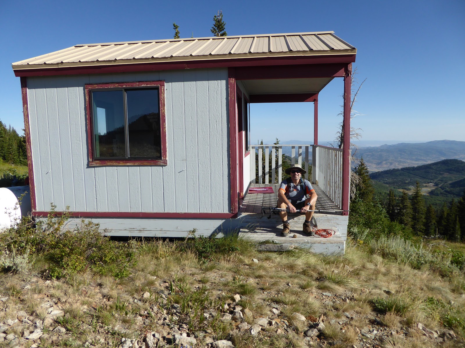
Waiting out the rain

So we kept going, continuing towards the base of Greeley Hill.  At this point, we did see a trail going off to the right, through the willows and heading straight up.  It wasn't clear whether this was an actual trail or a game trail, but we took it.  (This would later be a point of discussion between me and H: he though we should have kept going further along the actual trail; I thought we had already gone too far, based on the route description.)  Whatever it was we were on, it did go straight up and we kept to the trail/game trail as it faded in and out, which kept us clear of the wildflowers.

Scree field. Not pictured: noisy pikas

The flowers were spectacular, even though we are a couple of weeks past peak.  Also spectacular: there were so many hummingbirds, literal flocks of hummingbirds, zooming around the flowers and buzzing past us, chirping.  It was slow going, with the necessity for route-finding, plus all the stopping and looking at the scenery/flowers/hummingbirds, but we eventually made it to the ridge.  At this point, however, we had to stop for a rainstorm to blow through.  We huddled under some evergreen trees for about fifteen minutes, waiting for the storm to pass; once it did, the air was clear and the wind brisk but pleasant.

Sugarloaf Pass with Timpanogos in the distance

We picked our way along the ridge (above Eagles Nest, High Nowhere and North Rustler) to Greeley Pass, where the green plastic carpet led us to the other ridge of the ridge to pick up the High Traverse.  I don't ski out on the High T very often, and I certainly have never hiked it, so this was pretty new territory.  We were able to follow the traverse until a large scree field above Sunspot; after we rock-hopped across the scree field - getting scolded by pikas the whole way - we found an abandoned mining road, simply carpeted with wildflowers, that brought us to the access road to Collins.

Heading up to Mount Baldy

At the top of Collins, we continued around the EBT to Sugarloaf Pass, then scrambled up to the top of Baldy.  The flowers were incredible even up here, at 11,068 feet.  We paused for snacks and were very entertained by a bold, chunky chipmunk who scrounged a couple of granola bar crumbs.  Thus refreshed, we headed down the northwest ridge of Mount Baldy, pausing for a good look over the edge into the Main Chute.  There is still some snow at the very top.  It's very steep and gets pretty narrow just a little way down; I probably could ski it (in the winter), but I would have trouble convincing myself to drop over the edge to start.

Main Chute entrance

There was an actual trail down the northwest ridge, although it was quite steep and loose underfoot, so it took us a long time.  We also had to stop to marvel at the flowers - paintbrush and lupine, in particular.  The trail spit us out at the top of the Wildcat lift and then all that was left was to follow the access road out.  It was here that we finally started to see people on the trails and when we got back to the truck, both the upper and lower Albion parking lots were packed.

Imagine a whole hillside of these

This was a fantastic hike, one we both enjoyed greatly.  We like scrambling; we like route-finding, especially in a place like Alta where we're sure we won't get lost.  This loop took us on some hitherto untrodden territory and was absolutely gorgeous.  Our post-hike beers tasted especially good after this one.

Looking back at what we'd just come down

Hike stats:  6.47 miles; 4:42 total time; 2.2 m.p.h. moving average; 2,700 feet of elevation.


Thursday, August 10, 2017

2017 tour of utah - stage 7

Stage 7 (8/6/17) Salt Lake City, 73 miles and 5,450 feet of elevation gain.  For the first time in a while,the final stage of the Tour of Utah was not in Park City, but right in downtown SLC, revisiting the fun (for fans) and very difficult (for riders) circuit around the Capitol.  Eleven laps means eleven climbs up the top of State Street.  Just look at that awesome elevation profile:


We got our exercise done in the morning and then headed up to town midday, parking in my work garage and then walking up towards the festivities.  There was a little debate on where we should watch but we soon decided to park ourselves about halfway up the State Street hill where we could sit on the curb in the shade.  There weren't that many spectators at first but as the race wore on, more and more people filled in around us and it looked to be packed up at the top closer to the finish line.

Here they come, first climb up the hill

After a while, a group of four girls (teens to early 20s) and one boy showed up and sat behind/around us.  The girls all seemed to be girlfriends and/or sisters of girlfriends of Elevate-KHS Pro Cycling racers and the one guy was actually one of the riders: Jose Alfredo Rodriguez Victoria, a 20 year old sprinter who had podiumed on Stage 4 and then DNFed once the sprint stages were over.  The conversations we overheard were hilarious and there was much shrieking when the Elevate riders came through with the peloton.

Peloton still all together

Although it wasn't as hot as it had been, this final stage was still brutal.  On the first lap, the cyclists charge up that hill, and then get slower and slower as the race goes on.  The peloton splinters and riders start getting dropped off the back.  For the most part, there was a group of about 10-18 riders consistently out front, with everyone else just trying to hang on together.  On the final climb, everyone who was able to picked up the pace once more and pushed on to the finish line.

The very last rider on the very last climb 
on the very last stage of the 2017 ToU

H and I debated trying to make our way up there for the finish and the podium presentations, but ultimately decided to stay put, continuing to applaud as the final cyclists dragged themselves up that hill, minutes after the race was won.  After that, it just seemed reasonable that we stop by the Beer Bar on our way back to the truck, so that's what we did.

Yay beer!

Stage podium:  Marco Canola (Nippo-Vini Fantini); Brent Bookwalter (BMC); Gavin Mannion (UnitedHealthcare).  General Classification: Rob Britton (Rally Cycling); Gavin Mannion; Serghei Tvetcov (JellyBelly).  Team: BMC Racing; United HealthCare; Caja Rural.  Sprinter: Travis McCabe (UnitedHealthcare).  KOM: Jacob Rathe (Jelly Belly).  Best Young Rider: Neilson Powless (Axeon).  Most Aggressive: Manuel Senni (BMC).  Fan Favorite: Pier-Andre Cote (Silber).