Monday, October 29, 2018

getting in some more miles

We've been hiking so much this year (i.e., since ski season ended) that it feels a little weird if we don't get our boots in the dirt on the weekends.  After we MTBed on Saturday, we talked about where to hike; the fact that Round Valley's trails were still as wet where they were convinced us that anything in the Wasatch mountains themselves would be muddy and/or snowy and/or icy.  Wanting to keep to as dry trails as possible, we decided to go back to Round Valley on Sunday, to do a different loop and to get in some miles.

Glorious day in the Wasatch Back

We didn't have to wait quite so long for Park City warm up since hiking in cold weather is more comfortable than biking in it.  It seemed a little warmer than the day before had been and we both ended up in short sleeves, although I did wear my gloves for a while.  To entertain ourselves while we tromped around on these well-known trails, we decided to count how many dogs we saw; the over/under was 40.

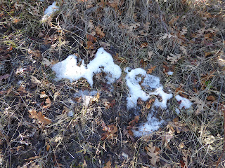
Teensy bit of snow lingering in the shade

Our route was: staring up the Practice Loop to Matt's Flat to Somewhere Elks to the top of the hill.  We had intended to go down on Rusty Shovel but that trail was closed for mud; we went down Rambler (the Sweet Sixteen switchbacks portion) and, to be honest, the top half should have been closed for mud as well.  We kept out of it and things dried up the further down we went.  We got on Ramble On to the Round Valley Connector, to Round Valley Express, to whatever trail gets you over to the North Round Valley trailhead.  Then we went up Happy Gilmor and Tin Man, then turned right and followed Rademan Ridge to the intersection of Cami's.  From there it was Matt's Flat and Ability Way, which brought us back to the truck.


We had seen 39 dogs when we got off the trail - and since I had the under, I was poised to win - but then there was a meet-up group of eleven huskies/husky mixes in the parking lot, bringing our total to 51 dogs.  You might think I would have complained about the loss but when there's eleven huskies running around, really nobody loses.


Hike stats:  11.43 miles; 3:35 hrs. hiking / 3.2 m.p.h.; 3:57 total / 2.9 m.p.h.; 1,100 feet of climbing

Friday, October 26, 2018

#rutssuck

It seemed like forever since we'd been on our MTBs (even though we only took one weekend off) so we were anxiously eyeing the mountaintrails.org maps to see if the trails were dry after the last storm.  Even then, we didn't believe it when they said Round Valley was full of snow and mud; those are lower elevation trails, mostly exposed, and the last week had been sunny and dry.  We were determined to go - but we waited until temperatures got up into the 50s, which meant we started riding around 11 a.m.

Dry trails in the sunshine

We try to be very careful with trails if they are wet because #rutssuck; having started riding in New England, we know how badly trails can get torn up when people ride through mud.  Our Round Valley route on Saturday was a new one, as we kept to the dry trails, rerouting when necessary.


If it sticks to your heels or your wheels, turn around

We started on Hat Trick/Fast Pitch (the jeep roads out of Quinn's Trailhead), then Matt's Flatt to Seventy 101 to PorcUClimb.  PorcUClimb had a couple of muddy patches where the gambel oaks kept things shady, so we got off our MTBs and carried them across to dry dirt.  After the climb, we intended to descend on Down Dog.  That trail was closed (per photo above) because it was too wet so we went down Nowhere Elks instead.  From there, we got on Valderroad, did the Practice Loop, then took Rambler to Ramble On.  The Staircase portion of Ramble On was the worst of the muddy bits but we were able to walk around the soft spots.  Then it was Rusty Spur to the paved bike path, to the North Round Valley trailhead where we picked up Happy Gilmor and Tin Man.  When we got to Rademan Ridge after finishing Tin Man, someone told us that that side of Rambler (a/k/a the Sagebrush Switchbacks, to us) was also closed.  So we descended from the ridge and picked up Round Valley Express (long hill to climb) to Cami's.  After that, we just jumped back on Matt's Flat to Ability Way and back to the truck.


Afterwards, at the Park City Brewery, we had a nice time talking with beertender Becky.  We knew she was originally from Massachusetts but this afternoon we learned that she was a sternman - excuse me, sternchick - for a commercial lobsterman out of Scituate during the summers of 2016 and 2017.  She went through her phone and showed us all sorts of photos she'd taken of the crazy-clawed lobsters she'd seen.  For our part, even though neither of us has worked on a commercial lobster boat, we both helped my dad haul traps when he had a recreational license and knew enough about New England fisheries to hold our own in the conversation.  It was a fun discussion and one neither she nor we expected we'd be having that day.


Ride stats:  15.33 miles

Tuesday, October 23, 2018

october houseguests

With only just enough time for us to do all the Moab laundry and clean the house, H's folks arrived for a visit.  We played it pretty lowkey, keeping an eye on the weather and the suddenly cold temperatures, which made it conducive to creating homemade soups and doing some house projects, although we still got out and about.

 Nice work, guys!

We usually try to have at least one project for H's dad to do because he's handy and we are ... not.  This visit he and H replaced the kitchen sink faucet (one trip to Home Depot and then to Lowe's for better faucet selection) and also installed a much-needed handrail going down into our basement (two trips to Home Depot).

Setting up the shot-ski

On Saturday, we drove over to Park City to see what was going on.  Lo and behold, we showed up as they were setting up the World's Longest Shot-Ski in an attempt to unseat Breckinridge.  Apparently the two ski towns take turns winning the title.  This year, Park City set up 1,275 shot glasses on skis (bolted and hinged together), filled the glasses with High West rye, and set the bar a little higher for our Colorado neighbors.

Click the link below for TGR's video of the shindig

We had no idea this was going on but once we saw it, we knew we couldn't leave until the record was broken.  Sadly, no spaces were available - all pre-sold and all sold-out - so we consoled ourselves with beer and lunch at the No Name Saloon until it was time to watch the big event.  Frankly, it was a big build-up for not a whole lot, but it's all for charity and it inspired us to try our own version at back at home.  Because why wouldn't you?

No caption necessary, really

Sunday, October 21, 2018

last day, better weather

Lo and behold - when we woke up Tuesday morning, it wasn't raining!  It was cloudy, however.  We packed up, gassed up, caffeined up and headed to the MOAB Brand Trails, which is our usual stop for one last MTB before heading home.  H had to do some bike maintenance before we hit the trails - the incessant damp over the last few days had put superficial rust on our chains and pedals. 

OMG the sun

Once cleaned up, we got our wheels in the dirt (not nearly as wet as you might think, given all the rain) around 9:30 a.m.  We did our Rusty Spur/Bar M loop twice and mostly had the place to ourselves, despite +/- 20 cars in the parking lot.  We saw the sun for about ten minutes before it clouded back up and cooled down again.

Chillin' post-ride

Post-ride, we dallied in the parking lot for a bit, watching MTBers, dogs and built-out Sprinter vans.  Then we hit the road, getting to Ray's Tavern for a late lunch of veggie burgers, hand-cut fries and beers.  The fries were so good we had to get an extra order of them. 

OMG the fries

We got back home around 6 p.m.  There was snow all around in the mountains as we had driven north but we never had to drive through any ourselves.  As much as we love the desert (and we do, even when it's soggy), snow in them thar hills is always a welcome sight.

Heading north, past the Book Cliffs

Friday, October 19, 2018

slickrock in the rain

When we got up Monday morning at 7:30, it was only raining lightly and the forecast was "cloudy with occasional rain."  We didn't really want to MTB in the rain - not the least of which was to avoid potentially damaging the wet trails - but we needed to do something.  We looked at our maps and books for a hike and decided to wing it by going up to Sand Flats Recreation Area (BLM land managed by Grand County) to see what we could find.

Good thing we packed these ponchos

The guy manning the entry station ($5/day or $25/annual pass) told us that any of the trails could be hiked, even the ones denoted as for MTBs or 4x4s.  Pretty much every trail at SFRA is famous/infamous (e.g. Hell's Revenge, Porcupine Rim, parts of the Whole Enchilada) but we decided to hike the Slickrock MTB Trail ... and then proceeded to sit in the car at the trailhead parking lot for an hour, waiting for the rain to stop.  Finally, at 10 a.m., we just decided to go because if we didn't hike in the rain, we weren't going to get to hike.  We put on our ponchos and headed out.

Atop the slickrock

The Slickrock trail is a 9+ mile lollipop: out for 2 miles, around a 5 mile loop, back for 2 miles.  There were a few MTBers out there but not many, not in the rain.  Despite its name, slickrock is a grippy surface for hiking and MTBing, and even wet wasn't particularly slippery.  I can't imagine riding it, however.  It is way above my skill level, going up and down very steep inclines, crossing sandy washes, climbing fins and skirting cliff edges with views of the Colorado River and the town.

Colorado River view

It continued to rain consistently until about noon and although temperatures were in the 40s, we were both overheating and sweating like crazy underneath those ponchos.  We chatted with a couple of MTBers but really didn't see many people until we were within three miles of the trailhead, when the rain had stopped.  Then lots of folks started heading out, on foot, on MTBs and on dirtbikes - fair weather fans all of them.  I can't imagine how busy this trail must be in good weather.

That moment when the sun came out

We hung out back at the truck for about an hour after we got back, people-watching, until it started raining again.  Back at the motel (with Pearl, Lumen and Barry in residence as office dogs), we got cleaned up - and covered the room with damp gear to try and dry it - and then went to Woody's,  where the bartender finally recognized us.  The sidewalks were drying as we walked down to the Moab Brewery for dinner at the bar.  We sat next to a couple of old local guys and had a great conversation with them, talking about the area, fly fishing, pictographs, traveling in the desert Southwest and, of course, the weather.

And then it clouded back up

After that, there was just enough time for a chilly cocktail back on the motel patio, as the temperature dropped quickly.  We couldn't believe this time in Moab had almost come to an end.  We couldn't believe it had rained the whole time.

And the temperature dropped

Hike stats: 9.1 miles; 3:06 moving time / 2.9 m.p.h. and 3:28 overall time / 2.6 m.p.h.; 2,000' of climbing


Tuesday, October 16, 2018

in which it is still raining in moab

Sunday morning, 7:30 a.m., 52 F, still pouring rain.  We were far too antsy to hang out in our motel room, however, so we put both MTBing and hiking gear in the truck in case the weather cleared up.  (Spoiler: it didn't.)  Since we had always wanted to see water coming down over the cliffs above the Potash Road, we did a quick cruise out there first.  It wasn't coming over the cliffs in massive floods but there were quite a few temporal waterfalls/intermittent streams that simply do not exist in drier days.

This waterfall?  Not usually there

We next drove up to Canyonlands/Island in the Sky where it was 55 F and still raining, with the clouds resting right on top of the mesa.  We drove all the way out to Grand View Point at the southern end of the mesa and then walked out - in the rain - to the overlook, wearing our knee-length L.L. Bean raincoats, which normally don't see much action in Utah.  The clouds swirled, giving us brief glimpses of the White Rim Road below but for the most part, all we were able to see was clouds.  I felt badly for the tourists who had come out on their big trips to see the spectacular Utah desert scenery; we get to see it all the time so a rainy day truly wasn't as big a deal for us.

Brief break in the weather

After a lunchtime pause at the picnic area at the White Rim Overlook/Gooseberry Trail trailhead (still raining so it was an in-the-truck picnic), we drove to Dead Horse Point State Park.  We went out to the end, to the Overlook, and when we got out of the truck, we just started laughing.  The clouds were so thick that it was just a solid wall of white at the cliff's edge - you could barely tell you were on a cliff, and there was certainly no way to know that you were on top of a 1,000 foot cliff with stunning views below.

H strides off into the mist

At this point we gave up and went back to the motel to clean up.  We went to Woody's and watched the 49ers vs. Cardinals game with a local 49ers fan, waiting out the torrential downpours - the heaviest of the weekend so far - that were passing through town.  During a break in the rain, we dashed to 98 Center and nabbed a seat right away.  The atmosphere and food there continue to be terrific but the drinks prices keep going up ($6 for a can of IPA? yikes) and the service is pretty inconsistent.

Me on the edge of Dead Horse Point Overlook

It was only sprinkling as we walked back to the motel after dinner.  We took advantage of the easing of the rain to sit for a while on the patio for beers and chats with other guests.  There also was some fretting about the weather: we had been in Moab for 2.5 days and had only ridden our MTBs once, and hiked not at all.  Yikes again.

Saturday, October 13, 2018

a trip to soggy moab

Amid the wet weather from Hurricane Rosa, we headed down to Moab for a long weekend.  We left on Friday, passing by snow-topped Timpanogos and the big burn scar in Spanish Fork Canyon, and watched the temperature drop to 37 F at Soldier Summit.  Skies cleared for a bit when we got further south but by mid-afternoon it was clouding up again.  After some discussion, we rejected a MTB ride in favor of a couple of beers at Woody's before checking in at the Kokopelli Lodge motel.  Several office dogs were in residence - Pearl, Jackson, Jasper, Lumen and baby Ladybug, with her very sharp puppy teeth.  We managed to get out of there, somehow without adopting anyone, got settled into our room and then hightailed to Zax's sports bar to watch the Yankees vs. the Red Sox, sitting next to a diehard Sox fan who had recently transplanted to Moab from New Hampshire, New England accent intact.

 The last sunshine for literally days

We got up at 7:15 a.m. Saturday and put both MTBing and hiking gear in the truck so we would be ready for anything.  Outerbike was in town and set up at the MOAB Brand Trails parking lot so we drove a little further on down the road, parking at a lot at the intersection of 191 and 313, then riding the paved bike path back up to the MOAB Brand Trails.  We did Rusty Spur and the Bar M loop - encountering next to nobody - then cruised through the Outerbike encampment.  H checked the weather app on his phone: thunderstorms in the area at 10:45 a.m.  It was 10:15 so we did another lap of Rusty Spur, then went back on the bike path to the truck.

Jackson, Jasper and bitey little Ladybug

Back at the truck, it wasn't raining right away but it was cloudy and cold (54 F) and I had forgotten to pack long pants.  We had a quick beer, deciding not to linger too long as we watched the darkening clouds.  We drove back to town around 11:30 a.m. as the rain began; it would still be raining that night when we went to bed.  We hung around the motel for the afternoon - with temperatures in the low 50s and steady rain, it wasn't even good weather to walk around town. 

Quick! Before it rains!

We went to Woody's around 4 for beers, watching the Baylor vs. K-State college football game with an actual Baylor fan (a contract electrician in town for a job), then around 5:30 we tried to get into 98 Center for dinner.  The place was already packed, the soggy weather no doubt having driven erstwhile adventurers in town and into the restaurants early, so we went back to the bar at Zax's for veggie pizza and five and a half innings of the Yankees vs. Red Sox.  It was still raining when we walked back to the motel so we finished watching the game and called it a day.  Surely it would be drier on Sunday - whoever heard of it raining so much in the desert?


Tuesday, October 9, 2018

moab soon

We just got back from Moab and are frantically doing laundry, downloading photos, restocking the fridge and dusting before houseguests arrive tomorrow.  Which is all to say that there will be Moab posts in the very near future ... but until then, this is what it looked like for us down there this time: cloudy, socked in and raining.

On the edge of Dead Horse Point State Park
- not that you can actually tell

Saturday, October 6, 2018

big water, little water

What to do, where to hike?  After all the driving we'd done last weekend, to Powder Mountain and the Uintas, we were looking for a hike a little closer to home.  We also wanted something with decent mileage (i.e., at least 8 miles).  We remembered one we'd done in 2016, meandering all over upper Millcreek Canyon, and thought we'd do a modification of that one: up the canyon, across the top and then back down via the historical trail.

Looking over the ridge into Canyons ski resort

It was mostly cloudy and very windy as we drove up to the Little Water trailhead at the very top of Millcreek Canyon.  Because the day was not so nice, we managed to get a parking spot there, even though it was around 9 a.m.; this is a very popular trailhead and oftentimes you have to utilize the overflow lots further down the canyon road.  Not for us this time, even though it was an even-numbered day and the MTBers were in full force.

Fall colors

As we did last time, we took the Old Red Pine Road trail, climbing steadily until we reached the Great Western Trail junction.  We saw just a couple MTBers on our way up and no hikers so we were able to enjoy the smooth, hard-packed trail nearly all to ourselves.  We checked out the view over on the Park City and then continued south on the GWT towards Desolation Lake.  The GWT follows the ridge here and deteriorates into some pretty rocky stretches as times.  We encountered more MTBers here, as well as a few trail runners, and everyone had pretty good trail etiquette.

Steep and dusty descent from the ridge

When we did this before, we had had a lot of trouble finding the historical trail we wanted.  Not so this time - the intervening years have shown this trail quite a lot of use and the turn-off was clearly evident.  It still doesn't get as much usage as the GWT, Little Water and Big Water trails but there were tire tracks in the dust and we did get passed by two MTBers near the end.

This unmarked (and unnamed?) trail is quite steep at the top but once you make your way down off the ridge, it winds its pleasant way through meadows and aspen groves before reconnecting with Big Water/the GWT.  It was a nice walk, made even better by the fact that we were protected from the wind which had been ferocious up on the ridge - the kind of wind that, H remarked, if you were skiing you would have quit early.

H in the meadow

When we left the historical trail, we had another 3+ miles to walk out on Big Water, the GWT and, finally, the Dog Lake trail.  We had to dodge a fair number of MTBers on the GWT and the trail from Dog Lake was steep and dusty.  But it went quickly and we were back at the trailhead soon enough.  The place had filled up, as had the overflow lots, but it was sprinkling a little bit and there weren't too, too many cars circling looking for parking places.  We had quick beers/snacks and then headed home.


Hike stats:  9.37 miles; 3:05 moving time / 3.0 m.p.h., 3:23 overall time / 2.8 m.p.h.; 2,150' of climbing


Wednesday, October 3, 2018

nine years

We've just ticked off another move-iversary: nine years, having arrived in SLC around 3 p.m. on October 3, 2009.  Looking back on our year - which we count as starting in October and finishing in September - what have we done?  Not as much skiing but a lot of hiking - and the hiking isn't done yet.  Here's what we did:

October 2017 - MTBing; hiking (Millcreek Canyon, Park City, Alta); trip to Fruita and Moab

November 2017 - MTBing; hiking (including the annual Sol-Bright hike after the first decent snow); Thanksgiving Turkey Trot

December 2017 - Alta's opening day (finally); some skiing; lots of baking at home because of the low snow conditions; good skiing on Christmas Eve and Christmas day (but cold)

January 2018 - Ski guests come to visit; skiing but very little new snow

February 2018 - Skiing but very little new snow

March 2018 - Skiing, including one storm day where it took H five hours to get up to Alta (for only 15" of new snow)

April 2018 - Skiing; rugby; rain

May 2018 - Closing day for Alta; Moab trip (including jeepin'!); hiking at home early because of the low snow conditions; MTBing

June 2018 - MTBing; hiking (Big Cottonwood Canyon, the Uintas, Ogden), and starting to train in earnest for The Big Hike.

July 2018 - Busy! MTBing; hiking (Alta, Park City, Beaver, Great Basin National Park); volunteering at the Crusher in the Tushar; camping at Great Basin National Park

August 2018 - The Big Hike at Bryce Canyon National Park; our friend P arrives in Utah; MTBing (Park City and Midway); hiking (Big Cottonwood Canyon, Park City, Snowbird); Tour of Utah

September 2018 - MTBing (High Star Ranch, Glenwild, Powder Mountain, Round Valley); hiking (Alta, Big Cottonwood Canyon, the Uintas, Millcreek Canyon)

And now, happy new year, everybody!

Monday, October 1, 2018

fly like an eagle

It rained and rained and rained on Saturday.

Just kidding!  It hasn't rained in weeks and Saturday was no exception, so we loaded up the MTBs and headed back over to Park City to put together a new route at Round Valley.  There were some clouds in the sky, and probably some drifting smoke as well, and it was pretty breezy.  Even though we didn't get onto the dirt until 10 a.m. - we waited for it to warm up to around 60 F - the temperatures were very pleasant.  There were lots of sports happening at the Quinn's Trailhead, so parking was at a premium, but since everyone was either participating or watching the soccer and/or lacrosse, the trails were sparsely populated.

Super-happy riding on Happy Gilmor

H had put together the route, consisting of trails we'd ridden before but put together in a new series.  We started by going up the Practice Loop, then taking Rambler out, down the Staircase and to the paved bike path.  We rode on the paved path for a little while, making our way out to the northern trailhead where we jumped back on Happy Gilmor and Tin Man to climb back up to Rademan Ridge.  We really like those two trails: you gain a lot of elevation but the trail surface is mostly smooth, with very few rocky sections.  From the ridge, we continued down the other side on Rambler, then climbed Rambler back up (via the Sagebrush Switchbacks) to the very highest point of Round Valley.  Next was a smooth descent on Down Dog (where we barked at the doofuses who weren't paying attention to the "NO UPHILL TRAFFIC" signs.  We climbed back up to Seventy 101, then climbed back up the hill we'd just ridden down via PorcUclimb - still love that one. Then, to round things off, we rode down Rambler about halfway, then took High Side to Kari's and back to the truck.  A really good ride.

The coolest thing about the whole day, however, were the two golden eagles we stopped to watch.  We were halfway down Down Dog when H saw these two HUGE raptors dive down into the sagebrush.  We couldn't see what they had gone after but we stood there for a number of minutes as they flew back up and started circling overhead.  We stopped again as we were working our way back up to PorcUclimb because they were still there, swooping low enough overhead that we could see their talons and sharp, curved beaks.  Their wingspans were probably close to six feet.  These eagles were huge - big enough that I was just a little nervous that they were scoping us out as potential tasty treats.  It was a real gift to see these creatures so close.


Ride stats:  15.7 miles; two golden eagles