Monday, May 30, 2016

dry enough

The weather here in northern Utah continues to be a little weird, with lots of little storms rolling in and out quickly, keeping it cool and damp.  On the plus side, we've not turned our sprinklers on yet! On the negative side, it's difficult to get outside and play when you're concerned about getting stuck out in a thunderstorm.  H has been getting on his road bike as often as he can but got caught Tuesday evening when one of those fast-moving little storms came in; then Wednesday, it looked like rain so he went running instead of riding, and by the time he got home, the skies were completely clear.  Very hard to plan.

The Memorial Day weekend was similarly difficult to plan.  Saturday's weather forecast predicted the storms starting around midday, so we opted out of the mountains.  I took it upon myself to wash the windows (which, if I'm honest, hadn't been washed in two or three years - yikes) and rip out a section of grass-infested ground cover in the front lawn.  That took me a while and managed to give me a bigger upper-body workout than I've had in ages.  H went for an early road ride and got 35 miles in.  He saw about sixty other cyclists - folks trying to take advantage of the window of sunshine - and lots and lots of yard sales - folks trying to take advantage of the window of sunshine.

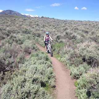
It doesn't look it, but technically I'm going uphill

On Sunday, the forecast pushed the storms back to later in the day and we geared up and headed to Round Valley for MTBing.  The temperature was very nice for riding: cool but not so cold that we didn't warm up.  It was a little breezy but not terribly so; we actually wished for a bit more wind in sections of the trail because there were some weird bugs - not biting but getting stuck in our ears and faces.  The trail traffic was much better than the last time we were out although, per usual, we started seeing more people around 10:30 a.m., which seems to be the magic hour for most people.  Even with the recent rains, the trails were in good condition, damp in a couple spots but no puddles.  Despite his long road ride the day before, H was riding great; I, on the other hand, was slow and had trouble focusing for some reason.  Still, it was a good day on the trails.

Guardsman Pass opened for the season this weekend so we headed that way to go home, stopping at our picnic spot for snacks.  It hadn't progressed much towards summer up at that elevation, however, with no leaves on the aspens and winterkill still all over the ground.  The wind was brisk and the clouds started moving in so we had our snacks in the truck, watching the hawks circling overhead, looking for small and delicious snacks of their own.  Since it had been six months since we'd been up at the head of Big Cottonwood Canyon, we drove through Brighton before heading down for home.  There's still a lot of snow up at the top of the canyons, something to keep in mind for planning hikes in the next couple of weeks.  Summer is coming, though, and that snow won't last too much longer.
Wednesday, May 25, 2016

washed out

Every year, every spring, I forget how much of a crapshoot the May weather can be in northern Utah.  We were totally washed out of outdoors activities last weekend - we did manage to get out for a run on Saturday, in between the morning rain and the afternoon rain - but the sun really didn't come out until 5:00 p.m. Sunday evening.  There was even snow at elevation!

And it doesn't look like its going to get all that much better in the near future:

Salt Lake Valley:


and Park City:


So it isn't the worst but it is chilly and possibly quite damp.  I guess we'll just have to see if we get washed out again.

Saturday, May 21, 2016

never on saturdays

After being cranky for a week about having to be back at work, it was once again the weekend!  There was some discussion over chicken wings at the Wing Coop Friday night whether we should go hiking or MTBing on Saturday: the final decision was MTBing since the weather was looking iffier for Sunday and it's always better to ride when it's dry.

We didn't get the earliest of starts - on the trail at 10 a.m. - but even so I was surprised by how many people were out on Round Valley's lovely trails.  Tons of dogs and their people (there are new signs saying that all of Round Valley's trails are now leash-free, except within 150 feet of the parking lots), trail runners, walker and oodles of MTBers.  Everyone was very pleasant but many seemed new to the trails and we found ourselves pulling over for other riders even if we were the ones going uphill.

At the top of the Sweet Sixteen switchbacks

Still, the trails were dry and in very good shape; the temperature was very nice for riding; and it was a lovely day, even with the headwind on the uphill return to the truck.  I found myself a little timid on some of the loose rock but ended up climbing well, only walking two switchbacks of the Sweet Sixteen and making it up the Staircase with no problems.  Over post-ride recovery beers, we agreed that while it was good to be back MTBing in Park City, this would be the last time (if possible) that we would ride on a Saturday: too many people.  It's great to see so many folks out and enjoying the trails and the nice weather.  I just don't want to ride with them.

Thursday, May 19, 2016

last day

The last day.  It's always sad on the last day of vacation, when real life comes crowding in to the edges of your consciousness.  You know it's coming but it's still a shock when it does.  We love Moab so much - which is a little strange, given that H really doesn't like excessive heat and boy, can it get hot in Moab - it's always difficult to say farewell to the desert's red rock.

But first, breakfast!  Despite the information we gathered both online and via the paper restaurant guide in our motel room, the Wake and Bake Cafe does NOT open at 7 a.m. on Sundays.  (It opens at 8 a.m.)  We were up and packed and ready to go so the thought of standing around for another hour didn't much appeal to us.  Instead, we found ourselves at the Jailhouse Cafe (101 Main Street).  We had skipped going there in prior years because the prices are a little higher than the Moab Diner, Wake and Bake, the Love Muffin and the Eklecticafe, but we were hungry and there wasn't a line to be seated.  The food was very good (a bacon and cheddar omelette for H and light, thin Swedish pancakes with lingonberry compote for me) and while yes, the prices are a little high, we were happy with our breakfast.  And there was a long, and growing, line to be seated when we left.

Bar M loop climb

The MOAB Brand trailhead was our next stop - and the stop for many other folks as well.  When we got there around 8:45 a.m., there were about 15-20 vehicles in the parking lot; when we left, there had to be 60-75 vehicles, more than we have ever seen.  Even so, we scarcely came upon other riders as we did two circuits of my favorite Rusty Spur/Bar M loop.  We did pass a tour group on the first Bar M climb, and then we LAPPED them on our next time around!  The weather conditions were perfect for riding: cool and sunny, with a tailwind for the backside of the Bar M loop, so H basically didn't have to pedal at all, eating up the miles on his big, 29" wheels.

Post-ride recovery beverages!

There were post-ride beers, of course, and then we headed for home, stopping in Green River for burgers at Ray's Tavern.  The weather completely switched over as we headed north and it rained for most of the drive back.  It seemed very green in the Salt Lake valley after our days in the desert.  It took us a little while to unload and unpack (and pile up the dirty laundry).  It'll take even longer to let go of the memories of another fantastic Moab sojourn.

Tuesday, May 17, 2016

double session

Because of the early bedtime the night before, we were up earlier Saturday morning and again off to the Moab Diner for granola with yogurt and fruit and a "Sweetwater Skillet".  We drove out of town to Dead Horse Point State Park, finding ourselves only the second vehicle in the parking lot - there's a lot to be said for early starts!  We were on the MTB trails by 8:45 a.m., doing the Pyramid/Big Chief loop on the east side of the park and Crossroads/Whiptail/portion of Twisted Tree on the west side (16.12 miles, 2 hours 22 minutes).

Always a view at Dead Horse Point State Park

We had the trails completely to ourselves ... except for all the desert cottontails and jackrabbits, and the solitary footprints of an unseen, early morning hiker. I did manage to crash on Whiptail: successfully riding up a rock ramp, only to hit a bump and go flailing into a bush.  It was nothing serious, just got banged up and scratched a bit, but it did manage to dent my confidence for the return ride.  When we got back to the truck, we were amazed to see the parking lot nearly full, and were even more grateful that we hadn't had to deal with riders on the trails.  As we stood around, consuming post-ride refreshments (including deli sandwiches we'd managed to remember this time), the temperature dropped, the wind picked up and some sprinkles of rain hit us.  Once again, we'd timed it just perfectly.

Park near here

After consulting our map and our weird little hiking book, Moab Country Day Hikes: Forty One-Day Hikes in the Moab Vicinity, by Fran and Terby Barnes, we came up with a nearby afternoon hike: page 43, Sevenmile Canyon - South Fork.  [What's weird about this book, and the other one we have, which is forty more day hikes in the Moab vicinity (purchased at the most excellent Back of Beyond Books bookstore, on Main Street in Moab), is that it doesn't give you mileage, and a lot of their listed hikes are basically freestyle, a la "walk out here and roam around for a while" - which is challenging for a rule-follower like me.]

Need to look this one up

There's no marked trailhead for the south fork of Sevenmile Canyon but we found it by following highway mile markers and then confirming the start by locating some wonderful desert bighorn sheep petroglyphs near where the book said to park.  We crossed Route 313, squeezed around a fenceline and entered the south fork of Sevenmile Canyon - which we had all to ourselves.  We were literally the only ones in there, which is simply remarkable given Moab's popularity.  There were tracks in the now-dry wash - both horse and 4WD vehicle - which meant that this fork of the canyon isn't entirely unfrequented, but to be all alone there, surrounded by red cliffs and blue skies and sand underfoot?  So cool.

Sevenmile Canyon South Fork

We didn't intend on hiking the length of the canyon but were on the lookout for a formation called "Fraggle Rock," which was a hole in a rock ledge with a round boulder perched on top.  The walking wasn't all that easy since we were in coarse sand but it was pretty flat.  The pretty canyon got narrower and narrower; we ducked under a gate set up by the BLM to keep all motorized vehicles from progressing deeper into the canyon, but which allowed foot- and horse-traffic to go on.  At this point, the sand was wet underfoot, as springs came to the surface.  The trees and smaller vegetation got much thicker and there were birds everywhere.

Funky canyon walls

At just past two miles, we spotted Fraggle Rock (very cool formation and exactly like the photo in our book) and called that our turnaround spot.  When we got back to the truck (5.14 miles round trip, 1 hours), the weather switched again to wind/cold/rain - once again, excellent timing on our part.  We drove back to town, cleaned up and managed to stay awake long enough for a 7 p.m. dinner reservation at Miguel's Baja Grill: margaritas, lamb tacos for me and the "Mother of all Burritos" for H.  What a good day.

Fraggle Rock!

Sunday, May 15, 2016

crater day

There had been some debate about both hiking and MTBing vs just hiking on Friday.  H had a huge blister on the bottom of his foot from our not-Druid Arch hike that I was worried about, but then my sit-bones were pretty sore from our ride at MOAB Brand Trails.  Generally, if we're doing double sessions, I like to MTB first and then hike.  H was concerned that hiking too late in the day would be either too hot or subject to afternoon thunderstorms.  We ended up planning to hike first, but brought MTB gear along with us just in case we were inspired to saddle up.

"Strenuous and difficult" - perfect!

Breakfast was at the Moab Diner: a Denver omelette for H and peanut butter and bacon on an English muffin for me.  As we ate, we watched scores of 1970s and 1980s vintage Toyota Land Cruisers driving past, as well as some kickin' old Broncos.  Any one of those old trucks would be my dream vehicle and it was fun to see so many of them around.

H on the trail down to the floor of Upheaval Canyon

The hike we decided to do was the Syncline Loop around Upheaval Crater in the Island in the Sky District of Canyonlands National Park.  It was partly cloudy and in the upper 70s when we got there, with not yet a full parking lot at 9:20 a.m. when we got on the trail.  The Syncline Loop is a longish hike (8.66 miles, done in 4 hours 25 minutes (we were slow because it was steep)) that plunges 1,300 feet in a mile right off the bat, descending from the mesa to the floor of Upheaval Canyon.  Despite the quick elevation loss, we didn't think the trail was as intimidating as Gooseberry had been - it never felt like you were clinging to the side of a cliff.

Admiring the view

Once down, we followed the canyon wash to a trail junction (option to head west to the Green River), then climbed up a short, steep hill via nicely-placed stair-stepped stones.  There was another trail junction at that point - the Crater Spur, heading into the Upheaval Dome crater itself - but our loop continued along the outside of the collapsed dome's rim, following a streambed, then heading up the spring-fed wash of the Syncline Valley.  It was getting hot at this point but some of the cottonwood trees provided brief shady respites for us.

Walking in the canyon wash

The climb was fairly steady here since we were working our way back to the top of the mesa.  There was a steep scrambling section (where our hiking poles were more hindrance than help) where we had to navigate big boulders and had a little trouble finding cairns in all the rock fall.  After the scramble (and after a Poptart break under a juniper tree), the last stretch of trail was somewhat of a grind: up a steep slickrock section and then slogging up a dry wash to the trailhead.  We passed through a juniper grove near the end of the loop and were soundly scolded for the intrusion by at least a dozen jays who had taken up residence there.

Starting the scramble section

The clouds had been gathering as we were nearing the homestretch and we were feeling smug about our choice to hike early, especially as we met other hikers heading in as we were coming out.  The temperature dropped and the wind picked up as we drank a post-hike beer and helped a couple of guys jump-start their old Durango.  The thunderstorms moved in for reals about twenty minutes after we'd finished the hike - we sat in the truck and watched the lightning flash all around - and then I felt very badly for the late-start hikers, out there in that weather.

Slickrock section, towards the end of the loop

We drove back to town, the thunderstorms deciding against afternoon MTBing for us.  After cleaning up, we walked to Milt's Stop N' Eat.  We easily scored seats at the counter and simply inhaled our burgers, fries and shakes when we got them; we had forgotten to make sandwiches for lunch so we were really quite hungry.  The full bellies hit us hard, however, and back at the Kokopelli, we both crashed, lights out at 9 p.m.

Friday, May 13, 2016

moab bound

Thursday was a bit of a transition day for us as we packed up our lovely little campsite, said farewell to the Needles District of Canyonlands National Park and drove north to Moab.  The weather seemed to be changing a bit - the last night's wind heralding the approach of a front - and some high, thin clouds ensured that it was not as hot as it had been.

The dreaded cattle guard crossing

We drove straight to the MOAB Brand MTB trails, north of town, and did our favorite circuit of Rusty Spur and the Bar M loop twice (18.93 miles, 2 hours 12 minutes).  There were several vehicles in the parking lot but we didn't really see anyone out on the trails.  We had intended to swap my clip-in pedals out for flat pedals, as we have done in past trips, but didn't get around to it before leaving home; I forgot my flat shoes anyhow so I rode mostly with just my right foot clipped in.  With it being the first time back on the bike, I was a little nervous going over the uphill cattle guard on Rusty Spur, and had to walk one short section at the start of the Bar M loop.  But I was climbing okay and by the second time around was beginning to regain some confidence on two wheels.

H, Bar M loop, La Sal mountains behind

After our ride, we went back to town but found it too early (2 p.m.) to check into our motel, so we bided some time at Woody's Tavern, talking with a young local river guide/waiter/lost soul over beers.  After we were able to get into our room and clean up, we did a necessary laundromat/grocery store run, then walked down to the Moab Brewery for an early dinner.  Although the restaurant did not seem as busy as it has on past Friday night visits, the bar was full.  H had a chicken burrito and a red rye; I had a gyro salad and a Johnny's IPA.  It was an early night for us  - and wow, all the nights seem to be early nights these days.

Wednesday, May 11, 2016

needles district, second day

Wednesday morning we got up, had breakfast (oatmeal with dried cherries and bananas, and Poptart chasers) and drove to the Elephant Hill trailhead in CNP.  Access is via a narrow, winding 2.7 mile dirt road and while we didn't meet anyone going the opposite way, we both were thinking that it could get a little nerve-wracking later in the day on the drive out.  We got to the trailhead around 9 a.m.  There were a good number of cars already there, including a jeep making its way up the challenging Elephant Hill 4WD/ORV road, but it wasn't full.  It was already hot, though, so we slathered on more sunscreen and hit the trail.

View of the Needles from the trailhead

The plan was to hike out to Druid Arch, a 10+ mile out-and-back and one of the most popular hikes in the Needles District.  At the third trail junction, however, we second-guessed ourselves and went the wrong way.  (Note to selves: for future reference, take Hiking Canyonlands and Arches National Parks because it has explicit mileage/junction directions.)  At about five miles into the hike, we did consult the book we had brought (without explicit mileage/junction directions) along with the GPS and determined that we were, in fact, nowhere near Druid Arch.  Because we had gone through half our water at this point, we decided to turn around.

The squeeze

Despite our mis-navigation, the trail was gorgeous, all slickrock and sandy washes and narrow passages through the giant sandstone fins that make up the actual Needles.  We saw lots of lizards and songbirds, some squirrels and plentiful deer tracks.  What we didn't see many of were people - and I suspect we would have, if we'd been on the Druid Arch trail - and that was just fine by us.

View of the La Sals from not-Druid Arch

When we got back to the truck, the parking lot was full and it was quite hot.  We met five cars on the drive out but amazingly, we had no trouble get pass one another.  After quick stops into the Needles District visitors' center (for a puzzle and a sticker) and the Needles Outpost store (for ice and shower tokens), we headed back to camp.  It felt great to shower off all the sand, salt and sunscreen and we then settled in under the juniper trees as the sun worked itself lower in the sky.

H on the trail

Dinner was not quite as good as the previous night's - chicken and broccoli alfredo, using canned chicken and home dehydrated broccoli - but we still snarfed it down quickly.  The evening was windy and quite a lot warmer than the night before; despite this, we felt a campfire was in order so that we could have something to stare at alternately with the stars overhead.

Looking west from our tent

Monday, May 9, 2016

canyonlands, needles district

As we did last year, we headed down to the greater Moab area for a few days to bid winter farewell, baring our pasty skiers' legs to the hot sunshine of southern Utah. We were on the road by 6:45 a.m. Tuesday morning but drove straight through Moab, instead continuing down to the Needles District of Canyonlands National Park.  When we had last been there a couple of years ago, we really wanted to return to explore further.  We had plans to camp for a couple nights but first, a hike!

Needles District, Canyonlands National Park

We parked at the Squat Flat Campground trailhead in the park, hitting the Squaw Flat/Big Spring Canyon loop around 12:45 p.m.  The loop was 7.2 miles, which we did in just under three hours under clear and sunny skies.  It felt very similar to the Neck Springs hike (Island in the Sky district) with short up-and-overs on slickrock and then down through washes.  There were lots of springs in the area so there was a fair amount of water.  We heard lots of birdsong and saw lizards, squirrels, a snake, chipmunks; there were plenty of deer tracks but no actual deer sightings; the wet spring conditions had brought lots of wildflowers to bloom as well.

Following the cairns up the rock

After our hike, we drove to the Needles Outpost, just outside the park boundary.  We had originally hoped to stay at the park's campground but they don't take reservations for some reason and when I called to ask, the ranger said that the sites tend to fill up around 8 or 9 a.m. each day (!!!).  There are numerous BLM campgrounds in the area as well, but we really didn't want to spend all day driving up and down dirt roads, looking for a place to pitch our tent.  The Needles Outpost takes reservations - and turned out to be a great campground.  We had the best tent site (#9) too.  Although online reviews from a couple years ago mention some less than pleasant experiences for campers, we found the staff pleasant and helpful; the showers were clean (and much appreciated); and the sites were in good shape.  Ours backed up against some red rock cliffs and we had several good-sized juniper trees shading the tent.

View of the La Sals from the slickrock

As we set up camp, other people started rolling in; we ended up with neighbors on each side (but not across the road, so our sunset view was unimpeded), but they were very quiet.  Dinner was a family-sized box of Zataran's Dirty Rice, supplemented with home-dehydrated ground beef, peas, corn and green peppers.  It was actually quite delicious and although we made too much (with no way to refrigerate the leftovers), we ended up eating most of it.

Dinner!

Being so far away from ... well, everything meant that the stars were absolutely spectacular.  We had a nice campfire and stared at the sky for as long as we could stay awake.  Which wasn't quite 10 p.m.  (This would prove to be our latest night of the whole trip.)

Best campsite!

Sunday, May 8, 2016

placeholder: upcoming

There will, I promise, be a REAL post very soon.  Just as soon as H and I remember how to download the photos from our recent trip to Moab.  We had a fantastic few days down there, doing a little camping, a little hiking, a little MTBing, a little falling asleep very early from all the activities.  In the meantime, here's a taste of what's soon to come:


Wednesday, May 4, 2016

placeholder: retrospective

Ah, shoulder season.  When the ski resorts are closed (except for Snowbird, but with the tram and Peruvian chair down, access is extremely limited) but the hiking and MTBing trails are still too wet.  The weather is eccentric - over 36" at the 'Bird this last week - with storms of the rain and snow variety moving through quickly, and it tends to be chilly.  Shoulder season is, for us, an opportunity to be at home: mow the lawn for the first time, chip away at the weeding, fold all that clean laundry that has been languishing on the guest room bed, dehydrate veggies and ground beef for future camping trips, switch over the gear in the mudroom from winter activities to summer ones.  All that is good and important but doesn't lend itself towards compelling blog posts.  So instead, here are some of my favorite photos from our Alta ski season.

November 27th - the season is just beginning

Blue skies over the High Traverse (and soft snow under it)

Christmas Day

Supreme chair the day after Christmas

January 2 - let the telemark skiing begin

Catherine's Area after a mid-January storm


Not many people in Catherine's Area that day

Mid-March, by the looks of the beard

Me, dwarfed by the Ballroom

I ain't afraid

Closing day