Sunday, May 31, 2015

porter fork

We ran a little short of bloggable activities since the weather last weekend put the kibosh on everything but our Silver Lake (American Fork) hike ... but now we're back in action.  After a very soggy May, some high pressure moved in for the weekend.  High pressure and much higher temperatures: we had the heat on just last weekend but are considering turning the A/C on already.

Fancy sign at the trail head

The hike we came up with for Saturday was up Porter Fork in Millcreek Canyon to the Porter Fork West Pass.  This was a brand new hike for us so we didn't know what to expect.  (In addition, we seem to have skimmed over just how much elevation we were in for when reading the description.)  The trail head is just below the Terraces trail head, about 4.4 miles up the canyon road.  The first 1.5 miles is on a narrow, paved, gated driveway that goes up past a number of wonderful cabins perched on the banks of a beautiful spring-fed creek.  Note that I said it "goes up" because it did, steeply, right from the start.

Western clematis climbing a tree

When the paved road ended, we kept going up, into the Mount Olympus Wilderness area, on an old mining road.  I felt badly for the mules who must have worked for the miners because that old road was quite steep.  We had it to ourselves, however, and whenever the road turned away from the creek, the silence was wonderful.  We passed through both evergreen forests and aspen stands, continuously climbing, until we reached a fork in the trail.

Looking back across Millcreek Canyon from old mine

At this point, we were walking on snow - although this trail is not all that high in elevation, the heavily-wooded Porter Fork faces north and thus holds onto its snow for a long time - and old footprints went both ways.  We went right first, whereupon the "trail" dead-ended at the ruins of an old mine.  We backtracked then and went to the left, but we still had to get out the map since the trail was completely covered with several feet of old snow.  We figured out where we needed to go and started up a steep snow-filled gully which came out at a wider meadow.

Post-holing = not my favorite

After a quick snack, we kept going up the meadow, this time following old snowshoe tracks.  The snow was pretty deep here and before long we were post-holing, sinking up to or past our knees and skinning our shins on the snow crystals.  Our slim hiking poles were all but useless - even before one of H's snapped in half.  About halfway up the meadow, H notices that some slabs of snow were shifting when he stepped down; there was about eight inches of the newest snow from last week on top of very old snow, and we immediately started worrying about setting off an avalanche.  But we were SO close to the top that we didn't want to turn back now, so we moved over and kept going up through the trees.  I was really struggling here since we were breaking trail ourselves instead of following those snowshoe tracks; a couple of times I post-holed up to my hips and having to pull our legs all the way up and out of that is tiring.  Plus it was really, really steep and with the snow covering the trail (which our book said was switchbacked), we were just going straight up.

View of the Salt Lake Valley from the pass

With one last push up that steep meadow, we came out on top of Porter Fork West Pass, at the junction of the Desolation Trail.  There, on the other side of the ridge, facing south, there was absolutely no snow.  We paused for a bit to refuel with some homemade beef jerky, but our feet were completely soaked and we didn't want to linger long enough to get chilled.

H heads down, following the snowshoe tracks

Our descent was much, much faster, especially in the snow.  It wasn't the right consistency for glissading but we could take long steps and slide a little bit; since it was soft underfoot, it was gentle on our knees - even though our shins got scraped up pretty well.  We kept cruising when we got off the snow as well, our sodden boots squishing down the trail surprisingly quickly for how steep it was.

OMG a flat spot!

We started seeing a few people as we got further down but Porter Fork is not a heavily used trail, which is nice for the folks who own cabins up there.  We're pretty sure that the reason it isn't more popular is because it's so damn steep.  When we got back to the car and had changed out of our wet boots, we pulled out the GPS: we had gained nearly 3,200 feet in just under four miles - that last stretch, from the fork in the trail to the ridge, gained about 1,000 feet in .8 miles, so no wonder it felt like we were going straight up!  As we drank our post-hike beers, we marveled at the hike statistics ... and worried about how well our legs would recover.


Hike stats:  7.89 miles RT; 4:17 hours total, 3:17 hours moving; 2.4 m.p.h. moving average; 3,171 feet climbed UP.


Tuesday, May 26, 2015

spring is the new winter

All that moisture that we wanted back in January, February and March?  We've been getting it in May.  In addition to the unsettled weather we had in Moab, the last two weeks have been literal wash-outs in northern Utah.  On average, Salt Lake City has 1.57 inches of rain through this point in May.  This year's May (month-to-date):  3.87 inches of precipitation and eighteen days of wet weather.  Last weekend we didn't do anything out of the house (other than breakfast at the Cottonwood Heights Cafe in its new Highland Drive location).  By Sunday of this past weekend, we had cabin fever enough to get out and try a new hike, inclement weather be damned.

H at Silver Lake Flat Reservoir

The first order of business was to find a hike.  We wanted (a) something low enough that we wouldn't be trudging through too much (if any) snow and (b) something totally new, which ruled out Millcreek Canyon, which we feel we've been in rather a lot of late.  H got out the books and the maps and we settled on hiking to Silver Lake (no, not that Silver Lake) in American Fork Canyon, above Tibble Fork Reservoir.  We drove up the canyon and past Tibble Fork Reservoir, parking at a small parking area just before the entrance to the Granite Flats campground.  The road continues, pavement ending, up to Silver Lake Flat Reservoir but we went on foot on a hiking/horse trail, thus avoiding the traffic (cars, pickups and ATVs) on the dirt road.

View across Silver Lake Flat Reservoir

The trail also cut off close to a mile of distance that the road has.  It was fairly steep in spots, and rocky with loose stones, and eroded from the rush of seasonal water hurrying down the hillside.  For a good chunk of the trail we were actually walking in a creekbed, picking our way carefully to keep our feet dry.  It was pretty chilly at 48F (and would only warm up to 52F) and wet feet seemed like a quick way to misery.  We saw tons of deer tracks but only one deer, standing at distance across a wash; there were also lots of dog paw prints (and, later, dogs) which might explain the dearth of actual deer.

Standing on mine tailings, looking back from whence we came

We came out across the access road at the end of Silver Lake Flat Reservoir, an unexpectedly beautiful man-made reservoir ringed with trees and snow-coated cliffs peeking out of the low clouds above.  We walked along the gravel shoreline to the far end, briefly consulted the map at the trail head and continued up towards Silver Lake.  It was cool, very humid and very green, initially winding through aspen groves before starting to climb via switchbacks on the south-facing slope.  We gained elevation quickly - the whole trail is a steady climb, right from where we parked - and there were a couple of creek crossings which required a little bit of focus.

Approaching Silver Lake - it's 
actively snowing/raining at this point

The ponchos had to come out about halfway up and as we ground up the final steep and rocky stretch, the rain came down in earnest, switching to sleet/snow just as we got up to the lake.  Silver Lake is a very pretty little alpine lake, reminiscent of Cecret Lake at Alta, but we didn't linger there at all; worried about the weather, we took a couple of quick photos and started back down.  It was slow going at first since the rocks were a little slippery.  Descending was chilly too and although the snow/sleet/rain stopped before too long (the weather would not move out entirely, however, and by the time we were back down in the aspens, we could see that it was precipitating up at the lake again), we kept our ponchos on for a while, just to stay warm.

Silver Lake in the snow/rain

Silver Lake Flat Reservoir was busier by the time we walked around it on our return, picnickers and fishermen braving the changeable weather - some teenagers were even swimming!  We weren't the slightest bit tempted by that and continued to retrace our steps back to the truck.  After changing into dry clothes, we drove down canyon a little bit until we found a vacant picnic spot.  The prior inhabitants had not completely doused their campfire (always douse your campfire! if it's too hot to touch, it's too hot to leave!) so we huddled up to it to stay warm for our post-hike beers.  We decided that we had liked that hike and would like to do it again, in the fall to see the aspens, but next time drive up to the trail head at Silver Lake Flat Reservoir and then continuing to hike past Silver Lake to another, smaller lake, Silver Glance Lake, a mile further on.  Next time!

Just trying to stay warm

Hike stats:  7.97 miles RT; 2,181 feet of elevation gain, topping out around 9,000 ft.; avg. speed 2.4 m.p.h.; 3:16 moving time, 4:03 total hike time.  And look, a map of our actual hike:


Saturday, May 23, 2015

moab in may: hiking (pt. 2)

On Saturday, after our MTBing at Dead Horse Point State Park, we opted for a non-park hike: out to the Jewel Tibbetts Arch on BLM land, outside of Canyonlands NP.  One of H's coworkers had told us about it and we were able to find it on our map, which was good since the sign on the road was tiny and easily missed.

Wash emptying into Hell Roaring Canyon

We drove in on a sandy two-track road about 1.3 miles to a small trailhead, then did an approximately two mile loop out to Hell Roaring Canyon and the arch, named after a rancher's wife.  The trail, faint but well-marked with cairns, wound its way through sagebrush meadows, dry washes and slickrock ledges, coming out at a dramatic canyon overlook.  We had all that spectacular scenery to ourselves too.

Jewel Tibbetts Arch

Sunday was our last day and we determined to make the most of it.  We loaded up the car and headed out after breakfast, driving down Kane Creek Boulevard which goes down the Colorado River on the opposite bank from the Potash Road.  The Moab Rim trail parking lot was full so we took a spot off to the side at the mostly empty Kings Bottom Campground just down the road.  I was ambivalent about hiking the Moab Rim trail since it is a motorized access trail, and sharing with ATVs and Jeeps seemed less than appetizing.  There was even a group of small rock-crawlers heading up there ahead of us, about ten of them.  But once I saw what they were driving up, how steep and crazy it was and how slowly they were going, I was psyched for it.

H walking out from Hell Roaring Canyon

The first part of the trail is a steep slickrock climb, about a mile long, perched on the edge of a cliff and peppered with stairs and ledges.  We passed a stranded Jeep about a third of the way up, chock stones under its wheels and a note on the windshield saying, "Broken.  Gone for parts. DON'T TOUCH."  It took us thirty minutes to complete the climb which well-earned its local nickname of the "Moab Stairmaster."

So, people drive their Jeeps up these stairs

Once at the top, we continued along the road/trail, pausing to watch three big rock-crawlers make their way through a series of giant pot holes and seemingly vertical ascents.  As we continued over sandstone ridges and whalebacks, we saw three other ATVs and met that large group of small crawlers as they were coming back down from the Hidden Valley overlook at the end of the motorized portion of the trail (you can continue on foot but it's too long without a shuttle at the other end).  Every single driver and passenger had huge grins on their faces; one of them shouted to us, "This is the best trail!"  Other than that, we really had the trail to ourselves, which was an unexpected treat.

Note the tire marks - and so steep I had to put my hands down

Because it was sprinkling, we took the shorter path to the overlook, then headed out, this time over "Sand Hill" and down through a sandy wash.  When we got back to the stranded Jeep perched on the slickrock ramp, a repair party was in full swing: five other Jeeps with winches, parts, tools, music, water, girlfriends and sandwiches.  They got it fixed (a steering gear issue) and when we got back to our truck, we were able to watch them slowly, carefully, painstakingly make their way down the rock.  It looked terrifying and I was so glad to have done it on my own two feet.

View towards Canyonlands from Moab Rim trail

We were glad to have done it in general: solitude, scenery and entertainment - the Moab Rim trail has it all and was a great last hike for our weekend.  What a fantastic trip.  We can't wait to get back to Moab.

Looking at the Colorado River from the Moab Rim trail

Wednesday, May 20, 2015

moab in may: hiking (pt. 1)

After we rode at the MOAB Brand trails on Thursday, it was still early enough in the day that we didn't yet want to head into town to check into the motel.  We drove into Arches National Park instead, and after consulting our books (this time, 50 Best Short Hikes in Utah's National Parks by Ron Adkison) and maps, found a short hike to a couple of arches that we hadn't done yet: Sand Dune and Broken Arches.

Looking back at Sand Dune Arch
(among the fins) from under Broken Arch

This was an easy hike, across a sandy field to a green wash under Broken Arch, then continuing past the arch (which most people don't seem to do), walking under and around sandstone fins to the Devil's Garden campground.  This is a small campground (50 sites) and the only one accessible by car (there are other primitive sites in the park but are accessible only by backpacking into them); some of the sites seemed quite nice.

Oh, dear deer!

The trail continued through the campground, looping back to Sand Dune Arch (about 2.2 miles total for the loop), and again we had it to ourselves, aside from a rabbit and a couple of mule deer.  We popped in on Sand Dune Arch - not really a hike, since it's only about a 200 yard walk in between rocky fins - and then headed into town.

Neck Spring loop

Friday morning, after breakfast and provisioning, we headed up to Canyonlands National Park.  We parked at the Neck Spring Loop trailhead at the Shafer Trail overlook; it was early enough that we didn't have to struggle for a parking space.  This is a fairly popular spot due to the overlook and we weren't sure how many people we'd see on the hike.  The book we were using this time, Best Easy Day Hikes: Canyonlands and Arches by Bill Schneider (he has a bigger book on all the hikes in Canyonlands and Arches that we are going to pick up next), said that it was one of the longer hikes in the book but not difficult by any means.

Neck Spring run-out

We ended up only seeing ten other people - pretty solitudinous for a hike in a national park.  The trail alternated between sand and slickrock, taking gradual descents into washes, following the contours of the canyon.  Towards the end there was a short, steep climb back to the top of the plateau, and the finish was on slickrock on the mesa.

Climbing back out of the wash

There were lots of springs down in the washes and the extra moisture meant deciduous trees, scores of songbirds and many, many deer and rabbit tracks.  There was evidence of 19th century ranchers too: abandoned water troughs and fences.  The loop finished out at a viewpoint, looking down at the Shafer Trail.  Hike stats:  5.75 miles; 2 hours and 11 minutes of walking, 22 minutes standing around looking at stuff; 1,068 feet elevation.

Abandoned water trough

We ate our lunch at the Aztec Butte trailhead (Aztec Butte is a total misnomer: the native peoples here were ancestral Puebloans) and then decided to climb the buttes to see the ruins.  We think we turned back too early on the larger butte, losing the trail to the top on the slickrock, but spent some time admiring the two 1,000+ year old granaries on the smaller butte.

Shafer Trail overlook

The weather started to turn at this point - we could see dark clouds, virga and snow squalls all around us - and we decided to skip the MTBing for the day.  It wasn't so dire that we couldn't do another quick walk, however, parking at an unnamed picnic area and walking out to the White Rim overlook.  The trail out there was very gentle, with a gradual slope winding its way through gorgeous red sand and juniper glades, and trail's end gave us some of the best views of the White Rim trail that we've ever seen.  At which point our camera battery died.

Granaries at Aztec Butte (smaller butte)

The wind picked up as we walked back towards the car, taking a short detour to peek over the edge of the plateau at the nearly-vertical beginning of the Gooseberry Trail (we have since decided that we really, really want to do that trail).  We were just two minutes away from being back at the truck when the rain - and hail - started and the temperature quickly dropped twenty degrees.  We drove out of the hail as we headed back to town but it was very windy and rainy and we felt pretty smug about not being out on our bikes in the storm.

White Rim trail overlook

Monday, May 18, 2015

moab in may: pause for refreshment

There are a decent number of dining options in Moab, in the summer at least as I imagine much of the town puts up its shutters over the winter.  Our first stop is almost always the Moab Brewery, where we had dinner our first night on our recent sojourn.  We walked there from our motel Thursday evening and scored a place on the corner of the bar.  It was busy but not as slammed as we have found it in the past.  For beers, I had a Dead Horse amber ale and H went with the Johnny's American IPA.  I was feeling the need for something green and had an enormous chicken caesar salad that was pretty good; H, who likes burritos, had a burrito.  People came and went, folks chatted with their neighbors at the bar, and things stayed busy but not crowded.

Friday morning we stopped for breakfast at the Moab Diner (Denver omelet for H and a peanut butter English muffin with bacon for me), which continues to confound us by refusing to be open on Sundays.  We got there early enough that there were plenty of tables available, but service was a little slow.  We had gotten some provisions at the grocery store before heading out for our adventures, so lunch consisted of sandwiches, beef jerky and chips at a trailhead - spectacular scenery makes the most banal food delicious.  The weather rolled in as we were leaving the Island in the Sky (Canyonlands NP) plateau and by the time we had gotten back to the motel, cleaned up and started walking in town, it was full-on pouring rain.  We swung by the in-town information center to pick up a guide to identifying local flora and then took shelter at Woody's Tavern for a couple of beers.  It was busier in there than we were used to: both pool tables and the foosball table were in use; plenty of scruffy young desert rats lined the bar; and the band was setting up for the evening's entertainment.

When the rain let up to a mere sprinkle, we hit the sidewalk again, walking back to Millcreek Boulevard to Milt's Stop & Eat.  Established in 1954 (and passing through several owners in the meantime), Milt's is still very popular, cranking out homemade chili, burgers, hand-cut fries and milkshakes.  We got there in time to get a couple of spots at the counter; the tiny place filled up around us and by the time we left, there were swarms of people at the walk-up window, getting to-go shakes despite the recurrence of the rain.  We split an order of fries (and made quick work of them, despite how blisteringly hot they were), and I got a cheeseburger and a small (huge) chocolate malt; H got a "Western BBQ Bacon cheeseburger," laden with grilled onions, bacon, cheese and BBQ sauce, and a chocolate shake.  It was all so delicious and I slurped my malt right to the bottom of the cup.

Mmmmmmmm-Milt's Stop & Eat

Saturday morning we went back to the Moab Diner for breakfast and to the grocery store for lunch provisions.  For dinner that night I had had the foresight to make reservations at Miguel's Baja Grill, remembering getting shut out as a walk-in in prior attempts.  We really like the food there - I got the pork tacos, H had the giant burrito with both red and green chile, and we both had their very good, but tiny, margaritas - but the service is so slow.  It's not that big a place and they had plenty of servers running around - they just need to do less running around and more paying attention, I guess.  Still, we weren't in a hurry to go anywhere so it wasn't that big a deal.

We went to a new (to us) place for breakfast on Sunday: the Wake and Bake Cafe.  We timed it just perfectly too as there was hardly anyone in there when we put in our orders (coffee and bagel with cream cheese and lox for me and a breakfast burrito for H), but by the time we got our food, there was a line out the door.  This is absolutely more of a locals place than the Moab diner: everyone in there was young, skinny and weathered, and I think more than one was wearing pajamas.  The lox made my bagel a little expensive but the breakfast tacos looked good and were quite reasonable - I'll give that a go when we go back.  Lunch was more scrounging out of the cooler between hiking and MTBing, leaving a little to be desired, but we knew we'd be stopping at Ray's Tavern in Green River on our way home.  The joint was pretty busy but we scored seats at the end of the bar where we devoured our cheeseburgers and fries, washing them down with some Uinta Cutthroat pale ales.  We always get sad when we have to leave to go home - but doing so with a bellyful from Ray's makes it all a little easier.

Saturday, May 16, 2015

moab in may: mountain-biking

To console ourselves with the loss of the ski season, H and I scampered off to Moab for an early May long weekend.  The weather seemed ominous when we left early Thursday morning - 30s and raining, which would end up being a lovely snowstorm in the Wasatch Mountains for Snowbird's final weekend - but it was mostly sunny, breezy and about 70 F when we got to the MOAB Brand Trails.

Focused on Rusty Spur

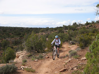
We did two laps of the Rusty Spur/Bar M loop for a total of nineteen+ miles.  There were very few people out riding when we got there; vehicles started rolling in when we finished.  The local Moab trail crew, the Trail Mix Committee, had done a lot of work on the trails since we'd been there last September: the hills on the back side of the Bar M loop had been regraded to be much less loose and rocky, and one uphill corner that I had never been able to ride had been de-bouldered and smoothed out - and I was able to ride it.  Otherwise, due to spring season and the recent precipitation, the trails were not nearly as sandy as they've been, making it a much more enjoyable ride.

Cruising around the Bar M loop

We really like those two trails, which feature cross country-style riding with rollers and swoops, a little climbing, a little slickrock - something for everyone, really.  Some beers and snacks in the parking lot concluded the first MTB ride of the weekend.

Near the Great Pyramid overlook, DHPSP

We didn't get out on our MTBs on Friday because the weather turned cold and wet after our hike [hikes will be in a separate post].  Saturday was a different story.  We got up and got going, stopping at the grocery store for gas and provisions, and at the Moab Diner for breakfast, then headed on up to Dead Horse Point State Park to get on the trails there.  It was a chilly start - 43 F (!!), partly cloudy and breezy - but it was already pretty busy up there by 9 a.m., certainly busier than we've ever seen it during our fall trips.  To get ahead of the hordes, we struck out for the Big Chief loop of the Intrepid trail system, both of us in long sleeves due to the cool temperatures.  My fingers got cold right away but warmed up after about fifteen minutes of pedaling.

Out on the Big Chief loop

The Big Chief trail is exactly the reason why I asked H to switch out my clip-in pedals for flats: I was on and off my MTB a lot, even though I did feel like I was riding more of the rocky step-ups than I have in the past.  We didn't see a single rider on that trail - although the rabbits were rampant.  When we got to the Crossroads trail junction, we took that across to the newer trails on the west side of the park road.  These trails were definitely sandy but since the sand was damp, they were very rideable.  We did the whole Whiptail trail (saw five other riders and lots of bunnies, including a huge jackrabbit), then took the Twisted Tree trail to close the loop.  I had to walk a fair amount of that trail (climbing up over rocks) but it's a short connector and so the hike-a-bike wasn't too bad.

Grinding uphill, Bar M loop

We headed back on Whiptail, having to navigate the singletrack carefully as more and more riders were showing up, many of them newbies who didn't have a clear concept of MTB etiquette.  Back on Crossroads, right before crossing the park road, I was enjoying the swooping rollers among the sagebrush when I took a corner too fast.  My rear wheel slid in the sand, my front wheel twisted and I went right over the handlebars into a sagebrush.  I got a little scratched and bruised, but nothing serious - only some stiffness and soreness that wouldn't really kick in until a couple days later.  H shook his head, reminding me to be more careful; I was mostly dismayed he hadn't gotten a picture of the crash! 

H with the LaSals behind him

 As we headed back towards the truck on Ravens Roll, the trails kept getting busier (one guy, heading downhill, told me to move over and I snapped at him that uphill riders had the right of way).  The parking lot was completely full and swarming with MTBers when we finished up - I was glad we'd gotten out early, despite the morning chill.  It was a great ride, crash notwithstanding, with 16.7 miles and incredible views every pedal stroke of the way.

MTB art shot! (and product placement)

On Sunday, after a fantastic hike on the Moab Rim Trail, we managed to squeeze in a quickie ride back at the MOAB Brand trail system before we had to head for home.  Since we were getting there after noon, it was pretty busy but we lucked out, not seeing with anyone on Rusty Spur and only coming across a few folks out on the Bar M loop.  My legs were feeling the fatigue (and my sit-bones were a little tender, getting back into the saddle!) from the morning's hiking exertion, but I still managed to climb all the hills.  There was no post-ride toast - we were out of beer, horror of horrors! - but with Ray's Tavern not far away in Green River, we were still able to send off the long weekend in style.

Wednesday, May 13, 2015

desert in bloom

We recently got back from a long weekend in Moab - which was wonderful, as usual.  In the past we've gone down there in the summer/fall and while we haven't given that up yet, we wanted to experience it in the springtime as well.  Some of the differences we noticed between the seasons: in the spring, we got cooler temperatures - as in, it pretty much snowed in the LaSals the whole time we were down there this time - and a better chance of iffy weather; the creeks and Colorado River were all quite high and moving quickly; a few bugs, gnats mostly; less sandy MTB trails. 

One big difference, and one that I had been hoping for, was the fact that the desert was in bloom: lots and lots of flowers.  Here are a sampling of what we saw (hopefully identified correctly - if I've gotten any of them wrong, PLEASE let me know in the comments):


Prince's Plume

Fragrant Evening Primrose

Harriman's Yucca

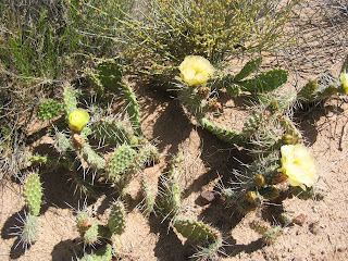
Flowering cactus - possibly prickly pear?

Another flowering cactus - possibly prickly pear?

Woolly locoweed

Eaton's Penstemon

Another kind of primrose (?) 

Blackbrush

Claretcup - spectacular in person

Hopi Blanket Flowers, maybe (?)

Purple Asters