
Still dark when we started

Sun coming up and moon over Gunsight (Alta)
We got up at 5 a.m. Willingly. On a Saturday morning. We weren't sure exactly how many miles we'd be hiking, nor how many feet of elevation we'd be climbing, so we wanted to give ourselves an early start. This time of year, that meant it was still dark when we parked the truck on the canyon road above Snowbird. The moon was big overhead as we walked up the road towards Alta. We kept going up along the dirt Summer Road and then, the sky brightening overhead, turned onto the trail through Albion Basin, spotting two moose and several mule deer, including a still-spotted fawn and its mother. There was a steady wind blowing down the canyon and my hands got really cold even as the rising sun hit the mountaintops overhead; it wasn't until we got to the Catherine's Pass trail head that I could move my fingers.

Catherine's Pass
The parking lot at that trail head was surprisingly full: from bow-hunters trying to fill their deer tags, we discovered, talking to some of them on our way up to Catherine's Pass. The early morning temperature was pleasant as we quickly got to the pass and then continued up to the junction of the Sunset Peak/Great Western trails, putting the first five miles of the day behind us. There were a few other hikers out, nabbing the sunrise from the ridge, but it was still and quiet and we felt like it was all ours.

Descending the GWT in Alta Dry Fork
After double-checking the map, we descended into new territory for us, following the Great Western Trail down into the Alta Dry Fork. This was a beautiful drainage with trees and dramatic cliffs and a now-dry creek that must just be amazing in the spring. As the sun came over the ridge, we passed a couple of campers, and a couple of trail runners passed us, and it was all perfectly quiet. At the bottom of the drainage, we got on a jeep road that led us south and east. We had transitioned into an aspen forest at this point. And despite all the hunters we saw out and about, we still saw several silent mule deer, disappearing soundlessly into the underbrush.

This is the backside of Devil's Castle
At a junction, we turned right onto another dirt road, now beginning to move up into Mineral Basin, past the Pacific Mine reclamation area and several campsites. Supposedly there is a trail head to Pittsburg Lake there somewhere, but we never saw that trail so we aren't sure. The "road" we were on was very rough - high clearance 4x4 or ATVs only - with lots of rocks and wet spots from nearby
springs. It ran along the American Fork River, still fairly small as it cascaded out of Mineral Basin and down American Fork Canyon behind us; we had to cross it once and I felt luck to keep my feet dry with the remaining miles ahead of us.
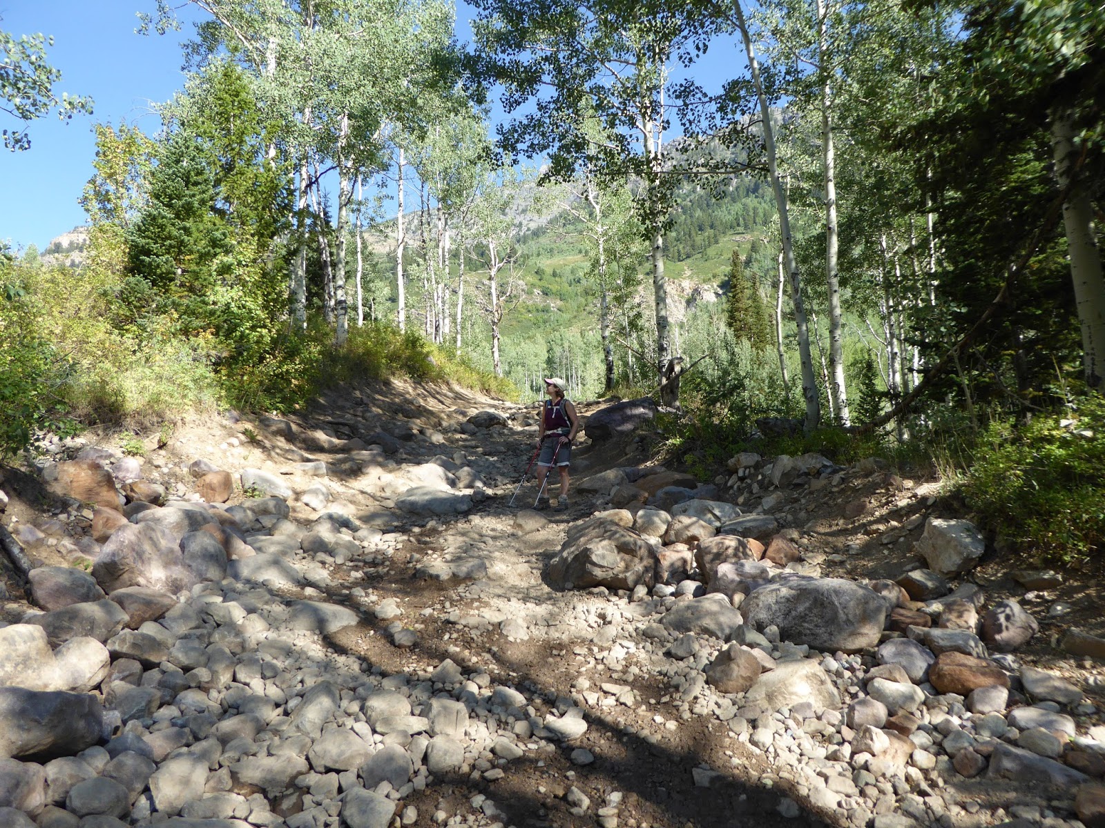
I have trouble calling this a "road"
We paused for a snack at around eleven miles and gazed up at the lodge at the top of Snowbird, looming high above us in the distance. Our goal in sight, we kept on and the road/trail/tumbledown of rocks got steeper. It wasn't my favorite surface for hiking - rocky and loose - but we had to keep going and once we crossed onto Snowbird's property, the road smoothed out a bit. We chatted with a couple of guys on an ATV - who greeted us by exclaiming how impressed they were that we were hiking what they'd just driven - and then continued on up the ski area towards Hidden Peak and our tram ride down.

Our goal. Way the hell up there.
The section from the bottom of the Mineral Basin Express chair to the top of Snowbird was tough for me. It wasn't too hot, despite being fully exposed to the sun, but it was steep and my legs were pretty tired at this point. Whenever the road would flatten out, I would pick up the pace a little but as soon as the incline picked up again, I could feel myself flagging. Even when H said, "We can't let the guy [who had clearly ridden the Peruvian chair up and come through the tunnel] beat us," all I could muster was "Really?" and shuffle a little faster for a few yards. Note: that guy did NOT beat us.

On Snowbird property at least
We dragged ourselves up to the tram and availed ourselves of the free ride to the base of Snowbird. I know it would have been more bad-ass to walk it but that would have added another 3+ miles, with the switchbacks, and we felt we'd probably done enough. H could feel hot spots on the balls of his feet and my back started to stiffen up as soon as we stopped moving. Sweaty and dirty, we still managed to feel smug, knowing that not a single person on that tram had done what we had just done. We walked up the path under the Chickadee chair, past all the people in line for the alpine slide, and got back to the truck.

Summit achieved!
Although we had had the forethought to bring our Oktoberfest mugs with us - just in case - neither of us was willing (or possibly able) to take those mugs back down the hillside for beer and polka music. So we had surreptitious PBRs while we changed out of our hiking boots and then headed down the canyon for home. This loop wasn't the longest hike we've done - Ben Lomond still holds the distance record - but it was the longest combined with the most elevation. It had beautiful scenery in a part of the Wasatch we hadn't seen before and we had the trails mostly to ourselves for the whole way. It was a great hike - even if it did result in bedtime before the sun went down that night.

Check out this profile: from the 'Bird up to Catherine's
Pass, down Alta Dry Fork, up Mineral Basin to Hidden
Peak, down Peruvian Gulch and back up to where we parked
Hike stats: total distance 16.33 miles (14.7 miles hiked); 7 hours 21 minutes trip time, 6 hours 6 minutes hiking time; 2.2 m.p.h. average speed (or 2.7 m.p.h. if you count the tram ride); 4,900 feet of elevation.


Wow, that's incredible. Great job. Found this looking up the Great Western Trail, I've done many segments across the Wasatch.
ReplyDeleteThanks (and also for finding and commenting!)! We went back and did that loop again a few years later as part of training for doing the whole under the rim trail at Bryce Canyon NP, but we've only done it those two times. That last slog up to the top of Sugarloaf is ... a slog. It's pretty awesome to find spots in the Wasatch without hordes of people tho.
ReplyDelete