Last night I was in the mood for Mexican food and suggested to H that we travel all the way up town to the Red Iguana (736 W. North Temple; also 866 W. South Temple). Although I love their food, I am very particular about when to go to the Red Iguana; because it is so popular, there's always a wait, which means standing outside, which is unpleasant in the blast-furnace heat of summer and frigid cold of winter. Mid-spring and mid-fall are better. It was in the low 50s as we waited to be seated, huddled under the glowing heaters and sipping hot cider the restaurant thoughtfully provides, watching the full moon rise over the mountains.
Once seated, we were given water, chips and homemade salsa immediately, followed quickly by our waiter to take our drink order (Dos Equis for H and a margarita for me, rocks with salt). Despite the gargantuan menu, we took little time deciding what to have for dinner. H had two chile verde burritos and I had the mole coloradito. The Red Iguana is particularly known for their moles and that's what I go for. The coloradito is made with pine nuts, almonds, peanuts, sesame seeds, ancho and guajillo chiles, chile poblano and Mexican chocolate and served over grilled pork loin. The pork was sliced thinly and a little tough, but the mole was the important part and if I could have licked my plate clean I would have. This is the fourth of their moles that I've tried: it was a little salty but the depth of flavor is amazing. The mole negro is still my favorite - I have four more to try before I've had all their regular ones.
If you're ever in Salt Lake City, and you like Mexican food, you should go to the Red Iguana. It's worth the wait every time.
Saturday, October 19, 2013

Tuesday, October 15, 2013
unintentional
Knowing that Saturday was going to be the only really good day out of the long weekend, we made sure to plan a hike. It was pretty chilly first thing in the morning (mid 30s) and between that and the possibility of snow up higher, we thought we'd give Grandeur Peak in Millcreek Canyon a go. We'd done Grandeur Peak a couple years ago and it's a good hike for this time of year: it's a south-facing trail without much tree cover, which means no snow and warmer temperatures, and at about six miles round-trip, a decent but not taxing distance.

We drove up Millcreek Canyon and parked on the road outside the Church Fork picnic area (NFS-run picnic areas being closed due to the government shut-down). We walked up to the trailhead and then, after about a half mile, checked out the trail sign: to the left was the Grandeur Peak trail and to the right was the Pipeline Trail. Since we hadn't done this section of the Pipeline, we made a spur of the moment decision and went right, figuring we'd just see where we'd end up. This trail is mostly broad, smooth and flat, which means it gets a lot of use, by hikers, dog walkers and MTBers. It is very easy walking and, because of this, we had a fast pace going: 3.1 m.p.h.

When the Pipeline Trail ended at Elbow Fork (where the trailhead to Mt. Aire is), we consulted our map and decided to make a loop of it, crossing the canyon road and starting up the trail to the Terraces picnic area. This trail could not have been more different than what we'd just been walking, located on the shady, extremely steep, north-facing slope. As we wound our way up steep switchbacks and then walked along the ridge, H noticed that this trail was a clear example of the differences between north- and south-facing slopes, the vegetation abruptly switching from damp evergreens to dry scrub oak as we crossed from one side of the ridge to the other.

The trail ended at Terraces and we walked along the canyon road for a little bit before crossing and getting back on the Pipeline Trail for the finish. By the time we got back to the car, our feet were getting tired and my hips had tightened up. We checked the GPS and realized why: we'd walked 9.93 miles - nearly twice what we'd intended to do. After that, there was clearly nothing left to do but change into dry clothes and hit the Porcupine for beers and nachos. Those nachos went down fast too, I must say.

Trail stats: 9.93 miles with 1,973 feet of climbing, 3 hrs. 15 min. hiking/20 min. resting, 3.1 m.p.h. moving average speed/2.7 overall average.

Looking down Millcreek Canyon to the Salt Lake valley
We drove up Millcreek Canyon and parked on the road outside the Church Fork picnic area (NFS-run picnic areas being closed due to the government shut-down). We walked up to the trailhead and then, after about a half mile, checked out the trail sign: to the left was the Grandeur Peak trail and to the right was the Pipeline Trail. Since we hadn't done this section of the Pipeline, we made a spur of the moment decision and went right, figuring we'd just see where we'd end up. This trail is mostly broad, smooth and flat, which means it gets a lot of use, by hikers, dog walkers and MTBers. It is very easy walking and, because of this, we had a fast pace going: 3.1 m.p.h.

Dark and chilly on the north-facing slopes
When the Pipeline Trail ended at Elbow Fork (where the trailhead to Mt. Aire is), we consulted our map and decided to make a loop of it, crossing the canyon road and starting up the trail to the Terraces picnic area. This trail could not have been more different than what we'd just been walking, located on the shady, extremely steep, north-facing slope. As we wound our way up steep switchbacks and then walked along the ridge, H noticed that this trail was a clear example of the differences between north- and south-facing slopes, the vegetation abruptly switching from damp evergreens to dry scrub oak as we crossed from one side of the ridge to the other.

Hot and sunny on the south-facing slopes across the canyon
The trail ended at Terraces and we walked along the canyon road for a little bit before crossing and getting back on the Pipeline Trail for the finish. By the time we got back to the car, our feet were getting tired and my hips had tightened up. We checked the GPS and realized why: we'd walked 9.93 miles - nearly twice what we'd intended to do. After that, there was clearly nothing left to do but change into dry clothes and hit the Porcupine for beers and nachos. Those nachos went down fast too, I must say.

The snow is still up pretty high at this point
Trail stats: 9.93 miles with 1,973 feet of climbing, 3 hrs. 15 min. hiking/20 min. resting, 3.1 m.p.h. moving average speed/2.7 overall average.
Saturday, October 12, 2013
october visitors
Our recent house guests were H's parents, back to visit for a record sixth time. We lucked out on the weather for a change: it has sometimes been hit-or-miss, with 5 F in December, 60s in St. George in May and early fall snows for some of their prior visits. This time it was clear and cool, with the rains holding off until the day of their departure.
Because of the nice weather, one day we were able to take a scenic drive from American Fork to Sundance, up and over the Alpine Loop. We took a chairlift ride to admire the stunning scenery (and H and I marked out another hike to do at another time) and then admired the old bar at the Owl Bar over beers.

Another day found us on a moose hunt, driving over Guardsman Pass to Park City, then over the Jeremy Ranch Road to Morgan County, looping around to come back down Emigration Canyon. Moose count: zero. We didn't let this get us down too much, however, and went up to Snowbird for Octoberfest. The place was mobbed with people, largely due to the spectacular weather. We enjoyed beers, kettle corn, polka music and a tram ride. H's parents, who live in upstate New York, figured that 11,000 feet was as high as they'd ever been with their feet on the ground. Again, the views were stunning and we were able to point out to them some of the places we've skied. Moose count: zero, but several big mule deer were spotted from the tram.

Their last day out here I had to go back to work, so H, his folks and B went out to Antelope Island. Moose count: zero, but hundreds of bison, pronghorn antelope, mule deer and birds. Maybe next time we'll bag H's mom her first moose (visually speaking, not with a gun) - we'll need to since after six visits we're running out of new stuff for them to see in the greater SLC area!
Because of the nice weather, one day we were able to take a scenic drive from American Fork to Sundance, up and over the Alpine Loop. We took a chairlift ride to admire the stunning scenery (and H and I marked out another hike to do at another time) and then admired the old bar at the Owl Bar over beers.

Visions in blue
Another day found us on a moose hunt, driving over Guardsman Pass to Park City, then over the Jeremy Ranch Road to Morgan County, looping around to come back down Emigration Canyon. Moose count: zero. We didn't let this get us down too much, however, and went up to Snowbird for Octoberfest. The place was mobbed with people, largely due to the spectacular weather. We enjoyed beers, kettle corn, polka music and a tram ride. H's parents, who live in upstate New York, figured that 11,000 feet was as high as they'd ever been with their feet on the ground. Again, the views were stunning and we were able to point out to them some of the places we've skied. Moose count: zero, but several big mule deer were spotted from the tram.

Atop Hidden Peak with Alta in the background
Their last day out here I had to go back to work, so H, his folks and B went out to Antelope Island. Moose count: zero, but hundreds of bison, pronghorn antelope, mule deer and birds. Maybe next time we'll bag H's mom her first moose (visually speaking, not with a gun) - we'll need to since after six visits we're running out of new stuff for them to see in the greater SLC area!
Tuesday, October 8, 2013
four years and then some
We've been busy with houseguests (more on that later), so busy that I forgot to remark on the fact that last Thursday, October 3, 2013, marked our four year move-iversary, a/k/a amazingly we've been out here in SLC for four years! It's gone so quickly. We try to stay busy and yet the more we do, the more we realize is out there to be done: more skiing, more MTBing, more hiking, more camping... So stay tuned for the continuing adventures.


View from the top of the main Sundance chair
Saturday, October 5, 2013
round valley rambling
We went back to Park City and the Round Valley trails on Sunday, to do our regular 20-ish mile MTB loop. It was sunny and breezy, a perfect temperature to ride, although I struggled whenever we rode into a headwind. Despite the recent stormy weather the trails were in great shape: not at all wet or muddy, and the spots that had been dusty/sandy earlier in the summer were now back to that great hard-packed dirt that I like so well.
There were a couple of changes that we noticed this time out. They (whoever maintains the trails) have cut a new trail in the Rambler vicinity; we didn't try it since it's still really new but that may give us some more options in the future if we decide to branch out. They have also installed a fancy new stone marker naming the hill we have been calling "Hammerhead": Pladsen Hill. I don't know who Pladsen is (or was) but now he's got a serious hill named after him. I managed to pass a guy going up (!!) the Rambler switchbacks, which is pretty awesome for me. And even more exciting, on three downhill switchbacks where I have put my foot down, every single time I've ridden these trails, I did not have to put my foot down and rode through the turns successfully. That made me feel pretty good.

Afterwards, we went up Guardsman Pass again, stopping in a dirt pullout out for beers and a snack. Although we could see snow-covered Timpanogos today, the weather was definitely turning: the temperature dropped, the sun went behind the clouds and the wind picked up. I had to bundle up in all the clothes I'd brought - plus wrap up in an old flannel sheet we keep in the truck - but I still managed to drink my beer while drinking in the views.
There were a couple of changes that we noticed this time out. They (whoever maintains the trails) have cut a new trail in the Rambler vicinity; we didn't try it since it's still really new but that may give us some more options in the future if we decide to branch out. They have also installed a fancy new stone marker naming the hill we have been calling "Hammerhead": Pladsen Hill. I don't know who Pladsen is (or was) but now he's got a serious hill named after him. I managed to pass a guy going up (!!) the Rambler switchbacks, which is pretty awesome for me. And even more exciting, on three downhill switchbacks where I have put my foot down, every single time I've ridden these trails, I did not have to put my foot down and rode through the turns successfully. That made me feel pretty good.

Kinda chilly for late September
Afterwards, we went up Guardsman Pass again, stopping in a dirt pullout out for beers and a snack. Although we could see snow-covered Timpanogos today, the weather was definitely turning: the temperature dropped, the sun went behind the clouds and the wind picked up. I had to bundle up in all the clothes I'd brought - plus wrap up in an old flannel sheet we keep in the truck - but I still managed to drink my beer while drinking in the views.
Wednesday, October 2, 2013
trailbreakers
The weather changed shortly after we got back to SLC, ushering in chilly temperatures (we refuse to turn the heat on this early and thus we had a 55 F morning inside the house) and dropping six inches of snow in the mountains of the Wasatch - and over a foot out in the Uintas! We wanted to go for a hike on Saturday to play in the snow before things warmed up and it melted so H found us a great one that we hadn't done yet, up to the Maybird Lakes.

The trail into Maybird Gulch splits off of the Red Pine Lakes trail, about 2.5 miles from the White Pine/Red Pine trail head. It was sunny and 35 F when we got to the parking lot Saturday morning. There were several other cars there but not nearly as many as you would see on a summer weekend. Snow covered the trails: it was quite beaten down and slick along first mile of the old road from the trail head to the Red Pine turnoff, and well-traveled for the next 1.5 miles to the bridge marking the Maybird route. No one else had gone up into Maybird, however, so we were breaking trail as best we could, not knowing the route at all. There were tons of animals tracks - deer, fox/coyote, squirrel, mice - and we ended up following the footsteps of a fox or coyote for much of the trail ... until he stranded us on top of a cliff and we had to backtrack to find the real trail.

We found the frozen little lakes nestled in a talus bowl underneath the Pfeifferhorn, bright blue sky arcing overhead. As we enjoyed the dramatic scenery, a solo hiker came up behind us, and another one shortly after that, and both guys thanked us for breaking the trail for them. There are apparently three lakes up there although we only saw two of them; the snow-covered boulder field made for treacherous shoreline hiking and we decided to leave further exploration of the bowl for another, summer day.

With the sun so bright above us, temperatures rose quickly through midday and as we descended, it was almost like hiking through a rain forest in places as the snowmelt cascaded from the branches overhead. What had been icy on the way up was mostly slushy on the way down and our water-resistant hiking boots finally gave in to the repeated drenchings. There were dry shoes and socks waiting for us at the truck - and beer - an excellent end to an excellent hike. It was steeper than we thought it was at the time and both of us ended up with tight calf muscles - something to remember when we go back to see the Maybird lakes the next time.

Hike stats: 7.66 miles round-trip; 2,254 foot elevation gain; 2.0 m.p.h. average speed.

All bundled up for the start of the hike
The trail into Maybird Gulch splits off of the Red Pine Lakes trail, about 2.5 miles from the White Pine/Red Pine trail head. It was sunny and 35 F when we got to the parking lot Saturday morning. There were several other cars there but not nearly as many as you would see on a summer weekend. Snow covered the trails: it was quite beaten down and slick along first mile of the old road from the trail head to the Red Pine turnoff, and well-traveled for the next 1.5 miles to the bridge marking the Maybird route. No one else had gone up into Maybird, however, so we were breaking trail as best we could, not knowing the route at all. There were tons of animals tracks - deer, fox/coyote, squirrel, mice - and we ended up following the footsteps of a fox or coyote for much of the trail ... until he stranded us on top of a cliff and we had to backtrack to find the real trail.

Great colors along the way
We found the frozen little lakes nestled in a talus bowl underneath the Pfeifferhorn, bright blue sky arcing overhead. As we enjoyed the dramatic scenery, a solo hiker came up behind us, and another one shortly after that, and both guys thanked us for breaking the trail for them. There are apparently three lakes up there although we only saw two of them; the snow-covered boulder field made for treacherous shoreline hiking and we decided to leave further exploration of the bowl for another, summer day.

Section of the Red Pine Lakes trail
With the sun so bright above us, temperatures rose quickly through midday and as we descended, it was almost like hiking through a rain forest in places as the snowmelt cascaded from the branches overhead. What had been icy on the way up was mostly slushy on the way down and our water-resistant hiking boots finally gave in to the repeated drenchings. There were dry shoes and socks waiting for us at the truck - and beer - an excellent end to an excellent hike. It was steeper than we thought it was at the time and both of us ended up with tight calf muscles - something to remember when we go back to see the Maybird lakes the next time.

The Pfeifferhorn rising above Maybird Gulch
Hike stats: 7.66 miles round-trip; 2,254 foot elevation gain; 2.0 m.p.h. average speed.
Sunday, September 29, 2013
long weekend in moab, pt. 4
All that gorgeous weather we'd been having in Moab? That all changed when we got up Sunday morning. The sky was overcast and we could see rain in the distance. When we checked the forecast, the area was under a flash flood watch and a severe thunderstorm watch, with the threat of snow at higher elevations and possible large hail, all potentially starting late morning/midday. We had planned to do the ranger-led Fiery Furnace hike at Arches National Park at 10 a.m. and when we checked in, the ranger was watching the weather maps. She thought it would be okay but would call it off if things got dicey. We went back outside and, frankly, with ominously dark clouds to the north and east, the potential for "dicey" looked pretty good.
We stopped for breakfast at the Sweet Cravings Bistro, at the north end of town on Main Street. The food was tasty - excellent coffee, a slice of veggie quiche for me and an egg, cheese and bacon bagel for H - but seemed overpriced for the small portions. The lady behind the counter told us that the storm could get caught by the La Sal mountains but that would effect Arches as well. After breakfast, we stopped by the Chile Pepper bike shop so I could get some new MTB socks. Thunderheads were building over the La Sals and all around us, we could see intermittent lightning stabbing down from the low clouds. If all went well, the Fiery Furnace hike could take as long as 3.5 hours, which would be cutting it close to pick up B from the kennel, and if we factored in driving in a hailstorm ... we decided to save the Fiery Furnace for another, sunnier, less sketchy day.

So that was it. We headed back to Salt Lake, getting caught in an incredible downpour when we stopped in Green River for a couple of melons. While we didn't actually drive through any hail, there were drifts of it on the roadside in numerous locations along the way; that night, safe at home, we heard that Moab had gotten nailed with big flash floods and ping-pong ball-sized hail around noon. We were disappointed that we didn't get to the Fiery Furnace but we felt better when we heard about the crazy weather we'd missed. We'll just save it for another trip - and trust me, there'll be more trips. You can't run out of things to do in Moab!
We stopped for breakfast at the Sweet Cravings Bistro, at the north end of town on Main Street. The food was tasty - excellent coffee, a slice of veggie quiche for me and an egg, cheese and bacon bagel for H - but seemed overpriced for the small portions. The lady behind the counter told us that the storm could get caught by the La Sal mountains but that would effect Arches as well. After breakfast, we stopped by the Chile Pepper bike shop so I could get some new MTB socks. Thunderheads were building over the La Sals and all around us, we could see intermittent lightning stabbing down from the low clouds. If all went well, the Fiery Furnace hike could take as long as 3.5 hours, which would be cutting it close to pick up B from the kennel, and if we factored in driving in a hailstorm ... we decided to save the Fiery Furnace for another, sunnier, less sketchy day.

Ominous skies north of Green River
So that was it. We headed back to Salt Lake, getting caught in an incredible downpour when we stopped in Green River for a couple of melons. While we didn't actually drive through any hail, there were drifts of it on the roadside in numerous locations along the way; that night, safe at home, we heard that Moab had gotten nailed with big flash floods and ping-pong ball-sized hail around noon. We were disappointed that we didn't get to the Fiery Furnace but we felt better when we heard about the crazy weather we'd missed. We'll just save it for another trip - and trust me, there'll be more trips. You can't run out of things to do in Moab!
Friday, September 27, 2013
long weekend in moab, pt. 3
Saturday morning we got up at 7 (which seemed decadent in comparison to Friday's timetable) and walked over to the Moab Diner for breakfast. It's got good, but not great, food - H had a western omelette and I had one egg, over medium, with superlative bacon - but my biggest issue is that it isn't open on Sundays. I find it baffling that a diner, on Main Street in Moab, is not open for breakfast on Sundays during high season. Baffling. After thus sustaining ourselves, we went back to the motel to pack for the day's activities of MTBing and hiking.

The first stop was just north of town at the MOAB Brand Trails. We rode 13.1 miles, taking the new Rusty Spur loop, then the Bar M loop, then Rusty Spur again. The MOAB Brand Trails is not necessarily where the local hot-doggers go to ride, although there are some challenging trails winding around the slickrock; the Bar M is an old jeep road with some slickrock and sand and the Rusty Spur is great (but too short) red dirt, hard-pack singletrack. We finished up just as it was starting to get busy, with SUV- and van-loads of families and tour groups moving in for midday rides, and this time we were smart enough to remember the cooler for post-ride beers.

Next we drove back towards town, turning off onto 128 to hike Negro Bill Canyon to the Morning Glory natural bridge (4.4 mi. RT). I'd done this hike last year but H hadn't. The trailhead parking lot was packed but we managed to time it right, with most people heading out as we were heading in. We met lots of very nice dogs who seemed to appreciate the shade of the canyon walls and cool canyon streams as much (or more) than we did. There is some up-and-down but not a lot of elevation gain overall; despite the gentle grade, it was pretty hot in the sun and the sandy ground made us work for our steps in places. Afterwards, we found a shady spot by the Colorado River for our second round of PBRs.

Keeping up with our agenda, we got cleaned up back at the motel, then walked to Woody's for drinks and part of the Utah State football game before putting our hiking boots back on for a sunset walk to Delicate Arch. This was also an extremely popular idea and by the time we found ourselves a chunk of rock to sit on up by the arch, there must have been close to 200 other tourists there. As it got closer to sundown, however, the clouds started to build up in the west. We managed to get a couple of photos of Delicate Arch without any other people in the shot and then walked out before it got dark since there wasn't going to be any sunset to speak of.

We got to Miguel's Baja Grill around 8 p.m. and were seated for dinner at 8:30. We really like their food (the chicken version of the "Mother Of All Burritos" for H and lamb enchiladas with both red and green sauce for me; also, margaritas) but the service was terrible. I'm willing to go back but I think we'll ask to sit in a different section; we had the same waiter last year and he was pretty slow then too. At this point we were pretty beat so we went back to our room, eyeing the cloudy skies, packed up our stuff and started watching the worsening weather reports.

Hooray for [remembering the] beers!
The first stop was just north of town at the MOAB Brand Trails. We rode 13.1 miles, taking the new Rusty Spur loop, then the Bar M loop, then Rusty Spur again. The MOAB Brand Trails is not necessarily where the local hot-doggers go to ride, although there are some challenging trails winding around the slickrock; the Bar M is an old jeep road with some slickrock and sand and the Rusty Spur is great (but too short) red dirt, hard-pack singletrack. We finished up just as it was starting to get busy, with SUV- and van-loads of families and tour groups moving in for midday rides, and this time we were smart enough to remember the cooler for post-ride beers.
The blue skies and red sands of Negro Bill Canyon
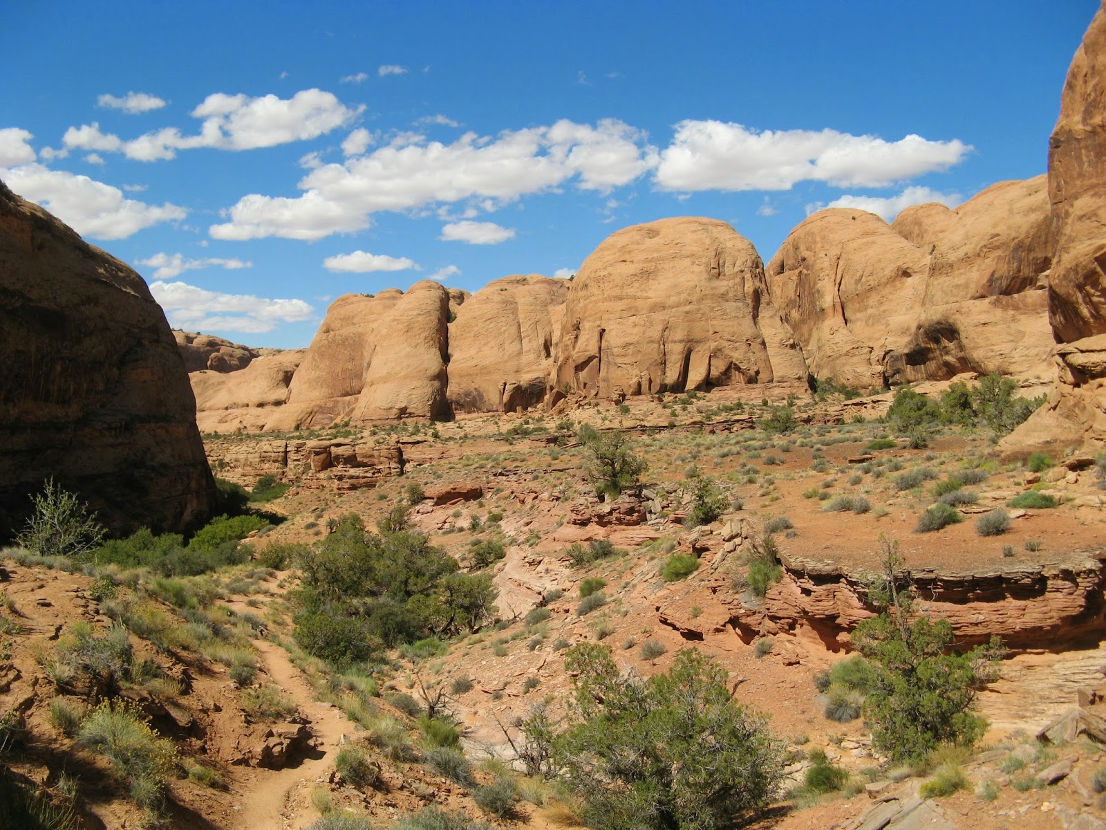
Next we drove back towards town, turning off onto 128 to hike Negro Bill Canyon to the Morning Glory natural bridge (4.4 mi. RT). I'd done this hike last year but H hadn't. The trailhead parking lot was packed but we managed to time it right, with most people heading out as we were heading in. We met lots of very nice dogs who seemed to appreciate the shade of the canyon walls and cool canyon streams as much (or more) than we did. There is some up-and-down but not a lot of elevation gain overall; despite the gentle grade, it was pretty hot in the sun and the sandy ground made us work for our steps in places. Afterwards, we found a shady spot by the Colorado River for our second round of PBRs.

H under Morning Glory Bridge
Keeping up with our agenda, we got cleaned up back at the motel, then walked to Woody's for drinks and part of the Utah State football game before putting our hiking boots back on for a sunset walk to Delicate Arch. This was also an extremely popular idea and by the time we found ourselves a chunk of rock to sit on up by the arch, there must have been close to 200 other tourists there. As it got closer to sundown, however, the clouds started to build up in the west. We managed to get a couple of photos of Delicate Arch without any other people in the shot and then walked out before it got dark since there wasn't going to be any sunset to speak of.

I can't believe there are no people in this shot
We got to Miguel's Baja Grill around 8 p.m. and were seated for dinner at 8:30. We really like their food (the chicken version of the "Mother Of All Burritos" for H and lamb enchiladas with both red and green sauce for me; also, margaritas) but the service was terrible. I'm willing to go back but I think we'll ask to sit in a different section; we had the same waiter last year and he was pretty slow then too. At this point we were pretty beat so we went back to our room, eyeing the cloudy skies, packed up our stuff and started watching the worsening weather reports.
Wednesday, September 25, 2013
long weekend in moab, pt. 2
When I said we were getting a "very early start in the morning," I meant we got up at 5:00 a.m. on Friday, planning to see the sun rise, and were driving up to Canyonlands National Park by 5:30. We got to the Mesa Arch trail head around 6:15 a.m. and were unsurprised to see a fair number of other cars in the parking lot with more rolling in as we watched. We walked in on the easy, wide and well-marked trail a quarter mile to the arch, not needing our headlamps because the near-full moon was still up.

There were already people stationed in front of the arch - which perfectly frames the sun coming up over the La Sal mountains - so we climbed up the rocks to the left and settled in there. There was enough moonlight to reflect in dozens of small pools and puddles down on the White Rim plateau in Buck Canyon, 1200 feet below. As the sky got brighter and brighter, more and more people (including a Japanese bus tour) showed up and when the sun finally got above the La Sals, you couldn't hear anything but cameras clicking and whirring for about three minutes.

Bathed in the stunning morning light (clear skies and 50s), we ate some store-bought mini muffins of dubious flavor and nutrition before heading over to Whale Rock, near Upheaval Dome (1 mi. RT). We had the Rock all to ourselves and the 360-degree views were glorious, the air probably the clearest we'd ever seen. At this point, it was only about 9 a.m., so we decided to do another short hike, this time out to Murphy Point (4 mi. RT). Most of the length of trail used to be an old road, so the surface was pretty flat and sandy, segueing to slickrock for the last little bit. Out on the point we had views of the White Rim, Green River and Junction Butte.

Our next stop was the MTBing trails at Dead Horse State Park. There are three loops - the small Intrepid (approx. 1 mi.), the medium Great Pyramid (approx. 4 mi.) and the large Big Chief (approx. 9 mi.) - and we did them all, in that order. These are great trails with a mix of surfaces (hard pack, slickrock, gravel, sand); there were a couple of places we had to get off and walk, but not that many, and the surrounding scenery is killer. We passed a couple of 30-somethings on the Big Chief loop; they caught up with us afterwards in the parking lot and the woman told me I was a "badass." I'm choosing to feel complimented by that - I did pass her going up a hill, after all.

It was only around 3 p.m. when we finished, still too early to go back to the motel; even though we'd only planned on Mesa Arch and the Dead Horse MTBing, we decided to tack on another short hike: to Corona Arch (3 mi. RT), which H had not yet done. It was pretty hot crossing the sun-baked sand and slickrock but we had the arch all to ourselves up there. It's ginormous and quite impressive.

After that, it was clearly time for a beer. We'd packed the cooler before leaving the room ... but then left it there in a total rookie move. So we went back to the motel to have our beers on the bench outside the room and rehash the day: 14+ miles on the MTBs, 8+ miles by foot and amazingly clear views. At the desk clerk's suggestion, we walked to Paradox Pizza where we quickly devoured a large pepperoni and kalamata olive pie, washing it down with Johnnie's American IPAs. We were pretty tired at this point and managed just one more drink back at the room, calling it quits for the day just before 10 p.m.

Sunrise over the La Sal Mountains
There were already people stationed in front of the arch - which perfectly frames the sun coming up over the La Sal mountains - so we climbed up the rocks to the left and settled in there. There was enough moonlight to reflect in dozens of small pools and puddles down on the White Rim plateau in Buck Canyon, 1200 feet below. As the sky got brighter and brighter, more and more people (including a Japanese bus tour) showed up and when the sun finally got above the La Sals, you couldn't hear anything but cameras clicking and whirring for about three minutes.

Sunrise glowing under Mesa Arch
Bathed in the stunning morning light (clear skies and 50s), we ate some store-bought mini muffins of dubious flavor and nutrition before heading over to Whale Rock, near Upheaval Dome (1 mi. RT). We had the Rock all to ourselves and the 360-degree views were glorious, the air probably the clearest we'd ever seen. At this point, it was only about 9 a.m., so we decided to do another short hike, this time out to Murphy Point (4 mi. RT). Most of the length of trail used to be an old road, so the surface was pretty flat and sandy, segueing to slickrock for the last little bit. Out on the point we had views of the White Rim, Green River and Junction Butte.

Big Chief loop, La Sals in the distance
Our next stop was the MTBing trails at Dead Horse State Park. There are three loops - the small Intrepid (approx. 1 mi.), the medium Great Pyramid (approx. 4 mi.) and the large Big Chief (approx. 9 mi.) - and we did them all, in that order. These are great trails with a mix of surfaces (hard pack, slickrock, gravel, sand); there were a couple of places we had to get off and walk, but not that many, and the surrounding scenery is killer. We passed a couple of 30-somethings on the Big Chief loop; they caught up with us afterwards in the parking lot and the woman told me I was a "badass." I'm choosing to feel complimented by that - I did pass her going up a hill, after all.

There's a very tiny H (green shirt)
under the arch for perspective
It was only around 3 p.m. when we finished, still too early to go back to the motel; even though we'd only planned on Mesa Arch and the Dead Horse MTBing, we decided to tack on another short hike: to Corona Arch (3 mi. RT), which H had not yet done. It was pretty hot crossing the sun-baked sand and slickrock but we had the arch all to ourselves up there. It's ginormous and quite impressive.

Boy, were we stinky and sweaty at this point in the day
After that, it was clearly time for a beer. We'd packed the cooler before leaving the room ... but then left it there in a total rookie move. So we went back to the motel to have our beers on the bench outside the room and rehash the day: 14+ miles on the MTBs, 8+ miles by foot and amazingly clear views. At the desk clerk's suggestion, we walked to Paradox Pizza where we quickly devoured a large pepperoni and kalamata olive pie, washing it down with Johnnie's American IPAs. We were pretty tired at this point and managed just one more drink back at the room, calling it quits for the day just before 10 p.m.
Monday, September 23, 2013
long weekend in moab, pt. 1

Fisher Towers under a perfect Utah sky
This past weekend marked the third year in a row that we've gone down to Moab for a long weekend. The first two times, H did the Moab Century, which meant that his Saturday was pretty much consumed by the road ride. This time he opted not to do that, instead compiling a nice, varied to-do list. And by "varied" I mean "a bunch of hiking and MTBing."

Slightly technical section of the trail
We were up and moving early Thursday morning, dropping B off at the kennel around 7 a.m. before she even knew what was happening. Rather than taking the usual way of I-15 to 6 East to 70 East to 191 South, we went the scenic route, continuing a little further east on 70 to the smaller Route 128, which goes along the banks of the Colorado River through Castle Valley to Moab.

View of the Colorado River from trail's end
Our first hike of the trip was below Fisher Towers, just before Castle Valley (4.4 miles round-trip; 2 hrs. 45 min.). After a quick lunch at one of the unoccupied camp sites near the trail head, we headed off across the red, red dirt and red, red rock, the towers looming overhead. No one was climbing the massive Titan but we did spy some (to our minds, fool-hardy) rock climbers, swarming a terrifying spire far above us. The sky was amazingly clear, the temperature a perfect mid-80s, the views absolutely impressive.

Can you see those wackadoo climbers up there?
We had a post-hike beer in the parking area before continuing along 128, following the river into Moab. Our accommodations were again at the charming, funky little Kokopelli Lodge; this year's motel room had a noticeable gap under the door, Ikea furnishings and a tight but nicely tiled shower. After checking in and showering up, we walked down Main Street to the Moab Brewery for dinner where H had a chicken burrito washed down with Johnnie's American IPAs and I dined on fish tacos and the Dead Horse Amber Ale.

Yeah, that spire is what those climbers are on in the last photo
It cooled down nicely as we walked back to the motel, making the evening's beers on the bench outside our room very pleasant. Bedtime was before 10 p.m. - and we had to pack for Friday's adventures first, because we were planning a very early start in the morning.

End of the road, so to speak
Subscribe to:
Posts (Atom)


 Posts
Posts


