Saturday, September 29, 2012

bikes in the desert, pt. 3

H was up and at 'em early Saturday morning, getting on his road bike before the sun came up to ride to the start of the Moab Century Tour for its 7 a.m. start.  (More on the ride later.)  I slept in a little longer, then took my time putting my hiking stuff together, eating 1.5 blueberry muffins and deciding where I was going to hike: Negro Bill Canyon to Morning Glory Natural Bridge, and then maybe back up to Corona Arch if I had time before I was supposed to meet H.  He had promised to take his time this year, stop at the rest areas and eat enough on his ride; we figured a 1 p.m. meet-up would give him six hours to do 100 miles.

The creek at the bottom of Negro Bill Canyon

The trailhead to Negro Bill Canyon is about three miles east on 128 (a Utah Scenic Byway).  It's a four-mile out and back along a lovely stream.  The walking is pretty easy - a slight climb all the way up the canyon, with just a couple of short, steep scrambles - but you have to cross (and recross) the stream nine times, and the path is mostly soft red sand.  This is probably a great hike in the summer since it stays shady until the sun is well overhead, plus walking along the stream keeps things cooler.  It's certainly a popular hike.  The trail ends at the Morning Glory Natural Bridge, a massive 243-foot long rock alcove arch, the sixth longest natural rock span in the U.S.  It's 75 feet up in the air but only separated from the wall behind it by about fifteen feet, so it's kind of hard to photograph.  When I got up there, there were a bunch of folks on top of the arch and rapelling down the adjacent wall; apparently there is a back way to hike in if you want to do that - there's no way up there from down below.

Morning Glory Natural Bridge

After watching the rapellers for a bit, I walked out (approx. 2 hr. RT), enjoying the gorgeous canyon views.  It was just after 11 a.m. when I got back to the truck so I thought I'd drive down Potash Road and hike in at least a little ways to Corona Arch.  I'd forgotten that the trailhead is ten miles down the road, though, so it didn't leave me a ton of time once I started up the trail.  I got in far enough to see that spectacular arch - and watch a crazy local attached to a bungee cord throw himself off the top of it - before turning around.  I was just about to get to my meet-up with H fifteen minutes early when I got a phone call from him: "I'm at the motel. Can you come let me into the room?"

Heading out Negro Bill Canyon

H had done the century in just 5 hr. 14 min. (avg. speed: 18.6 m.p.h.) and was the first century rider to finish!  He'd had a good time of it, riding with several other riders on a couple of occasions, but tending to drop them all on the uphills.  The roads were dry, the skies clear enough for views at Dead Horse Point.  I was really proud of him.  We got cleaned up at the room and then returned to the Aarchway Inn finish line so H could get his Mexican buffet lunch (I picked off his plate, much to his annoyance) and one free Moab Brewery beer (we brought back-up PBRs with us).  It was quite pleasant, sitting under the tent talking to other cyclists and watching scores more come in.  No one knew that H finished first - because it was a charity ride, not a race - but I did.

We hung around our room for a couple hours that afternoon, reading and napping, and then strolled over to Woody's Tavern.  Neither of us was particularly hungry because of the late lunch, so we just had a few drinks instead: $3.75 draft microbrews and $4 tart and tasty margaritas.  When we returned to the motel, Main Street was busy with people in the shops and restaurants, but we'd had enough for the day.  One more MTB ride tomorrow before we have to head home!

Thursday, September 27, 2012

bikes in the desert, pt. 2

Friday morning was rather chilly to start, so we walked over to the Moab Diner for breakfast while the sun started to warm up the desert air.  The Moab Diner is okay but nothing special - I had a mediocre granola, yogurt and fruit (being just down the road from Green River means the melon should be local!) while H had eggs, bacon, hash browns and toast - what sets it apart from all other diners is that it's closed on Sundays, which seems like an odd choice for a breakfast joint.  After thus fortifying ourselves, we went back to the motel, got our gear ready for the day's MTB adventure and headed north seventeen miles on 191 to the Klondike Bluffs trails.

Klondike Bluffs area

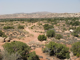
There were a few vehicles in the trailhead parking lot when we set out but we saw very few people all day.  The first trail we did was the Klondike Bluff Trail, an 8.2 mile out-and-back, combination 4x4 road and wide-open slickrock, climbing subtly but steadily out to the Arches National Park boundary.  Some of the 4x4 road was sandy and I quickly added sand to my list of MTB nemeses: even when coasting through, holding the handlebars steady, my rear wheel would slide out behind me.  I walked the sandy bits.  The slickrock portions were fun, especially since the rock was so expansive that I didn't have to worry about falling off any cliffs.  The MTB trail ends at the national park boundary but there's a footpath through the fence, so we left our bikes and hoofed it in another half mile or so, to a view point out over the park.  The skies were a little hazier than we would have liked, the result of the smoke from the Idaho wildfires that was drifting to cover all of Utah, but the views were still pretty spectacular.

A climbing the slickrock

We debated trying a different trail for the return (part of the Baby Steps loop) but ultimately decided to retrace our steps until we got to a trail junction where the Dino-Flow Trail joined the jeep road.  Not yet ready to quit, we headed out on that trail, a lower-intermediate skill level 4.6 miler of single-track and a little slickrock.  Dino-Flow was more challenging for me - I find single-track tough because my bike-handling is so all over the place; double-track gives me more margin for error - but H loved it as the trail wound up and down over small rollers, skirting the foothills.  I finally crashed, just as I was catching up to where H was waiting for me: he was up a little rise and said, "Don't stop pedaling!" and I of course stopped pedaling right before the top and fell over, banging my elbow and skinning my knee a little.  That took the wind out of my sails a little but we were near a short connector that brought us out to the Copper Ridge jeep road (lots of sandy bits) that we were able to follow back to the truck and our cooler of PBR.  Ride stats:  16.35 mi., 2 hr. 57 min. riding; 1,313 feet of climbing.

That's a purty MTB trail

We headed back to town, hit the grocery store for muffins so H would have something to eat before his century ride on Saturday, got cleaned up and then walked down to the Moab Brewery.  This time it was a gyro wrap for me (lamb and steak, with lettuce, tomato, cucumber and feta) and the chicken cordon bleu dinner special for H.  And beers, of course: Scorpion Pale Ale and Dead Horse Amber.  We moseyed back to the motel for an early evening since we'd have an early morning: 100 miles on a road bike for H and a little hiking for me.

Cowgirl on a cattleguard


Monday, September 24, 2012

bikes in the desert, pt. 1

Figuring B had had more than enough fun camping last weekend, we dropped her off at the kennel last Thursday morning and hightailed it down to Moab for a long weekend of MTBing, road cycling, hiking and general desert revelry.  We love Moab.  Yes, it's a tourist town - it seemed like every other person was speaking French, and every third person was speaking German - but it's still got a mellow, outdoorsy vibe.  And the scenery!  Well, Moab could scarcely be more different than what I grew up with in New England, and the novelty of the red rock has not yet worn off for me.  The main purpose of the weekend was for H to do the Moab Century Tour like he did last year; this year we decided to take an extra day to get some more MTBing in.

Happy to be back in Moab

Like last year, we stayed at the tiny, adorable (but not for everyone) Kokopelli Lodge.  Check-in wasn't until 3 p.m. so we popped into the Moab Brewery for lunch and a couple of beers, then drove out to the Moab Brand trails to get our wheels dirty.  We did a combination of the Rockin A and Bar M trails (9.13 mi., 1 hr. 13 min., 536 ft. climbing) before I pooped out from a combination of it being hot (about 90+ F in the afternoon sun) and the Rockin A's terrain being more than I was comfortable with.  The Bar M trail I like: wide, rolling up and down, combination of easy slickrock and gravel jeep trail.

Why, of course I rode my MTB up there

After our ride we checked in, cleaned up and walked about two blocks to the funky Miguel's Baja Grill for dinner.  Although the service was a little rushed, and the salsa boring, our meals were good: I had two roasted lamb tacos, served with a lovely spicy red sauce, pico de gallo, rice and beans; H had the "Mother Of All Burritos" with roasted pork, black beans, rice and both chile verde and the red sauce.  We also had margaritas (along with a spirited discussion of whether the bright blue wall color would be suitable in our own home).  Then, en route to Eddie McStiff's for another couple of drinks, we stopped into one of the storefronts along Main Street and bought cowboy hats - yeehaw!  (Pictures coming later. )

Friday, September 21, 2012

b goes camping, pt. 3

Our second night was about as chilly (46 F inside the tent upon waking, 35 F outside) but not quite so restful: at 1:30 a.m., both H and I woke up to something snuffling and pawing at the ground, seemingly right outside our tent.  H assumed it was a moose or a range cow; I immediately guessed bear ... and then H couldn't stop thinking "bear" either.  So he shouted for a bit until we couldn't hear anything anymore, and then he poked his head outside with a flashlight.  He didn't see anything and we didn't hear it again, although it did take some time to get back to sleep since we were focused on all the night noises.  In  the morning, we looked around for any tracks but didn't see any.  It'll remain a mystery, I guess.

Taking a mid-morning break

Our Sunday morning routine was much the same as Saturday morning's: huddle around the campfire, clutching hot beverages, and then snarfing down breakfast (French toast) before it got cold.  Note to selves for next time: keep the butter container lid out of the dog's reach.  The only plan for the day was to pack up and go home (and commence the many, many loads of laundry to divest all the fleece of campfire smoke smell), so we took our time, cracking our first beers at 10:30 a.m.  It was 59 F by late morning, and felt warmer in the sun, as we leisurely took down the tent and loaded the truck, saying farewell once again to Cobblerest around noon.

H's girls

We were taking bets on how quickly B would fall asleep once we got in the truck.  Sure enough, she crashed as soon as we got going, resting her head on H's knee, just as she had done for our road trip across the country when we moved out here.  I think she had a good weekend.  Exhausting, what with all the fishing and digging and stick-chewing and general vigilance, but she seemed like she was having fun (as were we).  And she finally got to go do stuff instead of getting stuck at home.

Wednesday, September 19, 2012

b goes camping, pt. 2

Brrrr!  Coffee!!

It gets chilly overnight at 8,280 feet!  When we woke up at 7 a.m. Saturday, it was 42 F inside the tent and 36 F outdoors; it didn't get much warmer until the sun peeked over the surrounding mountains two hours later.  H had started the campfire, put the water on to boil for coffee and hot chocolate, woken B up and fed her all before I managed to convince myself to get out of my nice, warm sleeping bag.  We'd bought an air mattress to fit inside the tent and boy, did that make a difference - sleeping on the ground would have been awful.  We lingered over our hot beverages by the campfire, then gobbled down scrambled eggs and bagels toasted over the fire (imparting a nice, smoky taste), and by 11 a.m. it was warm enough to shed our layers of fleece.  It was time to go fishing!

The breakfast (and dinner) chef

We drove up the Mirror Lake Scenic Byway, checking out the roadside lakes and stopping at Mirror Lake itself (elev. 10, 200 ft.).  The place was hoppin' with lots of overnight campers and plenty of day picnickers, kayakers and fisherman - we wondered how busy it must be in the height of summer if it was so busy this late in the season.  There's a nice walking path all around the lake so we three walked it, dodging other dogs and noting potential fishing spots.  Back at the truck we loaded up with H's fishing gear, the camera and a couple of PBRs, then went back to the far end of the lake where the wind seemed calmer and there weren't as many people.

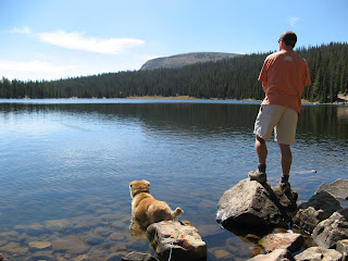
Fishin' buddies

Back in Maine, we learned that B hates the water.  Hates it.  Hates getting her feet wet on walks, hates wading, absolutely despises swimming.  We also learned that she loves fishing: at my folks' camp in western Maine, she would stand on the dock with H for hours, trembling with excitement as he cast and reeled in little bluegills and bass.  It had been several years since she'd been fishing and we wondered if she'd remember how much she used to like it.

Nice-looking rainbow

She remembered.  She was absolutely beside herself as H cast into Mirror Lake.  Fish were rising all over the place and she stared at the water, twitching with every splash.  When he reeled in his first rainbow, she waded in without hesitation, trying to grab the fish with her mouth.  The next one he brought in, she actually pounced on it, jumping off a rock into the water and knocking the fish off the hook.  She focused in on the fishing for nearly two hours - unheard of concentration for this dog - while H caught and released six beautiful trout (the ant and bubble rig was the way to go).  By the end, B was so excited that when H cast out a hookless bobber, she swam out and retrieved it, not once, not twice, but four separate times.  We were in hysterics.

Such focus

After all the fishing excitement, we went back to the campsite for afternoon reading and beers.  It was super-pleasant in the sun but as before, the temperatures dropped quickly when the sun went behind the mountains: 59 F at 7 p.m., 52 F at 7:30 p.m.  Our dinner of bratwursts and potato salad was more low-brow than the night before but required less dish-washing, and we settled around the campfire and watched the brilliant stars pop out, the first one appearing in the sky at 7:50 p.m.  Bedtime was about the same as Friday night ... only this time I wore two pairs of socks to ensure warm toes.

Mirror Lake and surrounds

Sunday, September 16, 2012

b goes camping, pt. 1

It seems like B never gets to do anything anymore: she has to stay at the house when we go up Big or Little Cottonwood Canyons for hiking or skiing; she's too old and too poorly behaved off-leash to go MTBing; it's too hot in the summertime for car rides even.  When we were talking about going camping again before the snow starts falling, we thought that if we went back to the Uintas, where we just were at the end of June, it would be cool enough and dog-friendly enough for her, plus being late in the season meant it shouldn't be so busy.  We knew that taking her along would mean a relaxing weekend - no hiking because of her age (we think she's around 11 although we don't know for sure, having rescued her as an adult stray with no history) and the altitude, which she would be unused to.  But we could take short walks, and go fishing, and read in the sun.  So off we went to the Mirror Lake Scenic Byway, B stuffed into the backseat of the truck with all our clothes.

A little catnap before dinner

We stopped at Cobblerest, the campground we were at last time, around 11:00 a.m. on Friday and were thrilled to see no one else there in any of the eighteen sites.  We quickly claimed our old site (#7) and started setting up.  The skies were clear and blue, sun filtering through the trees to make it a comfortable high 60s.  I don't know if this happens every year at this time or if it's because of the low snow from last winter, but the Provo River behind our campsite was flowing at a fraction of its late June pace - there would be no backyard fishing for us here!  Instead, I walked up the river a little ways on the rocks, gathering driftwood for the campfire.  B wanted to come with me but the river rocks were difficult for her to walk on; she's become such an old indoor dog that the footing made her nervous.

Mmmmm - kindling

Instead, she contented herself with eating grass, chewing on the kindling H had collected and charging at the brazen chipmunk who seemed to realize that she was tied up and couldn't quite get to him.  We spent the afternoon reading in the peace and quiet.  A few cars drove through the campground but luckily no one moved in near us: a group of about six campers and two dogs took a large site near the campground entrance and two other small tents popped up on the far end of the campground - so we were virtually alone.  B, who is used to spending most of her days napping, finally crashed just before dinner, scraping out a little hole under the picnic table.

Nice evening light at Cobblerest #7

Because of the mountains all around us, the sun set around 6:30 p.m.  We had an early dinner of chicken and broccoli alfredo (B perked back up when food became available) and H got a very nice campfire going so I could try bacon s'mores (s'mores with a piece of bacon between the chocolate and the marshmallow - mmmmmm).  Unlike our summer sojourn, there was no moon and when the stars came out, they came out in force.  The temperatures plummeted quickly though, so we doused the campfire and were snug in the tent before 10 p.m.  B got to sleep in the cab of the truck - one of her favorite places on earth - and she sacked out as soon as H locked her in.

Wednesday, September 12, 2012

timp via aspen grove

We had a big day on Sunday - long, hot, tiring and glorious - hiking up Mount Timpanogos via the Aspen Grove Trail.  It was an early start, leaving the house at 6 a.m. to get on the trail at 7 a.m., and the sun was coming up behind us as we started up the switchbacks taking us into Primrose Cirque.  We'd done Timp before but took the Timpanooeke Trail; this trail would bring us up alongside Emerald Lake.

Taking a mid-morning trail-mix break

When we looked up at the cirque, we couldn't imagine there being a trail going up there.  But there was: dirt and rocks, lots of switchbacks but not too steep, several waterfalls and springs lower down.  Apparently in regular snow years there's water and waterfalls all the way up but not this time.  We got up and over the lip and strolled along the basin around Emerald Lake, Timp's cliffs rising above us into the sky.  We planned to circle the basin under the cliffs and across the boulder field, picking up the trail up the saddle that we'd done last time.

View of the summit from Emerald Lake

We had hoped to see some goats this time.  Some goats?  There were goats galore up there!  We met some hunters with a small herd of pack goats who were out doing some pre-season scouting.  Their pack goats waited patiently while we talked with them, leaning into us to get their ears scratched.  Pack goats are easier to handle and have less impact than horses or llamas.  They'll carry 30-40 pounds of gear depending on the goat.
Hikin' goats

We also saw oodles of mountain goats, which was just thrilling.  At first we'd hear them before we saw them: as they climbed around on the cliffs, hundreds of feet overhead, they'd knock off cascades of rocks, alerting us to their presence.  Those goats are absolutely bonkers. There can't be anything up there for them to eat (except maybe lichen?) and they're scaling near-vertical walls and walking around on the narrowest of ledges.

Mountain goats = not afraid of heights

Not all the goats were perched up on the cliffs, though.  We watched a big male saunter across a small snowfield under the cliffs and then turned around to find a group of four staring at us from just yards away.  There was a baby, its mother and two medium-sized goats.  They watched us closely as we kept moving, not wanting to spook them but not wanting to leave.  With all the wildlife so close, we spent a lot of time on that boulder field (plus the walking was slow going).

Looking back towards Emerald Lake from the boulder field


After we got up to the saddle, it was just 0.9 miles to the summit: rocky and vertiginous, with steep scrambling in spots.  This is where we saw most of the other hikers.  Timp is a very popular hike and there were around twenty people at the summit, despite it being a Sunday and even though we'd hardly seen anybody on the way up.  Since there isn't all that much room up on the summit, we only stayed for a few minutes before descending to the saddle to eat our lunch.


It was so cool to get so close to these guys

We went out the way we came, pausing again in the meadows by Emerald Lake to watch as dozens and dozens of mountain goats came over the ridge into the meadow for an afternoon snack - there were easily thirty in sight.  We'd never seen so many nor been so close to them.  Descending through the switchbacks was a slog: long and hot on the south-facing slopes, with a lot of knee-tenderizing step-downs.  When we made it back to the parking lot (and our cooler of beer), it was 3 p.m. and we were ready for the hike to be done.  But what a hike!  We really like Timpanogos, that enormous rock rising up over Utah valley: the scenery is stunning and getting to see all the wildlife was a real treat.

Hike stats:  14.68 miles RT; 6 hrs. 53 min. hiking time, 1 hr. 21 min. stoppage time for goat-viewing and lunch, etc.; 2.1 m.p.h. average speed; 4,860 ft. elevation gain; 11,749 ft. summit; 4 mule deer, 1 raccoon, 1 pika, 2-3 marmots, 5-6 domestic goats, countless mountain goats.


Monday, September 10, 2012

nothing doing

As this post's title might suggest, we didn't do much this past Saturday.  We had a big hike planned for Sunday (more on that later) and since I am finding that I am recovering much more slowly than I used to, I didn't want to do anything that would fatigue my legs too much.  H went on a road ride (somewhere around 38 miles, if I recall correctly) while B and I took a walk: halfway around our usual loop, then coming back through Dimple Dell.

It was a lovely day, clear and sunny - and B thought it was much too hot, not to mention too far since the Dimple Dell bit probably added close to another mile.  She actually stopped a couple of time in the shade and laid down for a minute or so, before getting back on her feet and bravely soldiering on.  I know, she's getting older - we think she's around eleven - and I should take care not to push her too far.  But she's been doing that drama queen/lie down when she doesn't want to walk since she was four; I just have to realize that she may not be crying wolf now.  We made it back to the house without incident and she was fine, just stared at me reproachfully ... until it was time for dinner and then all was forgiven.

Friday, September 7, 2012

sunset peak


On Monday (Labor Day), we and approximately half the population of the Salt Lake Valley went hiking up in Little Cottonwood Canyon.  I exaggerate a bit, of course, but the parking lots at the Bells Canyon trail head, the White Pine trail head and the Albion lot at Alta were as full as we've ever seen them.  Despite being annoyed at the crowds, we were pleased to see so many people out and enjoying the mountains - sure beats going to the mall. Although not the sunniest day ever (it was clear skies down in the valley but a big, stubborn cloud lurked over Catherine's Pass all morning, and then multiplied later in the afternoon), folks were clearly taking advantage of getting themselves and their kids out.

Catherine's moose

We had decided to do my Catherine's loop since H hadn't done it yet this summer, adding on the short jaunt out to Sunset Peak since neither of us had done that.  The well-traveled trail from the parking lot up to the Albion campground was being well-traveled, and we walked quickly, passing everyone ahead of us.  When we turned off to the Catherine's Pass trail, the crowds thinned a bit and we didn't come across too many other people until we reached the damp alpine meadow in the middle of Catherine's Area, where two bull moose were lounging, seemingly unperturbed by the human paparazzi.  We too took a bunch of pictures, thrilled at seeing a pair of large mammals two days in a row.  The moose could not have cared less.

Lakes Catherine, Martha and Mary 

It got busy again at the top of the pass, and also at the top of Sunset Peak.  The trail to Sunset Peak from the pass is about half a mile or so, gaining about 450 feet of elevation.  the trail is rocky, sandy and narrow, with a couple of tricky-ish bits where you don't want to miss your footing.  The peak itself is pretty small and pointed, but large enough for several different hiking groups to mill about, eating lunch, taking photos and generally gawking at the scenery.  Although you're only 200 feet higher than the top of the Supreme chairlift, the fact that you're on a pointy peak means that the 360-degree views are spectacular, clouds notwithstanding.  Sunset Peak is also home to fat and brazen chipmunks who clearly take advantage of their cuteness to coerce snacks from the hikers.

Timpanogos from Sunset Peak

We figured that the herds of people would dissipate once we headed across the Supreme Bowl and we figured right: we didn't see a soul on the walk down the access road through Alta until we got back to Albion Campground.  We dodged families heading up to Cecret Lake as we descended, paused for a few minutes to get our photo captured on Alta's Sunnyside web-cam, then sipped some PBRs in the parking lot, watching the clouds and the crowds move through.

Ready for ski season!

Hike stats: 7.60 miles RT; average speed: 2.7 m.p.h.; 2:48 hrs. walking, 3:42 hrs. total; 2,098 ft. elevation gain.

Wednesday, September 5, 2012

mineral fork

That's where we're headed

We had a leisurely start to our Sunday, heading up Big Cottonwood Canyon mid-morning to try a new hike: up the Mineral Fork trail to the Regulator Johnson mine.  Mineral Fork had been on our to-do list since last year, when we looked at the map during a hike to Lake Blanche and noticed it; you can actually do a two-fer, Lake Blanche to Mineral Fork, but you'll need a shuttle car since the MF trailhead is a couple miles further up the canyon from the LB trailhead.

Some of the many, many switchbacks

The Mineral Fork trail rises steadily but not too steeply.  The trail, an old mining road, is quite rocky - which is a little hard on one's feet - but pretty, following along creeks and shaded for the first couple of miles, then coming out of the trees so that you can see where you're heading, way up into the scree-filled upper bowl.  Once you're out of the trees, there are many, many switchbacks leading up past the old Wasatch mine and into the upper cirque.  The book said twenty-four switchbacks, while H and I thought we counted twenty-seven - no matter: there's lots.  The Regulator Johnson mine remnants consist of some old machine parts, tram tracks to nowhere, a small mine dump and a wonderful view back down Mineral Fork.  We didn't summit on this hike, as the ridgeline is another 200 or so feet further, with no trail, just a loose and rocky scramble.

Goat on the rocks

On the way back down, we startled a number of marmots who would cheep loudly, scurry away and then stop and stare accusingly at us.  More exciting than that, however, were the two mountain goats we came across, walking along some of the trail's switchbacks for easy grazing.  They allowed us to get pretty close - within 30 yards or so - before becoming nervous enough to move a little ways away.  Once their hooves were back on the rocks they seemed more confident, as though they knew we couldn't follow them up the cliffs.  We took a bunch of pictures and then continued back down the switchbacks.  They watched us for at least fifteen minutes - I hope we were half as entertaining for them as they were for us.

Looking down Mineral Fork towards BCC

Hike stats:  10.03 miles RT; 3 hr. 48 min. walking, with nearly another hour of stoppage time for photos, etc.; average speed: 2.6 m.p.h.; 3,194 ft. elevation gain.  This was another really nice hike, the gorgeous scenery and good walking made extra fun with the mining history and large mammal sightings.  And all so close to home!


Monday, September 3, 2012

muddy but no crashes

After our struggles to MTB after having hiked last weekend, we decided to reverse the order this weekend.  We went back to Round Valley, giving the MTB racers attempting the Park City Point to Point race plenty of time to depart the area. It had rained hard the night before, huge thunderstorms rolling through the area (and giving poor B the panics) and drenching the Wasatch Front and Back.  We were grateful for the rain since we've had so very little of it all summer, but what we'd forgotten about was The Mud.

Sign says "Danger!!!"

All things considered, the Round Valley trails were in very good shape, but all the places that I like so well because they're hard-packed dirt were now slick with mud.  Our tire treads packed quickly and it got very greasy very quickly.  It's probably been at least seven years since I MTBed in the mud and I had completely forgotten how, my rear wheel getting all slide-y and squirrelly in the puddles.  We had to slow down a bit to compensate - H still managed to ride all the way up Hammerhead Hill without incident, although the slick surface caused him to spin out a couple of times - but we managed it okay.  And even with the muddy spots, my legs were clearly feeling better than last weekend as I was able to climb at least a couple more of the Rambler switchbacks than before.

Frickin' mud puddles got my bike all dirty

Ride stats:  distance: 19.08 miles (my longest MTB trail ride yet as we added a small loop in the middle of our regular ride); time: 2:12; average speed: 8.7 m.p.h.; maximum speed (H's): 23.4 m.p.h.; total climb: 1,639 feet.