Showing posts with label history. Show all posts

Saturday, September 28, 2019

hidden valley petroglyphs

Feeling the need to get to the desert, we drove down after work last Friday, while it was snowing in the higher elevations of the Wasatch mountains and hailing down in our neighborhood.  Things dried up by the time we got to Spanish Fork and traffic was not all that bad.  After rolling into town, we stopped at Woody's for a beer to decompress ... and ran into my aunt and uncle from Minnesota.  We'd known they were in Utah - my uncle had a fishing trip on the upper Green; my aunt had planned on visiting several of Utah's Mighty Five - we just didn't know when they were going to be in Moab.  It was great catching up with them for a couple of hours; we would see them again in SLC Monday afternoon.

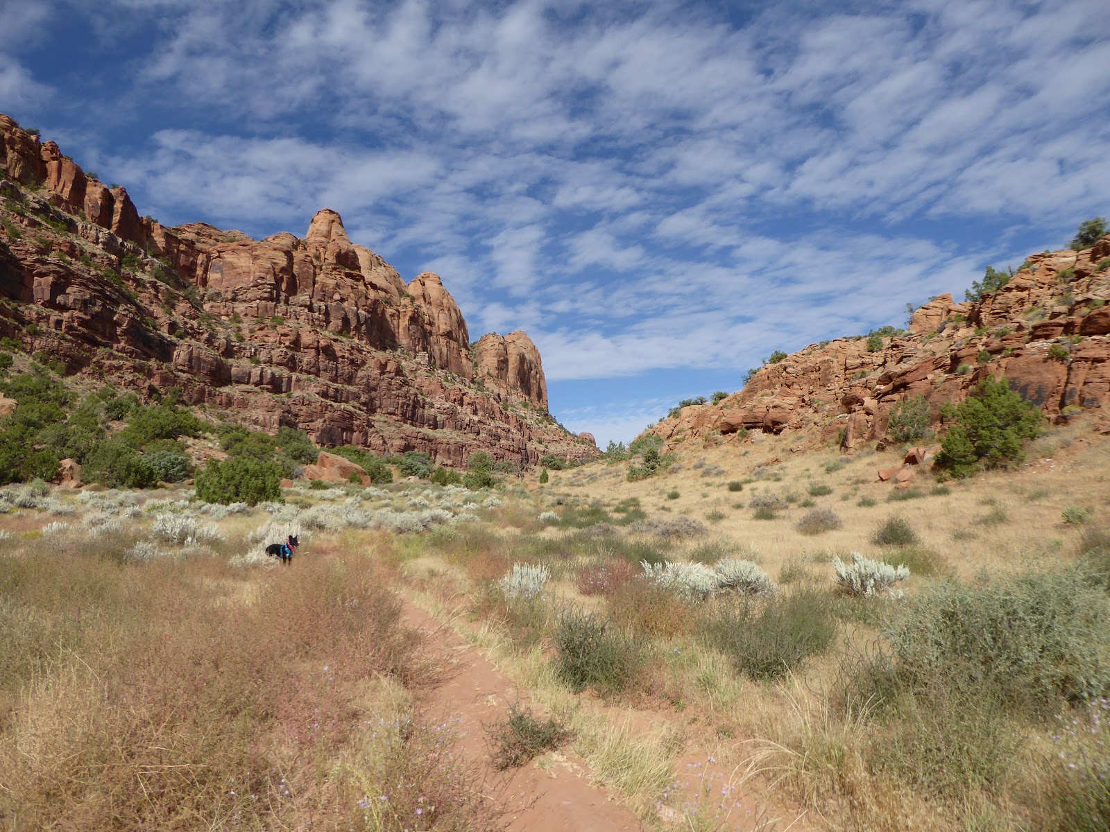
Gorgeous morning 

 Milton on the saddle

Since the sun doesn't come up until after 7 a.m. this time of year, we didn't get a real early start Saturday morning.  Trail options are a little limited right now for us: this is high season for Moab so there are a lot more MTBers/jeepers/ATVs out on the trails so we need to   be selective if we want to go off-leash with Milton.  We decided to go back to Hidden Valley to check out the petroglyphs we had missed last time.

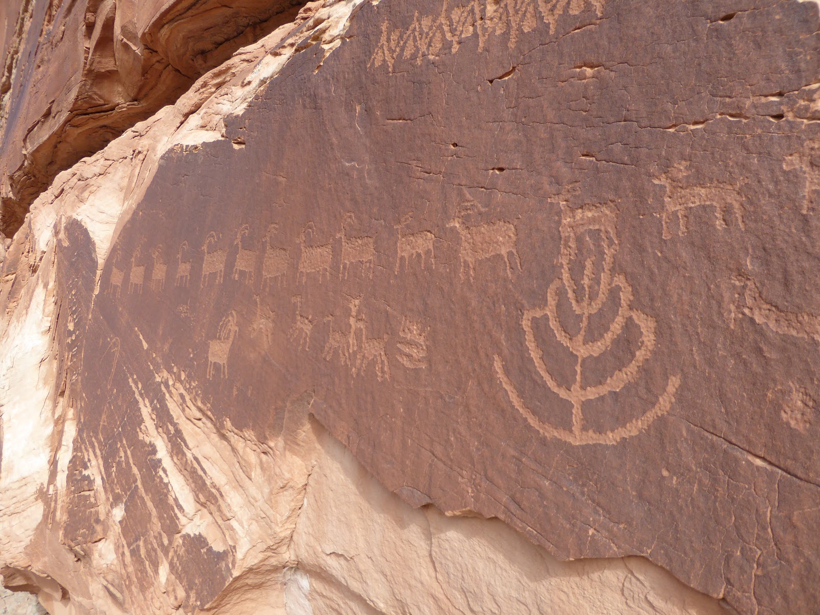
This one seems to have a squirrel

We got to the trailhead parking lot around 9:30 a.m.  There were five other vehicles already there but based on the number of hikers we saw, we figure at least two of the cars were MTBers for the Pipeline trail.  We actually timed it perfectly: we only saw two groups of hikers heading out as we were going in, plus one other group just as we got to the petroglyphs.

We have learned that most humanoid figures are not people, 
but representations of insects, plants or seasons

The morning was beautiful with cool, pleasant temperatures, a very light breeze and mostly clear skies.  We let Milton off the leash as soon as we  started going up the rocky ascent.  He stayed pretty close for most of the hike although he was keen on all lizards we saw.  He seems to be a sight hound: he'll chase anything that moves but once a lizard/ground squirrel goes to cover, he loses interest and moves on.

The lines of deer/sheep are my favorites,
possibly denoting the passage of time

Just as we got to the saddle, we stayed right where the trail split.  It climbed a little bit, bringing us to the base of the cliffs where, almost at once, we saw the rock art.  There were hundreds of petroglyphs along the cliff base, with a wide variety of shapes, figures, animals and plants.  We were really able to take out time with them since no one else was up there with us; Milton got a little bored with the pace and scouted out small scurrying things to terrorize.

Chonky boi

We followed the cliffs down, and then kept following the drainage down a little way further towards the Moab Rim trail.  As we looped back around to follow the lightly used jeep road back (we think it doesn't get much wheeled traffic up there because motorized vehicles aren't allowed all the way up to the saddle (thankfully), which preserves Hidden Valley), we saw three groups of hikers perusing the petroglyphs where we had been.

These are all estimated to be 7,000-12,000 years old

Still more people were coming in as we headed out, so our timing had been very good.  It was 12:40 p.m. when we got back to the car.  Milton hung out under a truck in the shade until more dogs and people showed up - then he worked the crowd.  Everyone likes Milton.

Love this one's split hooves!

We got back in time to put together some lunch, clean up, hang out a bit and then walk to Woody's for beers before returning home for dinner.  After dark, we attempted to sit out to star-gaze since it was so clear.  It was also so cold so we didn't last long.

Boys heading out

Hike stats:  5.7 miles; 2.0 m.p.h. moving / 1.7 m.p.h. overall; 3 hours 10 minutes


Thursday, September 29, 2016

new mexico: taos to santa fe

After another fabulous Casa Benavides breakfast, we were on the road at 8:15 a.m., pausing only for a few stops around town for photographs, gas, beer and ice.  We decided to take the long way between towns because, as H said, "Only we could take eight hours to do [what would normally only be] a seventy mile journey."

Actually had a fair number of expert trails for such a tiny place

Our route took us through the forested hills and canyons of the Carson National Forest, where we stopped at the adorable Sipapu Ski Area:  marketed as the first NM ski mountain to open and the last to close (if you can find it, that is), both H and I were instantly enamored with it.  Then as we continued south, we consulted the gazetteer and started taking trips up little side roads that wound narrower and twistier before fading out entirely in someone's dooryard.  We were pretty much looking to see what we could find: farms, old cemeteries, adobe ruins, elk crossings.

Out where the deer and the antelope play

After spotting it on the map, we pulled in at the Fort Union National Monument, which holds the ruins of three forts (log construction, begun in 1851; an earthen fort built in 1861; and the impressive stone and adobe construct still visible, put up in 1863 and finally abandoned in 1891), built to protect travelers on the Santa Fe Trail. Over 150 years later, the ruts of the Santa Fe Trail are still there, testament to the thousands of people who traveled it.  This is a very interesting and well-presented site, with a self-guided tour winding in and around the remains of the fort.

The low spot where I'm standing is where the
Santa Fe Trail is, perpendicular to those paths

While the rules of this national monument explicitly prohibits any reconstructions of the buildings, it allows for repairs and there were many workers out there, propping up leaning walls and slathering period-specific adobe, mud and plaster on the stonework.  Critters in the immediate area included pronghorns, turkey vultures and a tiny baby rattlesnake, curled up on a stone wall near where the guys were working.  Other than that, we mostly had the whole place to ourselves.

Jail house - built to last

From there we continued to Santa Fe, skirting enormous, lightning-filled thunderstorms: our weather had definitely changed from the clear blue skies at the start of our week.  We checked into the Guadalupe Inn, got cleaned up and headed to the historic Plaza, armed with a street map on which the inn's clerk had helpfully circled points of interest.

Mechanics corral

We walked around the Plaza, the Cathedral Basilica of St. Francis of Assisi and the surrounding neighborhoods, crossing over the dry-as-a-bone Santa Fe River several times.  For dinner, we ended up at the Blue Corn Cafe & Brewery: IPAs and ambers, a burrito for H and tamales with "Christmas" (both red and green) chile for me.  This was a newish place, close to the Plaza and so with a slightly touristy feel, although there were definitely some locals at the bar with us.  The food and beers were decent - but we noted that we had yet to find a brew that matched the Kaktus Brewery's IPA from our first day in New Mexico.

Not as fancy as the Chacoans, even made with better tools

It was full dark and raining as we headed back to the inn.  This was not keeping folks from going out, however, and we noted a couple of busy, fun-looking bars and restaurants as we passed, just keeping our options open for the next night out.

Our room at Guadalupe Inn: cool and very quiet

Tuesday, September 27, 2016

new mexico: aztec to taos

Up and at 'em the next day as we were moving on from Aztec - but not before we stopped in at Aztec Ruins National Monument, right there in the middle of town.  The ancestral Puebloan people who constructed the settlement there were a little later than the Chacoans, building and residing in the complex from the late 1000s until the late 1200s.  The architecture and engineering was very similar to Chaco but there were some flourishes that set it apart, like a decorative band of green stones built into the walls of some of the buildings.

Basically right in the middle of town

More of those structurally-complex corner windows

We explored there for about an hour and a half, walking through lower level rooms still with their original ceilings, climbing down into the reconstructed kiva.  The site is pretty expansive, with the fully excavated West Ruin, with over 500 rooms, as well as the partially excavated, and less (or not at all) accessible to the public, tri-wall sites, mounds and East Ruin.

Original ceilings

The decorative stripes are unusual and not found at Chaco

We had studied our gazetteer closely to figure out how best and most scenic-ly to get from Aztec to Taos, our next stop.  We didn't study it quite closely enough for the first bit of road, however, which ended up being several miles of rather rough dirt and shot-to-pieces signs (County Route 585, for the record, with sightings of a jackrabbit and some desert cottontails).  After that, however, it was smooth sailing.  We were pretty close to the Colorado border so we took a detour up there, following an old narrow gauge railroad from Chama, NM, up over Cumbres Pass, and pausing to admire the views and wet our whistles a bit.

That river is way the way down there

After that scenic interlude, we headed back south, driving through the Jicarilla Apache reservation, over the impressive Rio Grande Gorge bridge and past the truly bizarre Earthship Biotecture compound (fully sustainable, off-grid, science fiction-meets-fantasy-meets green building homes just outside Taos, some available for rent).  

Excellent place to stay in Taos

We checked into our home for the next two nights, Casa Benavides - a wooden floored and ceilinged room (with a truly tiny bathroom) in a former trading post, located within easy walking distance from the Taos Plaza.  Taos was busier than we expected; it is an old town, mostly adobe with a heavy Spanish influence, with narrow streets and heavy "rush hour" traffic on the main drag, and scores of restaurants, art galleries and knickknack shops.  The current town was established in 1615 but the neighboring Taos Pueblo predates it, built between 1000 and 1450.


We walked around for a while, checking out Kit Carson's house and grave, cruising the Taos Plaza and sort of following a self-guided tour I had printed off the internet.  When our stomachs started growling, we found ourselves at the Taos Ale House and bellied right up to the bar.  We had NM micro India black ales, a burger each (green chile cheeseburger for me and a BBQ bacon cheeseburger for H) and shared an order of green chile cheese fries and succulent house-made pickles.  The green chile was milder than what I'd had in Aztec but those cheese fries were so good - we practically inhaled our food.

Pretty local place even on the main street

Good beers and food, a friendly bartender and a chatty local next to us, and when we walked back to the inn, the crowds had cleared out and we had the place to ourselves.  We had one more beer on the porch in front of our room, listening to the raucous crickets and thinking that we'd had another good day and a pleasant introduction to Taos.

Window detail, Kit Carson House

Monday, September 26, 2016

new mexico: chaco culture national historical park

The Chaco Culture National Historical Park was the real impetus behind this trip.  H had wanted to go there for years; I didn't know about it until recently, but after watching a Robert Redford-narrated video about the Chacoan ruins, I too very much wanted to go.  Built in a desert canyon, miles from a reliable water source or any known trade route, the Chaco pueblos are a marvel of architecture and engineering.

Some shade in the desert

Built only with stone tools, with the supportive vigas (large beams) carried by hand from mountains over fifty miles away, these complex, sophisticated pueblos were not only elegant and complicated communities, they were astronomically aligned with the solstices, along sightlines over nine miles apart.  The largest Chacoan pueblo had four stories, over 600 rooms and 40 kivas, so these places were not inconsequential, but because the people had no written language (and because researchers have found no midden heaps or burial sites), almost nothing is known about them.

Hungo Pavi wall

Chetro Ketl

These remarkable structures were built in stages between the mid 800s and the early 1100s, with roads connecting Chaco with around 200 other great houses in the area.  And then, just barely after these pueblos would have been completed, the people left, dispersing throughout the Four Corners area.

Pueblo Bonito - look how straight the walls are still

We got up Sunday morning for a 6:45 a.m. departure, heading back southeast on 550 after fueling up with gas, water and caffeinated beverages.  We turned off the highway in Nageezi, then headed in towards the park: 7.8 miles (ten minutes) on a chip-and-seal/paved road, then 8.2 miles (sixteen minutes) on a "good" gravel road, and then an excruciating 4.3 miles (26 minutes!) on a rutted, washboarded dirt road.

Series of doorways in Pueblo Bonito

While at the visitors' center, we learned about needing permits for any hikes (free, located at trailheads) and a complimentary guided tour of Pueblo Bonito at 10 a.m.  That gave us just enough time to walk through the first two sites on the park's (blessedly paved) loop road: Hungo Pavi and Chetro Ketl.

Looking at an upper story window

We met the tour group at the Pueblo Bonito and while there were initially eight of us with an estimated tour time of 1.5 hours, more and more people piled on until there were nearly 30.  That was too many people for us - and clearly they wouldn't finish the tour in an hour and a half at that pace - so we slipped away, following the self-guided tour through the interior of Pueblo Bonito.  This massive complex was mindblowingly engineered, with the 1,000 year old vigas still evident in the sleek stone masonry.

Latillas (small) and vigas (large)

After filling out our permit, we did the Pueblo Alto hike, parking at the Pueblo del Arroyo trail head and checking out the Kin Kletzo ruins near the trail.  The loop was 5.4 miles (2 hrs. 45 min.), climbing up to the mesa and meandering through the desert and around the arroyo rim.  There were several overlooks along the rim - of Kin Kletzo, Pueblo Bonito and, later, Chetro Ketl - as well as interesting natural features like pecked basinsfossilized shrimp burrows and fossilized clam shells.

Pueblo Bonito from hike overlook

Perfectly circular

Both Pueblo Alto and New Alto were located up on the mesa, with 360-degree views; the newer pueblo still has walls standing but the older one is just foundation outlines and mounds.  We continued around the arroyo rim, stopping to be duly impressed at the Jackson Stairway that the Chacoans had hacked out of the cliff face, before climbing through a narrow crack to make our way down a level for the return.

Jackson Stairway, right up the cliff face

At this point, we were starting to get pretty hot - there is absolutely no shade out there in Chaco Canyon - so we hightailed it back to the car, passing several other hikers on their way up to the overlooks.  (There were more people at CCNHP than we expected but certainly far, far fewer than more accessible national parks and monuments.)  As we enjoyed our post-hike beers back at the car, we chatted with some folks - including one kid from Falmouth, Maine, who had recently moved to Santa Fe.  It truly is a small world, even in the most desolate corners.

Cretaceous clams

On the way down

After so many hours in the New Mexican sun, we didn't have much excitement for what was left of the day.  We drove back to the motel, managing to not jar loose any fillings on that terrible dirt road out of the park, got cleaned up, found some dinner and went to bed early.

Kin Kletzo from above

Chetro Ketl from above

Saturday, September 24, 2016

land of enchantment

Sorry for the recent absence, but H and I just got back from a great trip to northern New Mexico, exploring Chaco Canyon National Historic Park, Taos and Santa Fe.  We saw ancient ruins and petroglyphs, hiked in the desert and the mountains, collected a bunch of ski areas, ate a lot of green chile and drank some good local microbrews.  Right now we're deep into unpacking, doing laundry and sorting through all our photos but we'll get posts up here soon, the first one tomorrow.  Until then,


Friday, September 16, 2016

cardiff fork

When we made our attempt at Superior on Labor Day, we paused for a few minutes on Cardiff Pass, looking towards the Big Cottonwood Canyon side into Cardiff Fork.  Realizing we had never hiked into that drainage, we resolved to remedy that as soon as possible.  As we pored over our map and books, we were amazed at the number of old mines in Cardiff Fork; given how interested H is in the Cottonwood Canyons' history, we couldn't believe we hadn't gotten up in there yet to check it out.

Pretty good shape for an old mining road

Then, looking a little more closely at our map, we realized why: the entry to Cardiff Fork is the Donut Falls trail head.  Donut Falls is the easiest and shortest and, therefore, the most popular hike along the Wasatch Front.  It attracts an ungodly number of people, most of whom are not hikers.  And the trail to Cardiff Fork follows the trail to Donut Falls for the first half mile.  No wonder we'd been avoiding it.

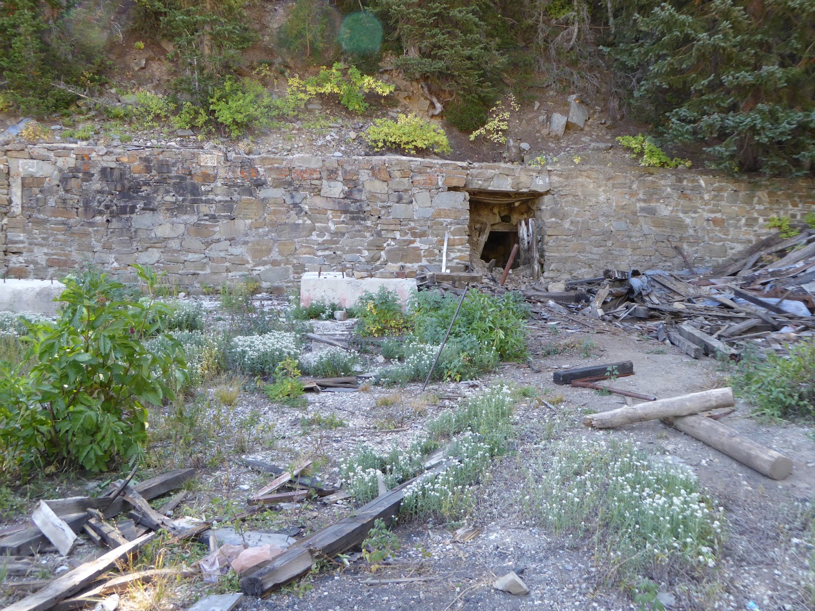
H at tunnel, collapsed just a little way in

But no longer!  Figuring that we could at least beat the masses by getting an early start, we were at the trail head (Mill D South Fork) at 8:10 a.m.  This isn't a summertime early start, of course, but we wanted the sun to come up a bit first.  Even so, it was 39 F when we started walking up the road to the trail head; I had remembered my gloves this time and both H and I had long sleeved shirts on, at least to start.  A large mule deer doe bounced across the road as we walked past the private cabins, and there were three cars in the trail head parking lot, but we didn't see a single person - which would no doubt change when we were on the way out.

One of the Cardiff mine tunnels

About a half mile from the trail head the trail forks, with the left fork going to Donut Falls and the right fork continuing up into Cardiff Fork.  Our book described the trail as an old mining road but it was the widest and best-maintained "old mining road" we've seen.  Which is not to say that it was easy walking, because these old mining roads are all loose and rocky (see also: Mineral Fork and White Pine Lake) and tend to be steeper than they appear.  As we continued up the drainage, the sun slowly made its way above the cliffs to the east, the light inching down the opposite canyon wall, making the pale red and orange leaves glow.  It seemed like everywhere we looked we saw mining remnants, mostly in the form of tailings and mine dumps, perched high above us; Cardiff Fork had had a wealth of lead, copper and silver to mine, as well as having a road leading from Alta down to Big Cottonwood Canyon.

Longer view of Cardiff tunnel and ruins

When we found a huge mine dump, we paused to explore, climbing the tailings and peeking into the collapsed tunnel.  A little further on we started to see NO TRESPASSING signs.  I had read some online articles about conflicts in Cardiff Fork between the Forest Service and private landowners: the old road leading up the drainage to the Cardiff mine crosses a patchwork of public and private land, but back in 2012, the Forest Service seemed to have worked out a deal with the landowners, allowing hikers to hike up the drainage as long as they stuck to the road.  Still, I have a thing about trespassing and got extremely twitchy, to the point of making H backtrack to where I thought there might have been a different way up to the mine.

Huge Cardiff mine ore bin

There wasn't but the delay allowed us to meet up with another couple who were also heading up to the mine.  The man had been up there a lot and had a bunch of information to share, including reassuring me that we were allowed to be on the old road.  We climbed the mine dump to get a good view of the old ore bin - bigger than the one in Park City and still in reasonably good shape - as well as the stonework surrounding the now-collapsed and blocked tunnels.  The Cardiff mine was a massive operation back in the day (beginning around 1910); it was worked on and off until the 1950s, when active mining shut down in the area, leaving behind the ruins that are slowly fading away today.

Mt. Superior

After checking out the Cardiff ruins, we continued up the mining road behind the mine because the man we'd met said it would take us up to a meadow, then fade to singletrack up to Cardiff Pass.  There were lots more "no trespassing" signs but we pressed onward, quite steeply in places, making a couple of wrong turns/dead ends before getting to the beautiful meadow.  There were mining remnants up there, including mine dumps, open shafts and collapsed tunnels, but the road died out without transitioning to any singletrack we could find.  We consulted our book and our map and stared at the ridge above us, looking for even the vaguest of trails to the pass.  We didn't find any.  We're pretty sure we could have scrambled and bushwhacked our way up there - it wasn't that much further - but in the end opted not to.

Looking up at Cardiff Pass

Our descent went very quickly, despite the steep sections and loose, rocky footing.  We met five other hikers on their way up the Cardiff Fork trail, making the tally seven hikers in the first four hours.  As we neared the junction with the Donut Falls trail, we decided to count to see how the last bit of our hike would compare to the first part: we counted 168 people in the last half hour.  Told you Donut Falls was popular.

The meadow at the head of Cardiff Fork

The parking lots had filled up by the time we got back to the car, with hikers, MTBers and picnickers swarming the place.  We took our boots off our tired, sore feet (that loose, rocky trail really wrecks havoc underfoot), downed a quick beer and a sandwich and took off, getting out of the zoo.  There's a tremendous amount of history up in Cardiff Fork, that upper meadow is beautiful and I would love to figure out a way to get up to the pass to look down at Alta, but with the rough footing and the oodles of people at the trail head, I don't foresee us getting back up there again anytime soon.

Trail's end (for us, anyway)

Hike stats:  9.82 miles; 2,400 feet of elevation; 3:54 hours hiking plus 54 minutes of standing around looking at stuff; 2.5 m.p.h. average hiking speed.