Monday, August 29, 2016

echo reservoir to park city to echo reservoir

Well, that was a big one!  A couple of weeks ago, before we watched the final stage of the Tour of Utah, we did a MTB ride on a portion of the Historical Union Pacific Rail Trail, going ten miles out from Park City and then turning around and heading back.  We did some research on the trail and, after thinking about it a bit, decided that we should do the whole thing.  But because we didn't want to shuttle cars, we would have to do an out-and-back; and because we wanted a downhill finish, we would have to start at the far end, climb to Park City, and then coast back down to the truck.

Ready to ride.  Also, brrrrrr

We got up around 5 a.m. Saturday morning, driving out and getting onto the trail at Echo Reservoir around 7 a.m.  The sun was just coming up and it was a chilly 40 F.  A couple of osprey, one with a fish clutched in its talons, circled above us; on the trail, desert cottontail rabbits bolted for cover; and a little further on, from down on the shore of the reservoir, two mule deer bucks stared at us.  In less than two miles my fingers were so cold that I couldn't move them, despite having taken precautions to wear my long fingered bike gloves.  We stopped for a few minutes and then continued on, wishing the sun would come up just a little faster.

Sunrise on Echo Reservoir

This rail trail runs from Echo Reservoir, along the Weber River through the farming valley communities of Coalville and Wanship, then up the canyon (below I-80) alongside Silver Creek past Tolgate Canyon, to finish up in Park City.  The Union Pacific Railroad built the railway in 1880 to transport silver and coal, but abandoned the line in 1989.  The converted dirt and cinder double track rail trail was opened in 1992 as the first non-motorized rail trail in Utah.

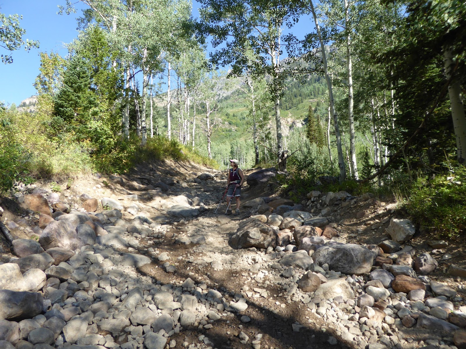
Halfway up the "steep" section

Because it is an old railroad line, the grade is very gentle (trains don't do steep) and with few curves.  It is, however, about twenty-six miles long and since we were doing it as an out-and-back, I was a little concerned about the distance.  H had a plan for me, however, with regular stops to stretch and eat a little (half a Payday candy bar every five miles on the way out), and lots of hydration.  With my bonk on the hike last weekend, keeping my energy up was going to be important for this distance.  We also planned to get into Park City in time to get something to eat at Squatter's - and Utah beer totally counts as hydration.

Made it!

After the sun came up, we could see the surrounding farm country.  We had the trail nearly to ourselves: seeing just a few walkers and cyclists near the Coalville and Wanship trail heads, and then a few more around mile 18, in the middle of the "climb" from the valley to the outskirts of Park City.  It was a gorgeous morning and we made good time, the even double track allowing us to ride next to each other and talk for the duration.  The closer we got to Park City, the more recreationers we saw, and it felt busy when we got to the paved part of the trail towards the end.

Beer - it's what's for breakfast

We had made such good time (3.5 hours for 26+ miles) that we were fifteen minutes ahead of our planned arrival at Squatter's - and worse luck, an HOUR before they were allowed to serve beer.  We made the most of it, however, getting seats in the bar and absolutely devouring our breakfasts.  We'd never had breakfast at Squatter's and the menu was terrific: Since I try to avoid egg/cheese during warm weather exertions, I went with a side of bacon to go with some "Utah scones," which are fluffy bites of fried dough, served with warm jam.  H had a fabulous looking omelette with ham, bacon, sausage, cheese and two kinds of peppers.  The joint was hopping and it took a while for our breakfasts to come out of the kitchen.  We were fine with that because that meant we could drag our feet just a bit and get a couple of Full Suspensions as soon as they were available.  It was the right thing to do.  As H remarked, not many people would ride 27 miles before 10:30 a.m. for beer and breakfast - but we did.

Huge golden eagle

Thus sustained, we got back on our bikes and retraced our route, this time much faster because it was noticeably downhill from Park City.  Before we knew it, we'd gone six miles, and then ten, and then out of the canyon and entering Wanship.  Our pace slowed a little there because the trail flattened out, plus we stopped to take photos of the scenery, wildlife (golden eagle, kingfishers, killdeer) and farm life (alpacas, cows, horses, goats and sheep).

The Tiny Ass Ranch

I had one candy bar left so we also stopped for snack/stretch breaks at mile 10 and mile 18.  By the time we got to the far side of Coalville, with only a few miles left, I was starting to feel it.  My neck and shoulders were tight from leaning on my handlebars all day; my sit bones were getting sore; and I was feeling some fatigue in my legs.  The very last bit around the shore of the reservoir was just slightly uphill too - normally, it wouldn't have been a problem but after 52 miles, I was feeling it.

Alpaca farm

But we made it, getting back to the truck after 54.39 miles in six hours (5:10 of riding and 50 minutes of resting/taking photos) (not including our brunch stop).  This was by far the longest ride I've ever done, certainly on a MTB and probably ever.  It felt great to have a beer, looking out over the reservoir.  It felt even better to have accomplished that ride.  It wasn't technical but it was long and I'm so glad we did it.

Made it!

P.S.  I crashed hard that night and went to bed before 8 p.m., well before the sun went down.

Bridge at the trail's terminus

Thursday, August 25, 2016

lessons learned

It is entirely possible that we overdid it a bit with our Mineral Basin loop hike on Saturday because when we woke up on Sunday, we were all, no MTBing, not today, and went back to sleep.  H had big blisters on his feet and my back and neck were very stiff, plus I could feel the fatigue still in my legs when I went up and down the stairs, extra sleep notwithstanding.  So we spent Sunday morning at home, doing laundry and watching some Olympic MTBing, then packed up a cooler and went up to Brighton.  We did three laps around Silver Lake, enough to give us three miles' worth of walking, then settled into our camp chairs with snacks and suds to watch the comings-and-goings.  Although Silver Lake was pretty busy, and there were plenty of people hiking at Brighton, it was definitely less overrun than it had been just a month or so earlier.  Winter is coming, I can just feel it.

As we enjoyed the nice mid-70 degree temperatures, we discussed some of what we had learned on the hike the day before.  First, I need to always bring gloves if we are going to start early like that.  My hands had been so cold that they really hurt and that was entirely due to poor planning on my part.  Second, we need to be better about nutrition while hiking.  We had plenty of food with us (apples, granola bars, trail mix, beef jerky and peanut butter-and-raisin roll-ups) but all we ate were the roll-ups because nothing else seemed appealing.  We were never hungry but we definitely could have used the energy so we'll have to figure out what we might be inclined to eat - and then eat it.  Third, it's not a race.  We tend to go at a fairly quick pace (for people our age in reasonable shape who have desk jobs) and don't stop very much, and we (I) hate it when other hikers pass us.  There was plenty of daylight left in the day - it would have been fine if we'd slowed up a bit or taken a few more stops to rest and eat and enjoy the scenery.

Fourth, I shouldn't wear my Keen sandals when we walk three times around Silver Lake.  I didn't get any blisters on Saturday but I sure did on Sunday.  Lesson learned.

Tuesday, August 23, 2016

alta dry fork - mineral basin loop

Well, that was a big one!  As I've mentioned before, we've been trying to expand our Wasatch Front hiking horizon to find less-frequented hikes.  H had been studying the maps quite closely and put together a loop that wasn't in any of our books: a long loop starting and ending at Snowbird. Wait a minute, you say, how can any hike around Snowbird - during an Oktoberfest weekend - be considered "less frequented"?  Well, if you do the 16+ miler that we did, it definitely is.

Still dark when we started

Sun coming up and moon over Gunsight (Alta)

We got up at 5 a.m.  Willingly.  On a Saturday morning.  We weren't sure exactly how many miles we'd be hiking, nor how many feet of elevation we'd be climbing, so we wanted to give ourselves an early start.  This time of year, that meant it was still dark when we parked the truck on the canyon road above Snowbird.  The moon was big overhead as we walked up the road towards Alta.  We kept going up along the dirt Summer Road and then, the sky brightening overhead, turned onto the trail through Albion Basin, spotting two moose and several mule deer, including a still-spotted fawn and its mother.  There was a steady wind blowing down the canyon and my hands got really cold even as the rising sun hit the mountaintops overhead; it wasn't until we got to the Catherine's Pass trail head that I could move my fingers.

Catherine's Pass

The parking lot at that trail head was surprisingly full: from bow-hunters trying to fill their deer tags, we discovered, talking to some of them on our way up to Catherine's Pass.  The early morning temperature was pleasant as we quickly got to the pass and then continued up to the junction of the Sunset Peak/Great Western trails, putting the first five miles of the day behind us.  There were a few other hikers out, nabbing the sunrise from the ridge, but it was still and quiet and we felt like it was all ours.

Descending the GWT in Alta Dry Fork

After double-checking the map, we descended into new territory for us, following the Great Western Trail down into the Alta Dry Fork.  This was a beautiful drainage with trees and dramatic cliffs and a now-dry creek that must just be amazing in the spring.  As the sun came over the ridge, we passed a couple of campers, and a couple of trail runners passed us, and it was all perfectly quiet.  At the bottom of the drainage, we got on a jeep road that led us south and east.  We had transitioned into an aspen forest at this point.  And despite all the hunters we saw out and about, we still saw several silent mule deer, disappearing soundlessly into the underbrush.

This is the backside of Devil's Castle

At a junction, we turned right onto another dirt road, now beginning to move up into Mineral Basin, past the Pacific Mine reclamation area and several campsites.  Supposedly there is a trail head to Pittsburg Lake there somewhere, but we never saw that trail so we aren't sure.  The "road" we were on was very rough - high clearance 4x4 or ATVs only - with lots of rocks and wet spots from nearby
springs.  It ran along the American Fork River, still fairly small as it cascaded out of Mineral Basin and down American Fork Canyon behind us; we had to cross it once and I felt luck to keep my feet dry with the remaining miles ahead of us.

I have trouble calling this a "road"

We paused for a snack at around eleven miles and gazed up at the lodge at the top of Snowbird, looming high above us in the distance.  Our goal in sight, we kept on and the road/trail/tumbledown of rocks got steeper.  It wasn't my favorite surface for hiking - rocky and loose - but we had to keep going and once we crossed onto Snowbird's property, the road smoothed out a bit.  We chatted with a couple of guys on an ATV - who greeted us by exclaiming how impressed they were that we were hiking what they'd just driven - and then continued on up the ski area towards Hidden Peak and our tram ride down.

Our goal.  Way the hell up there.

The section from the bottom of the Mineral Basin Express chair to the top of Snowbird was tough for me.  It wasn't too hot, despite being fully exposed to the sun, but it was steep and my legs were pretty tired at this point.  Whenever the road would flatten out, I would pick up the pace a little but as soon as the incline picked up again, I could feel myself flagging.  Even when H said, "We can't let the guy [who had clearly ridden the Peruvian chair up and come through the tunnel] beat us," all I could muster was "Really?" and shuffle a little faster for a few yards.  Note: that guy did NOT beat us.

On Snowbird property at least

We dragged ourselves up to the tram and availed ourselves of the free ride to the base of Snowbird.  I know it would have been more bad-ass to walk it but that would have added another 3+ miles, with the switchbacks, and we felt we'd probably done enough.  H could feel hot spots on the balls of his feet and my back started to stiffen up as soon as we stopped moving.  Sweaty and dirty, we still managed to feel smug, knowing that not a single person on that tram had done what we had just done.  We walked up the path under the Chickadee chair, past all the people in line for the alpine slide, and got back to the truck.

Summit achieved!

Although we had had the forethought to bring our Oktoberfest mugs with us - just in case - neither of us was willing (or possibly able) to take those mugs back down the hillside for beer and polka music.  So we had surreptitious PBRs while we changed out of our hiking boots and then headed down the canyon for home.  This loop wasn't the longest hike we've done - Ben Lomond still holds the distance record - but it was the longest combined with the most elevation.  It had beautiful scenery in a part of the Wasatch we hadn't seen before and we had the trails mostly to ourselves for the whole way.  It was a great hike - even if it did result in bedtime before the sun went down that night.

Check out this profile: from the 'Bird up to Catherine's
Pass, down Alta Dry Fork, up Mineral Basin to Hidden
Peak, down Peruvian Gulch and back up to where we parked

Hike stats:  total distance 16.33 miles (14.7 miles hiked); 7 hours 21 minutes trip time, 6 hours 6 minutes hiking time; 2.2 m.p.h. average speed (or 2.7 m.p.h. if you count the tram ride); 4,900 feet of elevation.


Friday, August 19, 2016

back to the ballpark

Salt Lake City is a smaller market, pro sports-wise, with only Real Salt Lake and the Utah Jazz as the big league teams.  There is no NFL here - but that is more than made up for by the rabid college football fans - and hockey and baseball are minor league.  That doesn't mean that it isn't fun to go to the games, however!  H's work recently had an outing at the Salt Lake Bees home field, Smith's Ballpark at 77 West 1300 South, in Salt Lake City.  We hadn't gone to a game in years so we were glad of the opportunity.

First we went to Lucky 13: beers at the ballpark are exorbitantly priced and Lucky 13 is just across the street, so we went up early and had a couple of Uinta Cutthroats at the bar.  It was pretty busy, although certainly no busier than it has ever been when we've gone there, but then cleared out fifteen minutes before the game started.

Under the lights

The Bees are the Triple-A affiliate of the Los Angeles Angels.  Their opponent that night was the Round Rock Express (Texas Rangers).  Despite having Tim Linceum (two time Cy Young Award winner and three time World Series champion, knocked down to AAA after an injury) pitching for the home team, the Bees lost 5-4 in extra innings.  It was a gorgeous night for a game, with cooler temperatures and the setting sun reflecting off the Wasatch mountains.  To be honest, we didn't watch a whole lot of the game itself, instead spending most of our time chatting with folks and also standing in line for Chicago dogs for a ballpark dinner.  If you're a fan of baseball and find yourself in SLC in the summertime, watching the Bees is certainly a pleasant way to spend an evening.

Tuesday, August 16, 2016

august visitors

H's parents are our most frequent visitors but up until now, they haven't gotten to experience much nice weather, instead enjoying varying degrees of rain and snow in March, May, October and November.  We encouraged them to give the summer a try and they ended up timing it just right, coming out for a five day trip under clear blue skies and temperatures no higher than the low 90s.

Mineral Basin

Because the weather was so nice, we were able to get out in it more than we have during their prior visits: doing a scenic drive over the Mt. Nebo loop, then up to Sundance for a beer at the Owl Bar; and spending time in both Big Cottonwood Canyon (breakfast on the deck at the Silver Fork Lodge, where the hummingbirds were out in force, and a trip over Guardsman Pass to Park City) and Little Cottonwood Canyon (a hike to Cecret Lake at Alta and a chairlift ride up Snowbird).  We especially lucked out at Snowbird: spotting a moose from the Peruvian chair and then getting to see the last of the wildflowers in Mineral Basin.

The boys at Cecret Lake

The relaxed pace also allowed time for cocktails on the patio while the Wasatch mountains turned pink with alpenglow, casting a rosy light on some summer vacation.

Tuesday, August 9, 2016

2016 tour of utah - stage 7

Stage 7 (8/7/16) Park City to Park City, 78 miles with 7,883 feet of elevation.  The final stage of the Tour of Utah may be short but it is mighty: beginning and ending in Park City, the stage route (designed by Levi Leipheimer) makes a loop, climbing up over Empire Pass with its average grade of 10% and maximum grade of over 20%, to descend at a screaming pace through Deer Valley.  And this year the event organizers made it even tougher: the last 500 meters were a nasty climb all the way to the top of Main Street - because only "America's Toughest Stage Race" would inflict such a long, uphill finish on its riders.

H and I made plans to do our Round Valley MTB loop before hitting downtown Park City for the race festivities.  We've done this a couple of times and last year even managed to time it so we could watch the riders heading out of town as we were heading back in.  We had just pulled into the parking lot at 10 a.m., ready to hop on our MTBs, when the skies got really, really dark.  Within moments, bolts of lightning were flashing all along the mountains and it started pouring.  Now, I don't mind getting caught in the rain while biking, but you will have great difficulty convincing me to start out in the rain.  Plus: lightning.

Not sure what it is - but pretty

We stayed put in the truck, watching the storm cell move through (and then watching a second one move through as well).  After about an hour, the sun was coming through again and the asphalt was immediately beginning to dry.  We had some concerns about riding on wet trails, however - don't ride on wet trails! - so H suggested that we take the paved rail trail out like we normally do but then, instead of turning towards Quinn's Trailhead, staying on the rail trail to see what that was about.

This bike path is actually the Historic Pacific Union Rail Trail State Park, running from Park City to Echo Reservoir.  The whole thing is around 28 miles long and turns to gravel after it crosses State Route 40.  We only did ten miles out (and then ten miles back) but that was enough to pique our interest for a full exploration later this year.  The section we did was great, in good shape, following a creek through cow pastures, past a ranch (founded in 1861) and then down the canyon with I-80 above us.  Incredibly, we could scarcely hear the highway, making for a pleasant pedal.  Of course, leaving from Park City is all downhill, so it was a ten mile, 2% grade uphill on the way back.  With a headwind, of course.

Doesn't that look like a nice trail?

After our ride, we changed our clothes, snarfed down sandwiches and a couple of beers and caught a shuttle to Main Street.  This was where we saw the new, uphill finish and deemed it mean to the riders but great for the fans.  We found a spot in the shade (which was great as the sun seemed to be trying to make up for lost time) near a Jumbotron, and waited while the riders made their way up Empire Pass and back down into town.  The crowd lined both sides of the street, banging on the barricades and cheering for first Bob Roll, as the former professional bike racer rode up to the finish, and then for the riders as they came in.

Lachlan Morton won both the stage and the Tour, having made a definitive move at the bottom of the climb up Empire Pass and making himself uncatchable for the climb and the descent.  Young Adrien Costa came in second on the day, with Darwin Atapuma rounding out the podium.  Andrew Talansky seemed to have exhausted himself winning Stage 6 and his teammate Joe Dombrowksi (last year's ToU winner) pulled him up and down the mountain Sunday, and then gave him the fourth place finish.

The positioning of the finish line and the stage (different from prior years) made it impossible for us to clearly see or take photos of the awards presentation.  Hopefully they'll adjust that for next year.  In any case, the Tour of Utah is a super-fun event for fans to watch and a super-grueling race for the riders - thirteen riders abandoned on Stage 7 alone.  Can't wait for next year.

Stage 7 podium:  Lachlan Morton, Adrien Costa, Darwin Atapuma.  General Classification:  Lachlan Morton, Adrien Costa, Andrew Talansky.  Sprinter:  Kiel Reijnen.  King of the Mountain:  Adrien Costa.  Best Young Rider: Adrien Costa.  Most Aggressive Rider:  Rob Britton (USA, Rally Cycling).  Fan Favorite:  Taylor Eisenhart.  Team standings:  BMC, Cannondale-Drapac, Axeon Hagens Berman.

Sunday, August 7, 2016

2016 tour of utah - stage 6

Stage 6 (8/6/16) Snowbasin to Snowbird, 114 miles and 11,165 feet of elevation.

Stage 6, the Queen stage of the Tour of Utah, where races are won and spirits are broken.  I mean, look at that up there: 11,165 feet of climbing.  Those riders who have never ridden the Tour of Utah may have thought that the earlier stages were tough but really, the last two stages are truly unbelievable.  Leaving Snowbasin and descending Trappers Loop, the riders wound their way through Morgan County into Summit County, through Midway and up to Guardsman Pass.  After cresting the ridge, they descended Big Cottonwood Canyon, took a hard left onto Wasatch Boulevard to climb up to the bottom of Little Cottonwood Canyon, then the grueling climb up to the finish at Snowbird.

Rain delay selfie

Knowing that Little Cottonwood Canyon would be closed -to traffic at 1 p.m., we got our exercise in early: me doing my 3.25 mile run and H doing a 46 mile road ride.  We both enjoyed the cool morning temperatures, something we haven't gotten to experience of late with the recent hot spell.  We were packed up and out the door a little after noon.  The crowds were just beginning to gather on the roadside as we drove up; Tanners Flat seemed a little subdued, likely due to the police presence (which we gathered was there to keep the fans from interfering with the riders) but there also seemed to be more corporate tents, squeezing out the individual spectators.

Talansky and Atapuma charging to the finish

We parked the truck, grabbed the cooler and headed up to the festivities, first strolling through the vendors before snagging a spot at the fence, near the Jumbotron so we could watch the race in progress.  Starting at 2:30 p.m., the winds picked up and the skies darkened; there was lightning in the area and the event organizers shooed all the spectators up to the Snowbird lodge.  No sooner had we gotten up there than the clouds let loose and it just poured rain, thunder crashing all around.  People stood in clusters, either watching the live stream of the race on their phones or just watching the weather.  After about forty minutes, the storm cell moved on.  The rain let up and as the crowd meandered back to the race course, the sun came out; by the time we'd gotten back to our spots, the road was steaming and it was as hot as if the storm had never come.

L to R: podium girl, A. Costa, Taylor Eisenhart, A. Talansky,
K. Reijnen, Ben King, podium girl

From where we were standing, we could see the riders coming down to final 500 meters.  It was neck and neck for the stage win - Andrew Talansky and Darwin Atapuma had been riding together the whole way up - but in the last couple hundred meters, Talansky had some kick and dropped Atapuma just enough to take the stage.  He had also surged ahead of Lachlan Morton enough to take the yellow jersey, meaning that the last stage of the Tour of Utah was actually going to make a difference as to who wins the whole Tour.  Stage podium:  Andrew Talansky; Darwin Atapuma (Columbia, BMC): Adrien Costa (USA, Axeon - and only eighteen years old!).

Saturday, August 6, 2016

2016 tour of utah - stages 1, 2, 3, 4 and 5

It's Tour of Utah time again!  This installment showed a return to southern Utah for the initial stages, with the usual Snowbird and Park City finale.  There seemed to be fewer well-known names but the race did manage to attract several national cycling champions and some up-and-comers who are making their presence known, like Greg Daniel, last year's winner Joe Dombrowski, local Tanner Putt, Lachlan Morton, Joey Rosskopf, Ben King, Andrew Talansky and Peter Stetina.  Danny Pate and Chris Horner even came back again, true veterans in their late 30s and early 40s, respectively.  We were only able to get to the sixth and seventh stages but this is what went down during the rest of the week.

Stage 1 (8/1/16) Zion National Park to Cedar City, 84 miles and 6,679 feet of elevation gain.  For the first time ever, the Tour of Utah got into one of the state's five national parks, a feat three years in the planning due to permitting and permissions issues.  The first 20k were in the park and were designated as a neutral zone with a speed limit, so the riders were actually gawking at the amazing scenery.  Once out of the park, the race started in earnest, with a climb up to nearly 10,000 feet before descending past Cedar Breaks National Monument.  Stage podium:  Kristofer Dahl (Canada, Silber Pro Cycling); Colin Joyce (USA, Axeon); Rick Zabel (Germany, BMC Racing).

Stage 2 (8/2/16) Escalante to Torrey, 99 miles and 9.435 feet of elevation gain.  The course went back along Scenic Highway 12, one of the most gorgeous roads on the planet, a little shorter than the last time the Tour was here in 2013.  The riders had two difficult climbs and finished with two 17-mile circuits in Torrey.  Stage podium:  Robin Carpenter (USA, Holowesko/Citadel/Hincapie); Ruben Companioni (Cuba, Jamis); Travis McCabe (USA, Holowesko/Citadel/Hincapie).

Stage 3 (8/3/16) Richfield to Payson, 119 miles and 6,337 feet of elevation gain.  Although technically less climbing than the day before, going up and over Mount Nebo (3,000 vertical feet) proved brutal, blowing apart the peloton and causing several riders to be cut for not making the time cut-off (which I know is in the rules but still seems harsh).  There was a big crash just as the climb began, which caused USA national champion Greg Daniel to abandon with a broken collarbone.  Stage podium:  Lachlan Morton (Aussie, Jelly Belly); Adrien Costa (USA, Axeon); Andrew Talansky (USA, Cannondale).  NOTE:  Lachlan Morton won this stage back in 2013 - it clearly suits him.

Stage 4 (8/4/16) Lehi to Kearns, 96 miles with 4,504 feet elevation gain.  This was a "flat" stage - at least for Utah - and frankly not that exciting to watch as the riders cruised up and down the west side of the Salt Lake Valley along the Mountain View Corridor.  The winds were challenging, however, as was the smoky haze from area wildfires, and it was a fun stampede to the finish at the Olympic Speedskating Oval in Kearns.  Stage podium:  Travis McCabe; Kiel Reijnen (USA, Trek); Lucas Haedo (Argentina, Jamis).

Stage 5 (8/5/16). Antelope Island to Bountiful, 114 miles with 6,948 feet of elevation gain.  Like last year, the riders started on Antelope Island, came across the causeway and headed north, with short, tough climbs over the North Ogden Divide and Trappers Loop, and finishing with not one but two climbs up the Bountiful Bench.  Stage podium:  Kiel Reijnen; Tao Geoghegen Hart (Great Britain, Axeon); Alex Howes (USA, Cannondale).

At this point, the morning of the Queen Stage (Snowbasin to Snowbird), Lachlan Morton still has the yellow jersey.  He's only got it by about nine seconds over Andrew Talansky, however, so today may make a huge difference.


Thursday, August 4, 2016

once again, wildflowers

Sunday was the final day of the Cottonwood Canyons Foundation's 2016 Wasatch Wildflower Festival.  Friday had been guided walks at Brighton (morning) and Solitude (afternoon), Saturday was at Alta, and then finishing things off at Snowbird.  The CCF's goal with the wildflower festival is not to get more people from greater Salt Lake to come up into the canyons for the flowers but rather to educate those people who already do spend time in the canyons.

Gentian

As we had last done in 2012, we drove up to the 'Bird early enough to sign up for one of the advanced hikes ($5 per person donation to CCF nabbed us tram tickets to the top of Hidden Peak, and then a guided walk down) and then have breakfast (huevos rancheros and granola with fruit and yogurt) at the Forklift.  The first round of hikes started at 9:30 a.m. and we found ourselves in a group of 14, including our guide Eric and his two sons, Miles and Ian.

Perry's primrose

We were not the youngest people in our group but we were also not the oldest, and we soon figured out that we had spent more time up in the Wasatch mountains than anyone else in the group, including our guides.  In fact, Eric had never walked down from the top of Snowbird before, so while I scouted out a way to the access road, H answered people's questions about the surrounding peaks.

Tolmey's owlclover

Our route down was via the access road and the Peruvian gulch hiking trail.  The road and trail are quite steep in sections and the road tends towards loose gravel, which was slippery in spots.  The land surrounding the road is pretty dry, so it was nice to get off onto the smaller trail for sections since that afforded us access to a wider variety of flowers.  We saw a pika up near the summit, a couple of grouse midway down and potguts throughout the walk.

Elephant's head

The whole point was the wildflowers, however, and Snowbird did not disappoint:  we identified over forty different flowers (just a drop in the bucket, when there are technically 200+ varieties of penstemon alone).  Our guides were quite knowledgeable and if none of the three of them knew the flower offhand, they had brought multiple books for reference.  We only ended up with one flower that we couldn't name:

Paintbrush

The pace was expectedly slow and as we neared the bottom, H and I, plus young Ian and another hiker, couldn't take it any longer, cruising back to the Snowbird deck without waiting for the rest of the group.  (Still, we made it down in about an hour's less time than the first time we did the festival, so I guess that's something.)  H and I found an unoccupied table with an umbrella and camped out there, waiting for Eric to come through so we could thank him for the informative walk.

Coyote mint

Since we had that shaded table, it seemed a shame to give it up.  H fetched us beers from the Birdfeeder (deckside grill) and I went down to General Gritt's for a couple of fabulous Regulator Johnson sandwiches.  Ghostowne, a country/rock band, was playing on the deck, and they were fun, with original songs titled "Doublewide," "I Only Smoke When I Drink and "Cigarettes and Black Coffee," with lines like "I'm a menace to sobriety."

Showy goldeneye

We felt no need to leave any time soon, listening to their whole set, enjoying the music, the cooler temperatures and just generally being pleased about things.  Clearly, the Wildflower Festival is an outstanding way to get out and enjoy the canyons.

Lewis's monkeyflower

Monday, August 1, 2016

smoky mountains

To change things up a bit (and because we had planned to do something different on Sunday), we went MTBing at Round Valley on Saturday.  Not knowing exactly what to expect for trail traffic, we got an early start, getting on the bike path in Park City a little before 8 a.m.  The skies were clear except for the haze from area wildfires, particularly the ones in Kamas, Currant Creek and along the Utah/Wyoming border; we could smell the smoke in the air and it actually irritated our eyes and throats.

Up, up and away

The hot air balloons didn't seem to mind the smoke, however, rising above it to float above us.  We counted at least five sailing above us until the wind picked up.

That's as close as the elk let us get
before they took off

We needn't have worried about Saturday morning crowds: there definitely were more people than on Sundays at that time but there certainly weren't hordes like we have found on holiday weekends.  We did have another good wildlife ride too, seeing two mule deer, a young hawk, a desert cottontail and a whole herd of elk.  The elk were especially cool to see.  We've seen them in the higher foothills around Park City but never out in Round Valley.  There were maybe 10-12 of them and for such large animals, they move so quickly and quietly, simply disappearing into the scrub oak before we got too close.

Wascally wabbit

My riding was only meh.  For some reason, my legs were quite tired for the first half of the ride and I seemed to be flailing more than usual.  By the time we got to the Staircase, however, I had snapped out of it and rode up those three long steps better than I ever have.  There was just a bit of a tailwind for the first part of the bike path return trip too, which was an unexpected treat.  Maybe one day we'll get a tailwind for the whole thing - that would be grand!

Into the sagebrush I go