Thursday, June 30, 2011

cuteness

These little guys didn't make any of the prior posts but they're just so cute that I had to include them.  Both were taken on H and Paul's excursions.

This fuzzy, adorable, little raccoon, clearly a juvenile, was scrounging around in American Fork Canyon, digging up worms or grubs or something:


And this Uinta ground squirrel - a "potgut," in local parlance - popped out of his Butler Fork hole and posed long enough for H to take his portrait:

Tuesday, June 28, 2011

deer valley

Recapping the events of a week ago Tuesday:  On Paul's last day here in Utah, the guys were trying to figure out where they could hike that wouldn't have too much snow and that might have the possibility of spotting the shy and elusive elk.  They decided to head to the Wasatch Back (Park City side of the mountains) since it tends to have less snow than the Wasatch Front, plus the only place H and I have seen elk has been on that side.

Some snow on the ski trails, but not that much

We don't have very many maps/books for the Wasatch Back, however, so they first stopped at REI to see if they had any maps of WB hiking.  Nope, but try Cole Sports in Park City.  Cole Sports: no maps, but Deer Valley is probably your best bet.  Snow Park Lodge at Deer Valley:  we're not sure where you should go, but you should ask at the Deer Valley mountain bike shop.  DVMTB Shop: you're not dressed for hiking - there's way too much snow up there!

At this point, the guys just started walking, following ski trails and MTB trails up and down three different peaks.  There was not too much snow up there and they had gorgeous views of Park City and the Jordanelle Reservoir.

View of the Jordanelle Reservoir and Dam

They also found a mama and a quite young baby moose strolling about the ski mountain, and were able to get close enough for some decent pictures without startling/annoying the mother.  After they'd taken some photos, the moose family just unconcernedly disappeared into the woods.  H may not have been able to deliver any elk, but he is the moose whisperer for sure!

Two moose are loose!

Sunday, June 26, 2011

butler fork

Recapping the events of last Monday:  While I went back to work, the boys went hiking (lucky boys), doing a trail that I've always wanted to do because every time we drive by the trailhead, there's a bunch of cars there: Butler Fork to Reynolds Peak.  It's actually right near Dog Lake, just a little lower down on Big Cottonwood Canyon.

Paul, heading up to Reynolds Peak in June

They followed the trail up to Dog Lake, encountering snow fairly early on, then walked up the ridge to Reynolds Peak, sort of but not always following the trail because the trail was difficult to follow, due to all the snow.  From the peak, a steep, wide, snow-filled bowl led down towards Dog Lake and H decided that they should glissade down instead of going back the way they came.  It was a little intimidating because it was so steep, but the snow was compacted enough that there wasn't any worry of breaking through and postholing.

Paul, glissading down from Reynolds Peak

They had to bushwhack a little from the bottom of the bowl until they reconnected with the Dog Lake Trail, then followed that trail down and walked the last little bit along Big Cottonwood Canyon Road to get back to the car at the Butler Fork trailhead.

Oh! And I almost forgot the best part: on the way up the canyon, they had to stop for a few moments because a young moose was standing in the road, taking a drink from a puddle.  The guys were able to take a bunch of photos before the moose moved back off into the trees.  I think H must be the moose whisperer, he's seen so many lately!

The moose is loose!

Saturday, June 25, 2011

water, water everywhere

After my race (yes, a week ago now - just trying to catch up) and breakfast, and a quick trip home to clean up, H, Paul and I jumped into the truck and headed east to search for more large mammals - inspired by the cow moose we'd spotted in Big Cottonwood Canyon who was enjoying her own breakfast.  We decided to try Cascade Springs first, outside of Midway, in the Uinta National Forest.  After a long, winding drive up a dirt road busy with ATVers and dirt bikers, we found it, a lush oasis hidden away in the foothills.

The cascading pools

Cascade Springs is a natural artesian spring where rain and snowmelt in the Wasatch Range makes its way through fractures in the bedrock and bubbles up to flow down the hillside in a series of cascading pools.  More than 7 million gallons of water flows through here every day, making it a prime wildlife watching spot.  There are slim brown trout in the shallow pools, badgers, moose, deer and elk, and songbirds galore.  The DNR has constructed careful paved and wooden boardwalk paths in three short loop trails around the springs.  We walked them all, marveling at the beauty and diversity of plant and animal life.  (We didn't see any badgers but we did spot a mule deer trying to pass unnoticed in the gambel oaks.)

After Cascade Springs, we headed to Kamas to pick up the Mirror Lake Scenic Byway.  You can't go all the way through to Wyoming because of the still-deep snow, but you can get in there to camp and tour around.  To be completely honest, at this point I was pretty sleepy from the 4:15 a.m. wake-up and the run, so I snoozed in the truck while H and Paul walked along the madly rushing rivers - there is a LOT of water in northern Utah's rivers and creeks right now - and took photos of moose and mule deer.

River along Mirror Lake Byway/UT 150

When the clouds had started to roll in and the temperature dropped, the guys woke me up and we headed back to the Salt Lake valley.  Knowing it was going to be an early evening for all of us, we got a quick meal of garlic burgers and beer at the Cotton Bottom before heading home.  I daresay each of us slept pretty soundly, thanks to the long day and plenty of fresh air.

Tuesday, June 21, 2011

crack of dawn

Because I'm a crazy person, I signed up for the Crack of Dawn 8K which took place Saturday, June 18th, at 6 a.m.  Did you get that last part?  6 a.m. start.  The only reason I thought this was a good idea was because the race was all downhill: the start was a mile above Log Haven in Millcreek Canyon and the finish line was in the shopping plaza at the base of the canyon road.  I'm guessing that the reason the race started so early was to get the runners in and out of the canyon before all the hikers/bikers/dog-walkers/picnickers started showing up as Millcreek is a very popular place.

Our instructions were to pick up our timing chips at the finish line between 5-5:15 a.m. and get up to the start by 5:30 a.m.  There were buses bringing people up to the start or, if you could convince someone to get up early with you, you could get dropped off.  I promised H and Paul that I'd buy breakfast if they'd take me to the start and thus, because we're apparently all nuts, we got up and out the door by 4:35 a.m. to meet all our deadlines.  The sky started getting brighter around 5:30 a.m. while the guys waited with me at the start.  I sent them down the canyon at 5:45 a.m. and by the time we started running, the sun was peeking over the canyon walls.

Eight kilometers (right around five miles) is a lot of down, let me tell you that.  I was worried that my knees would take a beating but it was my quadriceps that ended up being sore.  The first mile was great - and when I checked my pace, I was running nearly twice as fast as my regular flat pace! - but then it started getting steeper in some spots, and I could feel the stress in my legs.  Breathing wasn't a problem since gravity was doing all the work; the fatigue came from fighting the downhill for that distance.  And if that wasn't enough, the last .5K was uphill - a tiny little rise to the finish line, which was just mean.

Bring on breakfast!

It was actually quite fun, above grumbling aside.  My pace averaged out to being two minutes/mile faster than normal and I finished in the top half of the 106 entrants, which surprised me because it seemed like everyone was passing me.  And the best part was that I had run five miles before 7:00 a.m., leaving me to chow down on corned beef hash and eggs at the Silver Fork Lodge completely guilt-free.

Monday, June 20, 2011

out of towners

Our friend Paul arrived in SLC Thursday night for a few days to visit with us, do some hiking and take as many wildlife photos as he could.  Friday was sunny and cool (low 70s), perfect for hiking - so H and Paul headed for the hills while I headed for work.  The plan was to meet up later since my former boss and her husband were in town for just one night, so we were all going to have a drink together.

Mountain Man Paul

There's still a ton of snow in the mountains of the Wasatch Front but H picked a trail that was nice and dry: Mt. Aire in Millcreek Canyon (H and I did Mt. Aire last year on 6/6/10).  They reported that the weather was perfect and the summit clear, with only patches of snow.

View from the top of Mt. Aire

I met up with my former boss and her husband and, after a stroll through Temple Square to see the sights, we met the guys at Bar X.  It was quiet when we got there, but when we left - my group to go to a very nice dinner at the 9th and 9th Mazza; H and Paul to go looking for moose - inside was filling up and the little sidewalk patio was quite full.

H and Paul went back up Emigration Canyon to where H had gone MTBing earlier in the week.  And, as I said before, that is definitely the place to find moose because they found another one.  Now I am WAY behind on my moose-viewing - going to have to do something about that.

The moose is loose

Saturday, June 18, 2011

la-cai noodle house

Last Saturday (I know, I'm behind, but we've got houseguests to entertain) we met some friends for dinner at La-Cai Noodle House (961 State St.).  Since our friends live in Davis County (north of SLC) and we live by Little Cottonwood Canyon (south of SLC), La-Cai seemed like a good place to meet in the middle.  I'd been there before for lunch as it isn't too far from my work, but H had never been.

La-Cai serves Chinese and Vietnamese food.  Our table shared appetizer orders of potstickers (small and rather well-done) and fresh (soft) wrapped spring rolls with peanut sauce.  Our friends had the rice with curry shrimp and a beef stir fry; we had the rare beef pho for me and a gorgeous spicy beef sate soup for H, who said it was very good although he had to add some srichacha sauce to up the spicy quotient.

I like their pho: huge bowls of clear and tasty broth with noodles, veggies and meat-of-choice, served with sprouts, Thai basil and lime wedges.  Some online reviews are not so impressive with the pho, but I like it (that's actually all I've ever tried at La-Cai) and until I find some I like better, I'm standing by it.

Thursday, June 16, 2011

where to find moose

H went mountain-biking with a co-worker after work on Wednesday.  They met on the far side of Emigration Canyon, by Little Dell Reservoir, and biked up the Mormon Pioneer Trail to the top of Big Mountain Pass.  At first I was a little envious ... but that was until I heard that they climbed 1,650 feet in 5.3 miles.  The long climb made for an exciting descent too - H confessed to still being a bit timid on the downhill, but was raving about his big 29er wheels as regards the climbing and the way they ate up the ground once the trail flattened out.

He ended up pulling away from his buddy on the flat, in fact, due to the bigger wheels and the fact that H didn't mind charging through the mud puddles (took him a while to clean his bike when he got home, btw).  And it was as he was tearing it up on his own that he surprised not one, not two, but THREE moose who really didn't expect MTBers on their walking path.  It all happened too quickly for a photo opportunity, unfortunately, but H said he was easily within fifteen feet [Ed. note: not fifty, as previously reported.] of the big galoots.

That is so cool.  And while I'm envious of the moose sightings too, I wouldn't have seen them anyway if I'd been there since I'd have been so far behind.  That's okay.  Now we know where to find them!

Tuesday, June 14, 2011

smoke on the river

Saturday was pretty nice and after we did our morning activities - a 46-mile road ride for H; dragging B around my 3.5 mile loop and then weeding the backyard garden beds for me - we headed towards Heber City for the Smoke on the River BBQ Championship ... hoping to get a lead on some decent Utah barbecue.

The event was held at River's Edge at Deer Park, an RV-park/campground located on the Provo River right underneath the dam at the Jordanelle Reservoir.  (Literally right underneath the dam: we were way under the level of the water and if the dam had given way, we would have been obliterated.  Lucky for us, the dam looks to be pretty solid.)  This is a pretty cool little family-run campground with big rig/RV hook-ups, cabins that sleep 4-6, wooden "yurts" that sleep 2 and a big "family compound" for up to 15 folks.

Can you read it? "IQ4U"

There were food vendors - Tommy's Texas BBQ (whom we will be visiting when next in Heber City, at 100S 650 W), corn on the cob (with this wicked cool corn cooker that looked like a giant one of those cafeteria toasters, where you put the corn in one side and the conveyor belt delivers it all roasted on the other side), hand-fried potato chips, beer - jewelry and crafts.  Live music played all day: we got there for Lash Larue, who played some very agreeable bluegrass-ish tunes.  And all around the campground the competitors had their smokers set up.  Most of them were BBQ competition teams who also do catering, but there was a backyard division for amateurs too.  Everywhere you walked, you could smell smoked meats ... it was heavenly.

Tasty pulled pork with very excellent pickles

The event was a little expensive for how low-key it was, with a $10 per person entry fee, plus paying for your food and your beer.  But we decided we really couldn't complain as we sat in the sun, eating pulled pork and brisket sandwiches (quite good), drinking Moab Brewery Dead Horse Ale and listening to bluegrass by the riverside.  We stayed to watch the awards ceremony: the grand prize winners, local boys R&R Barbecue, won around $4,000 (in addition to winning the whole shebang, they placed in every category, I believe, including at least two firsts) and are headed to Lynchburg, Tennessee, in October for the 2011 Jack Daniels World Championship Invitational Barbecue.  That's cool - make SLC proud, boys!

Sunday, June 12, 2011

big bad voodoo daddy

H and I don't go see live music all that often - unless it's during the day at a festival or something - I don't like the crowds and generally speaking, H doesn't like to stay up that late.  But we'd seen a couple of songs from Big Bad Voodoo Daddy's set at a festival at Liberty Park last summer and when we saw that they were coming to the Sandy Amphitheater, we thought that might be a fun show to see.  And oh yes, it was!

The Sandy Amphitheater is a great, open-air venue.  At capacity it holds 2,750 people:  966 seats close to the stage and a lawn that will hold 1,800.  There's a snack bar (no alcohol); the restrooms are big and clean; and the whole place is landscaped quite nicely, nestled into the hillside at 9400 South and 1300 East.  Our seats were on the east side, about seven rows up from the stage.  It was a little loud, so close and sitting right in front of a set of speakers, but it was nice to be close enough to see the musicians' faces.

BBVD, just gettin' into the swing of things

The Big Bad Voodoo Daddy puts on a dang-good show.  They're a nine-member swing/jazz/Dixieland/big-band band: lead singer/guitarist, pianist, stand-up bass, drummer, two trumpets, two saxophones and a trombone.  The guys have been together for nearly twenty years and they still look like they're having a blast, wearing their zoot-suits and playing the heck out of their instruments.  The music is infectious: I was chair-dancing from the moment they started playing - and H was tapping his toes throughout.  Their most recent album is apparently a tribute to Cab Calloway, so a lot of what they played were arrangements of songs from the 1920s and 1930s: the Calloway Boogie, Minnie the Moocher, Reefer Man, The Jumpin' Jive, etc.  By the end of the second set, even the staid Utahn audience had gotten out of their seats and rushed the stage to dance.  I don't think I've ever seen a group with such a random sense of rhythm, but they were having fun and that's what matters.

We'd absolutely go see BBVD again if/when they come back to the greater SLC area.  And we'll go back to the Sandy Amphitheater too sometime - music out in the open air is the way to go.

Thursday, June 9, 2011

don't be a joey

This technically counts as a ski season post topic, but (1) since I forgot to post it this winter and (2) since Snowbird is planning on being open until July 4th and Snowbasin is reopening on the weekends until further notice, it's still technically ski season.  So.  When our ski friends were out here in March, Chris mentioned that his teenaged daughter and her buddies had a name for all the goobers out there that you don't want to ride the chairlift with - they're all Joeys.  I immediately latched onto this - because then I could ski up to H in the liftline and say, out loud, "OMG, did you see what Joey was wearing?" plus we could yell "Joey!!!" at people from the chairlift, in each case without fear of offending anyone.  We then had to come up with a list of who qualifies as a Joey (Andrea was totally appalled that we came up with so many in such a short time).

If you don't want to be a Joey, don't get caught on the hill with the following:
  • fur-lined hood
  • one-piece ski suit
  • fanny pack
  • NFL jacket (unzipped) worn over a hooded sweatshirt
  • rear-entry boots
  • flowered gaiters
  • helmet cover (spikes, fins, dreads, etc.) if you're an adult
  • costume - unless it's some special dress-up ski day
  • bouquet of lift tickets / series of lift tickets stuck onto each other
  • perfect feathered hair & sunglasses combination (especially if it's snowing)
Feel free to leave additional Joeys in the comments!  And remember, friends don't let friends be a Joey.

Monday, June 6, 2011

stansbury island trail

With the wet and cold spring (what spring?) and extra-deep snowpack, our northern Utah hiking options are somewhat limited*.  But H found us a pretty good one - and one we hadn't done yet: the Stansbury Island Trail.  All told it was a 10.2 mile loop which we did in 3:16 walking (plus 0:39 minutes' worth of stops); the highest point on the trail was just 4,974', which was just 619' above the trailhead, and our total elevation gain (all the cumulative ups) was 1,140'.  Can you tell we got a new GPS?  Lots of data to play with!

Looking south into the Rush Valley
over the salt evaporation ponds

Stansbury Island is located about 37 miles west of SLC, right off I-80.  It's not technically an island since you can drive out to it, passing innumerable salt evaporation ponds run by Morton, Cargill and other salt companies, and it's part of the Stansbury Mountain range.  The cool thing about this hike is that once you climb up to the high point, you just follow the ancient Bonneville shoreline around the island: 15,000 years ago, the enormous Lake Bonneville that covered most of northern Utah was at about 5,200 feet.  The lake's shoreline left the "bench" along the Wasatch Front.  When the lake suddenly drained 500 years later, the lower shoreline, called the Provo Shoreline, at about 4,840', is what's found on Stansbury Island.  The Stansbury Island Trail traipses along this shoreline, winding in and out of several canyons, and working its way from the western side of the island to the eastern, skirting the southern edge.  The views of the Stansbury Mountains, the Rush Valley, the Oquirrhs and the Wasatch range were fantastic.

Tabbys Canyon

We pretty much had the place to ourselves, seeing just one guy on the trail and a couple of redneck MTBers at the finish (and not counting a bunch of guys shootin' guns into the gravel pits at the south end of the island).  The walk is pretty easy: the only up is right at the start, and the footing on the trail is either hardpack dirt or rock.  The strenuousness comes from the length of the trail and the fact that there is no shade at all.  Usually by June the vegetation is dry and crispy; because of our wet spring, the grasses were still green and the wildflowers were out, but it did get hot.

H on the bench

We found one tree near the trail to have our lunch under, at about 5.4 miles into the hike.  I had wanted to go back the way we came, thinking that descending to lake level and walking back on the jeep roads (which is the return bit of the loop) would be (1) hot, (2) buggy and (3) too close to the shooters for comfort.  H pointed out that we needed to minimize our time in the sun and walking back on the jeep roads would be quicker than following the trail in and out of the canyons.  So down we went, blowing on our whistles to let the gunmen know we were approaching (and we weren't really that close nor anywhere near their line of fire).  But I was right: it was very hot down at lake level and out of the breeze, and those little biting gnats got pretty bad for about a quarter-mile stretch.  (By the end of it, I ended up with several itchy bites and H looked like a poppyseed bagel with all the gnats stuck in the sunscreen and dried sweat on his face.)

Art shot!

Although our guidebook said the jeep roads were intuitive and would lead right back to the trailhead, they seemed to peter out and we slogged for a little over a mile on the main road (which is still dirt, so it's not that main of a road).  We saw a group of four or five jackrabbits - big bunnies - cross the road ahead of us and that was the only mammal sighting of the day.  It felt really good to get our boots off when we got back to the car and even though it was in the high 80s when we quit, the cooler managed to keep the PBRs cold enough to be palatable.

I don't think we'd count this as one of our favorite hikes, what with the road-walking, and I think it would be more fun in the fall when it's cooler and less buggy, and perhaps mid-week might bring fewer shooters.  But I don't think many people ever do that hike, so that makes it kind of special, and it was a good start to the hiking season.

* although a few more 85-90 degree days like Sunday should get the snow melting but good.

Saturday, June 4, 2011

not-so dry creek

H and I do try to make the most of our weekends (when they're sunny and dry or it's ski season): for example, today I weeded and gardened while H went for a road ride and then went in to work for a bit, then we took the mountain bikes up to the city for a ride up Dry Creek to the Bonneville Shoreline Trail.  We parked up in the Federal Heights area at Popperton Park and followed a bike path through a gated community (pretty high rent neighborhood) to the single track cutting up the wash through the rolling hills.

The track followed Dry Creek which, because of the extra heavy snowpack and all the rain we had in May, was not at all dry.  We had to cross it numerous times, in fact.  Since I am such a novice MTBer and nervous about riding into and out of rushing creeks, I walked my bike across, sometimes halfway up to my knees in the clear and (fortunately) not very cold water.  Also, since I am such a novice MTBer and every frickin' trail out here seems to be up-up-up on the outbound leg, I found myself pushing my bike up many of the hills.  H likened it to "hiking with weights;" I likened it to hyperventilating and trying not to fall over into the shrubs whenever I had to dismount.

View of the Bonneville Shoreline Trail from H's MTB

After about 1.5 miles of nothing but up, we connected with the Bonneville Shoreline Trail as it followed the hills.  We had fantastic views of the city - the U, the state capital building, the Great Salt Lake.  I did a little better at that point, although the trail was fairly narrow and rutted in spots from the recent rains.  We followed the BST until it connected with the City Creek trail, paused for the views and some water, and then turned around.  I'd like to say that I'm much better on the downhill rides but no, that's not true.  While I don't have to get off and walk (unless it's really rocky and/or a loose gravel steep hairpin turn or a drop-off into a rushing creek), I'm still a big chicken and go pretty slowly.  Still, it felt good to be actually RIDING.

By the time we got back to the truck our brakes were pretty squeaky, so we dropped the bikes off at the bike shop in Sugarhouse for their 30-day tune-up and then, since we were in Sugarhouse, stopped in at Fiddler's Elbow for a pitcher of Full Suspension (totally fitting because, you know, of just having gone MTBing on fully-suspended bikes) and a black bean quesadilla.  And now, back home, we've got sausages on the grill and bourbon slushes in hand and are planning what to do with the second half of our weekend.  My money's on a hike - I'll let you know.

Wednesday, June 1, 2011

on the return trip

May 22, 2011 - We didn't dillydally Sunday morning on our last - and as luck would have it, mostly sunny - day in St. George, instead getting up, packing the car and swinging by The Egg and I, as recommended for breakfast.  Yes, The Egg and I is a franchise (with one apparently coming soon to Maine), but its only location in Utah is in St. George and you know, the food was pretty dang good:  our table's repast included the raspberry-granola pancake with raspberry yogurt, a Greek frittata (loaded with artichoke hearts, tomatoes, asparagus, mushrooms and pesto), a granola/fruit/yogurt parfait and a Mexican omelette (chorizo, green chiles and pork green chile sauce).  Plus H's Diet Coke was served in a carafe so he could refill to his heart's content.
The massive cliffs of Kolob Canyons

At Exit 40 on I-15 N is another Zion NP entrance, one much less travelled, leading into Kolob Canyons.  There's a visitor center and a 5-mile very scenic drive to the Kolob Canyons viewpoint.  There are several trailheads along the way but no campgrounds: we saw a number of folks down below us on the trails carrying big backpacking backpacks.  When you park at the end of the scenic drive, there's a short (approx. .5 mi.) unpaved walk along the ridgeline to where the views of the red rock canyons festooned with deep green trees are particularly striking.  We managed to time it just right so that the busload of French tourists was just going back to the bus when we were heading out.  It was just spectacular and even though some high thin clouds were coming in, it really seemed as though we could see forever.  We took a 
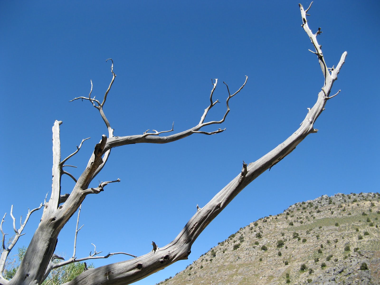
lot of pictures, there and about halfway out at the Taylor Creek Canyon - which was so verdant that I felt a couple of dinosaurs should have been ambling through the trees.

Looking into the Taylor Creek canyon

The drive north was much different than the drive south had been on Thursday.  For one, it wasn't raining and/or snowing, so H was much more relaxed.  Also, we could actually see the scenery out our windows.  To break things up a little bit, we turned off I-15 at Cedar City and drove to the Parowan Gap to check out the approximately 1,500 petroglyphs carved into the sandstone.  Thought to be as many as 5,000 years old, these petroglyphs are really incredible and so very little is truly known about them.  There are geometric figures, lizards, snakes, bear claws, anthropomorphic figures ... one particularly cool figure, called the "Zipper Glyph", may have been created to serve as a solar calendar.  Whatever it may be for, it - along with its surrounding glyphs - is fascinating.

Solstice Zipper glyph - about as tall as I am

When we got back to greater Salt Lake, none of us was quite ready to say the getaway was over, so after we liberated B from the kennel (happy, thirsty and shaved right down for her summer haircut), we stopped by the Hog Wallow for a beer on the patio.  There, in the sun-dappled shade by the coolly-splashing fountain, we raised our glasses of Uinta Cutthroat Pale Ale and toasted an excellent excursion to southern Utah.