Thursday, July 28, 2022

csa summer (part 1)

This year we signed up for a CSA (community supported agriculture): getting a 2-person box of produce weekly for fifteen weeks from Tagge's Famous Fruit and Veggie Farms.  I'm sure we could have found a smaller farm to support but I can pick up our share from my regular fruit stand so it's very convenient.  Plus the boxes have been great!  Here's what the first three boxes have had:

Week 1:  radishes, English peas, cherries, zucchinis (3), romaine lettuce and red leaf lettuce.  We made: radish leaf pesto with zucchini "noodles," quick-pickled radishes and then spiralized the remaining zucchini and froze it for future baking/soups.

Week 2:  cherries (amazing!), zucchini (1), summer squash (2), scallions, apricots, green beans and cantaloupe.  We made: radish leaf and zucchini pesto, mango smoothies with summer squash, cantaloupe smoothies with summer squash and then froze half the apricots for future baking.


Neither H nor I are huge zucchini/summer squash fans but the squash does disappear nicely and inoffensively into smoothies; and you'd never know there was zucchini in the risotto.  Not only is the produce wonderful, it's challenging us to try new dishes. 


Saturday, July 23, 2022

wildflower season

The last day of the four day Wasatch Wildflower Festival (held annually at the four Cottonwood Canyons ski resorts) was at Alta on Sunday ... so I thought that might be a good day to go to Snowbird to check out the wildflowers.  While H did a road ride, took Milton for a good walk and then basically cleaned the whole house, I got up at 5 a.m., puttered around until the sun came up and then pulled into the main Snowbird lot at 6:30.  It was 59F - a special treat as it was forecasted to get up for 104F in the valley later in the day - and a gorgeous morning.

Paintbrush and horsemint

I went up the Peruvian Gulch trail to the Cirque trail (40 minutes), walked along the ridge between Peruvian Gulch and Gad Valley (30 minutes) , and then dragged myself up the final slog to Hidden Peak (10 minutes but it felt much, much longer).  I pretty much had the place to myself: there was one couple ahead of me who I finally passed along the ridge - I would have passed them sooner, I think, except I kept stopping to take flower photos - and there was one trailrunner descending the ridge as I went up.  The summit was a ghost town (although the lower level bathrooms were open).

Sedge (with its cute square stems)

I descended via the Peruvian Gulch road, then connected with the trail.  It was slow-going on the way down (took me an hour and a half) as it is quite steep and both the road and the trail are really loose in spots.  People had started getting out on the trails by then: I encountered one MTBer (on his way to ride the Big Mountain trail and super-bummed that he had to ride to get to it) and 41 hikers on their ways up.

Columbine, paintbrush and lupine

In my completely inexpert opinion, peak wildflower season is about a week away.  Lots of flowers weren't fully in bloom yet, like the anemones, green gentian, monkeyflowers and coneflowers, and I didn't see any fireweed or scarlet gilia at all.  Still, there's lots going off right now - in addition to all I've posted here, there were a bunch that I didn't get photos of (bluebells, Richardson's geraniums, common yarrow, Western wallflowers and western coneflowers, to name just the ones I recognized).

Elephanthead - so cute and tiny!

Sulphur buckwheat - amazing acid yellow color

Wasatch penstemon

Paintbrush and scorpionweed (?)

Lupine (smaller than Eastern counterpart)

Couldn't identify this one, but that color!!

Green gentian close-up

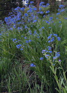
False forgetmenots and paintbrush

Field o' sunflowers

The only blooming Lewis's monkeyflower I saw


Wednesday, July 20, 2022

rad

H has been researching e-bikes as a way to make his commute more environmentally friendly.  He's certainly fit enough to just commute on a regular bike but there is a wicked hill on the commute home - like, the whole thing is uphill, and steep in one spot - so an e-bike seemed like the way to go.  Plus, who doesn't want to buy a new bike?!!

Trying it out

After exhaustive research, he ended up getting a RadWagon electric cargo bike, which I think is one of the coolest-looking bikes around.  And this thing can haul!  It can carry up to 350 lbs. (including the rider) and comes with all kinds of accessories so you can customize it to suit your needs: bags, baskets, running boards, buckets, canopies, pet carriers.

Milton says, despite this mock-up,
it will not be used as a pet carrier

H is hoping to use the RadWagon (which clearly needs a name) in place of the truck for commuting and errands, year-round to the extent possible.  So he wanted a bin on the back that would hold his laptop bag, but also be big enough for groceries or a case of beer.  This would also require a platform mounted on the back of the bike for support.  

Assembly

Rather than buy something, he designed and built it over the course of two weekends: gluing the boards together for the platform, then reinforceing them with brackets; painting it a sleek black; drilling the holes and mounting it on the bike; and finally mounting the tub onto the platform.  

Mounted

It looks fantastic (and we spent some time putting a bunch of stickers on it so it looks even cooler now) and is just what he was imagining.  So rad!

Wicked rad


Sunday, July 17, 2022

entering wasatch wildflower season

 It has been forever since we've done any hiking in SLC.  In May, we were in Moab a lot during prime hiking conditions, and June just slipped away so quickly.  I hadn't been up to Alta since skiing ended for me in April; even though Milton couldn't go with me, I wanted to get up there Saturday morning.  Although we've been hiking the desert, I'm out of shape for climbing mountains.

Buttercups

We're also in a bit of a heat wave - to add to the drought and the drifting wildfire smoke - with temperatures into the 100s for about a week.  This means you have to get up early if you want to do anything outside.  I got up at 5:15 and was leaving the parking lot at Alta's Albion base area an hour later, the sun just peaking over the mountains and the temperature an incredible feeling 56F.

False forget me nots

I didn't do anything new (and wasn't breaking any land speed records either), just hiked up through the Sunnyside area (where they are replacing the triple chair with a six-person monstrosity) to catch the Catherine's Pass trail.  Once at the pass, I continued up and across the top of Catherine's Area to the top of Supreme, then down via the access road to the campground (second weekend open but still several empty campsites).  There'd been a few people up above but as I went back down through Sunnyside, the throngs started arriving, wandering around with their noses in their Trail Forks app even though these trails are well-marked and rather obvious.

Paintbrush and lupine

It's still early for peak wildflowers but they're definitely on their way.  In addition to the ones pictured, I also saw columbines, bluebells, scarlet gilia, sticky geraniums, horsemint and possibly some anemones and penstemon.

Friday, July 15, 2022

perhaps not the smartest way to choose a trail

When we'd been down by the Colorado River on Saturday morning, we'd watched those two BASE jumpers hiking up along the cliffs.  Monday morning, H, Milton and I set out to see what that was all about, obviously not intending to get up to where they launched themselves off the cliffs but wanting to check out the trail.  We parked at the picnic area, crossed the road and followed the unmarked but clear trail.  At first it was great, going along a wide rock shelf that gained elevation slowly but steadily.  But as we got higher, the footing got looser, the climb got steeper and the edge of the cliffs got edgier.  There wasn't a lot of chitchat until we three had safely gotten over the ridge and away from the cliffs.

This looks fine

Once up there and around the corner, however, it was easy walking, pretty and with a different perspective on the Moab valley than you usually get.  We never saw the turnoff where the BASE jumpers must go to get up higher on the sandstone wall, but we followed first a trail, then a game trail and then an old jeep track that connected with the Raven's Rim Adventure Tours road.  This is a private road, but there were no No Trespassing signs, plus there are connectors with the Hell's Revenge 4x4 roads so we felt okay about wandering around for a while.

I'm too lazy to look up the name of this arch

There was absolutely no way we were going to attempt going back down what we had come up as H doesn't like heights/edges and I get very, very nervous when the footing is loose.  We walked out on the Raven's Rim road, pausing to speak with a tour coming up on side-by-sides (tour guide: "This is sort of a private lane" before saying it was okay for us to walk out on it).  Just above the tour company buildings, there was an actual No Trespassing sign so we veered off onto a trail (marked "Trail") that led us down into the back of the Moab Springs Ranch Resort.  We pretended we belonged there and walked through the grounds out to the bike path, then followed the bike path back to where we'd parked.

Much less cliffy here

Note to selves for future reference:  maybe next time don't pick a trail that BASE jumpers use.  Those people have better tolerance for heights and cliffs, plus they just jump off the top and don't have to hike back down.

Sort of a private lane

Hike stats: 6.42 miles; 2:26 hours / 2.6 m.p.h. moving ; 2:43 / 2.4 overall; 930' elevation

Wednesday, July 13, 2022

search for the source

When Milton and I did our top-to-bottom Grandstaff hike on Saturday, before we dropped to the canyon floor there was a good view of the main branch of the canyon as it continued up towards the mountains.  From all the greenery, it was clear that this was where all the water that flows through Grandstaff Canyon - and makes it such a popular hike for dogs - comes from.  I figured, why wouldn't we go back and check that out? 

This was about a 20 foot drop; worked
our way down around to the right

That's what we did on Sunday, while H did another twenty-five mile road ride.  We got up at 5:30 and drove back out to the Sand Flats antenna, walked out to the overlook off of the Fins N' Things trail and dropped into the WSA.  Instead of keeping to the established trail we'd done the day before, we picked our way - carefully, stepping on rocks so as to leave no trace - to the canyon floor immediately.  We kept to the wash, which was either sandy or smooth rock slabs, and only had to work our way around one impassable (at least 20 feet high) pour-off.  Where we had to make our way down a scramble, I left behind a tiny cairn so that I could remember where to go back up on the return.

Looking back at the canyon junction

When we got to where the other branch came in, I left a tiny cairn there too and we started to make our way up the main branch.  There was lots of bird song.  It got choked with vegetation (much of it sharp - I kept pulling thorns, spines and stickers out of both Milton and myself) and we had to hug the cliff wall to push through.  

Mind the thorns

We crossed the creek ... and found ourselves in a swamp.  I was not expecting a swamp.  It was shallow  and not that long and once I gave up the hope of keeping my feet dry, we were quickly through it.  Only later, when it was too late to do anything about it, did I wonder about poison ivy - which is definitely found in Grandstaff Canyon, notably under the Morning Glory Arch.

Dogs love swamps

After the swamp the water completely disappeared as we made our way through some dry tumbledowns.  Around a corner the canyon widened and we were able to follow a very distinct trail (i.e. more than a game trail) through a grassy, sagebrush-dotted area.  This trail allowed us to skirt yet another swamp before the water disappeared again.  Obviously, this means that all the Grandstaff Canyon water is from springs, where the water is below the surface, surfacing in the swampy areas.  The geology eventually forces it to the surface down canyon, where it becomes that nice creek; up canyon, however, the surface water is only occasional.

An actual trail.  Of sorts.

We kept going a little further as the canyon wider and dry, although slow going with some scrambling.  Not wanting to be out too long in the hot desert sun, we retraced our route back to the car - scattering those little cairns as we went, to leave no trace - and luckily didn't break out with any poison ivy rashes.  When we got home, I took a look at the map: we'd barely made a dent in exploring upper Grandstaff - that canyon just goes and goes and goes.

Up canyon view

Hike stats: Only 5.76 miles; 2:31 hours / 2.3 m.p.h. moving; 2:57 / 2.0 overall; 910' feet of elevation

Monday, July 11, 2022

sandflats to the river

Ever since we realized that we could hike from the Sandflats Recreation Area down to the Colorado River via Grandstaff Canyon, I've wanted to do it.  We hiked up the canyon about halfway, then turned around and gone back out; we've hiked down the canyon halfway, and then turned around and hiked back up.  It's just not feasible without a shuttle car.  Or a good plan.

Grandstaff overlook from Fins N' Things

H wanted to just do a road ride but Milton and I wanted to hike.  Our plan was for H to drop us off at the antenna off the Sandflats road; we would hike down canyon while H did his twenty-five mile ride; H would pick us up at the Grandstaff Canyon trailhead parking lot when we were done.  I didn't think I had any cell service along the river, and we weren't really sure how long this would take us, so he would leave home at 9 to come pick us up (and I would text if I could and we got out sooner).

Upper Grandstaff

We got dropped off at 6:15, walked out Fins N' Things against traffic (there was no traffic at that time of the morning) and turned left onto the overlook spur.  At the canyon overlook, we walked through the gap in the fence marking the WSA (Wilderness Study Area) boundary and headed down into the canyon.

Almost swimming

There was tons of birdsong and, once we got to the bottom, plenty of water.  Milton got down before I did - the trail is easy to follow and pretty good underfoot, alhtough cliffy in a couple of spots - and had already plunged into a small pool, much to the dismay of the resident frogs.  From there, we just followed the trail out until our branch of the canyon merged with the popular, Morning Glory Arch-containing, other branch.

Lower Grandstaff

We encountered a fair number of people on our walk out, but not nearly as many as I expected for a Saturday morning.  Things definitely seem a little quieter in Moab - too hot for those who know better, I suspect.  We got to the parking lot around 8:35 and I tried to text H for an earlier pick-up.  As I suspected, no service, so Milton and I found a comfortable rock in the shade to sit on.  With all the rafts, SUPs and kayaks heading up the river, there was plenty to watch while we waited.

When he got us, we drove back down river to the new picnic area (now with pit toilet!) for snacks/beers.  While we were there, we watched two girls with backpacks hiking along the cliffs above the river, making their way up and over the point.  Not too long after that, we heard the BANG of parachutes opening and we watched two BASE jumpers floating down to the road from the cliffs overhead.  It was those two girls, and when they landed, they efficiently packed up their chutes, hopped in their car and drove off.  It had taken no more than an hour and half, from when they drove in until when they drove away.

Hike stats: 6.08 miles; 2:09 hours / 2.8 m.p.h. moving; 2:19 / 2.6 overall; 490' elevation

Saturday, July 9, 2022

chasing waterfalls

 I convinced H that hiking Mary Jane Canyon Friday morning would be a good idea: gotta go in the morning because it's just too dang hot later in the day, and during the week would be much less crowded than a weekend or holiday.  We got up at 5:30, tossed the dog in the car and headed off.

Prince's Plume

It is about a forty-five minute drive out there from in town.  At that hour, there wasn't much traffic on the river road.  We drove out past Castle Valley and Onion Creek (30 minutes), turning down the dirt ranch road.  That road is quite washboarded and it took us a whole fifteen minutes to get down to the parking area; someone in a jeep or truck - something more rugged than a Subaru Crosstrek - wouldn't need to be quite so cautious.

Heading into the canyon

We were the first ones there and headed out into the canyon.  There was less water than the last time we did this hike - Memorial Day weekend, so definitely more available water earlier in the year - but there was still plenty.  I felt a little silly carrying water for Milton but better safe than sorry out in the desert, plus we really weren't sure how much water there would be.

At the waterfall

It was super pleasant in the canyon.  There's no point trying to keep your feet dry, so that helps keep you cool; the high, narrow canyon walls kept us completely shaded the whole way in, and protected from the wind as well.

Milton is just not sure about this nonsense

Distance to the waterfall is just over four miles and it is a very fast four miles.  Despite wading in the creek, the footing is quite good and just a gradual uphill the whole way out.  We could hear the falls long before we saw them; Milton was a little intimidated by the noise.  H waded in up close, testing the force of the water with his hand and trying to convince Milt to come a little closer.

Extremely well-built nest

We saw seven people heading in as we were on our way out, two with dogs, but we didn't see anyone until we were half an hour from the falls - our pace was good and we felt like we'd had the place to ourselves.  This place is a gift (unfortunately too well-known at this point), an oasis in the desert with the water and the access for dogs.

Big as my thumb

It was also a pretty good day for small wildlife (other than the dead thing Milton tried to roll in).  There were lots of birds, including heard-but-not-seen canyon wrens, and some cool nests tucked in along the cliff walls.  I also found a chonky caterpillar and my very first black widow spider.  I didn't tell H about the black widow until we'd gotten back out of the canyon.  It's perfectly safe, though, because she was in a huge snarled web that no human would intentionally walk into, fastened under an overhang on the wall so no human would inadvertently walk into either.

Dangerous lady: black widow

Hike stats: 8.55 miles; 2:48 hours/3.0 m.p.h. moving; 2:57 / 2.9 overall; 490' elevation


Tuesday, July 5, 2022

the shape of things to come

 This latest long weekend in Moab gave us four different hikes to share!  None of them particularly long but each interesting (at least to us).  But we've got to sort through all the photos and find our notes so you'll have to content yourself with this content for now: this wicked rad skull Milton and I found.