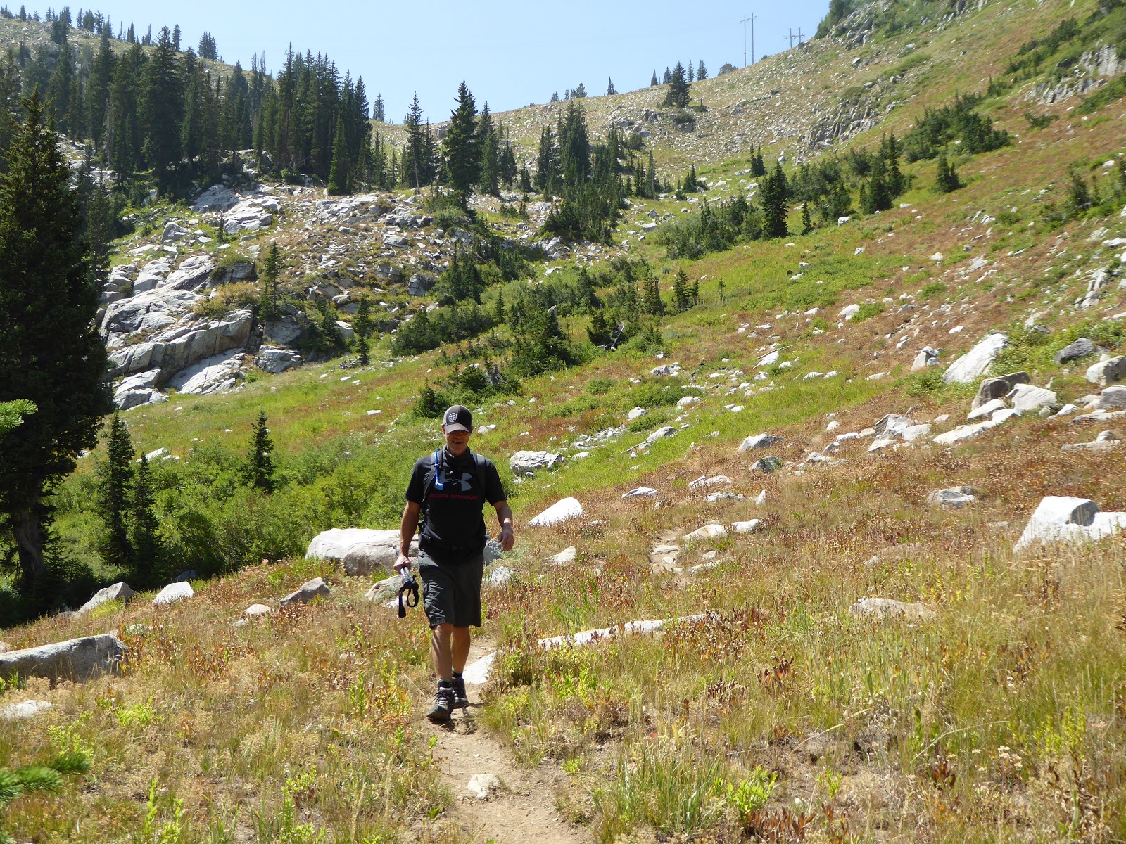
Showing posts with label Brighton. Show all posts

Monday, November 23, 2020

stay-at-home

 Another weekend spent hunkered down.  Some of Utah's ski resorts have opened: Brighton, Brian Head and Park City Mountain Resort opened Friday 11/20, while Alta is due to open Monday 11/23, Snowbasin on 11/27 and Snowbird on 11/30.  We did go up to Alta Saturday morning to pick up our season passes; mountain employees were busy at Wildcat base, practicing setting up the corrals with "ghost lanes" to help with social distancing.  We got our passes but continue to fret about skiing: whether it's safe, whether it will be fun at all with all the necessary restrictions, how to get up there, etc.

Other than that, we stuck around home, staying distant and safe while Utah's coronavirus numbers climb ever higher.  Milton and I took a couple of long walks - although it got down into the low 20s, Saturday was especially gorgeous with clear skies and sunshine.  I baked socca and lemon blueberry breakfast cookies, plus a vegetable soup and black-eyed peas and collards.  I even vacuumed, whether it needed it or not (it did).

With the Thanksgiving holiday coming up, we'll have a few days to get out and do something more interesting than soup-making and laundry, I promise.  Until then, stay safe!

Thursday, November 21, 2019

sol-bright 2019

Shoulder season continues: wherein we have to do yardwork (there's only one tree in the front yard but SO many leaves) and errands (my MTB had a squeak) on Saturday but get out for a quick hike on Sunday.  With ski season purportedly just around the corner, it was time for our traditional Sol-Bright hike.

 Tradition

It was mid- to late-morning by the time we pulled in to the parking lot at Silver Lake (closed for the season, with the nordic center not yet open).  There were plenty of parking places still, although there were people milling about; by the time we finished up, it would be pretty busy with people strolling the boardwalk in their city shoes, slipping on the ice.  We could see a few people out on the lake playing pond hockey - no moose sightings, however.

 Wolverine Cirque looking a little thin, snow-wise

We started out going counter-clockwise on the boardwalk, then turned right towards Lake Solitude, then took the left fork so that we would be going up through Brighton and returning down through Solitude.  It was cool to start, especially in the shade, but we were already peeling off layers as we started the climb above the lake.  The sun was bright and it felt good.

 A rare hatless H photo

We passed a couple of groups of people but once we were above the frozen reservoir, we didn't see anyone else - until we got to the top of the Summit chair (RIP the wonderful old double chair that used to be there), where there were a couple of guys working.  I always forget how steep it is hiking up Liberty/Dynamite/etc.  It is STEEP.  But there had been several snowmobiles up and down before us so the footing was good: not slippery and no post-holing.

 Not much snow yet in the hills behind me 

We lingered up at the top for a few minutes, making our way around the corner to take a look at Wolverine Cirque.  You could see ski/board tracks all around but nothing recent; there had been rather more snow earlier in the week before the sun came back out.

 Honeycomb Canyon

For now, however, we were enjoying the sun.  We made our way down through the Solitude side, making really good time until we got into the trees after Lake Solitude.  Then the trail got quite icy and we had to pick our way carefully to as not to take a digger.  Some microspikes or Yaktrax would have helped.

Cheers for post-hike beers

When we got back to Silver Lake, we continued around the boardwalk, just to finish up the loop.  As is tradition, it was time for parking lot beers - with a toast to the upcoming ski season.  All hail Ullr!

Hike stats: 5.05 miles; moving: 1:55 time / 2.6 m.p.h; overall: 2;32 time / 2.0 .m.ph.; 1,340' of elevation

Friday, July 19, 2019

blustery at brighton

It's not really fair when it's clear and sunny and hot all week and then Saturday rolls around and it's overcast and cool with a chance of rain.  It wasn't actively raining, however, so we figured it was worth risking a quickie hike up at Brighton, just to get some exercise and get out of the house.

There's still snow in them thar hills

We hadn't realized that it was the first weekend of the Wasatch Wildflower Festival and thus were a little surprised to see so many cars at Brighton on such a gloomy day.  The clouds certainly weren't keeping the crowds away and the guided hikes were lining up right on schedule.  We upped our pace to get ahead of folks, cruising quickly through the lower part of the ski area to the turn-off for Clayton Peak.  Once on that trail, we didn't see anyone else until we were headed back down.

Brave little flowers

To be honest, this year's wildflower festival was a little short on the wildflowers due to the cool spring and the lingering snowpack.  We saw just a few hardy blossoms in the lower meadows and once we got up higher, there was still a good amount of snow in the pine forests.  The ephemeral creeks were cranking, rushing their way down the mountains to join up with Big Cottonwood Creek.

On the ridge, Clayton Peak behind me

We had to route-find a little bit on our way up to the ridge, due to the snow in the woods.  Once up on the saddle, it proved blustery and cold.  Even though the trail up to Clayton looked clear, we weren't really dressed for the chilly temperatures; one really doesn't expect cold weather in Utah in mid-July.

Still impressive tree wells

When we got back down to the main trail, there were literally hordes of people coming down from the lakes.  We couldn't get out of there fast enough and eventually found respite at the base of Big Cottonwood Canyon in a pitcher of Epic Session IPA at the Hog Wallow.  The older we get, the less we like crowds - but we'll always like beer.

Hike stats: 4.5 miles; moving 1:52 and 2.4 m.p.h. / overall 2:20 and 1.9 m.p.h.; 1,150 feet of elevation


Wednesday, November 21, 2018

solbright

As has become tradition, we did our Solbright (i.e. Solitude + Brighton) hike this past Sunday, after enough snow had fallen to make this our last hike of the calendar year.  Brighton - which had already opened for the season - said it was 11 F in the morning, so we waited a bit for it to warm up; when we got up there, it was much warmer than we expected and we were both over-dressed.

 Signage

Like last year, we started counter-clockwise around Silver Lake, then peeled off onto the Twin Lakes trail.  Although the Silver Lake parking lot was full (as was the Brighton resort lot - packed!), there really weren't many people out there: we passed two groups of four as we climbed up to the dam, and then saw another two at the dam, and then no one else. 

Summit ahead

It had been a few days since the last snowfall so the path was well-trodden up to the dam.  When we continued up past the dam, into Solitude proper, foot traffic had been less heavy but the footing was still okay.  Even as we slogged up the access road on the steep last bit to the top of the Summit chair, it wasn't icy and we could walk in some snow-cat tracks.

That's me, holding hands with H's shadow

As always, it is pretty up at the top of Solitude, with views into Honeycomb Canyon and across Big Cottonwood Canyon to the now-closed Guardsman Pass road.  Any hillsides that were south- or west-facing were pretty much clear of natural snow but the shady spots were holding onto theirs.  We backtracked a little ways and then took the access road down to Lake Solitude.  There were a fair number of squirrel and deer tracks but other than one squirrel who scolded us, this hike was critter-free. 

H with Honeycomb Canyon behind him

We finished by completing the loop around Silver Lake and then (of course) toasted the end of hiking season with parking lot beers.  As we did, some Brighton skiers were showing up after their time on the hill.  We talked with them and everyone seemed pretty stoked to get the ski season started.  That's the best out here: you can finish one season's activity and then head right into the next with no downtime.

No snow across the way

Hike stats:  5:26 miles; 1:49 moving time / 2.9 m.p.h; 2:14 overall time / 2.3 m.p.h.; 1,400' climbing

Saturday, August 25, 2018

return to brighton ridge run

When H and I last did the Brighton Ridge Run, we then remarked that we thought our friend P would like that hike when he got out to Utah.  On Sunday, we arranged to meet him in the Brighton parking lot at 7 a.m. and take him around the route.  From Midway, he was able to come up and over Guardsman Pass, avoiding the highway entirely.

Oh deer

One of the reasons we thought he'd like this hike was because we have always seen a lot of wildlife there and this time was no mistake.  In the cool (43 F) morning temperatures, as the sun was just coming up over the mountains and through the lingering wildfire smoke, we saw 10-12 mule deer, including a couple of good sized bucks and lots of does with fawns.  We also saw a lot of pikas (all of whom scolded us incessantly) and several hawks, who were having fun riding the updrafts.

A and H, top of Clayton Peak

And P and H, top of Clayton Peak

The views are usually spectacular on this hike, where you can see where you're going and where you've been all the way around, not to mention about seven different ski reasons and Mt. Timpanogos.  This time, however, the smoke from local and California wildfires made it difficult to see anything much further than Big and Little Cottonwood Canyons. We did get a break in the haze for a while, though, hence the blue skies in a couple of these photos.

H at The Nook on Preston Peak

We started at Brighton, went to the top of Clayton Peak and then backtracked a little to the top of the Snake Creek Express chair.  From there, we found a faint trail that took us to the top of Preston Peak and then down to the Crest Express chair.  Finding this faint trail was a HUGE bonus: the last time we did this, we went far out of our way on the access road to get to the top of Crest Express.  This faint trail saved us about a half hour of walking.

Looking at Sunset Peak from Pioneer Peak

As has happened before, we had to do a little route-finding along Pioneer Ridge to Sunset Peak.  Because so few people do this section, the trail is very faint.  It is sandy and loose footing too, and very steep in spots, with some definite no-fall zones.  The key is to go slowly, looking ahead, and not to worry.

A and P on the final approach to Sunset Peak

There were a fair number of people atop Sunset, as well as down lower on Catherine's Pass.  We had the option of heading out there - going back down to Brighton past Lakes Catherine, Martha and Mary - but it was decided that we would keep going and finish the loop.  So up we went, first Tuscarora, then Wolverine.

P in the meadow below Twin Lakes Pass

We chatted briefly with a couple of Forest Service rangers as they lunched on Wolverine, then continued around the cirque and down to Twin Lakes Pass.  Here we took the steeper (and possibly not official) trail down the meadow's bowl and walked out along the shore of the reservoir.  Then, only the last bit remained: to walk down the access road to Brighton base.  Since the air temperature was relatively cool, this section wasn't the hot, baking slog it often is.

Cheers for post-hike beers!

There was a fair amount of action happening at Brighton base: a little flea market, cruising motorcycles, people lunching, hikers and trail runners coming and going. We ate our own lunches off in our own little corner and then bid adieu to P.  Hopefully he'll be willing to hike with us again: nearly ten miles, mostly above 10,000 feet, is not easy, especially for someone who was living at sea level less than a month ago!


Hike stats:  9.81 miles; 2.0 m.p.h. moving average; 7:20 total time; 4,060 feet of climbing


Wednesday, January 24, 2018

until

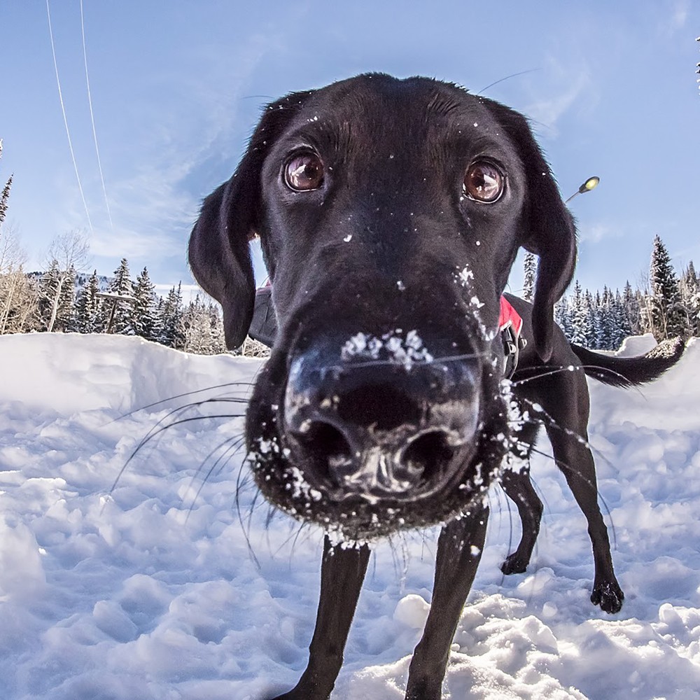
Life sometimes gets in the way of new blog posts.  That is what is happening now, so until we're able to get our ducks in a row, here are some photos of various Utah ski resorts' patrol dogs:

Image result for utah ski patrol dogs 
Sugar Bear (Brighton)

Image result for deer valley ski patrol dogs 
Rooster (Deer Valley)

Image result for alta lucy ski patrol dogs 
Fitz and baby Lucy back in the day
(Alta)

Monday, November 13, 2017

tradition

We have, the past few years, done a hike at Solitude/Brighton after the first snow of the year, to say goodbye to summer and welcome winter.  The original route was from Silver Lake to Lake Solitude, up and over the back of Solitude, past the Twin Lakes dam and along the Sol-Bright trail back to Silver Lake.  Last year, since the snow situation was looking dire in the early season, we did that loop backwards and lo, last winter we had the best snow we've had in years.  H, who is not superstitious about anything, announced on Friday that we would be doing the Sol-Bright hike on Saturday and, since it worked so well last time, we would again be doing it in reverse.  So much for not being superstitious.

Silver Lake, early winter style

It was pretty chilly in the morning so we busied ourselves with some chores: house-cleaning, laundry, making oatmeal-dried cranberry cookies.  We got up to the Solitude Nordic Center at Silver Lake around 12:30 and were surprised to find plenty of parking places; the Big Cottonwood Canyon road had been pretty busy on the way up and the various hiking trailheads had been quite full, so we assumed Silver Lake would be jam-packed too.  Happy to be wrong!

View of Brighton

We went clockwise around the lake on the boardwalk, teetering on the ice, then turned off onto the Twin Lakes trail.  Although the snow wasn't super-deep, we were walking on snow for the most part, unlike last year when there wasn't any at all.  It was mostly sunny, with a light breeze, and temperatures were in the low 30s but noticeably colder in the shade.  We warmed right up climbing up to the Twin Lakes dam, then kept the grind going on up to the top of Solitude's Summit lift.

Top of Summit lift

Once past the dam, there was more snow and so many animal tracks.  Deer, porcupine, coyote, squirrels and smaller critters - the snow was positively trampled in spots.  We stumped our way up to the top of the lift to enjoy the views of Honeycomb Canyon, Brighton and Guardsman Pass across the canyon (now closed for the winter).  Then, before we could get too chilled, we retraced our steps for a ways before turning off onto an access road down into Solitude.  The snow was deep in some spots here, coming up to nearly my knees, and we found a couple of short pitches where we were surprised no one had come up to ski.  No fat bike tire tracks either - just critters.

Totally skiable

We went around Lake Solitude, the snow depth dropping with our elevation, crossed through the woods and under the Sunrise lift, heading back towards Silver Lake.  In a shady grove we happened upon a small herd of mule deer: a buck and what we guessed were two does and two fawns, now old enough to have lost their spots and look like mini-mes of their moms.  The buck was skittish but the does were not, standing their ground and watching us, warily and interestedly, but not at all scared.  We watched them for a little while and then continued on our way, letting them go theirs.

Very much unafraid

Back at the car, we were surprised to find the parking lot busier than before; there seemed to be lots of photographers taking advantage of the afternoon light.  We paused at the Silver Fork on our way down the canyon, stopping in for a couple of beers and some chips and salsa (they have a restaurant license and have to serve food, even if you're just sitting at the bar), and talked with another couple (transplants from New Jersey/Maryland) about how awesome Utah winters are.  And we're ready for another one.  Let it snow.


Hike stats:  4.92 miles; 1:59 hours; 1,400 feet of elevation

Monday, July 17, 2017

brighton ridge run

Three years ago, we did a great hike up at Brighton, running around the ridge and picking off six peaks all above 10,000 feet.  Last year, we climbed Clayton Peak (a/k/a Mt. Majestic).  This year, we hadn't been hiking all that much and I was really jonesing for a decent hike.  I thought we could link the two together and really make a good walk out of the so-called Brighton Ridge Run.

Unnamed peak; hiker name: H

We were on the trail at 7 a.m., enjoying the cool air and the almost-but-not-quite-at-peak wildflowers on the lower ski runs under the Majestic and Crest Express lifts.  We encountered just a couple people before the Dog Lake turn-off and then no one (other than a fair number of unwelcome but slow-moving mosquitoes) as we made our way up.  That trail through Brighton's bowls is just wonderful.  It climbs steadily but is smooth and gentle underfoot, hard-packed dirt and pine needles - super-cushy.  The last bit to the summit is steep with small boulders to scramble; cross-sounding pikas scolded us as we made our way up.  Then it was summit #1, Clayton Peak, at 10,750 feet above sea level.

Lakes Mary and Martha from Pioneer Peak

There was no time for lingering, however, because this summit had taken us longer than I thought it would (failure to adequately research falls on me).  We also weren't sure how to get to our next summit and had to descend much further than I had hoped before finding a dirt access road which would take us up.  This "ridge run" does have a trail but it is faint and fades in and out; a recurring theme for the hike would be losing and re-finding the path.  We made our way up through the wildflowers to the ridge behind the top of the Crest Express lift and started around.

Catherine's Pass/Lake Catherine and Tuscarora

That first summit is apparently unnamed (elevation 10,315 ft.) and the trail is barely there either.  It's easy to know where you're going on a ridge, however, so we picked our way through the boulders until we found the trail again.  There is a fair amount of up and down on this hike, as we descended to the low point and then scrambled up to Pioneer Peak (10,447 ft.).  From here, on our left a gorgeous green drainage fell away towards the Heber Valley, and to our right, the Brighton lakes were as full as we've ever seen them, compliments of all the wonderful snow we got this past winter.

Last summit: Mt. Wolverine

From Pioneer Peak to the popular Sunset Peak is probably the sketchiest part of the ridge run.  We lost (and found) the trail several times; the footing is extremely sandy and loose; and the ground falls away very steeply, so that whole section is absolutely a "no-fall" zone.  It is also a no-other-hikers zone, which is always a treat in the increasingly busy Wasatch.

Wolverine Cirque

There were, however, scads of people atop Sunset Peak 10,648 ft.), as we knew they would be.  Lots of hikers will nab that summit as it is an easy extension from Catherine's Pass, whether you've come up from the Alta side or the Brighton side.  We left the crowds behind us as quickly as we could, pausing for snacks at Catherine's Pass (where we grievously disappointed the resident chipmunk who had been hoping for dropped goodies) before continuing on.  Again, there was a bit of route-finding as the trail faded in and out, but we eventually found ourselves at the summit of Mt. Tuscarora (10,654 ft.), a popular winter summit for backcountry skiers.  We had to cross a bit of snow on our way down and back up to Mt. Wolverine (the high point at 10,795 ft.), and then the footing was a bit precarious in spots - narrow, rocky, loose - as we skirted Wolverine Cirque.  We even encountered a skier, resting a bit before his second run down the cirque.  When asked how it was, he said, "It's a little wavy.  But it's good for July," and then grinned at us.  Wish we'd gotten to see him ski.
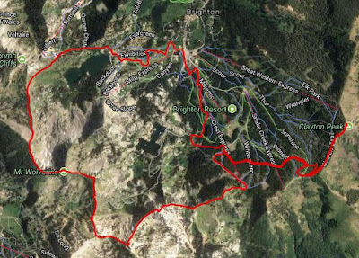
I love this map

We continued around the ridge, picked our way down the boulder field to Twin Lakes Pass.  Here, two things were evident: the wildflowers are truly on the verge of peak gorgeousness; and there is so much water in the reservoir that Twin Lakes is just one lake right now.  It's great to see.  From there, it was basically a long slog out via the ski resort's access roads.  It was hot and the gravel footing is looser than I like since my hiking boots tend to slip on the loose stuff.  But cold beer and sandwiches were waiting for us at the car and that's good motivation.

Pretty sexy profile there

When the stats were pulled together, we ended up doing 10.64 miles with 4,100 feet of climbing (4:37 hiking and 1:19 stoppage time meant about six hours on the trail all told).  That was a longer hike than I had envisioned [see above re poor research skills] but it is such a beautiful hike, and manages to avoid the teeming hordes even located where it is.  Totally worth it, every time.