Sunday, September 29, 2013

long weekend in moab, pt. 4

All that gorgeous weather we'd been having in Moab?  That all changed when we got up Sunday morning.  The sky was overcast and we could see rain in the distance.  When we checked the forecast, the area was under a flash flood watch and a severe thunderstorm watch, with the threat of snow at higher elevations and possible large hail, all potentially starting late morning/midday.  We had planned to do the ranger-led Fiery Furnace hike at Arches National Park at 10 a.m. and when we checked in, the ranger was watching the weather maps.  She thought it would be okay but would call it off if things got dicey.  We went back outside and, frankly, with ominously dark clouds to the north and east, the potential for "dicey" looked pretty good.

We stopped for breakfast at the Sweet Cravings Bistro, at the north end of town on Main Street.  The food was tasty - excellent coffee, a slice of veggie quiche for me and an egg, cheese and bacon bagel for H - but seemed overpriced for the small portions.  The lady behind the counter told us that the storm could get caught by the La Sal mountains but that would effect Arches as well.  After breakfast, we stopped by the Chile Pepper bike shop so I could get some new MTB socks.  Thunderheads were building over the La Sals and all around us, we could see intermittent lightning stabbing down from the low clouds.  If all went well, the Fiery Furnace hike could take as long as 3.5 hours, which would be cutting it close to pick up B from the kennel, and if we factored in driving in a hailstorm ... we decided to save the Fiery Furnace for another, sunnier, less sketchy day.

Ominous skies north of Green River

So that was it.  We headed back to Salt Lake, getting caught in an incredible downpour when we stopped in Green River for a couple of melons.  While we didn't actually drive through any hail, there were drifts of it on the roadside in numerous locations along the way; that night, safe at home, we heard that Moab had gotten nailed with big flash floods and ping-pong ball-sized hail around noon.  We were disappointed that we didn't get to the Fiery Furnace but we felt better when we heard about the crazy weather we'd missed.  We'll just save it for another trip - and trust me, there'll be more trips.  You can't run out of things to do in Moab!

Friday, September 27, 2013

long weekend in moab, pt. 3

Saturday morning we got up at 7 (which seemed decadent in comparison to Friday's timetable) and walked over to the Moab Diner for breakfast.  It's got good, but not great, food - H had a western omelette and I had one egg, over medium, with superlative bacon - but my biggest issue is that it isn't open on Sundays.  I find it baffling that a diner, on Main Street in Moab, is not open for breakfast on Sundays during high season.  Baffling.  After thus sustaining ourselves, we went back to the motel to pack for the day's activities of MTBing and hiking.

Hooray for [remembering the] beers! 

The first stop was just north of town at the MOAB Brand Trails.  We rode 13.1 miles, taking the new Rusty Spur loop, then the Bar M loop, then Rusty Spur again.  The MOAB Brand Trails is not necessarily where the local hot-doggers go to ride, although there are some challenging trails winding around the slickrock; the Bar M is an old jeep road with some slickrock and sand and the Rusty Spur is great (but too short) red dirt, hard-pack singletrack.  We finished up just as it was starting to get busy, with SUV- and van-loads of families and tour groups moving in for midday rides, and this time we were smart enough to remember the cooler for post-ride beers.

The blue skies and red sands of Negro Bill Canyon

Next we drove back towards town, turning off onto 128 to hike Negro Bill Canyon to the Morning Glory natural bridge (4.4 mi. RT).  I'd done this hike last year but H hadn't.  The trailhead parking lot was packed but we managed to time it right, with most people heading out as we were heading in.  We met lots of very nice dogs who seemed to appreciate the shade of the canyon walls and cool canyon streams as much (or more) than we did.  There is some up-and-down but not a lot of elevation gain overall; despite the gentle grade, it was pretty hot in the sun and the sandy ground made us work for our steps in places.  Afterwards, we found a shady spot by the Colorado River for our second round of PBRs.

H under Morning Glory Bridge

Keeping up with our agenda, we got cleaned up back at the motel, then walked to Woody's for drinks and part of the Utah State football game before putting our hiking boots back on for a sunset walk to Delicate Arch.  This was also an extremely popular idea and by the time we found ourselves a chunk of rock to sit on up by the arch, there must have been close to 200 other tourists there.  As it got closer to sundown, however, the clouds started to build up in the west.  We managed to get a couple of photos of Delicate Arch without any other people in the shot and then walked out before it got dark since there wasn't going to be any sunset to speak of.

I can't believe there are no people in this shot

We got to Miguel's Baja Grill around 8 p.m. and were seated for dinner at 8:30.  We really like their food (the chicken version of the "Mother Of All Burritos" for H and lamb enchiladas with both red and green sauce for me; also, margaritas) but the service was terrible.  I'm willing to go back but I think we'll ask to sit in a different section; we had the same waiter last year and he was pretty slow then too.  At this point we were pretty beat so we went back to our room, eyeing the cloudy skies, packed up our stuff and started watching the worsening weather reports.


Wednesday, September 25, 2013

long weekend in moab, pt. 2

When I said we were getting a "very early start in the morning," I meant we got up at 5:00 a.m. on Friday, planning to see the sun rise, and were driving up to Canyonlands National Park by 5:30.  We got to the Mesa Arch trail head around 6:15 a.m. and were unsurprised to see a fair number of other cars in the parking lot with more rolling in as we watched.  We walked in on the easy, wide and well-marked trail a quarter mile to the arch, not needing our headlamps because the near-full moon was still up.

Sunrise over the La Sal Mountains 

There were already people stationed in front of the arch - which perfectly frames the sun coming up over the La Sal mountains - so we climbed up the rocks to the left and settled in there.  There was enough moonlight to reflect in dozens of small pools and puddles down on the White Rim plateau in Buck Canyon, 1200 feet below.  As the sky got brighter and brighter, more and more people (including a Japanese bus tour) showed up and when the sun finally got above the La Sals, you couldn't hear anything but cameras clicking and whirring for about three minutes.

Sunrise glowing under Mesa Arch

Bathed in the stunning morning light (clear skies and 50s), we ate some store-bought mini muffins of dubious flavor and nutrition before heading over to Whale Rock, near Upheaval Dome (1 mi. RT).  We had the Rock all to ourselves and the 360-degree views were glorious, the air probably the clearest we'd ever seen.  At this point, it was only about 9 a.m., so we decided to do another short hike, this time out to Murphy Point (4 mi. RT).  Most of the length of trail used to be an old road, so the surface was pretty flat and sandy, segueing to slickrock for the last little bit.  Out on the point we had views of the White Rim, Green River and Junction Butte.

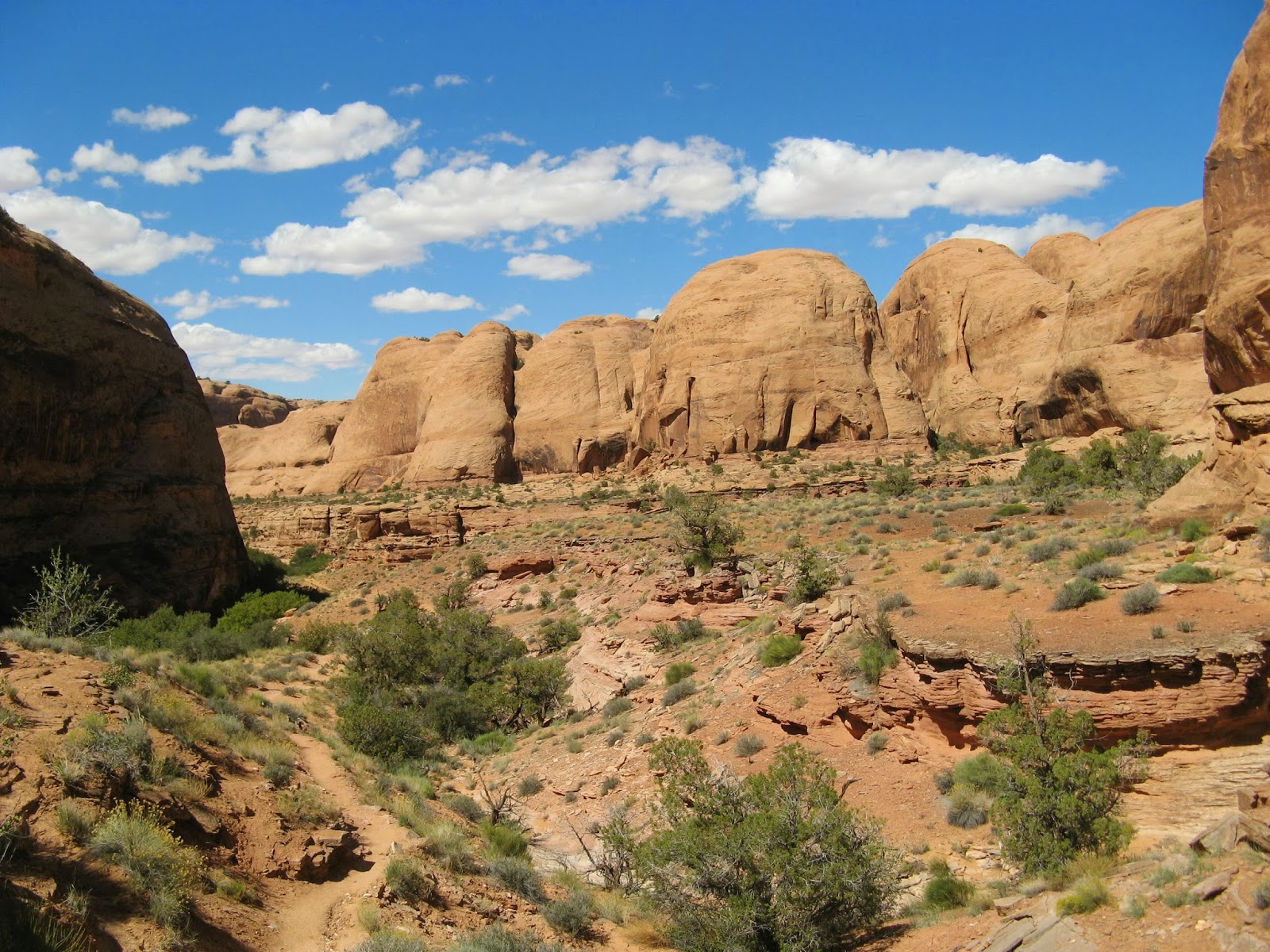
Big Chief loop, La Sals in the distance

Our next stop was the MTBing trails at Dead Horse State Park.  There are three loops - the small Intrepid (approx. 1 mi.), the medium Great Pyramid (approx. 4 mi.) and the large Big Chief (approx. 9 mi.) - and we did them all, in that order.  These are great trails with a mix of surfaces (hard pack, slickrock, gravel, sand); there were a couple of places we had to get off and walk, but not that many, and the surrounding scenery is killer.  We passed a couple of 30-somethings on the Big Chief loop; they caught up with us afterwards in the parking lot and the woman told me I was a "badass."  I'm choosing to feel complimented by that - I did pass her going up a hill, after all.

There's a very tiny H (green shirt) 
under the arch for perspective

It was only around 3 p.m. when we finished, still too early to go back to the motel; even though we'd only planned on Mesa Arch and the Dead Horse MTBing, we decided to tack on another short hike: to Corona Arch (3 mi. RT), which H had not yet done.  It was pretty hot crossing the sun-baked sand and slickrock but we had the arch all to ourselves up there.  It's ginormous and quite impressive.

Boy, were we stinky and sweaty at this point in the day

After that, it was clearly time for a beer.  We'd packed the cooler before leaving the room ... but then left it there in a total rookie move.  So we went back to the motel to have our beers on the bench outside the room and rehash the day: 14+ miles on the MTBs, 8+ miles by foot and amazingly clear views.  At the desk clerk's suggestion, we walked to Paradox Pizza where we quickly devoured a large pepperoni and kalamata olive pie, washing it down with Johnnie's American IPAs.  We were pretty tired at this point and managed just one more drink back at the room, calling it quits for the day just before 10 p.m.

Monday, September 23, 2013

long weekend in moab, pt. 1


Fisher Towers under a perfect Utah sky

This past weekend marked the third year in a row that we've gone down to Moab for a long weekend.  The first two times, H did the Moab Century, which meant that his Saturday was pretty much consumed by the road ride.  This time he opted not to do that, instead compiling a nice, varied to-do list.  And by "varied" I mean "a bunch of hiking and MTBing."

Slightly technical section of the trail

We were up and moving early Thursday morning, dropping B off at the kennel around 7 a.m. before she even knew what was happening.  Rather than taking the usual way of I-15 to 6 East to 70 East to 191 South, we went the scenic route, continuing a little further east on 70 to the smaller Route 128, which goes along the banks of the Colorado River through Castle Valley to Moab.

View of the Colorado River from trail's end

Our first hike of the trip was below Fisher Towers, just before Castle Valley (4.4 miles round-trip; 2 hrs. 45 min.).  After a quick lunch at one of the unoccupied camp sites near the trail head, we headed off across the red, red dirt and red, red rock, the towers looming overhead.  No one was climbing the massive Titan but we did spy some (to our minds, fool-hardy) rock climbers, swarming a terrifying spire far above us.  The sky was amazingly clear, the temperature a perfect mid-80s, the views absolutely impressive.

Can you see those wackadoo climbers up there?

We had a post-hike beer in the parking area before continuing along 128, following the river into Moab.  Our accommodations were again at the charming, funky little Kokopelli Lodge; this year's motel room had a noticeable gap under the door, Ikea furnishings and a tight but nicely tiled shower.  After checking in and showering up, we walked down Main Street to the Moab Brewery for dinner where H had a chicken burrito washed down with Johnnie's American IPAs and I dined on fish tacos and the Dead Horse Amber Ale.

Yeah, that spire is what those climbers are on in the last photo

It cooled down nicely as we walked back to the motel, making the evening's beers on the bench outside our room very pleasant.  Bedtime was before 10 p.m. - and we had to pack for Friday's adventures first, because we were planning a very early start in the morning.

End of the road, so to speak

Sunday, September 22, 2013

this just in

We just got back from a fantastic long weekend in Moab, and as soon as we get out from under the mountains of dirty laundry we'll get real posts up and running here.  But in the meantime, to tide you over, here is (hopefully) a quickie video from the top of little Whale Rock, near Upheaval Dome, Island in the Sky district, Canyonlands National Park.


That was taken at 8 a.m. last Friday, after we watched the sunrise at Mesa Arch.  More to come!

Friday, September 20, 2013

brighton lakes

After last Saturday's torrential downpours, Sunday was clearly our best bet to get out into the mountains.  We got up, threw our hiking gear and a cooler into the truck and were driving up Big Cottonwood Canyon just before 9 a.m.  Even at that hour we got seated right away at Silver Fork Lodge; we opted for an inside table since the skies were heavily overcast and the temperatures were hovering in the low 50s.  I had oatmeal with strawberries, bananas, walnuts and raisins (although I was really tempted by the new chorizo and egg breakfast sandwich) and H tucked into huevos rancheros.

We then continued up the canyon to Brighton to do the Brighton Lakes hike, up to Dog Lake, Lake Mary, Lake Martha and Lake Catherine (4.5 miles RT, plus some extra).  We had a little bit of trouble finding the trail head because our book said it was located on the southeast corner of the parking lot when in fact it was located in the middle of the eastern edge of the parking lot, right next to Brighton's Majestic lift.  Once we figured that out, we charged up the well-worn trail which crossed several ski trails before heading into the woods.

Lake Mary's granite bowl

We gained ground quickly (because hiking at ski areas is usually steep).  At just under a mile, we veered down a side path to teeny Dog Lake - not to be confused with the Mill D North Fork Dog Lake - which should have had a moose in it but didn't.  Back on the main trail, we went a couple of tenths of a mile further to reach Lake Mary, quite low this time of year but with plenty of water still gushing out of the dam's spillway.  Mary is surrounded by granite cliffs and on a sunny day is a popular spot for novice hikers; even with the chilly temperatures and descending clouds, there were still quite a few other folks up there.

On the shore of Lake Catherine

We continued along Mary's eastern shore, passing by the smaller and, to my eye, lovelier Lake Martha.  The trail kept going up, switch-backing a couple of times with nice views back over Brighton, passing several mine dumps of various sizes, before arriving at Lake Catherine.  Just above us was Catherine's Pass; we've been up there innumerable times from the Alta side and decided to see what it was like from the Brighton side.  The winds picked up a bit and the clouds dropped some more, occasionally obscuring Sunset Peak and Tuscarora from view.

On Catherine's Pass, with Lake Catherine behind

From up on the pass, we wondered if it would be possible to get around to the Twin Lakes side and make a loop, but the trail we tried petered out and we couldn't find any routes that looked good, especially with the sketchy visibility.  So we headed back down the way we came.  With less than a quarter mile to go, it started raining - not more than a seriously sprinkling - and we hurried to the truck.  We managed to find a dry spot under the overhanging roof of one of Brighton's lodges and had our PBRs there.  It's funny: Brighton was the very first resort we skied when we moved out to Utah and yet it's taken us nearly four years to do a hike there.  A nicer day would have improved the views a little but the scenery is still great, even shaded gray.

Tuesday, September 17, 2013

cabin fever

Oh my heck, posting has been pretty light in these parts, hasn't it?  Sorry about that.  But in my defense, we've been having a spate of rainy weather and haven't been doing so much - unless you're keen on reading about us doing five loads of laundry, organizing our piles of various Utah tourism clippings and brochures, and staring out the window at the weather.  We didn't much like doing it; you wouldn't much like reading about it.

I do have a post queued up about a hike we did last weekend, however, and the weather looks like it's changing for the better so we should be able to get outside and do stuff that's post-able.  So stay tuned!

Saturday, September 14, 2013

getting out for a bit

It was raining pretty steadily on Sunday morning when we took Paul to the airport for his flight back east. Because of that, after we said goodbye to our friend, there wasn't much left for us to do but go to Ruth's Diner for breakfast, stopping along the way at the Salt Lake Coffee Break for an interim cup of joe.  We were seated at Ruth's shortly after its 8 a.m. opening and the place filled up around us quickly, especially since there was no seating on the patio due to the weather.  H had a breakfast burrito and I had a spinach and mushroom omelet, with a half of a very good grapefruit.

Looking west down Little Cottonwood Canyon

We went home the long way - continuing up Emigration Canyon to the reservoir overlooks and then back down Parley's Canyon to circle around home.  We puttered around for a while, doing laundry and picking up the house, until it stopped raining.  The clouds lifted a little bit and H suggested we head up to Alta to see if there had been any more flash flood damage in Little Cottonwood Canyon.  There were a few rocks across the road and the shoulder seemed washed out in places but in general it didn't look that bad.

Weather-watching at Cecret Lake

We drove up to the Catherine's Pass trailhead and parked there for a quick walk up to Cecret Lake.  There were a few other people there but nothing like the hordes that had been coming up in the height of wildflower season.  Since we passed folks on the way up, we had the lake to ourselves for a little while.  It was quiet and pretty, with low clouds making their way up Albion Basin, hovering below the mountaintops.

Low clouds over Albion Basin

Back at the truck we paused for a couple of beers, giving directions and people- and cloud-watching.  It never really cleared up but that didn't really matter. What matters is getting out into the mountains, however you can.

Monday, September 9, 2013

visitor from back east

We had a good friend from Portland, Maine, visiting us last week: Paul, who came out to do some hiking and MTBing with us (if the monsoon season weather allowed) from Wednesday until Sunday.  I didn't have available time off to hike with the boys during the week, and H didn't take any photos, but I'll share with you what went on anyway.

Wednesday.  Paul got in around midday.  His brother, who lives in Arizona, was also in town for business, so to fill the hours before I got out of work and we could all meet the brother for dinner, H and Paul took a hike up to Bells Canyon.  P had come straight from sea level and Bells Canyon is a steep hike once it gets going, so they just went up for a while, admiring the looming cliffs overhead, and then came back down.  We ended up meeting Paul's brother at Market Street Grill in Cottonwood Heights.  Market Street is a seafood restaurant that apparently also has fantastic brunches.  H and I had never been there - coming from Maine as we have, it's difficult to want to eat seafood in the desert - so it was nice to try something new.  The restaurant is enormous and the service is very good.  I had a tilapia piccata; H and P's brother had a planked salmon special; Paul had a steak.  The food is fine, and in fact probably very good for out here.  It's just that when your favorite seafood place is Street & Company, there's really nothing that can beat that.

Thursday.  I went off to work and the boys went off to the mountains, knocking off the White Pine Lake hike in Little Cottonwood Canyon.  Despite this being an incredibly popular hike on the weekends, there were scarcely any people there on Thursday morning.  The lake level is low, but higher than the last time H and I hiked up there.  They saw a pika and lots of fish jumping in the lake.  After the hike, they checked out Snowbird, intrigued by the Aerie's "$3 Drafts Daily" sign.  Unfortunately, it was only 3:00 p.m. and the Aerie doesn't open until 5:00 p.m., so they were out of luck.  The views from up there were fantastic, though.  We had dinner at home that night - homemade tacos eaten out on the patio - and I got to catch up with Paul and hear about their day.  Bedtime was fairly early: they'd done a long but not too steep hike this day and had a shorter but steeper one planned for the next.

Friday.  On Friday, the boys went up to Lake Blanche.  This hike was much busier than the day before's and they marveled at the ill-preparedness of many of the other hikers: inappropriate footwear like boat shoes and flipflops, too small or no water bottles, no outerwear for possible inclement weather.  Paul appreciated the dramatic peaks surrounding Lakes Blanche, Lilian and Florence; he also appreciated using the hiking poles for the descent.  After we all got home and were getting ready for dinner, some crazy weather moved in quickly: strange-looking low clouds that filled the valley, completely hiding the mountains and foothills all around; a storm was moving in from the west, high winds pushing moisture, desert dust and Great Salt Lake stink into the valley; by the time dinner was over, it had rained and those weird clouds dispersed.  Dinner that night was up at Lucky 13, by the way.  We got seats at the bar and the fastest service to date: H had the Celestial burger (house-cured bacon, grilled onions, cheddar and BBQ sauce), Paul had the Bacon Stinky (bacon and blue cheese) and I had the Ol' Man (roasted jalapenos, grilled onions and Swiss).  Those grilled onions are glorious and the jalapenos ... I was feeling the burn but it was well worth it.

Saturday.  Our weather-luck finally ran out on Saturday.  We'd intended to take Paul to Round Valley for MTBing but it just wasn't in the cards.  We still went to Park City, though, and walked around town a little bit, then walked on the R.V. trails a little too, in between the sprinkles.  We went home via Guardsman Pass as the clouds thickened and darkened. By the time we got back to the house, a big ol' thunderstorm was shaking the valley. so we got some beers and some snacks and sat in the garage, watching the storm roll through.  Dinner that night was carry-out pizza and we hung out in the kitchen, shooting the breeze and recapping Paul's visit - over already but lots of fun.

Thursday, September 5, 2013

honeycomb and silver forks

What's a good way to kick off a long holiday weekend?  Go on a really fun hike that you've never done before!  The Labor Day weekend weather forecast for greater SLC was not great: overcast with 30% chance of thunderstorms after noon for Saturday and Sunday, 50% chance of storms on Monday.  So when Saturday morning came around, we got up and got going, out the door by 8 a.m., so we could safely knock off a new hike.  A couple of years ago, while we were skiing in Honeycomb Canyon at Solitude, we wondered if there was a way to hike up Honeycomb Canyon.  Turns out there is.  Also, as it turns out, the guy who wrote that hike description should have been a little more descriptive.

I wish you could see how steep this was

We parked on Big Cottonwood Canyon road just outside of the Solitude entrance and walked in, finding a service road on the north end of the parking lot that ran under the Eagle Express lift.  The morning temperature was cool, especially under the trees with the sun still behind the mountains, but the dirt road got steep in a hurry and we had no trouble staying warm.  We passed the bottom of the Honeycomb Return lift and continued up the drainage, following a clear but not heavily traveled path that ran alongside a dry creek.  As we continued up Honeycomb Fork, we gained a lot of elevation quickly: it seems like all hiking at ski mountains is steep.

Honeycomb Cliffs (before the clouds moved in)

We crossed the drainage under the looming white cliffs, pausing to explore some mining ruins (there are TONS of old mines in this area) - and even finding an accessible mine entrance.  You could see some of the wooden beans beams and posts supporting the mine tunnel; the entrance to the mine wasn't blocked and was big enough to enter, but it sure didn't look safe (and I'm slightly claustrophobic and enough of a horror movie fan to know that you shouldn't go crawling around in old mine shafts).  We kept grinding up the canyon - whoever cut this trail didn't waste any time making switchbacks - finally coming out at the top of the Summit lift.  We then went through the cut to the south and promptly lost the trail, having to pick our way over a boulder field to get back on the trail below us.  This took us to Twin Lakes Pass, which has great views of Brighton on one side and Alta on the other.

Would you go in there?

And then this is where things got interesting.  We knew we had to get to Davenport Hill, above Grizzly Gulch, before dropping over the other side into Silver Fork, a canyon that parallels Honeycomb and which joins up with it at the bottom.  But the trail was indistinct at best when we got to Davenport: we followed a clear trail marked with cairns for a while ... and then the cairns stopped and the trail disappeared.  We could see where we were headed - an old dirt road at the bottom of the canyon - and luckily the terrain forced us down towards it.  But for 90% of our descent we were bushwhacking.

About the last time we had a clearly defined trail

It was really a lot of fun.  We were never in any danger of being lost since at all times we could see where we wanted to go.  And when we looked at our GPS track, we were moving purposefully and in a way that made sense.  There just wasn't a trail.  Oh, we would happen upon a "trail" (or possibly just a game trail) and then lose it, and we would find these random cairns that would just stop after five or six.  We only had to backtrack from a cliff once and we made it down to the road with only a few cuts and scrapes.

Well-earned battle scars

We had just reached the road out when a HUGE clap of thunder reverberated above us in the clouds that had been steadily gathering since we left the ridge.  We walked briskly out, following the dirt road that turned into a paved road (that we had found ourselves on a couple of years ago whilst inadvertently skiing out of bounds at Solitude) that led us to the service road that took us back to Solitude.  Just a few minutes later, we were cozily ensconced in Brighton's parking lot, toasting (with PBRs, naturally) the successful end to one of the more fun (if less clearly defined) hikes we'd done in a while.

Stayin' dry, drinkin' PBR

Hike statistics: 8.11 miles, average speed 2.3 m.p.h. (told you it was steep - both up and down), 3 hrs. 29 min., elevation gain 2,287 ft.

Tuesday, September 3, 2013

jackson, wyoming - last day

On our last (half) day in Jackson, we went back to the Bunnery for breakfast (hey, why mess with a good thing?) for a breakfast burrito and Quiche Lorraine.  After packing up our room, we drove to the south edge of town to the adorable little locals' ski area, Snow King Mountain. Built in the 1930s, Snow King has a vertical rise of 1,571 feet, three chairs (only one of which goes to the top) and very steep trails - the majority of the trails seem to be expert level.

Love the retro sign

We bought lift tickets and rode the chair to the top, for spectacular views of all of Jackson Hole: the town, the other ski area, the Teton Range, the valley stretching northwards.  We opted to walk down so we could check out the trails which were very busy on this Tuesday, with hikers, trail runners, dog walkers and horseback riders taking advantage of the morning sunshine.  Snow King has a very laid back, old school charm and those trails look like they could be fun, given enough snow.

H atop Snow King Mountain

Our time in Jackson almost at an end, we swung by the Snake River Brewery again for some beer - a couple of pints drunk at the bar and a couple of six-packs tucked in the cooler - then walked to a deli to pick up road sandwiches.  We ate said sandwiches on a turnout overlooking the Snake River, sitting in the truck since the rain was pouring down.  And then, sated and happy with our long Wyoming weekend, headed south for home.

View of Jackson from the top of Snow King


Sunday, September 1, 2013

jackson, wyoming - day 3

Despite our best intentions, Monday ended up being more of a cultural/history kind of day and less of a hiking through the woods kind of day, in large part because the weather couldn't decide whether it wanted to rain or not.  It was still a good day, starting with breakfast at ... the Bunnery: huevos rancheros for H and the house O.S.M. oatmeal (oats, sunflower seeds and millet) with dried cranberries for me.

Bunnery breakfast

Our first stop was at the National Museum of Wildlife Art, located on the road up to Grand Teton National Park across from the Elk Refuge.  The museum is perched like a castle on the hillside, with lovely area-specific landscaping and an outdoors sculpture garden.  Inside, there are more than 550 artists represented by over 5,000 artworks, including a huge collection by Carl Rungius.  It's a lovely little museum - made extra entertaining by the crazy lady who was muttering to herself about how the painting placement offended her - and we spent over an hour and a half there.

Bison sculpture overlooking elk refuge

Next we drove out along the eastern portion of the GTNP, Antelope Flats, to Mormon Row where twenty-seven Mormon homesteaders settled in the 1890s.  Several of the structures are still standing, including the most photographed barn on the planet, as well as a pink stucco house and a lovely little log cabin with a front porch.  We continued in a loop around Antelope Flats, having to pause for a few moments until a young bison decided to move off the road and back to the large herd where he belonged.

The Moulton Barn

As rain sprinkled us, we did a scenic drive up to Signal Mountain, which gave us a view of the other side of the valley, then continued north, intending to do a short hike along the Snake River.  The rain kept up, however, so we kept driving north, just crossing over into Yellowstone National Park to a picnic area near the south gate where we had a couple of beers and watched a huge thunderstorm move through.  We even got hailed on for 30 seconds or so but the storm was moving quickly east and didn't last long.

Right before the thunder, lightning and hail

Since all the really good stuff in Yellowstone was over an hour and a half away, we headed south back to Jackson.  After we got cleaned up, we got a dinner recommendation from the front desk and walked to Thai Me Up for dinner.  Thai Me Up has been around since 2000 and is a nano-brewery in addition to being a funky Thai restaurant.  We sat out on the porch and although the service wasn't stellar, the beer and food was.  They had about six of their own beers on tap (mostly IPAs) and the ones we had (I don't remember their names but they were brewed with Yakima hops) were very good.  We shared an order of spring rolls; H had pad kee mow, a/k/a drunken noodle, with chicken; and I had kang kwio wan, a/k/a green curry, with chicken.  The food was absolutely fantastic - I cleaned my bowl and if I could have licked it clean, I would have.  Delicious.  They also had some funky house cocktails.  I wanted a Lemongrasshopper (gin and tonic with lemongrass and Thai basil) but they were out for some reason, so I went with a Mosquito instead (mojito made with vodka and Thai basil - a little bland for my palate but definitely refreshing).  When we go back to Jackson, we'll go back to Thai Me Up for sure.

Grrr! (we didn't actually see any bears)

After dinner we went back to the Million Dollar Cowboy Bar, mostly because I wanted to try a "44 and soda" which we'd been told about on our visit the night before:  44North Mountain Huckleberry Vodka (from Idaho) and soda.  It was okay, a little too sweet even when mixed with just soda, but it's good to try new things.  We watched some tourists play pool for a while, then called it a night and went back to the motel.