Tuesday, May 30, 2017

such a slow start

I'm not complaining about the snow - I'm really not.  We had a fantastic ski season and all this snow (Snowbird reported still having a 109" base on Memorial Day weekend) means good things for our water supply.  BUT.  But all the snow still in the mountains means a slow start to the hiking season.  I don't like post-holing and I don't like wet feet.  I guess I'll just have to wait.  In addition, the Saturday of the holiday weekend was still pretty chilly.  The weekend before I had optimistically taken the comforter off the bed to segue to summer sleeping.  H pointed out the forecast (40s, 50s and 60s) and I promptly put the comforter back on.  Brrrrr.  Saturday was a beautiful day as the cold front moved out but temperatures still didn't get above 68.  That's fine if you're in the sun.  It's cool otherwise.  So H went for a road ride and got chilled; and I went for a run and didn't overheat in the slightest.

Pre-

I also dragged out the dehydrator to do some strawberries.  (That machine cranks out a lot of heat so we usually only use it once the weather turns cold.)  Strawberries had been on sale at the grocery store.  It's still a little early for them so they weren't fabulous, but they were certainly good enough to dry.  Every time I use the dehydrator, I can't believe how much the food shrinks down.  Four full trays of fresh, sliced strawberries dehydrated down to a half a ziploc bag's worth.  And for all they weren't the very best berries, the end result was chewy and very sweet, with a concentrated strawberry flavor.  Who needs candy when you've got this stuff?

Post-

Saturday, May 27, 2017

trip to town

H and I don't tend to do much to celebrate our birthdays but we do try to use them as an excuse to go out to dinner somewhere we don't usually go.  My birthday was way back in January.  We didn't go out then because the roads were so often messy and on the weekends, after skiing the last thing I wanted to do was put on jeans and go out.  Too tired!  But then winter segued into late winter, and late winter into spring, and H was all, if we don't go within six months of the birthday, we're not going to go.  So we got organized and made reservations for an early Saturday dinner in the trendy SLC neighborhood of 9th and 9th.

It was a gorgeous late afternoon/early evening, however, so we went up to town a little early and stopped in for a pre-dinner beer at the East Liberty Tap House.  What a great little place!  We were there at 5 p.m., a good time to go on a sunny weekend day as it was in-between lunch and dinner rush.  The ELT is a small place but there is a great deck, a lower level inside with floor-to-ceiling glass doors that were open, and then a few seats up at the bar level.  Decor is spare - white walls, industrial ducting and mid-century knickknacks.  We grabbed a couple seats at the bar and a friendly server brought us beers: I had a 16 oz. Proper oatmeal red (on nitro) and H had a beaker (technically, a Florence flask but we didn't dispute the terminology) of Park City IPA.  We really enjoyed sitting there, watching the hipsters (so many hipsters even here - I can't imagine what Brooklyn or Portland, Oregon, must be like) and city people.

After our beers, we walked down the block to Mazza, scoring a table outside.  I had eaten at Mazza a couple times before, but not for several years, and H had never been there at all.  It was just starting to get busy when we were seated; the place would be nearly full by the time we left.  Service was good - prompt and polite but not intrusive.  We started with an order of hummus and pita (I've been making hummus at home and after Mazza's iteration, I now have to figure out how to make our homemade stuff smoother and creamier).  H ordered falafel on rice and some tabbouleh; I went with a small plate combination, selecting braised, herbed fava beans, mujaddara (lentils and rice) and a fatayer (pastry stuffed with spinach, onion and herbs).  The entrees seem a little expensive but you can certainly put together a filling and tasty dinner without breaking the bank.

It was fun being in the city for a change.  9th & 9th is a funky little neighborhood and there were lots of people out and about, enjoying the beautiful evening.  There were dog-walkers, lots of cyclists, yoga practioners post-workout, and the ice cream shops and cafes were busy with customers.  The deck at East Liberty Tap House was filling up as we walked back by to the car and we made a mental note to come back, maybe not waiting another six months to do so.

Thursday, May 25, 2017

back in my comfort zone

The nice thing about arranging vacation the way we just did is that we got two short weeks on either side of it.  Big fan.  When the weekend rolled back around then, we spent Saturday doing yard work (me) and road riding (H).  We also attempted a cocktail on the patio to usher in summer but northern Utah wasn't quite done with the winter weather yet (another storm was coming, which would bring some excellent snow to the mountains) and even though we bundled up in long pants and fleece, we got chilled.  Perhaps drinking rum and tonics (with ice) while sitting in the shade when it's 60F at most was not our best idea.  We'll try again when it warms up.

On Sunday, however, the sun was out and even though it was still cool, the MTB trails at Round Valley were deemed dry enough to have a go.  We did linger at home a bit, waiting for the temperature in Park City to get into the 50s, and so when we got to the Quinn's Trailhead (opting to skip the paved bike path to save our treads) it was pretty full.  The trails themselves didn't seem too crowded, other than the Sagebrush Switchback portion on the backside of Rambler - but we almost always encounter a lot of people in that stretch.

It's funny because several chunks of our Round Valley route are more technical than the Klonzo trails we did but because we have ridden Round Valley so many times, I don't get nervous (or, I don't get extra-nervous).  I actually climbed the Sweet Sixteen switchbacks (front side of Rambler which probably don't number sixteen anymore after they rerouted some of the trail, but I'm not going to rename it now) pretty well.  There are two switchbacks on that stretch that I have been unable to climb: #8: a very rocky turn to the left and #6: turn to the right/straight for a short, steep stretch/then turn to the right again.  My legs were feeling stronger than I anticipated when I approached #6 and I thought, my goal is to ride this switchback this summer and why not start now.  And I almost did it - got halfway up before my rear wheel slipped, startling me into putting my foot down.  I was annoyed that I hadn't been able to knock my goal off the first time out - but it left me feeling confident that I can accomplish it sometime soon.

Monday, May 22, 2017

peace out, moab

Since we haven't yet figured out how to live in Moab full-time, we had to at last pack up and go home.  But not before hitting the trails one last time.  First, however, we had breakfast at the Peace Tree Cafe (fruit, yogurt and granola; and a quinoa bowl with brown sugar, walnuts and dried cranberries).  Peace Tree is also a juice bar and they had some great-sounding smoothies on their menu; I was really tempted to get one but wasn't sure a smoothie would give me enough get-up-and-go for getting around the MOAB Brand Trails.  Perhaps next time.

Here comes the weather

When we got to the trails around 9 a.m., there were only ten other vehicles in the lot.  It was overcast and the cool temperatures meant that lots of desert cottontails were out and about, getting bunny things done.  As it turns out, even my non-smoothie breakfast didn't give me enough energy to combat the cumulative fatigue in my legs and I only made it once around our loop.  H went around again (much faster, as it turns out, when he doesn't have to wait for me) while I read my book, perched on the truck tailgate.  He finished up just as the rain started.  We tried to wait it out but the clouds looked like they were settling in for the long haul so we took that as a sign to hit the road.  We stopped in at Ray's Tavern - they are very busy during the mid-week lunch hour! - for a beer, garden burgers and fries, then continued on our way.  The red dust will wash out of our clothes but the memories of yet another successful Moab trip are here to stay.

It's like this sign was written for me


Saturday, May 20, 2017

in the steps of those who went before

We were up pretty early and out the door to a new (to us) set of MTB trails: the Klonzo trail system, about ten miles north of Moab and then twenty minutes east on a dirt road, across Courthouse Wash and into the desert.  Although we passed a ton of folks out camping, we were the only ones at the trail head parking lot.  We ate our breakfast bagels on the tailgate of the truck, got organized and headed out onto the trails.

 Dino tracks along the trail


Did you notice that photo above?  ACTUAL DINOSAUR TRACKS in the slickrock alongside the trail. SO COOL!

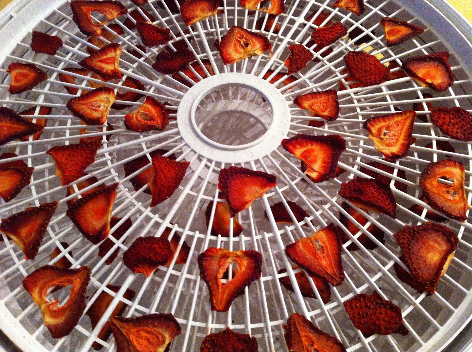
Post-ride refreshments

We ended up doing almost all of the Klonzo South trails: Midway to Carousel, Gypsy-Wizard-Magician, out to Zephyr (connector with the MOAB Brand Trails) and back.  I will admit that at first I was VERY nervous.  This was only the third time I'd been back on the bike, and this time on trails that I knew nothing about.  To be honest, they were pretty easy trails but Midway, where we headed out, was singletrack on a side hill and I had a death-grip on my handlebars, walking in several places that I totally could have ridden.  After some time on the gentle Carousel slickrock and Zephyr sand, I calmed down and I suspect that when we go back, I'll be fine.

False Kiva view

We only saw two other MTBs when we were out on the trail but when we got back to the truck for post-ride beers, it was starting to get busy, with MTBers, trail runners and assorted dogs arriving for their time on the trails.

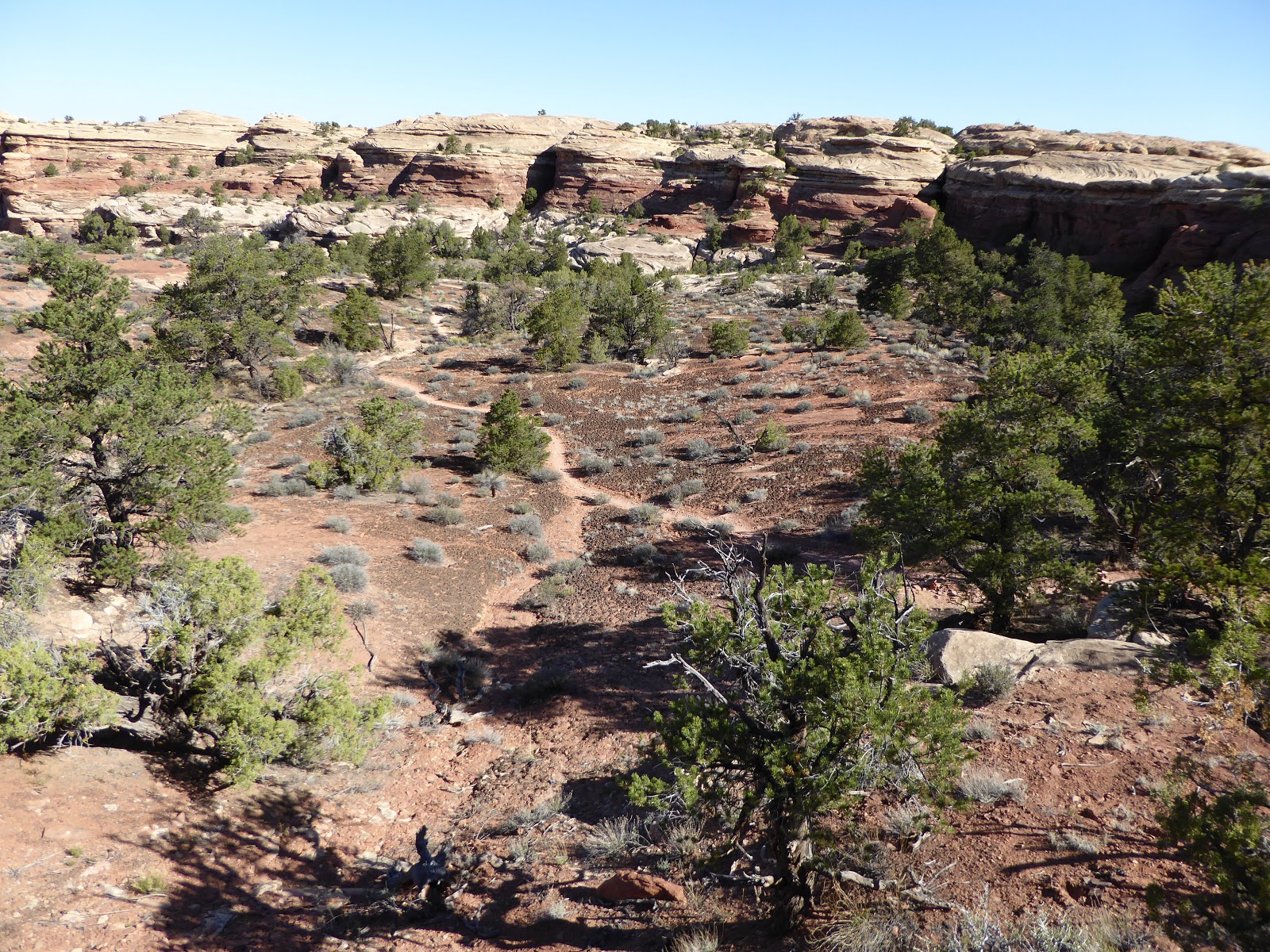
On the trail to False Kiva

Next stop was the Island in the Sky district of Canyonlands.  Saturday night, when we were at the Moab Brewery, a guy we were talking to told us about the "secret" trail to False Kiva.  This is an ongoing archeological site of Native American ruins, tucked under the rim of the mesa.  There is no sign (the park rangers have to tell you about it if you ask but it isn't marked so as to try to keep foot traffic down) but there is a trail and you are allowed to hike it.  So we did - and ended up seeing twelve people on this supposedly secret trail!

False Kiva is well-hidden

The trail is steep and rocky in spots, with some loose footing, but it was generally easy enough to follow the cairns when the trail got faint.  We found the site - a stone ring, peck basins, pictographs and roped-off burial sites - in a large alcove, completely hidden from sight.  We had to wonder: why did the native people build here? and how did anyone even find the ruins?

It's a false kiva because there's nothing underneath

After pausing at the Aztec Butte parking lot for beers, we headed back to town.  Frank the office dog was not in attendance but Pearl the office dog and her adoptable foster brother Nico were, so we stopped in for some bellyrubs.  Nico is pretty nervous around new people but after ten or fifteen minutes, he stepped close enough for H to scratch his ears.

Pictograph

We had pre-dinner beers at Woody's before trying out a new (to us) place for dinner, 98 Center, just around the corner from the motel.  It was great: tiny, casual, serving bahn mi and pho and steamed buns with kimchi (including vegetarian, vegan and gluten-free options), with $2 PBRs and $4 G&Ts.  We got there just before it filled up, scoring a prime booth, and enjoyed the people-watching - and there was plenty of that, with both tourists and locals in attendance for the evening's Open Mic.  We got home in between the downpours, watched the rain from our stoop and then called it a day.  A very good one, in fact.

Ride stats:  11.82 miles; 1 hr. 57 min.; 6.0 moving average (I'm so slow!); 14.3 max.

Hike stats:  2.6 miles, approx. 1.5 hours (including time spent at the ruins)

Thursday, May 18, 2017

double sessions

In the morning, we had thought to hit the Love Muffin Cafe for breakfast.  We got there a little late (7:30 a.m.), however, and the line was out the door, so we just headed on up to Dead Horse Point State Park and had bagels and peanut butter on the tailgate instead.  There were only five cars in the parking lot when we got there which meant we breakfasted uninterrupted and then got onto the trails around 8:45.  

Upright and loving it

We did the Big Chief loop (where we encountered just three other MTBers), then crossed to road to do Whiptail.  H continued around the Twisted Tree loop while I headed back.  This was only my second day back on the bike after a winter off and I was struggling with my bike handling, especially with all the uphill over rock plus immediate turn combinations.  He caught back up to me on Raven Roll and we barreled along back to the parking lot.  (At one point I stopped to let a small guided group go past.  The guide pedaled by and then slammed on her brakes, exclaiming to me, "I used to have a bike like that! That's a GREAT bike!" much to the amusement of her clients.)

In the vicinity of Marlboro Point

 When we got back to the truck (11:45ish), the parking lot was packed.  We pounded a couple beers and [H] did some preventative bike maintenance, then stopped in at the visitors' center to ask about Marlboro Point, which isn't actually in Dead Horse Point State Park but is located somewhere between it and the Island in the Sky visitors' center.  The very young state park ranger had never even heard of Marlboro Point but he googled it on his phone and let us read what he found - basically we were looking for an unsigned dirt jeep road before the national park boundary.

Some arches are just cute

Since we had our annual national parks pass, it wasn't much of an ordeal to go out to the Island in the Sky visitors' center next (and noting at least four unsigned dirt jeep roads en route) to ask about Marlboro Point.  The park ranger there was surprised at our question - I doubt she'd been asked it much, if ever - and while she didn't know, she had at least heard of it.  She disappeared into a back room for a couple minutes and then came out with "it's the first road on the right after you leave the park ... and then take the third right."

Top of the mesa, facing Dead Horse Point State Park

We found the road and headed in on foot; even though our truck is 4WD, it's a full-size pickup which makes maneuvering on narrow roads challenging.  Within just a few minutes, the road noise behind us vanished and it was just us in the desert.  We passed several camp sites (of the just drive in and take one variety), then turned down what we thought was the third right.  After a bit, we came to the cliff edge of the mesa.  The ground fell away and the Canyonlands were stretched out before us.

Coyote tracks (not shown: all the rabbit tracks that coyote was probably after)

We went back to the main jeep road and kept going, unsure of whether we actually found Marlboro Point (we didn't, actually) but enjoying the scenery nonetheless.  At one point, the road crossed a wash and we turned and just followed the wash out to the cliff.  The views were spectacular and we had the whole place to ourselves, except for range cows, jackrabbits and desert cottontails.

H, not at Marlboro Point, but whatever

We retraced our steps back to the truck and returned to town.  We got cleaned up, had cocktails in the shade, did some research for the next day's activities and then went on to dinner at Miguel's Baja Grill (the Mother Of All Burritos filled with poblano chiles, beans, onion and tomato for H; portobello mushroom tacos for A; margaritas for both).  To be honest, we crashed pretty early.

Ride stats:  19.29 miles (for H); 2 hrs 11 minutes; 8.8 m.p.h. average speed, 26.4 max. speed (again, H).

Hike stats:  5.15 miles; 1 hr. 42 min.; 3.0 m.p.h. moving average; a whopping 600 feet of elevation.


Tuesday, May 16, 2017

back to town

By Saturday morning, our camping interlude had come to an end.  I do like camping (now, out here where it is dry with no mosquitoes) and car camping is super-easy, with the air mattress and big cooler of cold beer and extra clothes just-in-case.  But I have my limits and 2-3 days is about it.  We broke down camp, reorganized the truck so we could access the hiking and MTBing gear better and headed back up to Moab.  This may have been the last time we stay at the Needles Outpost too: the campground is a private business, leasing land from the state, and the state is selling the 640-acre parcel at auction later this month.  We hope that it doesn't get bought by a developer - it would be difficult, since it is off-grid and all the water has to be trucked in - and it would be great if the new owner continued to operate the Outpost, especially since it's the only services within 45 miles of the Needles.

View of the La Sals from Needles District

We were up at the MOAB Brand Trails around 10:30 a.m. and got our wheels on the dirt a half hour later.  The parking lot was busy but not completely full, not a bad crowd for mid-morning on a weekend.  We did see quite a few people on the Bar M loop our first time around but it had cleared out by our second time through.  We finished up around 1:30 p.m., just in time for a squall with strong wind gusts to blow through.  H almost lost his hat!  Once the little storm moved off, we puttered around for a while, patting the various dogs who stopped by to say hello as we put our gear away.

Claret-cup in bloom

We checked in at the Kokopelli Lodge (office dog Frank was available for belly-rubs), took quick showers and then headed to the laundromat and supermarket.  Rain moved in again while we were finishing our errands - absolutely bucketing down for a while - but there was a break long enough for us to walk to the Moab Brewery.  The place was packed (and it wasn't even 6 p.m. yet) but we managed to score seats at the bar, where we talked with some folks.  One guy, originally from New Hampshire, now lives in Cottonwood Heights and skis at Alta; and a cycling couple now from Boulder but originally hailing from Vermont and Pittsburgh.  (The wife was wearing a Penguins shirt and was not happy that the Washington Senators were currently beating her team in playoff hockey on the bar's televisions.)  We ate healthily (veggie wrap and veggie burrito), drank some Johnny's IPAs and scored some hiking recommendations for the next day.  Not a bad way to transition back to civilization after a couple of days in the desert.

Sunday, May 14, 2017

needles district, day 2

We got up the next morning around 6:45 a.m., to the quiet sounds of other early risers around us.  After a quick breakfast (coffee, oatmeal and bagels with peanut butter and honey), we got into our hiking duds and headed off.  We had mulled it over and decided to do the Confluence Overlook hike again, figuring that it might be less busy than many of the other day hikes in the area.

Just past Big Spring Canyon

We had boots in the dirt (or on the rock, as it were) at 8:45 a.m., with only four other cars at the trailhead (including two from Maine and a truck from Montana) and just one guy who looked like he was backpacking heading out ahead of us.  The temperature was lovely and cool to start but heated up quickly under those clear skies, topping out around 88F by the time our hike was over.

Peekaboo

This hike is rated as "difficult" because of its length and exposure - there is almost no shade whatsoever for the entire 10+ mile round trip - but the walking itself is not so hard.  You scramble up and over sandstone fins and then walk on a well-defined path across the valleys in between.  We saw the kids from Maine as they were heading back to their cars from a night "cowboy camping" (which I took to mean sleeping in the open without tents) and caught up with the Montana guys out at the Confluence Overlook; in total, we saw twenty people out there, including the occupants of several jeeps out on the off-road roads. 

Very helpful ladder

The Confluence itself was not as sharply delineated as when we'd been there in 2014, possibly because of the recent area rains.  Still, you could definitely see the line where the Green River and the Colorado River merged.  It's pretty cool.  We found some shade under a boulder at the overlook and paused a while for the view and some snacks (apples, dried pineapple and vegan "jerky" ("Texas BBQ tofu" and "hot and spicy mushroom" which, while not fabulous, weren't terrible either - we're trying to eat healthier these days)).  Then we refilled our hydration packs, reapplied sunscreen and headed back. 

Path across the valley

This is when it started getting hot, baking in those valley crossings.  I handle the heat better than H does - he puts his head down and just walks, no more talking - but even I was feeling it.  I ended up putting on a long sleeve white t-shirt that I had brought to protect my arms from the sun.  Even with two applications of SPF50, it wasn't enough.  When we got back to the trailhead, there were a fair number of tourists milling around.  I overheard a couple of them say, "This looks good - it's flat," and smiled, because they hadn't gotten to the rim of Big Spring Canyon yet, where it drops off.  They had changed their minds, returned to their cars and driven off before we had even finished our post-hike beers.

View of the actual Needles

 We were pretty hungry (and thirsty too), so we stopped at the Needles District visitors' center on our way. out.  They have a couple of shaded picnic tables and we availed ourselves of one for chickpea salad roll-ups and more beers.  Thus refreshed, we went back to camp, rolling in around 2:45 p.m.  It was definitely hot at that point so we took showers and pulled our chairs into the shade provided by a twisted juniper tree for the afternoon.

Classic desert signpost

The evening was noticeably warmer and windier than it had been the night before, so we waited until sundown before making dinner (same as the previous night) and more pina coladas (which have become my new camping favorite: rum and Jumex coconut-pineapple nectar).  Because of the wind, we opted not to build a campfire, instead moon- and star-gazing in the quiet night.

Hike stats:  10.44 miles; 4 hrs 5 min. moving time, 54 min. stoppage; 1,800 feet elevation gain; 2.5 m.p.h. moving average.

Friday, May 12, 2017

needles district, day 1, 2017 edition

Even though Snowbird's lifts are still turning (and even though the Wasatch mountains will probably be getting more snow next week), we are segueing out of winter and into summer, most notably by our recent long weekend to greater Moab.  We left Salt Lake City around 6:15 a.m. Thursday, arriving at Needles Outpost campground noon-ish.  We picked out our campsite - #7 this time, which was not quite as fabulous as #9 - and set up the tent.

Getting settled in

After lunch, we drove in to Canyonlands National Park/Needles District and nabbed one of the last parking spots at the Squaw Flat trailhead for a jaunt around the Lost Canyon lollipop loop.  It was pretty hot since we didn't get started until 2:15 p.m., but it was a fairly well-shaded trail, following the wash under big cottonwood trees for the most part. 

Those shorts could scarcely be less flattering

Lost Canyon was beautiful, an oasis of green in the desert, with varnished cliffs, pockets of spring-fed pools and lots of birds and lizards (plus a couple of squirrels).  The hiking itself was mostly easy: flat along the creek beds with a little up-and-over on slickrock fins; the walking was tough, however, because the footing was sandy.  We don't have any photos from the hike itself because our camera battery had died but above is a post-hike parking lot beer.

Moonrise

Back at the campground, we cashed in a couple of shower tokens to get cleaned up, then made an elegant dinner of Zataran's dirty rice, supplemented with dehydrated vegetables, and pina coladas.  H became a Swiss Army knife-wielding hero to the next campsite over when they realized the didn't have a corkscrew for their bottle of wine.  The sun went down; the little bats came out, gobbling up the gnats; the moon came up, outshining the stars; and we had a campfire.  Welcome to the first day of vacation.

Hike stats:  8.6 miles (the GPS didn't get an accurate reading because we were hidden in the canyon) with 1.300 feet of elevation gain; 3 hours 7 minutes of movement, plus 29 stoppage minutes; 3.3 average moving speed.

Tuesday, May 9, 2017

here's a hint

This photo will give you a clue as to why we've been absent here at We Went West.  We'll be back up and posting soon, after we're done with the huge pile of laundry ...