Friday, September 28, 2018

island lake, reversed

As we were trying to decide on a hike for Sunday, H remembered the Island Lake one that we did back in 2015.  It seemed to tick off all the boxes: decent length, low traffic and not too steep.  Our knees could use a break after Lake Blanche and Honeycomb Canyon/Silver Fork.

Creek in a meadow, sometime before Duck Lake

We got out of the house around 7:30 and drove through Park City and Kamas to the Mirror Lake Highway.  Traffic was pretty light although we did have to stop several times because of cows in the road.  When the roadside signs say OPEN RANGE, they mean it.

This guy was chowing down on that pinecone

The last time we did this hike, the Crystal Lake trailhead parking lot was full and we ended up parking half a mile away at the overflow/horse trailer lot.  This time there were plenty of spaces and we were on the trail a little after 9 a.m.  There was another hiking group of four young women and three dogs - including a funny hound who kept baying, thus ensuring that none of us would run into any deer or elk.  Other than that, we had the trail to ourselves for most of the day.


Autumn colors, glassy pond

We had partial cloud cover for most of the day, as well as a light breeze, making the temperatures very pleasant for hiking.  I didn't even sweat through my hat!  The trail we did was about two-thirds rocky underfoot and one-third nice dirt/sand; and although there are a lot of small gains and losses, there are no long slogs up- or downhill.

Duck Lake

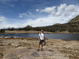
We ended up doing the route in reverse from what we had done in 2015: when we got to the Middle Fork/Long Lake intersection, we went left instead of right, which meant that we went past Weir Lake and Duck Lake first.  To mix things up, we followed a faint trail all the way around Duck Lake, scaring up a big osprey who seemed annoyed that we would invade his territory.

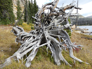
Duck Lake stump art

After circling Duck Lake, we did the short out-and-back to check out Island Lake.  Here we met three groups of backpackers, heading back to their cars after a weekend in the Uintas.  We ended up catching two of those groups on the hike out.

H at Long Lake

We retraced our steps on the Island Lake spur, then finished the loop by passing by Long Lake.  As we headed back to the trailhead, more people started coming in: a group of tourists, struggling with the elevation, asking "Where is the lake?" (to which we replied, "Which one?"); baby-toting hipsters looking for a picnic spot (to which we replied, "Um, anywhere?"); backpackers heading out for overnights; people taking their dogs out on the dog-friendly trails.  Despite all this, it still didn't seem crowded.  It just seemed like a nice day for a hike.


Hike stats:  9.50 miles; 3:39 moving/2.7 m.p.h.; 4:05 overall/2.3 m.p.h.; 1,400' climbing


Tuesday, September 25, 2018

tacos, beer and bikes

Oh, wow, Pow Mow - what nice MTB trails you have!

On Saturday, we ventured further afield than we have for a while, making the trek all the way up to
Powder Mountain in Eden to check out their MTB trails.  Their trail system is fairly new: begun, I believe, in 2015 and trail construction is ongoing.  We hadn't been to PowMow since 2013, which is actually the only time we've been to PowMow.  Although the resort is definitely changing with new development, it still has an isolated, old fashioned feel which I hope it holds onto as long as possible.

Part of what makes Powder Mountain unique is that it is a ski mountain in reverse: all the lodges and parking are at the top of the mountain.  This means that at the end of the day, whether you are skiing or MTBing, it's an uphill finish.  Something to keep in mind.

Paper Airplane feature (which I did not ride)

We parked at the Hidden Lake lodge and I poked my head into the rental shop to grab a trail map.  The kid working there recommended the 6.33 mile Brim Trail loop, as well as Paper Airplane and Baggage Claim as connectors.  He said most people drove out to the Brim Trail trailhead but we opted to leave the truck at the lodge and ride out to the Brim Trail.  See above re uphill finishes.

Although the trails are fairly well marked with flap poles, it's a little confusing to find the trails from the parking lot.  We rode out of the lot and back down the paved road just a little ways, before turning left (more pavement) where we found the start of Paper Airplane.  The first thing we noticed about this trail: a lot of down.  It was a little loose and rocky, in part because they do some of the high school MTB racing there which can really take a toll on the trails.  We passed the Paper Airplane feature - so cool! - and continued on down the 13+ switchbacks of Baggage Claim.  At one point, H's tires slid in the dusty dirt and he nimbly unclipped and jumped over the handlebars to land on his feet.

The Brim Trail is fantastic

At the bottom of Baggage Claim, we hopped on the Brim Trail which is, without a doubt, one of the nicest trails I've ridden.  It was a little dusty but not too loose, with reasonable climbing and not many rocks, crossing through aspen glades, open meadows and pine forests.  In the summertime, the flowers in the meadows are likely spectacular.  There was a breeze going the whole time and since we were riding at around 8,800+ feet, the temperature was very, very pleasant.  Super-nice riding.

What else could you possibly need?

Since I was going pretty slowly (panting for breath at the elevation), I suggested to H that he go on ahead around the loop.  I figured he could do the loop twice, lapping me, and then we could ride back up Baggage Claim and Paper Airplane together.  He took off and I continued on, happy at my own pace.  I got a little lost towards the end of the loop where it comes out onto Bobcat Ridge (?): the trail had turned to a jeep road and the meadow was crisscrossed with unmarked jeep roads.  I finally figured it out when I saw other riders, following them back to the Brim Trail trailhead parking lot. 

I finally found the connector to Baggage Claim and Paper Airplane on the far side of the lot and then began the slog back up to Hidden Lake lodge.  All that down we had at the start had to be gone back up now and the sustained climbing coupled with the loose dirt and rocks did me in.  I ended up pushing my MTB up most of the way.  What I thought was weird was that H wasn't coming up behind me.  He hadn't lapped me on the loop so I knew he wasn't ahead of me - I couldn't figure out where he was.

H covered a lot of ground

H had gotten lost too, in nearly the same spot I did.  He did the loop the first time but never found the trailhead parking lot, going off-trail through a meadow to reconnect with the Brim Trail for the second loop.  After the second go-round, he tried Doctor's Dozen in the hopes that it would bring him back to where he wanted to go.  But it didn't, leading him down way too far, which necessitated a brutal climb on the loose dirt access road back up to Hidden Lake lodge.  When he got up there and I wasn't there, his heart sank because he really didn't want to have to go down again to look for me.  Luckily, I got to the parking lot just then, saving him from any more climbing.

We cleaned up and then headed into the lodge for beer and tacos at Tacos, Beer & Bikes!, on their last day of the season (the MTB trails will stay open but the lodge is closing to switch over to winter operations).  We each had a beer and incredibly tasty jackfruit tacos with a homemade pineapple-sriracha salsa.  Delicious!!  It was a terrific day and I would guess we'd be back next summer for more tacos, beer and bikes when it's all so good.


H's ride stats:  20.62 miles with 2,100' climbing

Friday, September 21, 2018

of an evening

H and I decided to switch things up a bit and went for an after-work hike on Monday.  I snuck out a little early and met him at the parking lot across from the Porcupine, and then we drove up to the Mill B trailhead in Big Cottonwood Canyon.  Our destination was Lake Blanche, a hike I hadn't done since 2013; H did it more recently by himself in 2016.

Leaves just starting to turn here

Temperatures have been above normal and with lots of sunshine, it was pretty warm as we started up the first switchbacks leading out of the trailhead and into the drainage.  Luckily, much of this trail is shaded, either by aspens and gambel oaks or, because of the time we were hiking, when the sun started to go behind in the mountains.  When we were in the shade, it was very pleasant.

Lake Blanche with the Sundial looming above

What I forget every single time I hike this trail is how steep it is.  Since it follows the creek bed up the drainage to the lakes, the trail doesn't waste a lot of time with too many switchbacks.  We climbed steadily, not really taking any rests until we got to the lakes, and worked up a good sweat.

Lake Florence

When you hike this trail on the weekends, there are hundreds of other hikers; it is an extremely popular and well-known hike ... which is why we won't hike it on the weekends anymore.  At this time of the evening, on a Monday, however, we only saw a handful of people.  Nobody passed us going the same direction and we passed several people.  Even when we got up to the lakes, there weren't more than six or seven other folks up there and we all spread out, giving each other room to appreciate the scenery without the crowds.

H by the lake

We stayed up there for about half an hour, sitting on the warm rocks and enjoying the clear light and fall colors.  When we headed back down, it seemed to go fairly quickly: in between the steep and rock step-downs, there are nice stretches of trail that are soft, firmly-packed sand - easy to get your cruise on.  Until you get to the next rocky step-down.  The sun was starting to set across the valley as we drove out of the canyon.  It wasn't our usual weeknight routine but it was an excellent break from the gym.  A Stairmaster has nothing on the Lake Blanche trail.

Autumn on the hillside

Hike stats: 6.94 miles; 2:42 moving time/2.6 m.p.h and 3:24 total time/2.0 m.p.h.; 2,600 feet of climbing


Wednesday, September 19, 2018

change of seasons

When we did the Emma Ridge hike last weekend and peeked over the ridge into Honeycomb Canyon and Silver Fork, it reminded us that we hadn't done that loop in a while.  Sunday morning rolled around and found us heading up Big Cottonwood Canyon under cool but pleasant temperatures and much clearer skies.  We parked at the first Solitude entrance, not far from where a group of twenty-somethings were climbing out of their vans/trucks and cooking parking lot breakfasts. 

That looks like fall!

The aspens are starting to turn up there and with the quality of the light, this hike was the first time that it's felt like autumn.  We started on the Queen Bess MTB trail (under the Eagle lift), then walked up the paved Silver Fork road.  When the pavement ended, we stayed left on the trail - which ended up reconnecting with the old mining road just a little ways on.  There were a couple of older women coming up the mining road behind us but we were moving pretty quickly, and even though we stopped for a little while to watch the unconcerned mother moose and her calves, those hikers never caught us.

"Keep moving, buddy ..."

We saw two other hikers at the portal mine and then passed two more on the steep section up to the head of the canyon.  With all the mining ruins and debris, it's pretty clear why they named this canyon "Silver Fork."  We followed the trail up through the tailings to Davenport Hill: it was very steep and very loose in spots, but unlike last time, we managed to stay on the trail.

Following the old road

From Davenport Hill, we followed the old mine road down into Grizzly Gulch a little ways until we could turn left onto the trail up to Twin Lakes Pass.  Most of Silver Fork had been in the shade and, with the wind, actually chilly, but out in the sunshine it was extremely pleasant.  After pausing for a snack at Twin Lakes Pass, we kept to the higher trail that went around the hillside to Solitude, coming out a little way below the top of the Summit chair.   Although the access road is our usual route to the top of the chair, it is a horrible slog; instead, we kept to looker's left and scrambled up to the top of Summit chair.  More pleasant and we cut a little bit of distance off.

This bit up to Davenport Hill was so steep

We saw no people for the rest of the hike.  The population had been pretty sparse regardless - six people in Silver Fork, one in Grizzly Gulch and two at Twin Lakes Pass - but now we had the place to ourselves.  Much of Honeycomb Canyon is very steep, including following the old road from the summit and then the portion along the dry creek bed.  Everything was very dry too and H noted that we were walking like Pigpen with little puffs of dust coming up with every step.  

Dark blue sky above Solitude

As the wind blew through the canyon, golden aspen leaves danced overhead and there was no question that we have turned a corner on the seasons, even if it is still getting up to nearly 90 F down in the valley on occasion.  It was a beautiful autumn day in Big Cottonwood Canyon and we were glad to be out in it. 

Honeycomb Canyon trail (flat part)

Hike stats: 7.85 miles; 2:55 moving/2.7 m.p.h.; 3:30 overall/2.2 m.p.h.; 2500' climbinb


Sunday, September 16, 2018

round valley north

Believe it or not, after all these years of MTBing at Round Valley, we've found something new!  We put together a 16.7 mile ride, with 1600' of climbing - it was a great day, even with all the drifting smoke from the latest wildfires.  We got to the trail head a little before 10 a.m., at first a little taken aback at all the cars.  It was the final race of the the Park City Trail Series - a 13.1 mile trail run - and we knew we'd just need to keep out of the runners' way.  Fortunately, we were late enough that most of the runners were already heading for the finish line, and the route we had in mind didn't follow much of their course anyway.  Although it was sunny, it wasn't particularly hot so it seemed ideal for running (and MTBing too).  And whether it was the smoky air or the race, the trails were nearly deserted which was just awesome.

 Just finishing up Tin Man

We started on our regular route, pulling over and letting runners by whenever we saw them.  After cruising up Matt's Flat, we took Seventy 101 to PorcUclimb (much more fun with a working shifter, I thought) and then down Down Dog.  Then we went down and around to climb My Nemesis and out Round Valley Express to pick up a connector trail that brought us out to the North Round Valley trail head.  New to us!  We were as far from the truck as we could get and still be at Round Valley, with some sizable hills in between.  To climb those hills we went up Happy Gilmor (which was awesome: steady climbing on smooth dirt with good switchbacks) and Tin Man (which was a little more rocky but still pretty great).  This brought us to the top of Rademan Ridge where we had a choice: go back on Rambler to familiar territory or take Pulp Friction, a brand new, downhill-only trail and see how that was. 


It wasn't my favorite, to be honest.  Pulp Friction is a much more technical trail than the rest of Round Valley: steep and narrow with very tight switchbacks, and it's so new that the dirt isn't yet rubbered in.  At the bottom, we hopped back on Rambler (Rambler is EVERYWHERE), but a section we'd never done; it was very rocky and I ended up walking most of it.  Still, it got us back up to where we'd started on Rademan Ridge and from there it was well-known territory back to the truck, where our beers were waiting for us.  I don't know that I have much interest in Pulp Friction and that Rambler section but I would do Happy Gilmor and Tin Man again in a heartbeat and am psyched to have added some more fun climbs to our Round Valley repertoire.


Thursday, September 13, 2018

emma ridge

The north side of Little Cottonwood Canyon is Emma Ridge, dividing LCC from Big Cottonwood Canyon.  We've been up on that ridge several times (Cardiff Pass, Days Fork, Prince of Wales mine, Silver Fork/Honeycomb Canyon, etc.).  At some point I said to H, I bet we could make a loop by walking the length of the ridge and going down the bowl to the east of Flagstaff Mountain.  So that's what we did on Sunday and it was great.

P at the Honeycomb cliffs

We met P at the parking lot across from the Bells Canyon trailhead and drove up to Alta.  Even at that early time (about 8:30 a.m.), cars were already pouring into Snowbird, trying to nab parking before they started charging to park for Oktoberfest.  Once past the Bird, however, it was pretty quiet up at Alta.

Love a ridge walk

We parked above Albion and started up the trail, leading to the old mining road through Grizzly Gulch.  That first bit is really steep and I always forget that.  When the road forked - right to Twin Lakes Pass; left to Davenport Hill - we went left.  Temperatures were perfect: a little chilly in the shade but quite pleasant in the sunshine.

View of Alta from Emma Ridge

Since P hadn't been there before, we took a side trip out to the Prince of Wales mine, where the rebar gratings covering the pit openings has been replaced since our last visit.  We also climbed up to the ridge, where the Honeycomb cliffs top out at Solitude, and peeked over the chalky stones.  Although we've been in Honeycomb Canyon a fair bit, either hiking or skiing, we'd never been up there so it was fun to see it from that angle.

Clinging to the ridge

We retraced our steps back to Davenport Hill and then started out south along Emma Ridge.  For the most part the trail is evident, if not heavily trafficked.  It did fizzle out a bit at the Silver Fork/Days Fork divide, so we ended up scrambling up the same bowl H and I went down on our 2016 Days Fork hike.  It's definitely easier to go up those steep bowls than down.

Emma Ridge stretching back to the east(-ish) behind us

Once back on top of the ridge, the trail was pretty easily followed although it got faint and steep on the descent to the pass just west of Flagstaff Mountain.  This was where we planned to make our exit: from what we'd been able to tell, Flagstaff gets a little cliff-y on the Cardiff Pass (Pole Line Pass) side.  We didn't readily find any trails down (which was a little surprising) and instead followed game trails down the steepest portion until we reached a faded old mining road.

The way out

This would be a gorgeous bowl to explore in July because of the wildflowers.  As we made our way down, we saw tons of tracks and dirt wallows so the deer are big fans of this drainage too.

P and me, making our way down

We continued down the overgrown mining road, which got wider and clearer when we passed the turn-off to Cardiff Pass.  We followed the road out past Alta's town offices and just went up the main canyon road back to the car to complete the loop.

What we just came down

Despite the beautiful day, there were very few people out enjoying it up there, even when we moved the car down to Albion Base to take advantage of some shade to enjoy our beers.  It was extremely satisfying to stand there, looking up at Emma Ridge, knowing that we'd just walked it.  And later that day, H said that it was his favorite hike of the season.  If that's not a glowing recommendation, I don't know what is.


Hike stats:  7.14 miles; 3;02 moving time/2.3 mph moving average; 4:35 total time/1.6 mph overall average; 2650' feet of climbing

Tuesday, September 11, 2018

return to glenwild

H is, understandably a little bored with Round Valley. We ride there all the time and we have the trails pretty well in hand.  So when he suggested that we change it up a little and go to Glenwild to do the loop he and Darren did last fall, I thought that sounded like a good idea.  Personally, I hadn't ridden Glenwild since 2011 so I was overdue for a visit.

Lots of sharp zigzags = many switchbacks

We met P at 10 a.m. at the trailhead behind the Park City Brewery.  H had printed out the route and noted all the trail junctions on it; he warned us that there would be a lot of climbing on the front end but it was a loop with a downhill finish.  H had also fixed my shifter cable so I was back in business for climbing ... which was a good thing because yes, there was a lot of climbing, and right from the start with no chance to warm up our legs.  Still that first climb was a good ride - Bad Apple to Drop Out to Fink Again to 24-7 to Flying Dog - long switchbacks through sage brush fields.  The trail surfaces were rockier than Round Valley but I could still manage to ride them (for the most part). 

Such focus

Flying Dog was a great section, both up and down, in through aspen groves and past beaver ponds.  I was still riding okay although my legs were starting to get fatigued; P and I traded places a couple of times on some climbing sections but he is much, much better at descending so I was glad to be the caboose again as we started downhill on Cobblestone.  The Cobblestone trail is aptly named: it is very rocky.  I'm a tentative descender, made more tentative with loose rocks and even more tentative as I get tired because fatigue makes me an even wonkier bike-handler.  That trail isn't very long, however, and then we got to swoop on some rollers on the smooth, sage-surrounded Glenwild Loop. 

After a truly epic hike-a-bike

Then we made a mistake.  We came to a trail junction where our options were left or right.  Left looked like it just went into the Glenwild neighborhood while right headed back towards the trailhead.  H promised us that there was just a little bit of climbing left, then we would go around the side of the mountain to a downhill finish.  So we turned right, heading back to the trailhead.

Except it was the wrong way.  The left hand turn was the trail that climbed just a bit and went around the edge of the mountain.  The way we went was the Stealth trail that went pretty much straight up and over the mountain.  Almost two miles of climbing.  My legs were shot at this point and I pushed my MTB the whole way up.  H rode the whole thing, putting his foot down only once on a rocky switchback, and said his legs were shaking by the time he got to the top.  When P and I joined him there, somewhat later, we confirmed that that was definitely not the trail we'd intended to take.

So. Much. Climbing.

No big deal because it was truly all downhill from where we were: Stealth to 24-7 to Drop Out.  All of us were a bit shaky with the bike-handling at this point but I managed to ride over three of the little bridges on the downhill portion without riding off them, so I totally counted that as a win.  Something else to count as a win?  A brewery with IPA on tap just around the corner from the trailhead.  All MTB rides should end that way.

Ride stats:  15.91 miles; 3:51 total time; 2400' climbing

Saturday, September 8, 2018

broken laces

We went back to Round Valley on Labor Day Monday, deciding that we would take P around our original loop: My Nemesis, Hammerhead, Nouvelle Loop, Sweet Sixteen, Sagebrush Switchbacks and the Staircase*, plus the PorcUClimb and Down Dog thrown in because why not.  It would be about sixteen miles and very familiar, with both up AND down mixed in and I was looking forward to it because it was right in my comfort zone.

Forget about comfort zone - I was a disaster from start to finish.  First of all, I forgot to unlock my front fork so when we hit our first downhill - a rocky one down to the former My Nemesis - my MTB felt really weird.  I kept looking at my front tire, thinking that it was flat, because it was behaving so strangely.  It wasn't until we paused at the top of My Nemesis that I realized my fork was locked, making for a much rougher ride than it should have been.

The next downhill, down Round Valley Express, went much better.  But when we started uphill towards Hammerhead, I was really struggling.  I couldn't shift any lower and yet I was nearly standing up on my pedals, trying to mash them around.  It felt like I was in a very high gear but I wasn't, according to the indicator on my handlebars.  At the top of Hammerhead, H took a quick look at my bike and everything seemed to be in order; in fact, I thought it was my fault, that I was shifting wrong.  So we started up PorcUclimb and then, once again, pedaling was SO HARD.  I was unable to shift any lower and yet I was struggling to turn the pedals. 

I tried playing with the shifter on the Down Dog descent and that's when I realized that even though the chain was in the smallest rings in back, my shifter wasn't moving it.  H looked at it again at the bottom of Down Dog and noticed the problem:  my shifter cable had snapped and I was stuck in the small rings.  A-ha!  It wasn't me!  But being unable to shift down meant that the climbs ahead were out of the question for me.

You can see the frayed ends of the broken cable

I was a little annoyed that I couldn't do the rest of our ride because other than the shifting issue, I felt like I was riding well.  But I sent the boys on their way and mashed my way to the Nouvelle Loop, where I could pretty much coast back down to the truck.  I spent the next hour getting changed, eating my lunch, getting an early start on my beer and watching all the MTBer/trail runner/dog walker activity in the parking lot.  Before I knew it, H and P had finished the rest of the ride and were back to join me. 

Next project: H has to fix my shifter cable before Saturday's ride.

*  Don't try to find any of these trail names on the map.  They are all private names that H and I use because we can't remember any of the actual trail names.

PS - The "broken laces" title of this post is a call-back to the "new shoes" post from a couple weeks ago.  The "new shoes" are my new tires; the "broken laces" means the snapped cable.

Thursday, September 6, 2018

alta tour

Realizing that it had been a couple of months since we'd been up to Alta, H and I decided to hike up there on Sunday.  We got up there a little before 9 a.m., parking in the nearly-deserted Wildcat parking lot.  It was a gorgeous morning - sunny and cool and as clear skies as we've seen in weeks.  We met local rescue dog Luna (and her person) as we walked along the transfer tow, waved to the harmonica-playing lifty at the Sunnyside and passed a total of four hikers as we went up the main hiking trail through Albion basin.  Other than that, we had the place to ourselves.

Starting to look like fall in Albion Basin

At the signpost, we turned onto the Germania Pass trail (access road), which goes under the Sugarloaf lift and switchbacks up lower East Greeley.  This road is a grind, no doubt about it. We saw MTB tracks but I wouldn't like to attempt it, as loose and steep as it is.

Access road under Glitch and Glatch

We had lots of opportunity to stop and catch our breath, however, because the local fauna was out in force for us to watch.  We saw four deer, all bucks, and one of them was the biggest mule deer we've ever seen.  There were quite a few marmots and pikas scurrying around the rockfalls, whistling and cheeping at us.  We warned the pikas to be careful, though, as there were many, many hawks in the area, wheeling overhead, sharp eyes seeking out small and furry creatures.  We saw one hawk dive to the earth and come up with a tiny critter struggling in its talons; as we watched, the hawk dropped its prey and then caught it again, mid-air, before flying to a dead tree for breakfast.

These bucks were very wary of us

We came around the basin below Keyhole and continued up the EBT, more hawks circling overhead and one moose cow unconcernedly gazing at us from her shady spot in the trees.  A trail runner passed us coming off Sugarloaf just as we started up.  It's been a couple of years since we've summited Sugarloaf and, in the meantime, I'd forgotten how sketchy the trail is in spots: it's quite steep and the footing is loose and slippery.


Keep on walking, humans

Going up isn't too bad - and when we got to the top, the views were fantastic, as they always are - but coming back down, I did a lot of side-stepping, hoping to keep upright on my feet.  It seemed like it took forever to get down but it was only seventeen minutes, three minutes longer than the ascent - which tells you how steep it is.

Sugarloaf summit with Snowbird in the background

Once down, we walked across the saddle and started climbing Baldy.  After the short scramble (loose in spots), we made the ridge and hoofed it to the summit.  Even after all the hiking we've been doing, I still find myself breathing heavy up above 10,500 feet. 

Scramble on up

We went down the other side, Baldy shoulder, which we had done for the first time about a year ago.  And again, I had completely forgotten how steep and loose the trail was down off the top.  My quads would pay for it the next day but every step was down and we were at the top of the Wildcat lift sooner than I would have expected.

View of Collins Gulch access road from Baldy

After that, there was nothing to do but follow the access road down through Collins Gulch and back to Wildcat base.  There were a few more cars there - and we saw Charles Keller and his wife returning from their own Alta hike - but it was still pretty quiet.  So we watched the hawks, waved to Alta employees, drank some beers and just enjoyed the afternoon.


Hike stats:  7.75 miles (one of the shortest all summer!); 3:12 and 2.4 m.p.h. (pretty slow on the steep downhills) / 4:31 and 1.7 m.p.h (and lots of looking around at critters); 2,850' climbing