Tuesday, June 27, 2023

riding and receding

 Despite my literal lameness, we did manage to double-session every day, hitting the bike path on our cruiser bikes after our morning road rides and short hikes, respectively.  Since the route is mostly flat, it's an easy pedal and although it was often breezy, it was never too windy to be onerous.  We did two thirteen mile routes (from our house to the end of the bike path up the Colorado River and back) and one seventeen miler (from our house to the Arches National Park entrance to the end of the river bike path and back).  I'm super-glad to have these cruiser bikes - and to use them for more than just riding to the bar.  Although we did that too.

Not only is the water below the sign, 
the silt has covered the posts

We also stopped to check out the river level.  It has definitely come down since our jet boat ride as the peak snow melt has finished, but it still seems high and fast.  And it's still cold too: the adventure jet boat groups we saw were all wearing waterproof anoraks under their life preservers.  Come the August heat, the water will be refreshing but right now, it's hypothermia-inducing.

There's a beach where a concrete boat ramp should be


Saturday, June 24, 2023

something's afoot

 Content has been sparse since Memorial Day weekend, in large part due to my ankle sprain.  It's four weeks later now and while the swelling is less, it's still swollen and somewhat sore.  It's very stiff to walk on in the morning.  I've been wearing a compression wrap sometimes that helps with the swelling, and the doctor I (finally) saw recommended stretching for my Achille's tendon.  

Immediately after I sprained it, May 28

After two weeks of hobbling around, I couldn't stand it anymore and took my MTB out for some paved hill climbs around our Sandy neighborhood.  I wore that compression wrap and it wasn't too sore during the ride.  But when I stopped, I couldn't twist my foot to unclip from the pedal: I had to unlace my bike shoe, take my foot out of the shoe and then unclip the shoe from the pedal.

A little better by June 10

All of this is to say that hiking has been non-existent since then in northern Utah (plus most of our favorite trails are still deep with snow) and pretty vanilla in Moab.  We were down for a weekend recently and Milton was really needing some off-leash time.  While H did road rides (bike path rides) each morning, Milton and I walked down to the Jackson Street trailhead for the Pipe Dream trail to get at least a little trail time.  I limited us to two hours total, including on-leash sidewalk walking, so it really wasn't much to get excited about.  Except for the dog who got VERY excited to chase lizards, smally furry critters and birds.  Hopefully my ankle will continue to improve so we can go a little further afield next time.

Getting to the end of the southern
Utah wildflower season


Thursday, June 15, 2023

desert delights

 Our neighbor Amelia had invited us (and Milton) to do a locals-only hike with her and some other friends on Sunday.  Since it was a longer hike (9-13 miles, no one was sure) that would take most of the day, H opted to spend the day with his folks.  Milton and I joined the crew and just after 8 a.m., eight people and four dogs headed off.  But first, the three who had done the hike before swore the rest of us to secrecy.  So I will be sharing photos and a description, but no pins/tags on social media and no directions.

There's a white pictograph just above that alcove

This hike required a shuttle so we left a van at the empty Millcreek parking lot and took the other two trucks up to the start.  We walked on a jeep road for a while, the dogs running and sniffing and getting used to each other; besides Milton we had Amelia's Moscow, Dave's Tank and Trooper, a chunky chocolate lab visiting from Colorado.  When the road deadended, we dropped down into a wash.  There wasn't any water flowing at that time but there had been recently, so both Milton and Trooper immediately plunged into the biggest pool they could find.

Small petroglyph panel

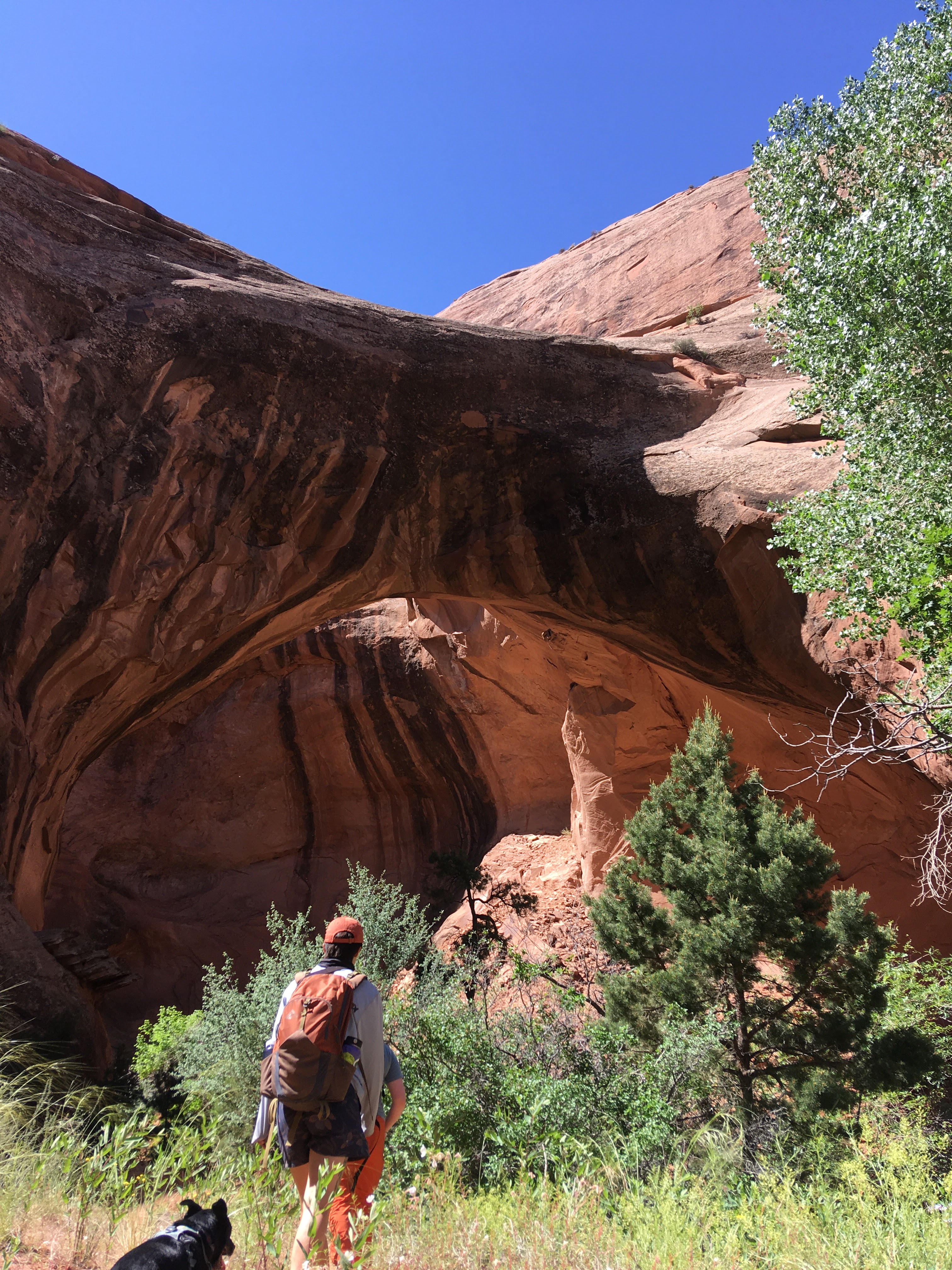
We continued down this wash for a while until it joined up with a branch of Millcreek, which was flowing nicely.  This was great because it meant that there was plenty of water for the dogs.  We stopped several times to check out petroglyphs and pictograms, and had lunch under the shade of an excellent arch.

Bit of an oasis

Last summer's floods had changed the course of the creek quite a lot (apparently) and we had to bushwhack somewhat where the trail had been swept away.  It was super pretty, though, and nice to walk in the creek.  We stopped to soak our hats and shirts as the sun climbed higher; I put Milton's white (white-ish) t-shirt on him when he started looking hot.

Good spot for lunch

For about eight miles we had this hike all to ourselves and when we finally heard voices of folks coming up from the left hand fork of Millcreek, it was a little startling.  We came out above the plunge pool and slid down some rock to get into it.  It was here that I slipped, rolled my right ankle and heard a POP.  "Well, that can't be good," I thought.  It was immediately sore and weak-feeling, and my Achilles tendon (which has been bothering me for a while now) was painful and stiff, but I could walk on it.

There were also grooves in the rock
nearby from sharpening arrows

As we headed for the trailhead, weaving our way through the increasing crowds, I fell behind.  Our neighbor Lauren slowed down for me and I told her what had happened.  She stayed with me - Milton, himself quite tired, didn't mind the extremely slow pace I was setting - for the last mile, which unfortunately included lots of people, some rock scrambling and a couple of creek crossings.  When we got to where the two Millcreek branches join, the water was much colder and more than twice as high and fast as it had been.  Lauren and I got across but we had to call and coax Milton: he didn't like it and got carried by the current a little before he found a shallower crossing.

Not a soul in sight

When we joined everyone at the van, someone in our crew was like, why didn't you say anything [about your ankle]?  But what was there to say?  I could walk on it, I needed to get back to the car, and it wasn't like we were going to call SAR for me.  So they gave me a beer and made me sit down in the van, and, as locals, we pointedly ignoring everyone who wanted our parking spot, as we toasted a very excellent hike.  The dogs would surely have agreed with the consensus except that they were all passed out, exhausted, under the van.

Probably not Pocket Arch


Sunday, June 11, 2023

jet set

 Oh my heck, where did that week go?!?

In any event, we were down in Moab over Memorial Day weekend.  It was probably crowded but since we stayed away from the parks and didn't go out to eat, it didn't affect us.  H's parents came to visit and we tried to take advantage of the very pleasant weather - sunny, mostly calm and not too hot - with scenic drives through the La Sals and along the Colorado River, picnics at our new favorite picnic spot above the Colorado River ...

The last bit of shade for two hours

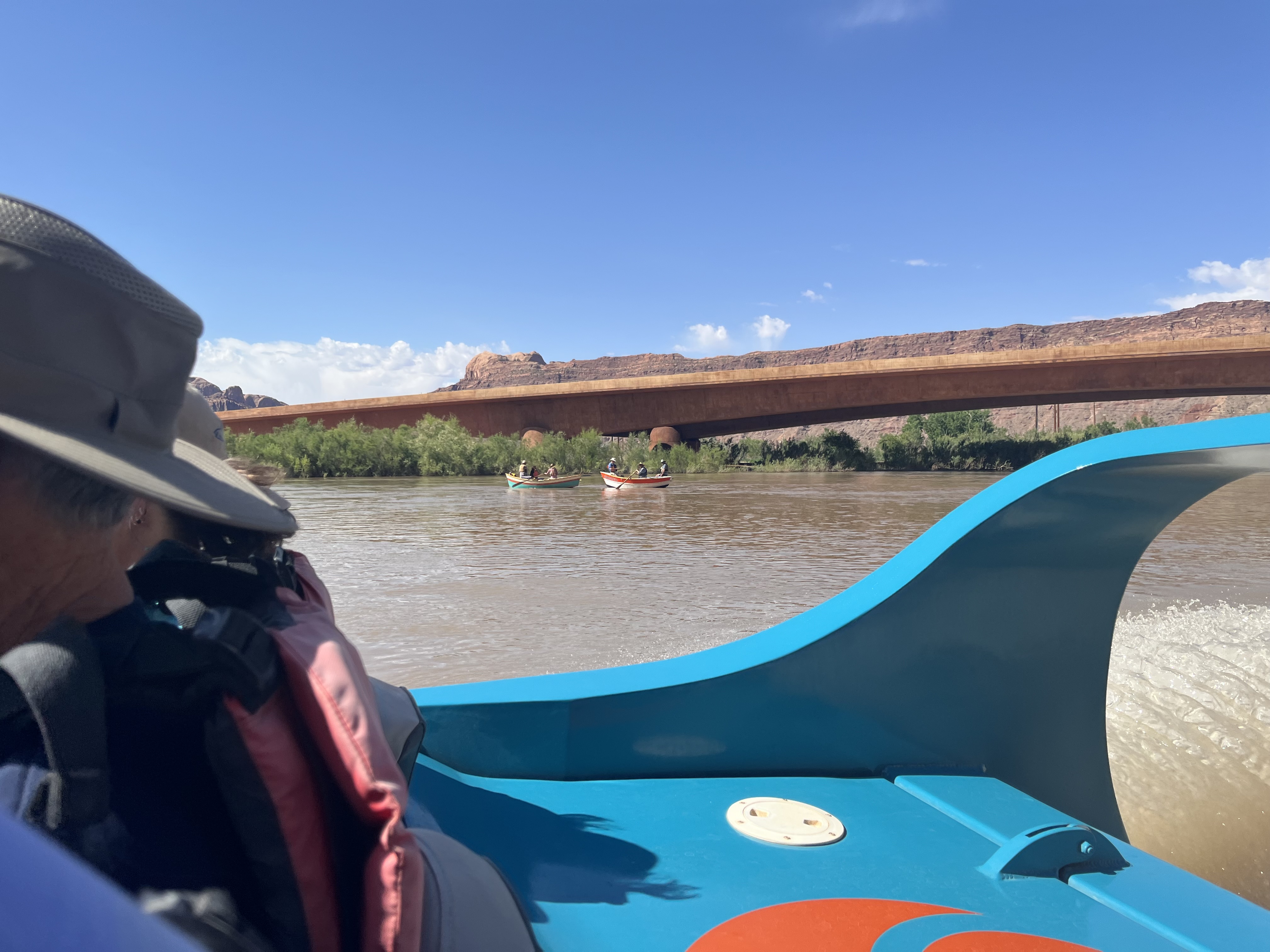
Speaking of the Colorado River, we booked a two-hour scenic river tour with Moab Jett.  We were at the HQ at 9:30 a.m. to sign waivers; once everyone was there (the boats seat ten passengers and besides the four of us there were two other couples, plus Rob, our driver/guide) we loaded up on the shuttle bus for the ride to the river.  They fitted us with life jackets, loaded us aboard and we were off.

Looking upriver

The river was running high (around 36,000 c.f.s.) and fast; anyone who was taking rafting or paddling tours was going to have a quick trip.  We started off downstream, so they could get photos of us coming up under the footbridge, and then roared upstream.  The trip is 26 river miles round trip: thirteen miles up to Red Cliffs Lodge and then back down again.  Rob told us that his primary focus would be safety - since the river was so high, there was quite a lot of floating debris to dodge - but he stopped often to point out features and talk about the area.  He was great.

Couple of wooden dories heading downriver

The highlight was near the Big Bend campground where we spotted a small herd of desert bighorn sheep.  We didn't see any lambs but there were 8-10 sheep on the top of a cliff overlooking the river.  We stopped to watch them for quite some time; our guide was as enamoured with them as we were.

Sure-footed sheep

Because the river was so high, a lot of the usual rocks were far below the surface.  This didn't mean that there weren't any rapids, however.  There were a couple of spots that had some churn to them and when we got to our turnaround spot, there were some standing waves that were at least four feet high.  Rob gave us a tiny taste of what the adventure tour must be like by hitting some of them (in the adventure tour, he said, they often have to stop to bail out the boat) before heading back downriver.

Sheep on a cliff

There was lots more river traffic at this point (nearing noon) and almost everyone seemed to know Rob, who has been driving for Moab Jett for nine years.  Back at the take out, he roared us through a swampy patch before splitting the bridge pylons and bringing us safely back to shore.  The take out was swarming with people now, rafters and kayakers and SUPers and tubers, lots with dogs and everyone keen to get out on the river.  It was nice that we'd had an early trip and had largely had the river to ourselves.

Once ashore, we had a quick parking lot lunch before stopping off for a beer and a trip rehash.  Was it touristy?  Absolutely.  Was it fun?  It was so much fun and we heartily recommend it to anyone.  In fact, both H and I have decided that we're going to have to go back a little later in the summer and do the adventure tour, just to see what that's all about.

TLDR: book a Moab Jett tour - it's worth it!


Sunday, June 4, 2023

call it a day

 H and his triple sessions!  Saturday he did a morning road ride (21.09 miles; 1:08:14 time; 18.5 average speed; 27.7 max. speed) before the three of us went to Day Canyon for a hike.  There isn't an official trailhead, just a spot for a few cars to park on the Potash Road, then a social trail put in by climbers over the years.  There was actually one car there when we got there, but it was a young family with their dog and we passed them quickly.

Heading up

Day Canyon is green and cool and shady at the mouth of the canyon, with tall cottonwood trees that had sent out literal drifts of cottony seeds.  But once you get past that, and the sun climbs above the canyon walls, there is no shade.  The climb is pretty relentless too.  We didn't try to reach the head of the canyon this time - on our previous two attempts, the trail just faded away before we got there - turning around after about an hour and a half of up.  On the return, however, we somehow got off the trail and ended up down in the bottom of the wash.  We actually preferred that: it was more fun having to scramble and there were some pools for Milton to wade in.  

Cottonwood going off

Hike stats: 6.82 miles; 2:18 time/3.0 m.p.h. moving; 2:28/2.8 overall; 1,050' elevation

Good place to turn around

Since it was our last day, we dropped Milton at the house - he wasn't upset about it as he definitely had cumulative fatigue - and took our cruisers (double session for me; H's third workout of the day) to Josie Wyatt's to see our favorite bartender.  We felt we had earned our beers and toasted to a very good spring break.

Cruise stats: 2.3 miles roundtrip; 15.21 minutes; 9.0 m.p.h. average speed; 19:8 max speed)

Thursday, June 1, 2023

falcon flow

Thursday.  H did a road ride (24.39 miles; 1:17:13 time; 18.9 average speed; 31.2 top speed) and then, at H's suggestion, we three went up to Sand Flats to hike Falcon Flow.  The Raptor Route is a series of three recently-constructed trails in the Sand Flats Recreation Area, put in as a slightly (but not all that much) easier alternative to the Porcupine Rim.  Falcon Flow was built in 2020, Eagle Eye in 2021 and Hawks Glide was completed in 2022.  

You can just barely make out H across the wash

We drove in a ways and parked at the first Falcon Flow lot.  There were a number of other vehicles there but, again, we only saw a handful of MTBers out on the trail.  Traffic on the Sand Flats road seemed to be starting to pick up a little, as folks were rolling in for long weekends.  We put Milton on his leash and walked up the road for over 2.5 miles to the upper entrance to the trail.  Although these MTB trails are technically two-way, you'd be foolish to bike up them.  Hiking up them isn't bad, though, although we preferred to get the road walk portion out of the way first.

So much green!

Falcon Flow is quite pretty, following along much of the Porcupine Rim trail but up above on the hillside.  A lot of the trail is sidehill-y, with steep downhill drop offs.  But it also goes through super pretty rocky bowls and washes.  It does have a long out, however: you see the Sand Flats road long before you come out on the Sand Flats road.

Cruisers

We paused at the Slickrock parking lot for a quick beer, then went home to shower and drop off a tired Milton.  Then we double- (me)/triple- (H) sessioned by hopping on our cruisers to go out along the river (no flat tires this time) before stopping by Woody's.

Hike stats: 8:08 miles; 2:27 time/3.3 m.p.h moving and 2:31/3.2 overall (not much stopping); 1,020' elevation

Cruise stats: 12.78 miles; 1:07 time; 16.8 average speed (that seems wrong/fast); 23.3 max. speed

Sunday, May 28, 2023

one of our favorites

 On Wednesday, since we had the truck fixed and back, we went over to Amasa Back for a hike (after H did his road ride: 22.61 miles; 1:15:31 time; 17.9 m.p.h. average speed; 28.2 m.p.h. top speed).  It isn't that long and it isn't that hard and it isn't that far away, but it's gorgeous and fun and never that overrun with people - all of which combines to make it one of our favorite hikes.

Dunno what this is, but very small and very hardy

We did our usual route - up the Hymasa singletrack to the Jackson's Hole overlook/Capt. Ahab intersection and then down via the Cliffhanger 4x4 road.  We were a little surprised not to see any jeeps or side-by-sides, although those folks don't tend to get as early a start as the hikers/MTBers; and we only saw a handful of MTBers.  Of course, weekends are much, much busier.

Yucca

Hike stats: 6:15 miles; 2:01 time/3.0 m.p.h. moving; 2:15/2.7 overall; 850' elevation

These have a light, pleasant fragrance 

Oh!  We also did some MTBing once the truck was available.  We still didn't want to drive too far, so we went to Moab Brand trails twice: on Tuesday afternoon (12.02; 1:22:00; 8.7; 21.9) and Friday morning (12.71; 1:24:00; 9.1; 19.8).  Milton was getting some cumulative fatigue so we didn't bring him either time.  Temperatures were just about perfect and it was never too crowded on the trails.  And although I didn't get any photos, the Sego lilies (Utah's state wildflower) were all over the place on the back half/downhill portion of Lazy EZ - gorgeous!

Wednesday, May 24, 2023

living the pipe dream

In addition to cycling the bike path while the truck was in the shop, Milton and I also had several Pipe Dream excursions, since we can walk to the trailhead from our house.  We did a short south-bound out-and-back on Saturday, an out-and-back to the Hidden Valley trailhead and back on Monday, and a north-bound loop on Tuesday.

Claret cups were bangin'

We got early-ish starts each time and barely saw anyone out there: one MTBer and dog (Lila? Stella? in any event, we've met them before and she is never that impressed with Milton) Saturday; a couple of hikers and a trail runner on Monday, although the Hidden Valley parking lot had quite a few cars in it; and only one older lady on Tuesday, who told us to be careful on our descent as it was a little loose.  Advice taken and appreciated!

Dunno what it is but it was everywhere

While we didn't encounter many people, there were lots of critters, most chaseable, according to the dog: rabbits, lizards, ground squirrels and tons of birds, including some chukars, which are a kind of partridge.  At one point, Milton took off after some squirrel, following it WAY up the hillside (see next to last photo below) before it lost him by diving into some rocks.  I called him back down and he was unfazed, happily pouncing (and missing) on a lizard moments later.

Penstemon, southern Utah version

The desert wildflowers were in all their glory as well, and will likely be past their prime by the time we get back down there, except for the prickly pears which hadn't started yet.  We need to get a book on southern Utah wildflowers; we're pretty good on the northern Utah ones but are pretty limited in identifying the ones out in the desert.

That black dot = the dog

By our third time on Pipe Dream, I was getting a little bored with it - not Milton, who obviously lives in the moment and was just glad to be out there, chasing stuff - but still appreciative that this trail, for both hikers and MTBers, is so accessible.

Prince's Plume (I know this one!)

Saturday, May 20, 2023

river(-adjacent) cruises

 Spring in Moab is usually pretty awesome (which is why it's such a dang busy time of year) and we were recently lucky enough to spend a few days down there.  Less lucky was that we hit a pothole on the way down (Utah's roads are appalling right no) and the truck ended up in the shop for a few days.  This stranded us somewhat but we were able to rally: H did a road ride each morning and we also put our cruiser bikes (his: 1989 Fuji Club, hers: vintage 1960s-ish Schwinn, recently christened "Alice") into action. 

This is from mid April (Milton is not pooping)

The paved town bike path is fantastic, running from beyond our house, through town, past Arches National Park and up the hill to end at Route 313, which is the road to Canyonlands National Park and Dead Horse Point State Park.  There is also a spur that goes up along the Colorado River, almost to Grandstaff Canyon.  On Saturday, we went from our house to the end of the river spur and back, veering to cross the river on the foot bridge to check out how high the water is.  It's high, and moving quickly, and is only likely to get higher at the snowpack in Utah and Colorado keeps melting.

Also mid April - note sign

Other Saturday activities: a short hike on Pipedream (more on that later), yard work, washing bikes, resealing our picnic table, walking to town for a beer and the Kentucky Derby.

Early May.  Same sign.  Lots more water.

I had so much fun with that cruiser ride on Saturday that I wanted to do it again on Sunday.  So we did, and I got a flat tire not long after we turned around to head back - nearly as far away as possible.  I did have a spare tube, and H did bring the pump, but Alice predates wheel quick releases and we had forgotten to bring crescent wrenches.  So we did the only thing we could do: walk the bikes back, with a stop to refuel at the newly-opened Proper Brewing.  

In the second photo above, you can just see those
 pipes on the far left (not Milton swimming btw)

Proper Brewing (which has a couple of locations in northern Utah as well) looks to be doing quite well.  It was busy when we got there, sometime after 1:00 p.m., with tourists and MTBers on their way back to town from the Porcupine Rim.  We had vegan burgers (pretty good) and beers (of the twenty or so on tap, at least half of them had fruit, which is not really our thing).  Thus replenished, we were able to make it the rest of the way home.

Got my shoulders right up there around my ears

Ride statsH's road rides - Friday 12.03 miles/0:42:09 time/17.1 m.p.h. average speed/28.8 m.p.h. top speed; Saturday 18.5/1;00:58/18.2/28.3; Sunday 19.09/ 1:05:03/17.6/26.4.  Cruisers - Saturday 12.87/1:16:00/10.1/17.8; Sunday 12.53/2:04:00/6.1/21.2.


Thursday, May 18, 2023

oops we did it again

 We went to Moab for a few days where the river and creeks were high, the flowers were going off and the weather was very pleasant indeed.  Now - four loads later - it's taken almost a whole week to get the laundry done.  (Not folded and put away done, but washed and dried.)  Suffice it to say, actual posts with photos will be put up soon(-ish).