
First snow underfoot
We started at 7:45 a.m., at which point the parking lot was already full; we were the first to park out on the canyon road and four other cars pulled in behind us by the time we hit the trail. The first section is the old road, wide and even but rocky, climbing steadily up to the junction where the White Pine and Red Pine trails split. There were a few other hikers starting when we did, much younger than we are and with backpacks and good footwear, so we opted to let them get by us. We turned off onto the trail to Red Pine Lake which is narrower than the White Pine trail. The Red Pine trail climbs steadily, steeply in some spots, almost entirely shaded. The trail is a little rocky and in spots we had to walk in some water due to some seasonal runoff.
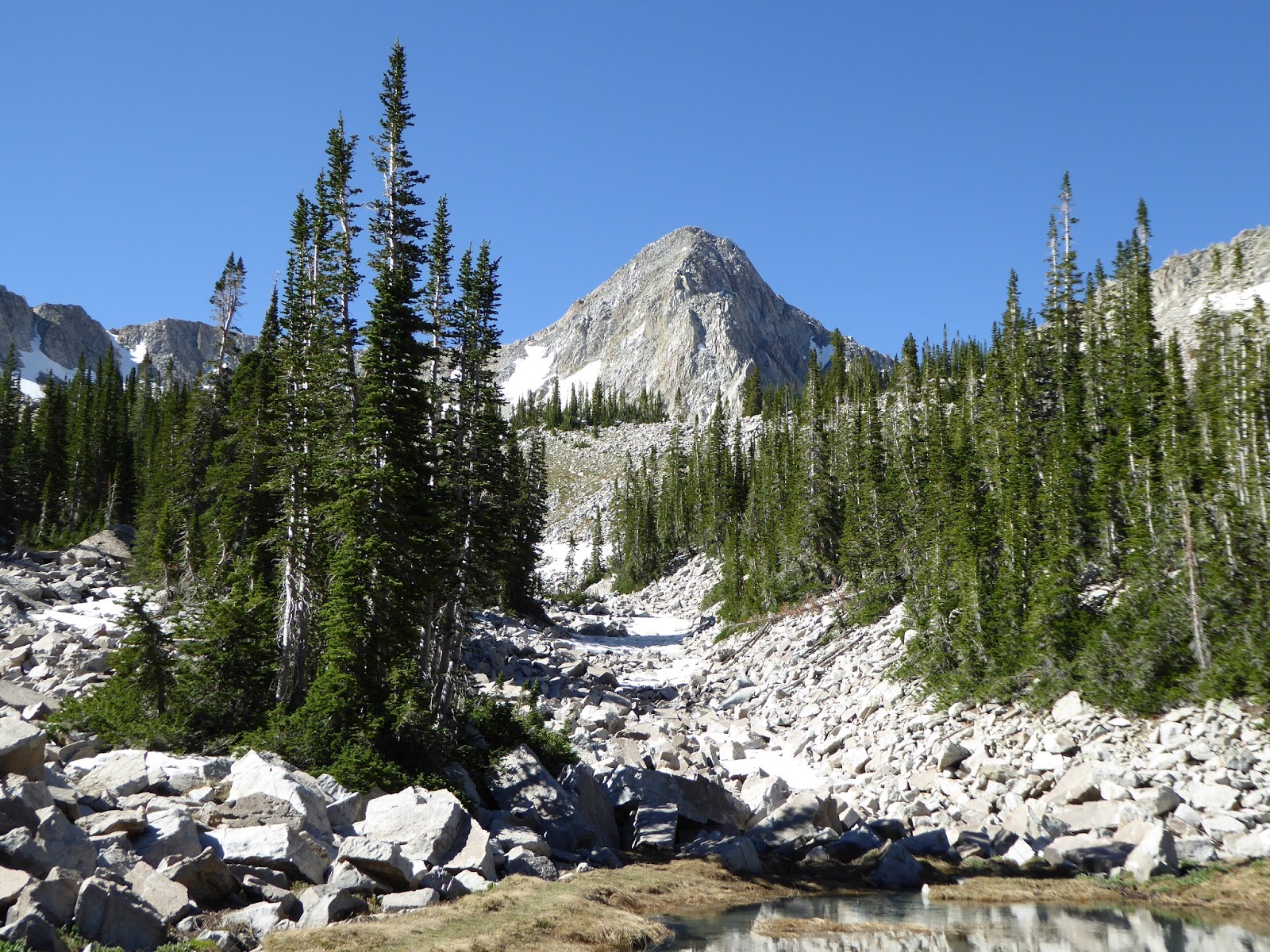
Nice view of the Pfeifferhorn
When we turned off onto the Maybird Gulch trail, the trail continued up steadily but not too steeply and definitely not as steeply as the final push to Red Pine Lake is. There was one other hiker on the trail up ahead of us and when we got to the two tiny lakes, ringed by rocky grey cliffs, he soon left. We paused for snacks at the upper lake and then decided to try something we hadn't done before: scrambling up the boulder field below the Pfeifferhorn.
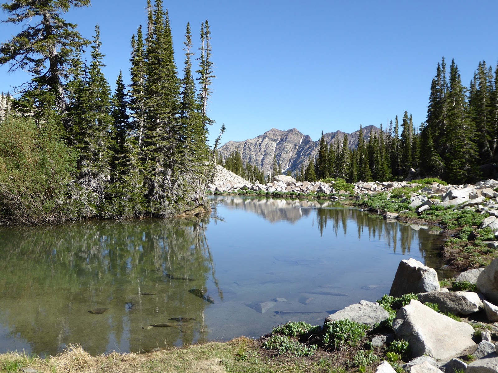
View of the far side of LCC (plus lake)
The Pfeifferhorn looms pretty large above Maybird Gulch, surrounded by boulder fields. We walked to the inlet of the upper lake and started rock-hopping immediately. The lakes are fed by snowmelt and probably some groundwater too but there isn't an above-ground creek: the water rushes downhill under the boulders. The sound was wonderful - and loud enough that we had to raise our voices to talk to each other - but we only caught fleeting glimpses of the water as it flowed past.

H rock-hopping in the bowl below the Pfeifferhorn
We scrambled up the side of a short bowl, stepping rock to rock cautiously as many of the smaller ones would shift under our feet. We got to the lip of the bowl, finding a great view of the little lakes below us, then picked our way through some pines and across some lingering snow to the far side of the bowl. Our descent down the bowl was a little quicker since we were able to glissade down some snow before hopping back onto the boulders.

View of both Maybird lakes from the boulder field
Our descent down out of the mountains was quick too despite having to dodge other hikers. White Pine/Red Pine are such popular trails that we knew we'd encounter a lot of other people, especially as the day got later. We passed just two other hikers on the Maybird Gulch trail, then sixty-six (!!!) on the Red Pine section and another thirty-four on the final leg back to the truck. The parking lot was overflowing and the canyon road near the trail head was lined with cars as well. Given how well-used the Red and White Pine trails are, it is amazing that we had most of Maybird to ourselves. I sure hope they don't ever put a sign up for it.
Hike stats: 8.4 miles round trip; 3:56 hours hiking time (plus another 1:14 standing around); 2.1 m.p.h. moving average speed; 2,498 foot elevation gain.
Edited to add the hike map:


No comments:
Post a Comment