
Pretty good shape for an old mining road
Then, looking a little more closely at our map, we realized why: the entry to Cardiff Fork is the Donut Falls trail head. Donut Falls is the easiest and shortest and, therefore, the most popular hike along the Wasatch Front. It attracts an ungodly number of people, most of whom are not hikers. And the trail to Cardiff Fork follows the trail to Donut Falls for the first half mile. No wonder we'd been avoiding it.

H at tunnel, collapsed just a little way in
But no longer! Figuring that we could at least beat the masses by getting an early start, we were at the trail head (Mill D South Fork) at 8:10 a.m. This isn't a summertime early start, of course, but we wanted the sun to come up a bit first. Even so, it was 39 F when we started walking up the road to the trail head; I had remembered my gloves this time and both H and I had long sleeved shirts on, at least to start. A large mule deer doe bounced across the road as we walked past the private cabins, and there were three cars in the trail head parking lot, but we didn't see a single person - which would no doubt change when we were on the way out.

One of the Cardiff mine tunnels
About a half mile from the trail head the trail forks, with the left fork going to Donut Falls and the right fork continuing up into Cardiff Fork. Our book described the trail as an old mining road but it was the widest and best-maintained "old mining road" we've seen. Which is not to say that it was easy walking, because these old mining roads are all loose and rocky (see also: Mineral Fork and White Pine Lake) and tend to be steeper than they appear. As we continued up the drainage, the sun slowly made its way above the cliffs to the east, the light inching down the opposite canyon wall, making the pale red and orange leaves glow. It seemed like everywhere we looked we saw mining remnants, mostly in the form of tailings and mine dumps, perched high above us; Cardiff Fork had had a wealth of lead, copper and silver to mine, as well as having a road leading from Alta down to Big Cottonwood Canyon.
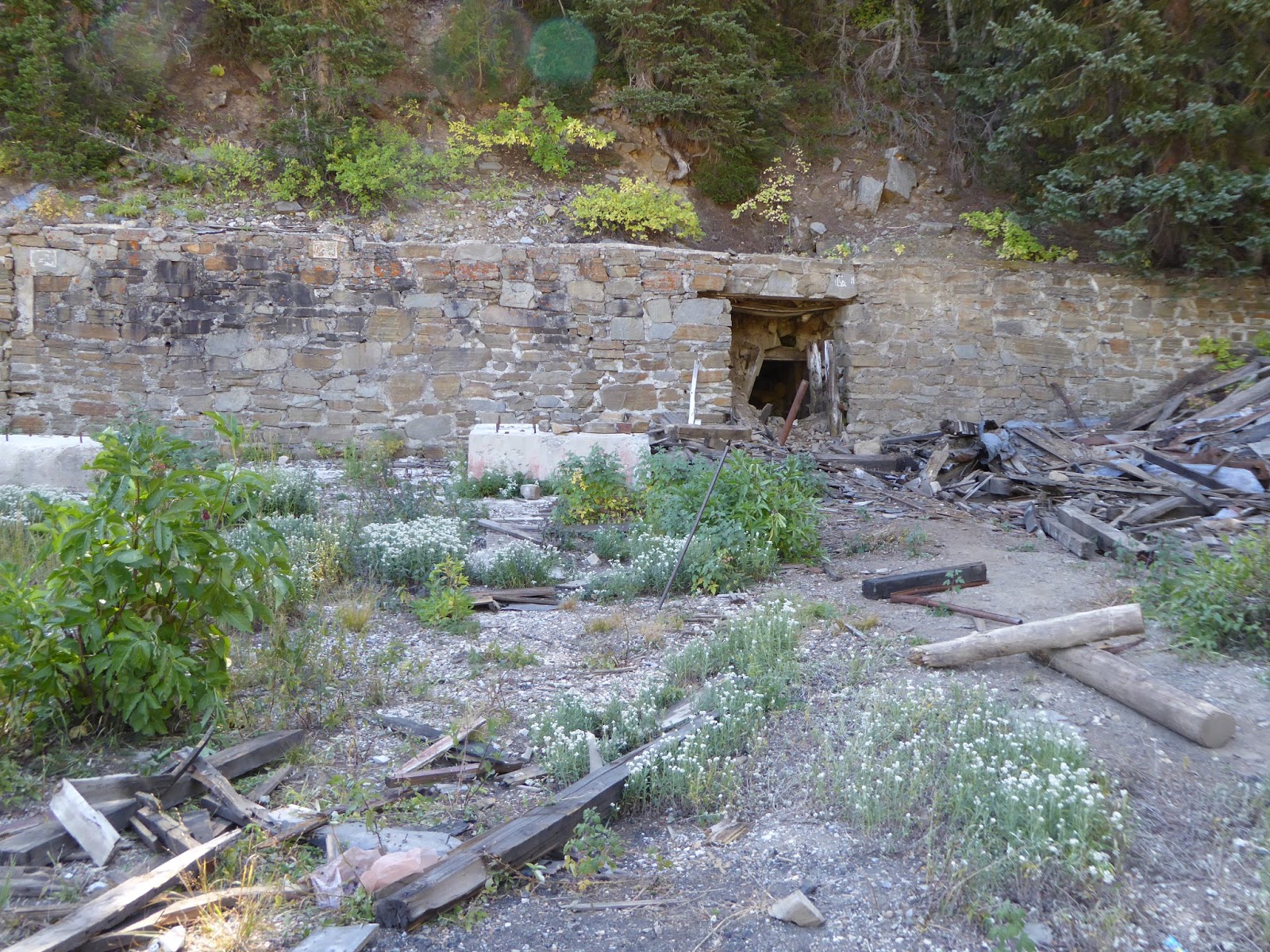
Longer view of Cardiff tunnel and ruins
When we found a huge mine dump, we paused to explore, climbing the tailings and peeking into the collapsed tunnel. A little further on we started to see NO TRESPASSING signs. I had read some online articles about conflicts in Cardiff Fork between the Forest Service and private landowners: the old road leading up the drainage to the Cardiff mine crosses a patchwork of public and private land, but back in 2012, the Forest Service seemed to have worked out a deal with the landowners, allowing hikers to hike up the drainage as long as they stuck to the road. Still, I have a thing about trespassing and got extremely twitchy, to the point of making H backtrack to where I thought there might have been a different way up to the mine.

Huge Cardiff mine ore bin
There wasn't but the delay allowed us to meet up with another couple who were also heading up to the mine. The man had been up there a lot and had a bunch of information to share, including reassuring me that we were allowed to be on the old road. We climbed the mine dump to get a good view of the old ore bin - bigger than the one in Park City and still in reasonably good shape - as well as the stonework surrounding the now-collapsed and blocked tunnels. The Cardiff mine was a massive operation back in the day (beginning around 1910); it was worked on and off until the 1950s, when active mining shut down in the area, leaving behind the ruins that are slowly fading away today.

Mt. Superior
After checking out the Cardiff ruins, we continued up the mining road behind the mine because the man we'd met said it would take us up to a meadow, then fade to singletrack up to Cardiff Pass. There were lots more "no trespassing" signs but we pressed onward, quite steeply in places, making a couple of wrong turns/dead ends before getting to the beautiful meadow. There were mining remnants up there, including mine dumps, open shafts and collapsed tunnels, but the road died out without transitioning to any singletrack we could find. We consulted our book and our map and stared at the ridge above us, looking for even the vaguest of trails to the pass. We didn't find any. We're pretty sure we could have scrambled and bushwhacked our way up there - it wasn't that much further - but in the end opted not to.

Looking up at Cardiff Pass
Our descent went very quickly, despite the steep sections and loose, rocky footing. We met five other hikers on their way up the Cardiff Fork trail, making the tally seven hikers in the first four hours. As we neared the junction with the Donut Falls trail, we decided to count to see how the last bit of our hike would compare to the first part: we counted 168 people in the last half hour. Told you Donut Falls was popular.

The meadow at the head of Cardiff Fork
The parking lots had filled up by the time we got back to the car, with hikers, MTBers and picnickers swarming the place. We took our boots off our tired, sore feet (that loose, rocky trail really wrecks havoc underfoot), downed a quick beer and a sandwich and took off, getting out of the zoo. There's a tremendous amount of history up in Cardiff Fork, that upper meadow is beautiful and I would love to figure out a way to get up to the pass to look down at Alta, but with the rough footing and the oodles of people at the trail head, I don't foresee us getting back up there again anytime soon.

Trail's end (for us, anyway)
Hike stats: 9.82 miles; 2,400 feet of elevation; 3:54 hours hiking plus 54 minutes of standing around looking at stuff; 2.5 m.p.h. average hiking speed.


No comments:
Post a Comment