As we drove into Moab on the evening of Thursday August 11th, we were heading straight into the center of the storm. The lightning was like nothing we'd ever seen - multiple strikes, cloud-to-ground and cloud-to-cloud, and I saw a fireball when one strike hit the cliff wall in the Portal area. When we got to Main Street, it was under about a foot of water between Center Street and 100 South. We turned up 100 South, going towards 400 East, which is slightly uphill of Main Street, and 100 South was a shallow river from the runoff coursing off the cliffs on the east side of town. Once we got past Dave's Market, we were high enough that water wasn't covering the road anymore, but the storm raged on for a while.
.JPG)
Water water everywhere
In the morning, it was beautiful. I had been thinking of going up to the La Sals for a hike since it had been a while (didn't go last summer due to the wildfire) but with all that rain, I wasn't sure what shape the roads would be in. So Milton and I headed out to Moab Brand Trails instead, for a short hike. We did the parking lot cutoff to left on Bar M, to Circle O, right on Bar M to the Copper Ridge Road and back out via the cutoff. I figured that there'd be plenty of water in the potholes on Circle O for Milton and boy was I right: anything that could hold water did hold water, and we even found a couple of spots that were deep enough for him to swim, not just wade.

Copper Ridge Road
Back at the car, we chatted for some time with Kevin, a Moab trail ambassador. This is a relatively new program, stationing people at the most popular trailheads to educate users about the trails, the desert environment and trail etiquette. He was a little bored - it wasn't that busy - so he stayed and talked until some new vehicles pulled into the parking lot.

Funky clouds over the La Sals
That afternoon, we walked into town to grab a beer at Woody's, leaving a little early to check out the flood damage (little did we know that two weeks later there would be much, much more). Millcreek had jumped its banks and rerouted itself near the bike path that we often walk Milton on in the evenings; the bike path tunnel under 400 East near the Youth Garden Project was full of water and debris; and the creek had encroached somewhat into the YGP.

Millcreek, wider and broader

Bike path tunnel

Main channel (wider and straighter) plus spillover
Past the high school and middle school, on the Millcreek parkway path, the little in-town campground had been slightly flooded, although campers were still perched on the east side, out of the mud (again, in the next flood, this campground would be completely inundated). The 200 South bridge was nearly choked with debris and the bike path was blocked off. On the other side, sand and mud covered part of the bike path and the creek was raging. It looked like chocolate milk.

200 South bridge over the creek
The new bike park, on the north side of the creek, was covered with a layer of sticky mud and the walkway along the creek was choked with flood debris, showing just how high the waters had risen. You could see where they'd shoveled sand and mud from the stairway up to Main Street. It was a mess (and would be even more of a mess two weeks later). Woody's was open. We asked the bartender about the storm and she said that the bar owner had been very nervous, seeing how the building is right on the banks of the creek. The bar was still standing and the beer was still cold, so all was right in the world.
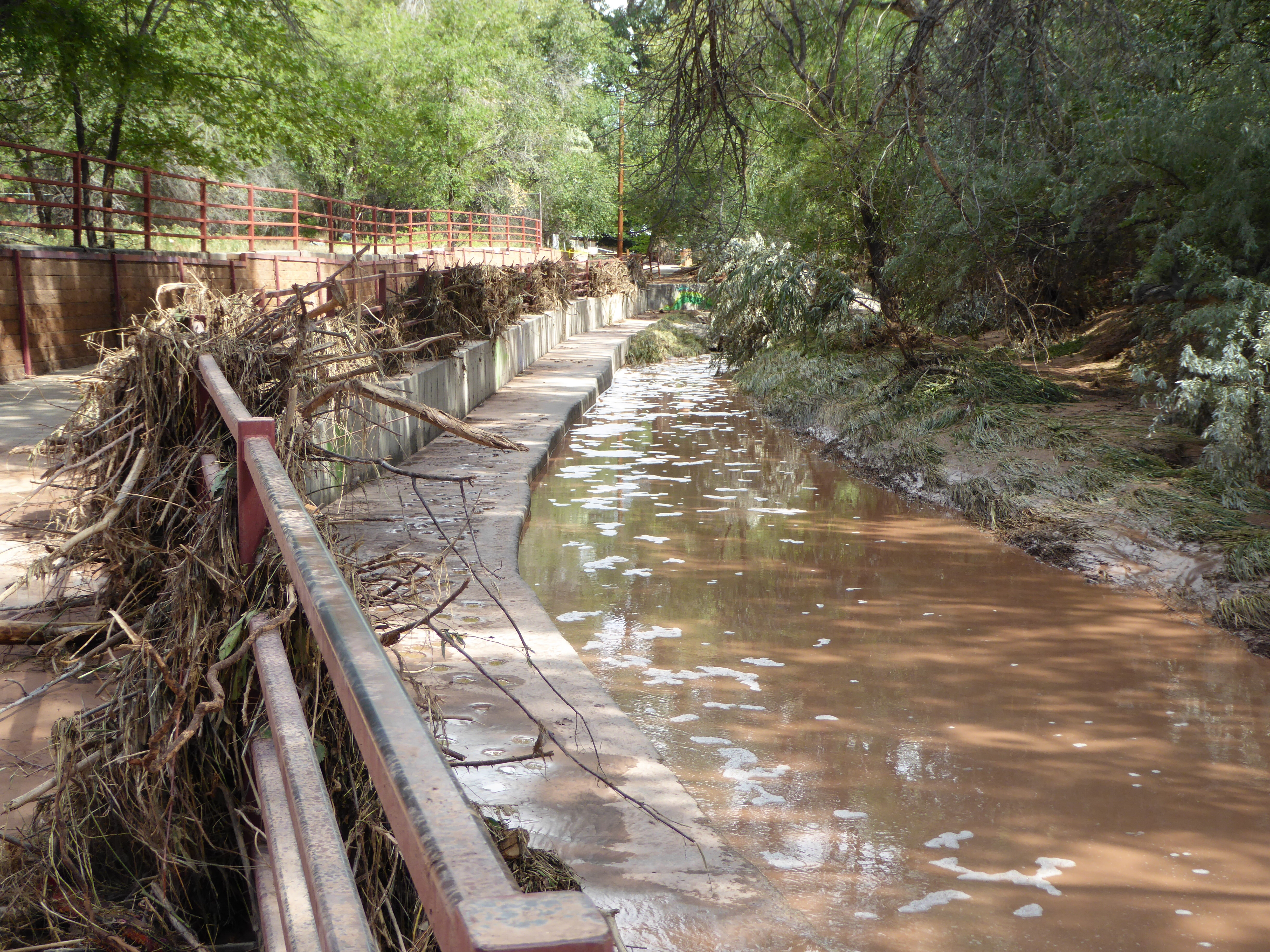
Flood debris on the walkway


No comments:
Post a Comment