Monday, September 26, 2016

new mexico: chaco culture national historical park

The Chaco Culture National Historical Park was the real impetus behind this trip.  H had wanted to go there for years; I didn't know about it until recently, but after watching a Robert Redford-narrated video about the Chacoan ruins, I too very much wanted to go.  Built in a desert canyon, miles from a reliable water source or any known trade route, the Chaco pueblos are a marvel of architecture and engineering.

Some shade in the desert

Built only with stone tools, with the supportive vigas (large beams) carried by hand from mountains over fifty miles away, these complex, sophisticated pueblos were not only elegant and complicated communities, they were astronomically aligned with the solstices, along sightlines over nine miles apart.  The largest Chacoan pueblo had four stories, over 600 rooms and 40 kivas, so these places were not inconsequential, but because the people had no written language (and because researchers have found no midden heaps or burial sites), almost nothing is known about them.
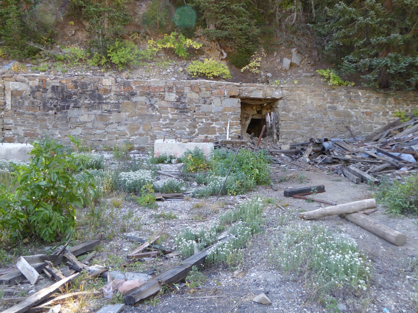
Hungo Pavi wall

Chetro Ketl

These remarkable structures were built in stages between the mid 800s and the early 1100s, with roads connecting Chaco with around 200 other great houses in the area.  And then, just barely after these pueblos would have been completed, the people left, dispersing throughout the Four Corners area.

Pueblo Bonito - look how straight the walls are still

We got up Sunday morning for a 6:45 a.m. departure, heading back southeast on 550 after fueling up with gas, water and caffeinated beverages.  We turned off the highway in Nageezi, then headed in towards the park: 7.8 miles (ten minutes) on a chip-and-seal/paved road, then 8.2 miles (sixteen minutes) on a "good" gravel road, and then an excruciating 4.3 miles (26 minutes!) on a rutted, washboarded dirt road.

Series of doorways in Pueblo Bonito

While at the visitors' center, we learned about needing permits for any hikes (free, located at trailheads) and a complimentary guided tour of Pueblo Bonito at 10 a.m.  That gave us just enough time to walk through the first two sites on the park's (blessedly paved) loop road: Hungo Pavi and Chetro Ketl.

Looking at an upper story window

We met the tour group at the Pueblo Bonito and while there were initially eight of us with an estimated tour time of 1.5 hours, more and more people piled on until there were nearly 30.  That was too many people for us - and clearly they wouldn't finish the tour in an hour and a half at that pace - so we slipped away, following the self-guided tour through the interior of Pueblo Bonito.  This massive complex was mindblowingly engineered, with the 1,000 year old vigas still evident in the sleek stone masonry.

Latillas (small) and vigas (large)

After filling out our permit, we did the Pueblo Alto hike, parking at the Pueblo del Arroyo trail head and checking out the Kin Kletzo ruins near the trail.  The loop was 5.4 miles (2 hrs. 45 min.), climbing up to the mesa and meandering through the desert and around the arroyo rim.  There were several overlooks along the rim - of Kin Kletzo, Pueblo Bonito and, later, Chetro Ketl - as well as interesting natural features like pecked basinsfossilized shrimp burrows and fossilized clam shells.

Pueblo Bonito from hike overlook

Perfectly circular

Both Pueblo Alto and New Alto were located up on the mesa, with 360-degree views; the newer pueblo still has walls standing but the older one is just foundation outlines and mounds.  We continued around the arroyo rim, stopping to be duly impressed at the Jackson Stairway that the Chacoans had hacked out of the cliff face, before climbing through a narrow crack to make our way down a level for the return.

Jackson Stairway, right up the cliff face

At this point, we were starting to get pretty hot - there is absolutely no shade out there in Chaco Canyon - so we hightailed it back to the car, passing several other hikers on their way up to the overlooks.  (There were more people at CCNHP than we expected but certainly far, far fewer than more accessible national parks and monuments.)  As we enjoyed our post-hike beers back at the car, we chatted with some folks - including one kid from Falmouth, Maine, who had recently moved to Santa Fe.  It truly is a small world, even in the most desolate corners.

Cretaceous clams

On the way down

After so many hours in the New Mexican sun, we didn't have much excitement for what was left of the day.  We drove back to the motel, managing to not jar loose any fillings on that terrible dirt road out of the park, got cleaned up, found some dinner and went to bed early.

Kin Kletzo from above

Chetro Ketl from above

Sunday, September 25, 2016

new mexico: abq to aztec

For the last several years, we've tried to get away on or about our wedding anniversary, exploring places like eastern and southern Utah, Jackson Hole and Sun Valley.  This year was our fifteenth anniversary and so we decided to go a little further afield to northern New Mexico.  We flew to Albuquerque (hereinafter referred to as "ABQ") and rented a car; we'd first thought to drive but from SLC that would be a 10+ hour voyage, whereas it was just a 1.5 hour flight.  With a morning flight, we were on the road, heading out of ABQ by noon.

You can also get a tour of the brewing tanks,
chicken coop and beehives, if you want 

On our way out of town, we spied a highway sign for Kaktus Brewing Company in Bernalillo.  Determined to sample as many local brews as practical, we finally found our way to this tiny, hidden and very funky brewery.  It was like drinking in your buddy's garage, hidden away off a narrow road behind a trailer park, but the young bartender was friendly (telling us that Kaktus had an ABQ location as well, which we filed away for future reference) and the Rocky Raccoon IPA was wonderful: lightly hopped with floral overtones and very drinkable.

Perched above the San Juan River

Thus refreshed, and armed with our New Mexico gazetteer and car GPS, we drove west/northwest on 550 for about 2.5 hours.  To be honest, there's a whole lot of nothing but wide open desert between ABQ and Aztec, New Mexico, a small town not far from the Four Corners area.  We checked into the decidedly local Step Back Inn, into a quiet, big room, with lots of great antiques and old school wallpaper.  The room rates are good but there is no wifi (if that's what is important to you) and scarcely any outlets for plugging in various things.

Navajo Lake - the most water we'd see all week

It was the town's Founders' Day celebration and we found an antique truck show at a park down by the river.  Next we tried the Aztec Ruins National Monument (right in town) but it was closed for the day.  Not discouraged, we headed out of town towards Navajo Lake State Park, pausing at the lovely old Our Lady of Guadalupe church just below the lake.  We drove up the earthen dam (dedicated in 1962) to check out the lake.  I hadn't thought it would be so big but there were a bunch of houseboats and motorboats enjoying the early evening.  Below the dam, we could see lots of fishermen and people floating on the San Juan River.

The Step Back Inn

In order to make a loop, we drove across the narrow dam and then through a pretty canyon on a twisting road (County Route 539), heading back to town as the sun set in our faces.  We did have some difficulty finding a non-chain place to eat but finally located Dad's Diner.  I had a spicy green chile cheeseburger, H had a Southwest-style chili burger and we each had chocolate shakes for dessert: the green chile made me sweat but the shake gave me goosebumps so it all evened out.  On the way back to the motel, we stopped at a grocery store for provisions - beer and ice (because we had had the foresight to pack a soft-sided cooler in our luggage) - and then called it a night, gearing up for the next day in the desert.

Saturday, September 24, 2016

land of enchantment

Sorry for the recent absence, but H and I just got back from a great trip to northern New Mexico, exploring Chaco Canyon National Historic Park, Taos and Santa Fe.  We saw ancient ruins and petroglyphs, hiked in the desert and the mountains, collected a bunch of ski areas, ate a lot of green chile and drank some good local microbrews.  Right now we're deep into unpacking, doing laundry and sorting through all our photos but we'll get posts up here soon, the first one tomorrow.  Until then,


Tuesday, September 20, 2016

while you're waiting

This here post is a placeholder.  H and I have some stuff we need to do so posting will be delayed a bit.  In the meantime, here are the moose and mule deer doe who watched us hike up Cardiff Fork last weekend.  The moose was so unimpressed with us that she didn't even bother to stand up.


Friday, September 16, 2016

cardiff fork

When we made our attempt at Superior on Labor Day, we paused for a few minutes on Cardiff Pass, looking towards the Big Cottonwood Canyon side into Cardiff Fork.  Realizing we had never hiked into that drainage, we resolved to remedy that as soon as possible.  As we pored over our map and books, we were amazed at the number of old mines in Cardiff Fork; given how interested H is in the Cottonwood Canyons' history, we couldn't believe we hadn't gotten up in there yet to check it out.

Pretty good shape for an old mining road

Then, looking a little more closely at our map, we realized why: the entry to Cardiff Fork is the Donut Falls trail head.  Donut Falls is the easiest and shortest and, therefore, the most popular hike along the Wasatch Front.  It attracts an ungodly number of people, most of whom are not hikers.  And the trail to Cardiff Fork follows the trail to Donut Falls for the first half mile.  No wonder we'd been avoiding it.

H at tunnel, collapsed just a little way in

But no longer!  Figuring that we could at least beat the masses by getting an early start, we were at the trail head (Mill D South Fork) at 8:10 a.m.  This isn't a summertime early start, of course, but we wanted the sun to come up a bit first.  Even so, it was 39 F when we started walking up the road to the trail head; I had remembered my gloves this time and both H and I had long sleeved shirts on, at least to start.  A large mule deer doe bounced across the road as we walked past the private cabins, and there were three cars in the trail head parking lot, but we didn't see a single person - which would no doubt change when we were on the way out.

One of the Cardiff mine tunnels

About a half mile from the trail head the trail forks, with the left fork going to Donut Falls and the right fork continuing up into Cardiff Fork.  Our book described the trail as an old mining road but it was the widest and best-maintained "old mining road" we've seen.  Which is not to say that it was easy walking, because these old mining roads are all loose and rocky (see also: Mineral Fork and White Pine Lake) and tend to be steeper than they appear.  As we continued up the drainage, the sun slowly made its way above the cliffs to the east, the light inching down the opposite canyon wall, making the pale red and orange leaves glow.  It seemed like everywhere we looked we saw mining remnants, mostly in the form of tailings and mine dumps, perched high above us; Cardiff Fork had had a wealth of lead, copper and silver to mine, as well as having a road leading from Alta down to Big Cottonwood Canyon.

Longer view of Cardiff tunnel and ruins

When we found a huge mine dump, we paused to explore, climbing the tailings and peeking into the collapsed tunnel.  A little further on we started to see NO TRESPASSING signs.  I had read some online articles about conflicts in Cardiff Fork between the Forest Service and private landowners: the old road leading up the drainage to the Cardiff mine crosses a patchwork of public and private land, but back in 2012, the Forest Service seemed to have worked out a deal with the landowners, allowing hikers to hike up the drainage as long as they stuck to the road.  Still, I have a thing about trespassing and got extremely twitchy, to the point of making H backtrack to where I thought there might have been a different way up to the mine.

Huge Cardiff mine ore bin

There wasn't but the delay allowed us to meet up with another couple who were also heading up to the mine.  The man had been up there a lot and had a bunch of information to share, including reassuring me that we were allowed to be on the old road.  We climbed the mine dump to get a good view of the old ore bin - bigger than the one in Park City and still in reasonably good shape - as well as the stonework surrounding the now-collapsed and blocked tunnels.  The Cardiff mine was a massive operation back in the day (beginning around 1910); it was worked on and off until the 1950s, when active mining shut down in the area, leaving behind the ruins that are slowly fading away today.

Mt. Superior

After checking out the Cardiff ruins, we continued up the mining road behind the mine because the man we'd met said it would take us up to a meadow, then fade to singletrack up to Cardiff Pass.  There were lots more "no trespassing" signs but we pressed onward, quite steeply in places, making a couple of wrong turns/dead ends before getting to the beautiful meadow.  There were mining remnants up there, including mine dumps, open shafts and collapsed tunnels, but the road died out without transitioning to any singletrack we could find.  We consulted our book and our map and stared at the ridge above us, looking for even the vaguest of trails to the pass.  We didn't find any.  We're pretty sure we could have scrambled and bushwhacked our way up there - it wasn't that much further - but in the end opted not to.

Looking up at Cardiff Pass

Our descent went very quickly, despite the steep sections and loose, rocky footing.  We met five other hikers on their way up the Cardiff Fork trail, making the tally seven hikers in the first four hours.  As we neared the junction with the Donut Falls trail, we decided to count to see how the last bit of our hike would compare to the first part: we counted 168 people in the last half hour.  Told you Donut Falls was popular.

The meadow at the head of Cardiff Fork

The parking lots had filled up by the time we got back to the car, with hikers, MTBers and picnickers swarming the place.  We took our boots off our tired, sore feet (that loose, rocky trail really wrecks havoc underfoot), downed a quick beer and a sandwich and took off, getting out of the zoo.  There's a tremendous amount of history up in Cardiff Fork, that upper meadow is beautiful and I would love to figure out a way to get up to the pass to look down at Alta, but with the rough footing and the oodles of people at the trail head, I don't foresee us getting back up there again anytime soon.

Trail's end (for us, anyway)

Hike stats:  9.82 miles; 2,400 feet of elevation; 3:54 hours hiking plus 54 minutes of standing around looking at stuff; 2.5 m.p.h. average hiking speed.


Tuesday, September 13, 2016

fall is pretty much here

The nights have been cooling down so nicely in the last week - and it's been eight days and counting since the A/C kicked on.  It's terribly dry, of course, with less than .7" of measurable rain in the last three months, but the sun is definitely lower in the sky which keeps things from heating up too much.  We usually have "monsoon season" in August and September and thus far it's been a bust.  That's not good for water-watchers but it's enjoyable for those of us who like to hit the trails, provided we don't mind all the dust.

We got the latest start of the season on Saturday and it really felt strange.  We went to Round Valley to MTB because we wanted to do a hike in Big Cottonwood Canyon but that canyon was closed/restricted Saturday morning due to a marathon.  But the late start was due to the fact that it was in the mid-30s F in Park City as the sun came up; with my cold finger issues on the Echo ride, it just made sense to let things warm up a bit before hopping on our bikes.  It was still chilly at 10:15 a.m. when we got on the trail, cool enough that I started out with my arm warmers and long-fingered gloves.  But the sun was out and it wasn't windy so I warmed up as soon as we started climbing.

Charging up a roller

We had no idea what to expect for crowds on the trail: yes, it was much later than we usually go out, and yes, it was Saturday, but it was also September, with kids back in school and the bulk of tourists gone home.  We were pleased to discover that it was not at all crowded.  We saw no MTBers on the first third of the ride, just walkers and dog-walkers; there were a few people riding in the middle section of our ride but not as many as there have been some days; and then it was sparse again for the last bit.  It was a very pleasant ride, despite my being completely unable to find my groove (although I did climb all my hills.  We really enjoy MTBing in the fall - and once the leaves are off the scrub oaks (making it easier to see people coming), it will be great.

Friday, September 9, 2016

labor day weekend part 3: steep

The weather forecast looked clear so we did a hike on Monday that was the opposite of our Saturday hike: from Alta to Cardiff Pass to Superior, very steep and completely exposed.  The skies were clear, winds were light and it was much, much cooler than it has been for months.  We knew that it would be busy out there on the trails because of the long holiday weekend, but we still waited just a little bit for the sun to come up and warm things before we started.  We left the car in the parking area near the Alta Lodge at 8:15 a.m. and there was still frost on the cars that had been parked there overnight.

That's where we're headed

The trail starts on an actual paved road that goes by the Alta town offices and police department, then quickly turns into a dirt road, and then turns off onto an old mining road.  There is a ton of mining relics and remains in those south-facing hills above Alta, collapsed and blocked shafts, mine tailings, old metal- and stone-work.  The old road climbs steeply between switchbacks, following the power line, then the trail splits off from the road and climbs even more steeply.

Bit of a grind here

The footing wasn't our favorite - loose and rocky - but the scenery was spectacular, giving us a completely different perspective of Alta and Snowbird across the canyon.  We climbed very quickly, flattened out for a bit in a tree-ringed meadow that looked perfect for a tentsite, then continued to climb for the last steep bit to Cardiff Pass.  Just below the pass, there was a jumble of rocks and we saw a ton of pikas, scurrying around, collecting grasses to store for the winter and meeping at each other.

Cardiff Fork (Big Cottonwood Canyon)

We paused for a moment at the pass.  To the north, the ground fell away into Cardiff Fork (which we have never been in and will have to remedy).  On the way up, I had thought we might be able to go east along the ridge, over Flagstaff Peak and along the Emma Ridge, descending through Grizzly Gulch to make a loop.  But to get to Flagstaff from the pass we would have had to get up (or past) a rocky, exposed cliff and we just weren't up for that.

Sketchy trail

Instead, we turned our attention to the west, towards Superior.  As we researched this hike, we uncovered vague and ominous descriptions of the trail disappearing, knife edges, the need for ropes.  As we started hiking, we knew that we might not make it to the summit.  H doesn't have a great head for heights, so knife edges are tough on him; I can scramble on slabs and boulders all day but get extremely nervous with loose footing.  We would just have to see.

Hellgate Couloir (45 degree pitch) with Alta far below

We started traversing the steep meadow bowl to the south of the pass, crossing over some old mine tailings.  We went through the notch there - where the ground just fell away in front of us - and promptly lost the trail, ending up picking our way down to it when we finally spotted it below.  From there, we were able to follow the trail, which ranged from rock to dirt to loose scree, as it went both along the ridgeline and on the south-facing slope.  We could see the trail ahead of us, climbing towards Superior to the south, although the trail did seem to fade away some distance from the summit.

The trail to Superior goes up to the left (south) of the ridge

The further out we went, the more nervous I got.  We were both extremely focused on where to put our feet next: the trail was narrow and the slope below us was incredibly steep - with a pitch of about 40 degrees.  I didn't pick my head up unless we were stopped and I had both hiking poles planted; luckily, we stopped a fair amount because the scenery was spectacular.  As we started the final approach, however, I got uncomfortable with the footing, loose scree on slabs.  Before we got to the summit - and I think we were really close, unfortunately - I asked H if we could turn around and head back.

Not scared right there

I had been dreading the return over the loose gravel but it didn't end up being nearly as slippery as I had feared and we got back quickly and without incident.  We stopped for a snack at Cardiff Pass and then continued back down the way we'd come up.  We met a lot of people going up as we went down; this is apparently a very popular trail.

H with Snowbird across the canyon behind him

The further down we got, the further away from my nervousness I got, and by the time we'd gotten back to the car, I was regretting having turned back.  I know enough to recognize and respect my discomfort in potentially dangerous situations, and up further the south-facing slope has a 50 degree pitch, but with time and distance (and a post-hike beer), I wonder if maybe I could have gone further, if the reward of the summit might have been worth pushing myself a little further.  Technically, we haven't crossed Superior off the list, and now that I know what to expect from the first four-fifths of the hike (and know I can do it), maybe we'll have to revisit it - on a less crowded day - and cross it off for real.


Hike stats:  It's not a long hike by any means but it is pretty steep and kind of nerve-wracking.  4.41 miles; 2:33 hours hiking time, 1:31 hours stoppage time; 1.8 m.p.h. moving average speed; 2,000 feet elevation.


Wednesday, September 7, 2016

labor day weekend part 2: blustery

H looked back at our calendar and realized that we hadn't done our regular MTB ride for five weeks: due to the Tour of Utah, house guests, our giant Mineral Basin hike and our giant rail trail ride, we hadn't been on Round Valley dirt since July 30th.  It was high time to remedy that.  Also, I was a little concerned that after five weeks off, I might have lost some ground skills-wise.  Despite being on our MTBs for 54+ miles the week before, that ride involved no steep climbing or switchbacks - or really any turning of any sort.  I needed to get back out there!

I definitely felt like I was getting back on the bike after some time away.  My bike handling skills, never terrific, were sub-normal for me and I felt like a spaz in the corners.  After a while, I settled down and began to climb pretty well, even passing five (!!!) people going uphill on the Sweet Sixteen switchbacks portion of Rambler.  I stayed a spaz on the downhill bits, however, skidding out a couple of times and feeling wobbly in the switchbacks, especially the ones turning to the right, which are a particular weakness of mine.  I also got hit a couple of times by gusty crosswinds but was determined to stay upright because I would never hear the end of it from H if I managed to get blown over into a sagebrush bush.

We did get rained on just a little

The weather wasn't ideal, with light showers moving through on increasingly blustery winds, but the temperature was absolutely fantastic, cool even in the sunshine.  There had been just a touch of rain in the days prior, enough to tamp down the dusty trails a little but not enough to make them wet,  And with the lower sun, changing leaves and cooler temperatures, it really felt like fall is here.  Another thing that felt like fall: very few people out on the trails.  We met (and passed) a couple on MTBs, riding with their two very well-trained dogs.  The woman had a number on the front of her bike and we asked her if she had done the P2P race.  She had (her fourth time - she said it's one of the best races she's ever done) and they were just out for a short recovery ride before heading home to Colorado.  I was very impressed that she would do a 7.5+ hour race on Saturday and then get her butt back on the saddle the next day - no five weeks off for her!

Sunday, September 4, 2016

labor day weekend part 1: crispy

We kicked off Labor Day weekend Friday night with beers at the Hogwallow - where we talked with a couple of local guys and got some ideas on places to explore in southwestern Wyoming and southern Utah - and tacos at the Lone Star Taqueria - where we confirmed that long holiday weekends means fewer people to fight for outside tables.  While we ate our fish tacos and chile verde burrito, we discussed outdoors plans for the weekend.  Our initial thought had been to MTB on Saturday but a quick check of mountaintrails.org showed the Park City Point 2 Point MTB race starting at Round Valley in the morning, and we quickly decided to hike instead.

Too early for aspens but the pinks 
are starting to show up now

In the morning, H checked the weather.  The forecast of mid-morning "lightning at elevation and winds gusting to 39 m.p.h." quickly put the kibosh on my suggestion of the Superior/saddle and we scrambled to come up with a non-peak hike.  We settled on the Terraces-Elbow Fork-Pipeline loop in Millcreek Canyon since the trail is not at all exposed and even on the ridge, we would be well below the surrounding peaks.  We got going fairly early, hitting the trail at 7:45 a.m.

Fall colors

Amazingly, we saw scarcely any other people.  Odd-numbered days are off-leash dog days in Millcreek Canyon and I expected (was hoping) to see lots of dogs.  We saw only three, as well as seven hikers, four MTBers and three trailrunners - that's practically deserted for Millcreek!  There were definitely cars at all of the popular trailheads but we couldn't figure out where the actual people were.


We headed up the Terraces end, doing that long grind that quickly got us warmed up, then crisscrossing back and forth across the ridgeline.  Fall is definitely approaching: the leaves are already changing and the flowers, grasses and ground covers are completely dry and crispy now, especially with no appreciable rain for well over a month.  We saw three hikers on this section.  The descent into Elbow Fork is quick, losing elevation much quicker than we gained it.  We crossed the canyon road there, picking up the Pipeline Trail, which we took down to Burch Hollow.  You end up losing a lot of elevation there too, but it's deceptive because when you get onto the Pipeline Trail, it's even with the canyon road.  But as the canyon road heads steadily downhill, the trail stays largely level, so when you get close to Burch Hollow, there are lots of switchbacks to drop you back down to the level of the road.

The flat stretch is the Pipeline Trail

It was just a quick hike (6.29 miles; 2 hours 39 minutes with stoppage time; 1,700 feet of elevation climbed) but it was clearly a wise one as the winds were already picking up as we left, with darker clouds beginning to accumulate at the peaks of the Wasatch.

Thursday, September 1, 2016

ready to wrap up summertime

Summer is taking its time letting go around here.  It really hasn't rained for over a month, not even afternoon thunderstorms.  It has been so hot for most of August that H was scarcely able to get out on his road bike; he prefers not to ride when it is over 90 F (and who can blame him?).  But the last week or ten days have been slightly cooler, and with the days shortening, it really is cooling down overnight.  The fifteen-day forecast has no temperatures higher than 90 F for northern Utah and that is great.  We are ready for fall.

The change in seasons means that ski sales and swaps are starting to pop up, retailers looking to clear out last year's stuff to make room for the new clothing and equipment and skiers/'boarders ready to get more gear.  SNIAGRAB is no more but here are some of what's around and coming up:

Ski 'n See - Ski-a-Rama Annual Tent Sale - jackets, pants, skis, snowboards, goggles, helmets and boots.  Now through 9/5

Milosport Snowboard Shop - ski swap on 9/3, line starts at 5 a.m. (!!!)

Snowbird Ski and Board Swap/New and Used Equipment Sale - Snowbird Level 2, 9/30-10/2, sales commissions benefit Snowbird Sports Education Foundation

Sports Den - ski swap 10/6-9 (plus Labor Day ski sale going on now)

2nd Tracks - ski swap 10/7-9 at SLC location, 10/21-23 at Ogden location and 10/28-29 at Orem location

Black Diamond - ski swap 10/22

Snowbasin - ski swap 10/27-29 (admission charged Thursday and Friday), percentage of proceeds to benefit Ogden Valley Winter Sports Foundation

Park City Ski and Snowboard Swap at the Basin Recreation Fieldhouse, 11/5-7 (admission fees charged)

More listings found here