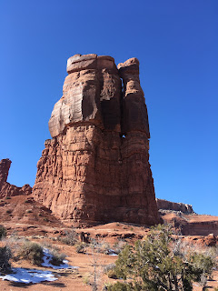
The last time we were in the Mill Canyon area, we noticed that there were tons of multi-use trails out there - equestrian, hiking, MTBing, 4x4 - and I've wanted to get out there ever since. On the recent long holiday weekend, we took an extra day and got out there around 10 a.m. on Friday. There was one van parked over by the dinosaur tracksite, which we suspect belonged to the bike-jorers we met out on the trail, and one bikebacker just stirring in a tent. It was a cool but beautiful morning: mostly clear skies and the sun would bring temperatures into the low 40s, with just a light, occasional breeze. Cold in the shade, it was great hiking conditions.
After coming through Tusher Wash (where we found a sign for a dead-end box canyon that we bookmarked for a later trip), we veered off onto the 3D 4x4 road to avoid some range cattle that Milton was far too interested in. It didn't seem to be going where we wanted it to (in hindsight, after studying the maps, it probably would have), so we ended up following some old roads across a ridge and down through a wash, which brought us to a social trail ... which brought us right back to the dinosaur bone interpretive trail. So it all worked out in the end.
We saw five other vehicles on our walk back to the car but the bikepacker had moved on. Milton was very tired and we all soaked in the extremely pleasant sunshine during post-hike snacks and beers. We also came up with a route for next time, plus I want to find that Tusher Tunnel and also check out the Bartlett and Tusher slickrock areas, so I have a feeling we'll be revisiting Mill Canyon again soon.
Hike stats: 9.5 miles; 3:17 moving time / 2.9 m.p.h.; 3:40 overall time / 2.6 m.p.h.


No comments:
Post a Comment