Pretty path
It was mostly cloudy and in the low 40s when we parked at Butler Fork before 8 a.m., which is likely why it wasn't any busier than it was. We walked up the Big Cottonwood Canyon road to the Mill D trailhead (which had quite a few cars in it) and started up the trail. We only saw a few other people, which is pretty amazing given the trail's popularity.
Desolation Lake from the Wasatch Crest
At the Dog Lake/Desolation Lake junction, we turned right for the 1.9 miles to Desolation Lake. Although this section gains ground quickly, the new-ish trail - switchbacks now, no longer going straight up the drainage - is very nice to walk on. It got cooler as we went up, with patches of snow lingering along the trail, and there was even a skim of ice on a vernal pond.
View from the Dog Lake connector trail
We paused for just a moment at Desolation Lake, admiring its turquoise color, then hoofed it up the short switchbacks to take in the views (and a snack of granola bars) from the Wasatch Crest trail which divides the Wasatch Front and the Wasatch Back. To the east, we could see the Canyons, the PC hill and, just beyond, Round Valley where we had ridden our MTBs the day before. Because it takes a while to drive between the canyons, you can forget how close and connected everything is here.
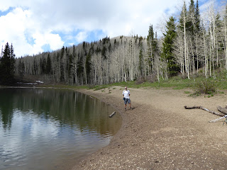
Leaves not yet out at Dog Lake
We then retraced our steps, heading down before we could get chilled. On the way up to Desolation Lake, we noticed a new trail to Dog Lake and since (1) it was new (to us anyway, likely installed in the last couple of years) and (2) it would mean we wouldn't have to do that steep grind up to Dog Lake, we eagerly took it. This is a short connector trail, very pretty and with very little foot traffic. It climbed a bit and we got a great view of the whole drainage, down to Big Cottonwood Canyon. We also got our first hummingbird sighting of the year.
Crossing the creek again
This new trail dropped us gently at Dog Lake and we paused there for more snacks before continuing around the lake to pick up the trail to Butler Fork. After not too much climbing, we reached the ridge and headed west, then turned off at the sign for Butler Fork. H remembered that you really can't get lost in Butler Fork: you just keep walking down the drainage. Shortly thereafter, he noted that at this time of year, walking down the drainage meant that we were actually walking in an actively flowing creek. We picked our way through the wet and muddy spots and then, after about a half mile from the ridge, the trail veered out of the creek bed to drier ground.
And the weather rolls in
We started to see more people as we finished out the hike; I felt for them because Butler Fork is very steep in spots, plus the weather was getting worse quickly. The sun had only come out once or twice all morning and now the clouds were rolling in. The rain began as we changed clothes in the parking lot and once back in the car, we turned on the heat as it had only warmed up to 57 F. This was definitely a day when timing was everything and for once, our timing had been perfect.
Hike stats: 10.91 miles (we're rounding up and calling that 11); 3:41 hiking time plus :56 standing around; 3.0 m.p.h. average moving speed (fast for us!) and 2.4 m.p.h. total avg. speed; 2,793 feet of elevation.


No comments:
Post a Comment