Bryce Canyon/Peekaboo Trail loop
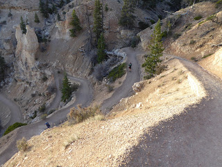
We were back at Bryce Canyon NP, hiking down the wide trail from Bryce Point at 8 a.m. Thursday morning, our last day in the area. A busload of tourists shadowed us down for a few switchbacks to take a million photos of the main amphitheater before returning to their bus. We kept going down, enjoying the easy footing and clear path (but realizing that we were losing a lot of elevation), eventually connecting with the Peekaboo trail.
Heading down from Bryce Point
We continued on Peekaboo counterclockwise until we reached the bottom of the canyon- incredibly encountering no other hikers. The sun was up high enough to bathe the pink, white and orange canyon walls with warmth and everything seemed to glow. At the trail junction where Peekaboo, Navajo Loop and the Queen's Garden trail converged, other park visitors started to pour in, most coming down the shorter but steeper trails from Sunrise Point and Sunset Point.
Switchbacks from Bryce Point
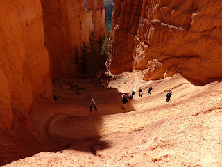
We walked the out-and-back to the Queen's Garden where there's a hoodoo that looks (somewhat) like Queen Victoria; we found the formations there a little underwhelming compared to the astounding beauty all around us everywhere else. Next was the Navajo Loop: we went up (north) past Thor's Hammer and then down (south) through Wall Street. This short loop trail is only 1.4 miles but it is steep and full of wonderful switchbacks.
Peekaboo junction
When we exited Navajo Loop, we rejoined Peekaboo to finish the loop (5.5 miles total). I don't even know what to say about the scenery except that it is exceptional: incredible colors and wild formations. Many popular formations along this loop include the Wall of Windows, the Three Wisemen, the Organ and the Cathedral, although we weren't able to identify most of them ourselves.
Thor's Hammer
We got back on the trail back up to Bryce Point, at this point leaving most of the crowd behind us. I had thought it was going to be a slog going back up but the ascent actually went quickly. Because the path is so smooth (for dirt and gravel), you don't have to watch your footing and can just keep putting one foot in front of the other, putting the distance behind you. The Bryce Point parking lot was bursting at the seams when we got back to the truck - nice weather brings out the tourists. While we encountered many more people on these trails than we normally do, we still really enjoyed the hikes. The scenery is just that good.
Going down the Navajo Loop
After a quick lunch at Ruby's Inn, we drove down to the Thunder Mountain trailhead parking lot in Red Canyon. Two people (including our dentist) had recommended this as a MTB trail: ride the paved bike path to the top and then take the trail back down. It sounded easy enough but it wasn't quite so simple. We climbed steadily on the bike path up to Coyote Hollow, then took a dirt Forest Service road in (and up) a ways to the Thunder Mountain trail.
Somewhere amongst the Bryce Canyon rocks
The first half of the MTB trail was great - rolling singletrack that followed the side of the hills with downhills to the left into the forested washes, and then short uphills to the right over the rockier ridges - but it involved more climbing than I had expected/hoped for. After our morning hike (9.3 miles total), my legs started to get fatigued and I found myself walking some of the short climbs that I should have been able to ride. A group of four French MTBers passed us here, one of them muttering "Zey told me it was all downhill from here!"
It's all just so dang pretty
Then, about halfway through the ride, the terrain completely changed as we started crossing exposed, rocky ridges and steep side hills, covered with loose, sharp rocks. We passed the French guys here as they stopped to take photos. I got nervous and started doing a lot of hike-a-bike, especially on the ridges and downhill switchbacks; even H had to walk more than he would have liked, but a fall could have resulted in bad abrasions at best and it was better to play it safe. The views were certainly dramatic.
H admiring the dramatic view
We finally got off that section and then, for the last 1.4 miles it was just awesome: rolling dirt singletrack, swooping through the trees and across dry washes, and all downhill. I don't think I had to pedal more than five or ten strokes. It was super-fun and was a fantastic way to end the ride - and I was particularly pleased that the French riders never caught back up to us.
I'm in there, waving at the camera from the crazy terrain
When we got back to Panguitch, we did some laundry at the Hitching Post RV Park and then returned one last time to the Cowboy's Smokehouse Cafe for dinner (pulled pork for H and, you guessed it, chicken fried steak for me). Oh! And we had some new animal sightings on the day: prairie dogs in Bryce Canyon NP and pronghorn antelope in the fields outside Ruby's Inn.
Thunder Mountain MTB trail map


No comments:
Post a Comment